La Paz, Leyte
La Paz, officially the Municipality of La Paz (Waray: Bungto han La Paz; Tagalog: Bayan ng La Paz), is a 5th class municipality in the province of Leyte, Philippines. According to the 2015 census, it has a population of 19,998 people. [3]
La Paz | |
|---|---|
| Municipality of La Paz | |
| Nickname(s): The Talent Capital Of Eastern Visayas
| |
| Motto(s): Dasig Lapaznon | |
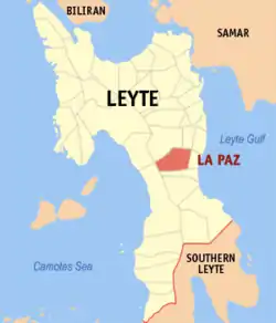 Map of Leyte with La Paz highlighted | |
OpenStreetMap 
| |
.svg.png.webp) La Paz Location within the Philippines | |
| Coordinates: 10°53′N 124°57′E | |
| Country | |
| Region | Eastern Visayas (Region VIII) |
| Province | Leyte |
| District | 2nd district of Leyte |
| Barangays | 35 (see Barangays) |
| Government | |
| • Type | Sangguniang Bayan |
| • Mayor | Angel A. Sia Jr. |
| • Vice Mayor | Lyndo A. Quiña |
| • Representative | Lolita T. Javier |
| • Councilors | List
|
| • Electorate | 13,951 voters (2019) |
| Area | |
| • Total | 72.70 km2 (28.07 sq mi) |
| Elevation | 144 m (472 ft) |
| Population | |
| • Total | 19,998 |
| • Density | 280/km2 (710/sq mi) |
| • Households | 4,957 |
| Economy | |
| • Income class | 5th municipal income class |
| • Poverty incidence | 39.29% (2015)[4] |
| • Revenue | ₱64,700,226.14 (2016) |
| Time zone | UTC+8 (PST) |
| ZIP code | 6508 |
| PSGC | |
| IDD : area code | +63 (0)53 |
| Climate type | tropical rainforest climate |
| Native languages | Waray Tagalog |
Barangays
La Paz (formerly a barangay of Burauen in the province of Leyte). La Paz is constitutional ruled by Spaniards in 1918. La Paz is politically subdivided into 35 barangays. [2]
- Bagacay East
- Bagacay West
- Bongtod
- Bocawon
- Buracan
- Caabangan
- Cacao
- Cagngaran
- Calabnian
- Calaghusan
- Caltayan
- Canbañez
- Cogon
- Duyog
- Gimiranat East
- Gimiranat West
- Limba
- Lubi-lubi
- Luneta
- Mag-aso
- Moroboro
- Pansud
- Pawa
- Piliway
- Poblacion District 1
- Poblacion District 2
- Poblacion District 3
- Poblacion District 4
- Quiong
- Rizal
- San Victoray
- Santa Ana
- Santa Elena
- Tabang
- Tarugan
Climate
| Climate data for La Paz, Leyte | |||||||||||||
|---|---|---|---|---|---|---|---|---|---|---|---|---|---|
| Month | Jan | Feb | Mar | Apr | May | Jun | Jul | Aug | Sep | Oct | Nov | Dec | Year |
| Average high °C (°F) | 28 (82) |
28 (82) |
29 (84) |
30 (86) |
30 (86) |
30 (86) |
29 (84) |
29 (84) |
29 (84) |
29 (84) |
29 (84) |
28 (82) |
29 (84) |
| Average low °C (°F) | 22 (72) |
22 (72) |
22 (72) |
23 (73) |
25 (77) |
25 (77) |
25 (77) |
25 (77) |
25 (77) |
24 (75) |
24 (75) |
23 (73) |
24 (75) |
| Average precipitation mm (inches) | 78 (3.1) |
57 (2.2) |
84 (3.3) |
79 (3.1) |
118 (4.6) |
181 (7.1) |
178 (7.0) |
169 (6.7) |
172 (6.8) |
180 (7.1) |
174 (6.9) |
128 (5.0) |
1,598 (62.9) |
| Average rainy days | 16.7 | 13.8 | 17.3 | 18.5 | 23.2 | 26.5 | 27.1 | 26.0 | 26.4 | 27.5 | 24.6 | 21.0 | 268.6 |
| Source: Meteoblue [5] | |||||||||||||
History
In the 1870s, a sitio was formed, and a chapel was built there before 1886. The chapel was called "rosaryohan." Spanish missionaries visited this place to teach the natives the doctrine. However, the people had to go to Dulag for the Holy Week and days of obligation in order to attend mass.
Until then, the sitio was named Cabadyangan. When the question of official name came up, the people unanimously selected the name "La Paz", in honor of their patroness.
The first hermana mayor was Victoriano Relano in 1908 when the first celebration of the fiesta in honor of the "Nuestra Senora de la Paz y Buen Viaje" was held.
In 1903, La Paz was made a barrio of Burauen. Capitan Estefanio de Paz was the first teniente del barrio. Three leaders went to Manila to petition to the central government to raise La Paz to the status of a municipality. With the help of provincial leaders, La Paz was declared a fourth class town in 1918.
On July 14, 1942, the Japanese forces invaded La Paz. A company of soldiers occupied the town with their garrison at the central school building. Because guerrillas constantly harassed them, the troops stayed in La Paz for only three weeks. However, one month later, more troops came. They constructed strong trenches around the school site. The Japanese abolished existing political parties and formed the "Kalibapi." They organized the local government and appointed a puppet mayor.
The Japanese tried to control the whole population of La Paz and organized the neighborhood associations in the poblacion as well as in the barrios. Schools were opened with emphasis on Nippongo, the Japanese language and the Asiatic ideologies.
Guerrillas infiltrated the town to learn about the enemy strength that was considered important information for the coming liberation. Many La Paznons risked their lives on these dangerous missions. In 1945, La Paz was liberated.
Demographics
|
| ||||||||||||||||||||||||||||||||||||||||||
| Source: Philippine Statistics Authority [3] [6] [7][8] | |||||||||||||||||||||||||||||||||||||||||||
In the 2015 census, the population of La Paz, Leyte, was 19,998 people, [3] with a density of 280 inhabitants per square kilometre or 730 inhabitants per square mile.
References
- Municipality of La Paz | (DILG)
- "Province: Leyte". PSGC Interactive. Quezon City, Philippines: Philippine Statistics Authority. Retrieved 12 November 2016.
- Census of Population (2015). "Region VIII (Eastern Visayas)". Total Population by Province, City, Municipality and Barangay. PSA. Retrieved 20 June 2016.
- "PSA releases the 2015 Municipal and City Level Poverty Estimates". Quezon City, Philippines. Retrieved 12 October 2019.
- "La Paz: Average Temperatures and Rainfall". Meteoblue. Retrieved 9 February 2020.
- Census of Population and Housing (2010). "Region VIII (Eastern Visayas)". Total Population by Province, City, Municipality and Barangay. NSO. Retrieved 29 June 2016.
- Censuses of Population (1903–2007). "Region VIII (Eastern Visayas)". Table 1. Population Enumerated in Various Censuses by Province/Highly Urbanized City: 1903 to 2007. NSO.
- "Province of Leyte". Municipality Population Data. Local Water Utilities Administration Research Division. Retrieved 17 December 2016.
External links
- La Paz Profile at PhilAtlas.com
- Philippine Standard Geographic Code
- Philippine Census Information
- Local Governance Performance Management System
Tacloban (capital) | |
| Municipalities |
|
| Component city | |
| Independent component city |
|
| Highly urbanized city |
|