Lake Pukaki
Lake Pukaki is the largest of three roughly parallel alpine lakes running north–south along the northern edge of the Mackenzie Basin on New Zealand's South Island. The others are Lakes Tekapo and Ohau. All three lakes were formed when the terminal moraines of receding glaciers blocked their respective valleys, forming moraine-dammed lakes.
| Lake Pukaki | |
|---|---|
 | |
 Lake Pukaki | |
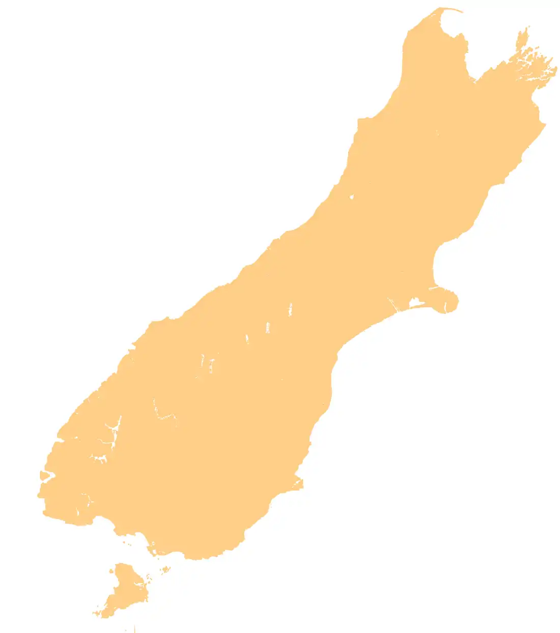
 Location of Lake Pukaki | |
| Location | Mackenzie District, Canterbury region, South Island |
| Coordinates | 44°07′S 170°10′E |
| Primary inflows | Tasman River |
| Primary outflows | Pukaki River |
| Catchment area | 1,413 km2 (546 sq mi)[1] |
| Basin countries | New Zealand |
| Surface area | 178.7 km2 (69.0 sq mi)[1] |
| Average depth | 47 m (154 ft)[1] |
| Max. depth | 70 m (230 ft)[1] |
| Water volume | 4.66 km3 (3,780,000 acre⋅ft)[1] |
| Surface elevation | 518.2 to 532 m (1,700 to 1,745 ft)[2] |
| Frozen | never (winter air temperatures can reach as low as −20 °C (−4 °F) though)[3] |
| Islands | Five Pound Note Island (now submerged) |
| Settlements | Twizel |
| References | [1][2] |

Geography
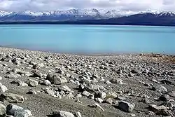
The glacial feed to the lakes gives them a distinctive blue colour, created by glacial flour, the extremely finely ground rock particles from the glaciers. Lake Pukaki covers an area of 178.7 km², and the surface elevation of the lake normally ranges from 518.2 to 532 metres above sea level.[2]
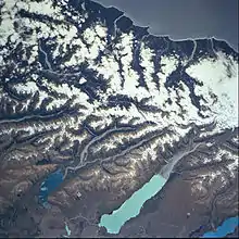
The lake is fed at its northern end by the braided Tasman River, which has its source in the Tasman and Hooker Glaciers, close to Aoraki / Mount Cook. Good views of the mountain, 70 kilometres to the north can be had from the southern shore of the lake.
Tahr Statue

There is a life size bronze statue of a Himalayan Tahr standing upon a boulder near the visitor centre on the southern shores of Lake Pukaki, This was the site of a protest by hunters fighting against the Department of Conservation’s controversial tahr culling programme in 2020.[4]
Hydroelectricity
The lake is now part of the Waitaki hydroelectric scheme. The lake's original outflow was at its southern end, into the Pukaki River. The outflow has been dammed, and canals carry water from Lake Pukaki and Lake Ohau through the Ohau A power station to Lake Ruataniwha. Pukaki is also fed by the waters of Lake Tekapo, which are diverted through a canal to a power station on Pukaki's eastern shore (Tekapo B station). The lake has been raised twice to increase storage capacity (9m in 1952, and 37m in 1976 ),[5] submerging Five Pound Note Island, which once appeared on New Zealand's five pound note. The current lake has an operating range of 13.8 m (the level within which it can be artificially raised or lowered), giving it an energy storage capacity of 1,595 GWh. Along with Lake Tekapo's 770 GWh storage, it provides over half New Zealand's hydroelectricity storage capacity. In September 2012, Environment Canterbury approved a change in conditions of Meridian Energy's resource consent controlling the water levels and flows of Lake Pukaki. The change allows Meridian to lower the lake a further five metres from the minimum level of 518m above sea level in the event of an energy crisis.[6]
Nearby settlements
The closest town to Lake Pukaki is Twizel, 7 kilometres (4.3 mi) to the south of the lake and Tekapo is 47 km (32 minutes drive) to the northeast. State Highway 8 skirts the southern end of the lake, and State Highway 80 runs north along the length of its western shore, to Mount Cook Village in the Aoraki / Mount Cook National Park.
The nearby Pukaki Scientific Reserve is home to the Nationally Endangered moth species Izatha psychra.[7]
Road Safety
State Highway 8 runs along the edge of Lake Pukaki. A number of crashes have occurred here as drivers have come around a blind corner, seen Lake Pukaki and wanted to stop at an unsafe location to enjoy the view. [8][9][10][11]
References
- Irwin, J. (September 1978). "Bottom sediments of Lake Tekapo compared with adjacent Lakes Pukaki and Ohau, South Island, New Zealand". N.Z. Journal of Marine and Freshwater Research. 12 (3): 245–250. doi:10.1080/00288330.1978.9515749.

- "Pukaki Lake Levels". Meridian Energy Limited. Retrieved 2008-03-09.
- Tom Hunt (23 June 2015). "New Zealand drops to 20C below freezing". Stuff. Retrieved 2016-09-16.
- "Tahr Jam protest to go ahead at Lake Pukaki". Stuff. 2020-07-12. Retrieved 2020-09-21.
- Five Pound Note Island - Lake Pukaki, N.Z.
- Lttlewood, Matthew (28 September 2012). "Meridian get freedom to lower lake". Stuff.co.nz. The Timaru Herald. Retrieved 2016-09-16.
- Hoare, Robert J. B. (2010). "Izatha (Insecta: Lepidoptera: Gelechioidea: Oecophoridae)" (PDF). Fauna of New Zealand. 65: 1–201.
- "New $150,000 safe stopping area for crash prone road near Lake Pukaki". Stuff. 2017-09-14. Retrieved 2020-09-21.
- "Multiple calls to 'police comms' before fatal crash in Lake Pukaki". Stuff. 2017-07-05. Retrieved 2020-09-21.
- "Tourists took wrong turn before plunging off cliff into lake". Stuff. 2016-03-14. Retrieved 2020-09-21.
- "Two people seriously injured in crash near Lake Pukaki". Stuff. 2020-07-26. Retrieved 2020-09-21.
Further reading
- Irwin, J. (1972). "Sediments of Lake Pukaki, South Island, New Zealand". New Zealand Journal of Marine and Freshwater Research. 6 (4): 482–491. doi:10.1080/00288330.1972.9515442.
External links
| Wikimedia Commons has media related to Lake Pukaki. |
- Department of Conservation – Mackenzie Basin short walks