Left Hand, West Virginia
Left Hand (also Justices, Knights, or Lefthand) is an unincorporated community in southeastern Roane County, West Virginia, United States. It lies along West Virginia Route 36 southeast of the city of Spencer, the county seat of Roane County.[2] Its post office [3] is still active.
Left Hand | |
|---|---|
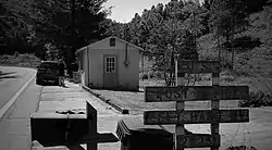 Left Hand WV Post Office | |
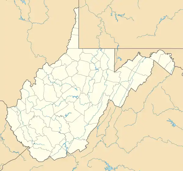 Left Hand Location within the state of West Virginia  Left Hand Left Hand (the United States) | |
| Coordinates: 38°37′7″N 81°14′42″W | |
| Country | United States |
| State | West Virginia |
| County | Roane |
| Elevation | 728 ft (222 m) |
| Population (2009) | |
| • Total | 390 |
| Time zone | UTC-5 (Eastern (EST)) |
| • Summer (DST) | UTC-4 (EDT) |
| ZIP codes | 25251 |
| GNIS feature ID | 1541751[1] |
The community was named after nearby Lefthand Run creek.[4] Despite the name, there is not a community named "Right Hand".
Education
An elementary school "Geary Elementary/Middle School" is located in Left Hand, West Virginia.[5]
Gallery
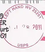 Left Hand postmark
References
- U.S. Geological Survey Geographic Names Information System: Left Hand, West Virginia
- DeLorme. West Virginia Atlas & Gazetteer. 4th ed. Yarmouth: DeLorme, 2007, p. 44. ISBN 0-89933-327-3.
- U.S. Geological Survey Geographic Names Information System: Left Hand, West Virginia
- Kenny, Hamill (1945). West Virginia Place Names: Their Origin and Meaning, Including the Nomenclature of the Streams and Mountains. Piedmont, WV: The Place Name Press. pp. 366–367.
- "Archived copy". Archived from the original on 2010-02-04. Retrieved 2009-12-22.CS1 maint: archived copy as title (link)
Municipalities and communities of Roane County, West Virginia, United States | ||
|---|---|---|
| City | 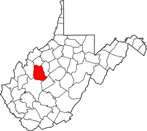 Map of West Virginia highlighting Roane County | |
| Town | ||
| Unincorporated communities |
| |
| Ghost towns | ||
| Footnotes | ‡This populated place also has portions in an adjacent county or counties | |
| ||
This article is issued from Wikipedia. The text is licensed under Creative Commons - Attribution - Sharealike. Additional terms may apply for the media files.