List of Historic Sites of Japan (Aichi)
National Historic Sites
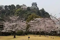
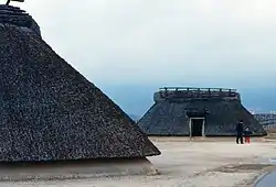
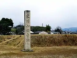
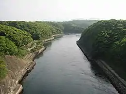
As of 1 September 2019, forty Sites have been designated as being of national significance (including one *Special Historic Site).[2][3][4]
Prefectural Historic Sites
As of 1 May 2019, forty-three Sites have been designated as being of prefectural importance.[4][6]
| Site | Municipality | Comments | Image | Coordinates | Type | Ref. |
|---|---|---|---|---|---|---|
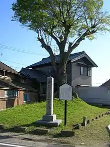
| Ono no Michikaze Legendary Birthplace 小野道風誕生伝説地 Ono no Michikaze tanjō den-setsuchi | Kasugai | 35°13′11″N 136°58′04″E | ||||
| Daichi Site 大地遺跡 Daichi iseki | Iwakura | 35°16′28″N 136°51′47″E | ||||
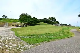
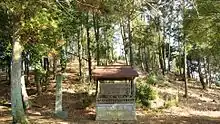
| Sumiyakibira Kofun Cluster 炭焼平古墳群 Sumiyakibira kofun-gun | Toyokawa |  | 34°52′41″N 137°26′12″E | |||
| Mamizuka Site 馬見塚遺跡 Mamizuka iseki | Ichinomiya | 35°17′29″N 136°49′14″E | ||||
| Ōnedaira Site 大根平遺跡 Ōnedaira iseki | Shitara | 35°10′08″N 137°37′44″E | ||||
| Takane Site 髙根遺跡 Takane iseki | Komaki | 35°17′30″N 136°58′48″E | ||||
| Kurabune Site 鞍船遺跡 Kurabune iseki | Shitara | 35°10′26″N 137°37′26″E | ||||
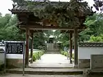
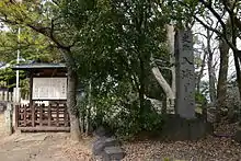
| Ōmidō-ji Site 史跡大御堂寺 shiseki Ōmidōji | Mihama | contains the grave of Minamoto no Yoshitomo |  | 34°46′15″N 136°51′11″E | ||
| Uri Castle Site 宇利城跡 Uri-jō ato | Shinshiro | 34°51′55″N 137°31′47″E | ||||
| Ōdakayama Old Kiln 大髙山古窯 Ōdakayama ko-yō | Handa | 34°55′44″N 136°56′50″E | ||||
| Iimori Castle Site 飯盛城址 Iimori-jō shi | Toyota | 35°07′57″N 137°18′58″E | ||||
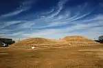
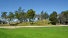
| Kago Pond Old Kiln 籠池古窯 Kago-ike ko-yō | Tokoname |  | 34°55′23″N 136°52′09″E | |||
| Iwaba Kofun 岩場古墳 Iwaba kofun | Nishio | 34°48′14″N 137°05′04″E | ||||
| Raigōji Ichirizuka 来迎寺一里塚 Raigōji Ichirizuka | Chiryū | 35°00′06″N 137°04′13″E | ||||
| Asai Kofun Cluster 浅井古墳群 Asai kofun-gun | Ichinomiya | 35°21′00″N 136°49′44″E | ||||
| Chōsenzuka Kofun 長泉塚古墳 Chōsenzuka kofun | Fusō | 35°21′21″N 136°55′26″E | ||||
| Maeshiba Lighthouse 前芝の燈明台 Maeshiba no tōmyōdai | Toyohashi | 19.8 m lighthouse built in 1669, in use until 1908, and restored in 1966 after damage in the Ise Bay Typhoon[7] | 34°46′49″N 137°20′07″E | |||
| Shitara Castle Site 設樂城跡 Shitara-jō ato | Tōei | 35°04′48″N 137°41′18″E | ||||
| Iwazu No.1 Kofun 岩津第1号古墳 Iwazu daiichigō kofun | Okazaki | 35°00′23″N 137°10′21″E | ||||
| West Kariya Jōmon Site 刈谷西部の縄文遺跡 Kariya seibu no Jōmon iseki | Kariya | 34°59′55″N 136°59′40″E | ||||
| Sarayama Old Kilns 皿山古窯群 Sarayama ko-yō-gun | Tahara | 34°36′14″N 137°06′05″E | ||||
| Okoshi Ferry Site 起渡船場跡 Okoshi tosenba ato | Ichinomiya | 35°18′37″N 136°44′12″E | ||||
| Yūfukuji Ichirizuka 祐福寺一里塚 Yūfukuji Ichirizuka | Tōgō | 35°05′02″N 137°02′42″E | ||||
| Kemizuka 検見塚 Kemizuka | Kiyosu | 35°13′07″N 136°51′05″E | ||||
| Toyota Ōtsuka Kofun 豊田大塚古墳 Toyota Ōtsuka kofun | Toyota | 35°02′44″N 137°09′56″E | ||||
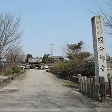
| Myōkō-ji Precinct 妙興寺境内地 Myōkōji keidai-chi | Ichinomiya |  | 35°17′07″N 136°48′00″E | |||
| Gongenyama Kofun 権現山古墳 (第一号墳/第二号墳) Gongenyama kofun | Toyohashi | 34°48′51″N 137°26′02″E | ||||
| Ikawazu Shell Mound 伊川津貝塚 Ikawazu kaizuka | Tahara | 34°38′44″N 137°08′53″E | ||||
| Kurozasa No.7 Kiln 黒笹七号窯 Kurozasa nanagō yō | Tōgō | 35°07′06″N 137°05′16″E | ||||
| Shinmeigū No.1 Kofun 神明宮第1号古墳 Shinmeigū daiichi kofun | Okazaki | 34°56′10″N 137°12′33″E | ||||
| Tayūzuka Kofun 太夫塚古墳 Tayūzuka kofun | Okazaki | 34°54′53″N 137°09′11″E | ||||
| Jōhōji Kofun 城宝寺古墳 Jōhōji kofun | Tahara | _01.jpg.webp) | 34°40′03″N 137°16′04″E | |||
| Myōkanji Kofun 妙感寺古墳 Myōkanji kofun | Inuyama |  | 35°23′07″N 136°56′51″E | |||
| Ikeda No.1 Kofun 池田第1号古墳 Ikeda daiichigō kofun | Toyota | 35°09′35″N 137°10′25″E | ||||
| Hatagashirayama-One Kofun Cluster 旗頭山尾根古墳群 Hatagashirayama-One kofun-gun | Shinshiro | .jpg.webp) | 34°51′43″N 137°27′20″E | |||
| Danjōyama Kofun 断上山古墳 (第9号古墳/第10号古墳) Danjōyama kofun | Shinshiro | 34°55′00″N 137°31′24″E | ||||
| Kesadaira Site 今朝平遺跡 Kesadaira iseki | Toyota |  | 35°08′20″N 137°19′34″E | |||
| Hachiōji Shell Mound 八王子貝塚 Hachiōji kaizuka | Nishio | 34°53′06″N 137°02′28″E | ||||
| Hakusan Jinja Kofun - Otabisho Kofun 白山神社古墳・御旅所古墳 Hakusan Jinja kofun・Otabisho kofun | Kasugai | 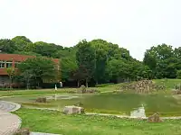 | 35°13′37″N 136°56′07″E | |||
| Karekinomiya Shell Mound 枯木宮貝塚 Karekinomiya kaizuka | Nishio | 34°50′17″N 137°01′12″E | ||||
| Itayama-Nagane Old Kiln 板山長根古窯 Itayama-Nnagane ko-yō | Agui | 34°56′23″N 136°56′29″E | ||||
| Utsunomiya Jinja Kofun 宇都宮神社古墳 Utsunomiya Jinja kofun | Komaki |  | 35°16′46″N 136°53′46″E | |||
| Kirahachimanyama Kofun 吉良八幡山古墳 Kirahachimanyama kofun | Nishio | 34°50′45″N 137°05′03″E | ||||
Municipal Historic Sites
As of 1 May 2019, a further four hundred and forty-three Sites have been designated as being of municipal importance.[8]
See also
| Wikimedia Commons has media related to National historic sites in Aichi prefecture. |
References
- "Cultural Properties for Future Generations". Agency for Cultural Affairs. Retrieved 12 September 2019.
- 史跡名勝天然記念物 [Number of Monuments of Japan by Prefecture] (in Japanese). Agency for Cultural Affairs. 1 September 2019. Retrieved 12 September 2019.
- "Database of National Cultural Properties: 史跡名勝天然記念物 (史跡, 特別史跡 愛知県)" (in Japanese). Agency for Cultural Affairs. Archived from the original on 30 June 2019. Retrieved 12 September 2019.
- 史跡 [Historic Sites] (in Japanese). Aichi Prefecture. Retrieved 12 September 2019.
- 豊明市指定文化財詳細 [Details of the Cultural Properties of Toyoake City] (in Japanese). Toyoake City. Archived from the original on 2 April 2012. Retrieved 4 July 2012.
- 都道府県別指定等文化財件数(都道府県分) [Number of Prefectural Cultural Properties by Prefecture] (in Japanese). Agency for Cultural Affairs. 1 May 2019. Retrieved 12 September 2019.
- 前芝の燈明台 [Maeshiba Lighthouse] (in Japanese). Aichi Prefectural Education Center. Retrieved 4 July 2012.
- 都道府県別指定等文化財件数(市町村分) [Number of Municipal Cultural Properties by Prefecture] (in Japanese). Agency for Cultural Affairs. 1 May 2019. Retrieved 12 September 2019.
External links
- (in Japanese) Cultural Properties of Aichi Prefecture
- (in Japanese) Historic Sites of Aichi Prefecture
This article is issued from Wikipedia. The text is licensed under Creative Commons - Attribution - Sharealike. Additional terms may apply for the media files.
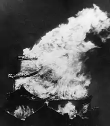
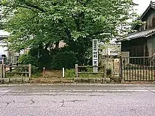
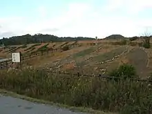











03.jpg.webp)
.JPG.webp)
