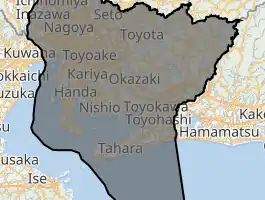
Aichi Prefecture
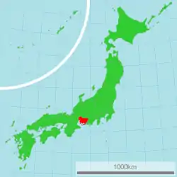
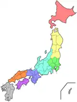
Aichi Prefecture (愛知県, Aichi-ken, Japanese pronunciation: [aitɕi̥ꜜkeɴ]) is a prefecture of Japan located in the Chūbu region of Honshū.[1](pp11,126) Aichi Prefecture has a population of 7,552,873 (as of 1 October 2019) and a geographic area of 5,172.92 square kilometres (1,997.28 sq mi) with a population density of 1,460 inhabitants per square kilometre (3,800/sq mi). Aichi Prefecture borders Mie Prefecture to the west, Gifu Prefecture and Nagano Prefecture to the north, and Shizuoka Prefecture to the east.
Aichi Prefecture
愛知県 | |||||||||||||||
|---|---|---|---|---|---|---|---|---|---|---|---|---|---|---|---|
| Japanese transcription(s) | |||||||||||||||
| • Japanese | 愛知県 | ||||||||||||||
| • Rōmaji | Aichi-ken | ||||||||||||||
 Flag  Symbol | |||||||||||||||
| |||||||||||||||
 | |||||||||||||||
| Coordinates: 35°10′43″N 136°54′50″E | |||||||||||||||
| Country | |||||||||||||||
| Region | Chūbu (Tōkai) | ||||||||||||||
| Island | Honshu | ||||||||||||||
| Capital | Nagoya | ||||||||||||||
| Subdivisions | Districts: 7, Municipalities: 54 | ||||||||||||||
| Government | |||||||||||||||
| • Governor | Hideaki Ōmura (since February 2011) | ||||||||||||||
| Area | |||||||||||||||
| • Total | 5,172.92 km2 (1,997.28 sq mi) | ||||||||||||||
| Area rank | 27th | ||||||||||||||
| Population (1 October 2019) | |||||||||||||||
| • Total | 7,552,873 | ||||||||||||||
| • Rank | 4th | ||||||||||||||
| • Density | 1,500/km2 (3,800/sq mi) | ||||||||||||||
| ISO 3166 code | JP-23 | ||||||||||||||
| Website | www | ||||||||||||||
| |||||||||||||||
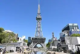
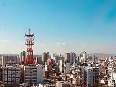
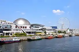
Nagoya is the capital and largest city of Aichi Prefecture, and the fourth-largest city in Japan, with other major cities including Toyota, Okazaki, and Ichinomiya. Aichi Prefecture and Nagoya form the core of the Chūkyō metropolitan area, the third-largest metropolitan area in Japan and one of the largest metropolitan areas in the world.[1](p685) Aichi Prefecture is located on Japan's Pacific Ocean coast and forms part of the Tōkai region, a subregion of the Chūbu region and Kansai region. Aichi Prefecture is home to the Toyota Motor Corporation, the world's largest automotive manufacturer, the largest listed company in Japan by market capitalization, and sixth-largest company in the world by revenue, with its headquarters in the city of Toyota. Aichi Prefecture features the Higashiyama Zoo and Botanical Gardens, Chubu Centrair International Airport, and Legoland Japan Resort.
History
Originally, the region was divided into the three hundred provinces of Owari and Mikawa.[1](p780) After the Meiji Restoration, Owari and Mikawa were united into a single entity. In 1871, after the abolition of the han system, Owari, with the exception of the Chita Peninsula, was established as Nagoya Prefecture, while Mikawa combined with the Chita Peninsula and formed Nukata Prefecture. Nagoya Prefecture was renamed to Aichi Prefecture in April 1872, and was united with Nukata Prefecture on November 27 of the same year.
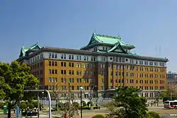
The government of Aichi Prefecture is located in the Aichi Prefectural Government Office in Nagoya, which is the old capital of Owari. The Aichi Prefectural Police and its predecessor organisations have been responsible for law enforcement in the prefecture since 1871.
The Expo 2005 World Exposition was held in Seto and Nagakute.
Etymology
In the third volume of the Man'yōshū there is a poem by Takechi Kurohito that reads: "The cry of the crane, calling to Sakurada; it sounds like the tide, draining from Ayuchi flats, hearing the crane cry". Ayuchi is the original form of the name Aichi, and the Fujimae tidal flat is all that remains of the earlier Ayuchi-gata. It is now a protected area.[2][3]
For a time, an Aichi Station existed on the Kansai Line (at the time the Kansai Railway) between Nagoya and Hatta stations, but its role was overtaken by Sasashima-raibu Station on the Aonami Line and Komeno Station on the Kintetsu Nagoya Line.
Geography
Government Ordinance Designated City City Town Village
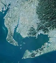
Located near the center of the Japanese main island of Honshu, Aichi Prefecture faces the Ise and Mikawa Bays to the south and borders Shizuoka Prefecture to the east, Nagano Prefecture to the northeast, Gifu Prefecture to the north, and Mie Prefecture to the west. It measures 106 km (66 mi) east to west and 94 km (58 mi) south to north and forms a major portion of the Nōbi Plain. With an area of 5,172.48 square kilometres (1,997.11 sq mi) it accounts for approximately 1.36% of the total surface area of Japan. The highest spot is Chausuyama at 1,415 m (4,642 ft) above sea level.
The western part of the prefecture is dominated by Nagoya, Japan's smallest city, and its suburbs, while the eastern part is less densely populated but still contains several major industrial centers. Due to its robust economy, for the period from October 2005 to October 2006, Aichi was the fastest growing prefecture in terms of population, beating Tokyo, at 7.4% and around with after Saitama Prefecture.
As of 1 April 2012, 23% of the total land area of the prefecture was designated as Natural Parks, namely the Aichi Kōgen, Hida-Kisogawa, Mikawa Wan, and Tenryū-Okumikawa Quasi-National Parks along with seven Prefectural Natural Parks.[4]
Cities
Thirty-eight cities are located in Aichi Prefecture.
.jpg.webp)
Mergers
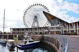
Economy
.JPG.webp)
Companies headquartered in Aichi include the following.
Companies such as Fuji Heavy Industries, Mitsubishi Motors, Pfizer, Sony, Suzuki, Bodycote, and Volkswagen Group also operate plants or branch offices in Aichi.
International relations
Sister Autonomous Administrative division
.svg.png.webp) Victoria, Australia – May 2, 1980
Victoria, Australia – May 2, 1980 Jiangsu, China – July 28, 1980
 Bangkok, Thailand – July 9, 2012
- Guangdong, China – November 25, 2013
 Gyeonggi Province, South Korea – November 10, 2015
 Texas, United States – April 22, 2016
 Ho Chi Minh City, Vietnam – September 13, 2016
- Washington, United States – October 18, 2016
.svg.png.webp) Brussels, Flemish Region, Wallonia, Belgium – May 15, 2017
Brussels, Flemish Region, Wallonia, Belgium – May 15, 2017- Indiana, United States – September 15, 2017
- Kentucky, United States – October 23, 2017
 Occitanie, France – June 5, 2018
 São Paulo, Brazil – September 10, 2018
Demographics
| Year | Pop. | ±% p.a. |
|---|---|---|
| 1890 | 1,473,099 | — |
| 1903 | 1,752,042 | +1.34% |
| 1913 | 2,073,224 | +1.70% |
| 1920 | 2,089,762 | +0.11% |
| 1925 | 2,319,494 | +2.11% |
| 1930 | 2,567,413 | +2.05% |
| 1935 | 2,862,701 | +2.20% |
| 1940 | 3,166,592 | +2.04% |
| 1945 | 2,857,851 | −2.03% |
| 1950 | 3,390,585 | +3.48% |
| 1955 | 3,769,209 | +2.14% |
| 1960 | 4,206,313 | +2.22% |
| 1965 | 4,798,653 | +2.67% |
| 1970 | 5,386,163 | +2.34% |
| 1975 | 5,923,569 | +1.92% |
| 1980 | 6,221,638 | +0.99% |
| 1985 | 6,455,172 | +0.74% |
| 1990 | 6,690,603 | +0.72% |
| 1995 | 6,868,336 | +0.53% |
| 2000 | 7,043,300 | +0.50% |
| 2005 | 7,254,704 | +0.59% |
| 2010 | 7,410,719 | +0.43% |
| 2015 | 7,484,094 | +0.20% |
| Source: Statistics Bureau, Ministry of Internal Affairs and Communications[6] | ||
As of 2001, Aichi Prefecture's population was 50.03% male and 49.97% female. 139,540 residents (nearly 2% of the population) are of foreign nationality.
Population by age (2001)
| Age | % population | % male | % female |
|---|---|---|---|
| 0–9 | 10.21 | 10.45 | 9.96 |
| 10–19 | 10.75 | 11.02 | 10.48 |
| 20–29 | 15.23 | 15.71 | 14.75 |
| 30–39 | 14.81 | 15.31 | 14.30 |
| 40–49 | 12.21 | 12.41 | 12.01 |
| 50–59 | 15.22 | 15.31 | 15.12 |
| 60–69 | 11.31 | 11.22 | 11.41 |
| 70–79 | 6.76 | 6.01 | 7.52 |
| Over 80 | 3.12 | 2.01 | 4.23 |
| Unknown | 0.38 | 0.54 | 0.23 |
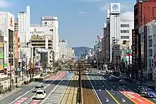
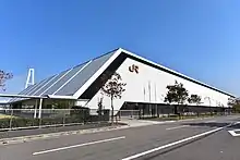
Transport
Rail
.jpg.webp)


.svg.png.webp) JR Central
JR Central Tokaido Shinkansen
- ■Tokaido Line
- ■Chūō Main Line
- ■Kansai Line
- ■Taketoyo Line
- ■Iida Line
 Meitetsu
- NH Nagoya Line
- IY Inuyama Line
- KM Komaki Line
- TA Centrair Line
- TA Tokoname Line
- ST Seto Line
- TK Toyokawa Line
- GN Gamagori Line
- TT Toyota Line
- KC Chita Line
- MU MY Mikawa Line
- TB Bisai Line
- CH Chikko Line
- TB Tsushima Line
 Kintetsu
- E Nagoya Line
 Aonami Line
.svg.png.webp) Nagoya Municipal Subway
Nagoya Municipal Subway.svg.png.webp) Higashiyama Line
Higashiyama Line.svg.png.webp) Meijo Line
Meijo Line.svg.png.webp) Tsurumai Line (connecting to Meitetsu Toyota and Inuyama Line)
Tsurumai Line (connecting to Meitetsu Toyota and Inuyama Line).svg.png.webp) Sakura-dori Line
Sakura-dori Line.svg.png.webp) Meiko Line
Meiko Line.svg.png.webp) Kamiiida Line (connecting to Meitetsu Komaki Line)
Kamiiida Line (connecting to Meitetsu Komaki Line) Toyohashi Railroad
 Aichi Loop Line
People movers and tramways
- Nagoya Guideway Bus
- Linimo
- Toyohashi Railroad
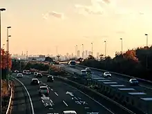
Road
Expressways and toll roads
- Chuo Expressway
- Higashi-Meihan Expressway(East Meihan Expressway)
- Isewangan Expressway(Ise Bayside Expressway)
- Meishin Expressway
- Mei-Nikan Expressway
- Nagoya Expressway
- Shin-Meishin Expressway
- Shin-Tōmei Expressway
- Tokai-Hokuriku Expressway
- Tomei Expressway
- Chita Peninsula Road
- South Chita Road
- Chubu International Airport Connecting Road
- Chita across Road
- Nagoya Seto Road
National highways
- Route 1
- Route 19 (Nagoya-Kasugai-Tajimi-Nagiso-Matsumoto-Nagano)
- Route 22 (Nagoya-Ichinomiya-Gifu)
- Route 23 (Ise-Matsuzaka-Suzuka-Yokkaichi-Nagoya-Toyoake-Chiryu-Gamagori-Toyohashi)
- Route 41 (Nagoya-Komaki-Inuyama-Gero-Takayama-Toyama)
- Route 42
- Route 151
- Route 153
- Route 154
- Route 155 (Tokoname-Chita-Kariya-Toyota-Seto-Kasugai-Komaki-Ichinomiya-Tsushima-Yatomi)
- Route 247
- Route 248
- Route 257 (Hamamatsu-Shinshiro-Toyota-Ena-Nakatsugawa-Gero-Takayama)
- Route 259
- Route 301
- Route 302
- Route 362
- Route 363
- Route 366
- Route 419
- Route 420
- Route 473 (Gamagori-Okazaki-Toyota-Shitara-Hamamatsu)
- Route 474
- Route 475
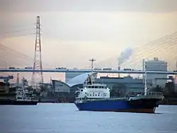
Ports
- Nagoya Port – International Container hub and ferry route to Sendai and Tomakomai, Hokkaido
- Mikawa Port – mainly automobile and car parts export and part of inport base
- Kinuura Port – Handa and Hekinan
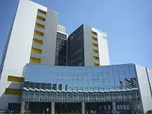
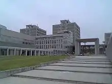
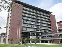
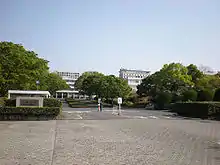
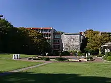
Education
Universities
National universities
- Aichi University of Education
- Graduate University for Advanced Studies - Okazaki Campus (National Institute for Basic Biology, Japan, National Institute for Physiological Sciences, Japan)
- Nagoya Institute of Technology
- Nagoya University
- Toyohashi University of Technology
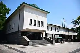
.JPG.webp)


Public universities


Private universities
- Aichi Bunkyo University
- Aichi Gakuin University
- Aichi Gakusen University
- Aichi Institute of Technology
- Aichi Medical University
- Aichi Mizuho College
- Aichi Sangyo University
- Aichi Shukutoku University
- Aichi Toho University
- Aichi University
- Aichi University of Technology
- Chubu University
- Chukyo University
- Daido University
- Doho University
- Fujita Health University
- Globis University Graduate School of Management – Nagoya Campus
- Japanese Red Cross Toyota College of Nursing
- Kinjo Gakuin University
- Meijo University
- Nagoya Bunri University
- Nagoya College of Music
- Nagoya Gakuin University
- Nagoya Keizai University
- Nagoya Sangyo University
- Nagoya University of Arts
- Nagoya University of Arts and Sciences
- Nagoya University of Commerce & Business
- Nagoya University of Foreign Studies
- Nagoya Women's University
- Nagoya Zokei University
- Nanzan University
- Nihon Fukushi University
- Ohkagakuen University
- Okazaki Women's Junior College
- Seijoh University
- Seisa University – Nagoya Schooling Campus
- Shigakkan University
- Shubun University
- Sugiyama Jogakuen University
- Tokai Gakuen University
- Tokyo University of Social Welfare – Nagoya Campus
- Toyohashi Sozo College
- Toyota Technological Institute
- University of Human Environments

.jpg.webp)
.jpg.webp)

.JPG.webp)
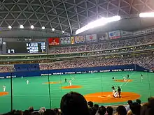
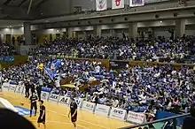
Sports

(Kariya)
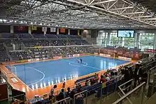
.jpg.webp)
The sports teams listed below are based in Aichi.
Basketball
- SAN-EN NeoPhoenix(Toyohashi and Hamamatsu)
- SeaHorses Mikawa(Kariya)
- Nagoya Diamond Dolphins(Nagoya)
- Toyotsu Fighting Eagles Nagoya(Nagoya)
- Aisin AW Areions Anjo(Anjō)
Volleyball
Tourism
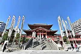

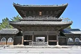
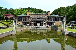
Notable sites in Aichi include the Meiji Mura open-air architectural museum in Inuyama, which preserves historic buildings from Japan's Meiji and Taishō periods, including the reconstructed lobby of Frank Lloyd Wright's old Imperial Hotel (which originally stood in Tokyo from 1923 to 1967).
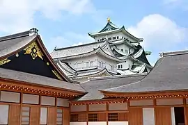
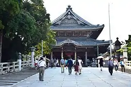
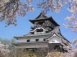
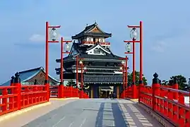
Other popular sites in Aichi include the tour of the Toyota car factory in the city by the same name, the monkey park in Inuyama, and the castles in Nagoya, Okazaki, Toyohashi, and Inuyama.
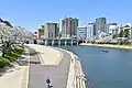
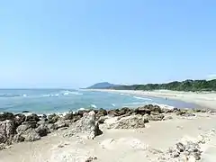
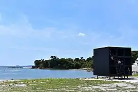
Aichi Prefecture has many wonderful beaches. For example, Himakajima Beach, Shinojima Beach, Akabane Beach, Utsumi Beach.
 Kiyosu Castle and Kiyosu Castle Park in Kiyosu
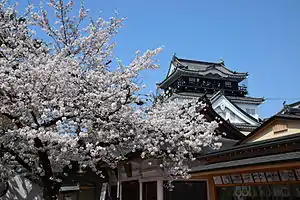


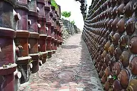 Tokoname pottery footpath
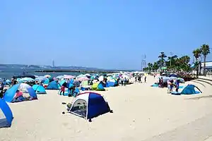

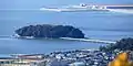
 Sakushima
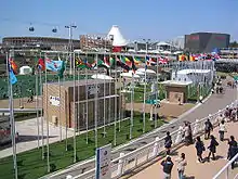
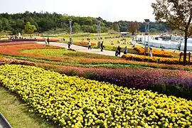 Site of Expo 2005
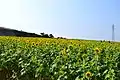
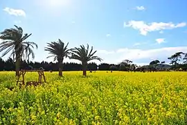 Field Mustard, Tahara
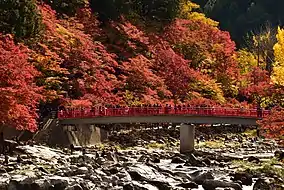
 Mount Hōraiji
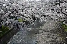
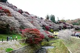 Obara shikizakura
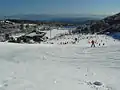
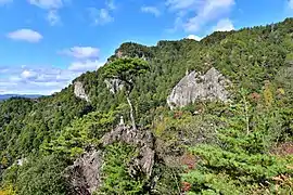
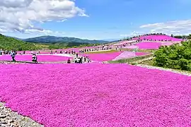 Chausuyama Plateau
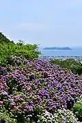 Katahara Onsen(Hydrangea Park)
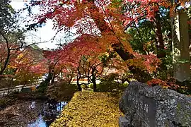 The ruins of Matsudaira
 Sakurabuchi Park
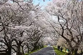 Kisogawazutsumi
 View of Cape Irago from Irako View Hotel
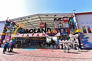
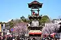
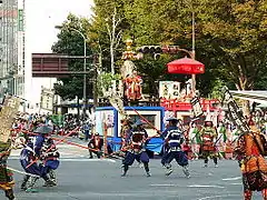
Festival and events
- Owari Tsushima Tenno Matsuri(Aisai, Tsushima)
- Inuyama Festival(Inuyama)
- Kamezaki Shiohi Festival(Handa)
- Chiryu Festival(Chiryū)
- Sunari Festival(Ama DistrictKanie)
 Owari Tsushima Tennōsai (eve)
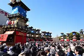 Inuyama Festival
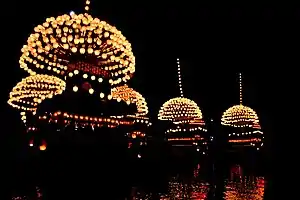
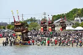 Kamezaki Shiohi Festival
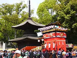 Chiryu Festival
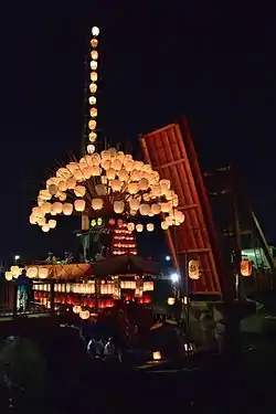 Sunari Festival
- Others
- Nagoya Festival(Nagoya City)
- Tsutsui-chō/Dekimachi Tennō Festival(Nagoya Higashi-ku)
- Miya Festival(Gamagōri)
- Toyohama Sea bream Festival(Chita District Minamichita Town)
- Okkawa Festival(Handa)
- Hōnen Matsuri(Komaki)
- Omanto festival(Takahama)
- Kōnomiya Hadaka Matsuri(Inazawa)
- Tezutsu Matsuri(Toyohashi, Toyokawa)
- Nagashino festival(Shinshiro)
- Mando festival(Kariya)
- Isshiki Lantern Festival(Nishio)
- Toba Fire Festival(Nishio)
- Owari Tsushima Autumn Festival(Tsushima)
 Nagoya Festival
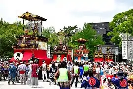 Tsutsui-chō/Dekimachi Tennō Festival
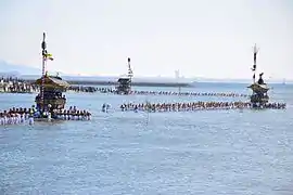 Miya Festival
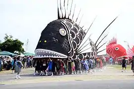 Toyohama Sea bream Festival
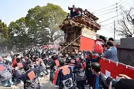 Okkawa Festival
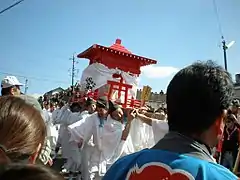 Hōnen Matsuri
 Omanto festival
 Kōnomiya Hadaka Matsuri
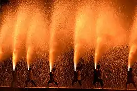 Toyokawa Tezutsu Matsuri
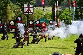 Nagashino festival
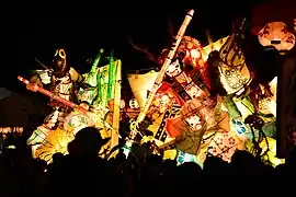 Mando festival
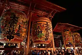 Isshiki Lantern Festival
 Toba Fire Festival
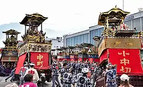 Owari Tsushima Autumn Festival
References
- Frédéric, Louis (31 May 2002). Japan Encyclopedia. Translated by Roth, Käthe. Harvard University Press. ISBN 978-0674007703. OCLC 58053128. OL 7671330M.
- "Summary of Aichi Prefecture". Aichi Prefectural Government Official Site. Aichi Prefectural Government Office. n.d. Archived from the original on 29 October 2020. Retrieved 11 November 2020.
- Sadamichi, Kato (1 July 2000). "Rediscovering an Ancient Poem to Save a Tidal Flat". International Studies in Literature and Environment. Oxford University Press. 7 (2): 189–197. doi:10.1093/isle/7.2.189. eISSN 1759-1090. ISSN 1076-0962. OCLC 819414712.
- "General overview of area figured for Natural Parks by prefecture" (PDF). Government of Japan. Ministry of the Environment. 1 April 2014. Archived (PDF) from the original on 5 November 2020. Retrieved 11 November 2020.
- "Business Locations". Sumitomo Riko. Archived from the original on 12 November 2020. Retrieved 11 November 2020.
- "Statistics Bureau Home Page". Ministry of Internal Affairs and Communications. Statistics Bureau. n.d. Archived from the original on 8 November 2020. Retrieved 12 November 2020.
- "Yama, Hoko, Yatai, float festivals in Japan". Website of the Convention for the Safeguarding of the Intangible Cultural Heritage. UNESCO. Secretariat of the Convention for the Safeguarding of the Intangible Cultural Heritage. n.d. Archived from the original on 10 July 2020. Retrieved 12 November 2020.
External links
| Wikimedia Commons has media related to Aichi prefecture. |
 Aichi travel guide from Wikivoyage
- Official website
- Aichi Now-Official Site for Tourism Aichi
- Aichi, HOME of the Samurai Spirit
| Nagoya |
| |||
|---|---|---|---|---|
| Core cities | ||||
| Special cities | ||||
| Cities | ||||
| Districts | ||||
| Authority control |
|---|
Host cities of Asian Games | ||
|---|---|---|
| Summer |
| |
| Winter | ||