List of Historic Sites of Japan (Aomori)
National Historic Sites
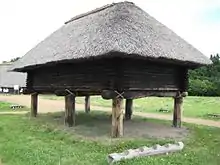
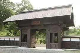
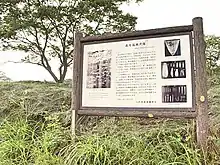
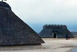
As of 1 July 2019, twenty-two Sites have been designated as being of national significance (including one *Special Historic Site).[2][3][4]

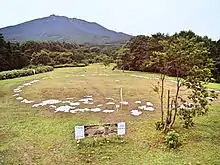
.jpg.webp)
Prefectural Historic Sites
As of 26 March 2019, a further twenty Sites have been designated as being of prefectural importance.[4][9]
| Site | Municipality | Comments | Image | Coordinates | Type | Ref. |
|---|---|---|---|---|---|---|
| Seki Old Stelai 関の古碑群 Seki no ko-hi-gun | Fukaura | forty-two C14 memorial stelai | 40°44′23″N 140°06′14″E | |||
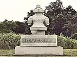
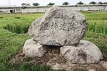
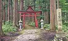
| Hachinohe Nanbu clan cemetery 八戸南部家墓所 Hachinohe nanbu-ke bosho | Hachinohe | 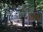 | 40°30′10″N 141°29′20″E | |||
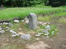
| Karauma Stele 唐馬の碑 Karauma no hi | Sannohe | 40°23′45″N 141°15′50″E | ||||
| Tenma Ichirizuka 一里塚 ichirizuka | Hachinohe | in Tenma; one mound survives | 40°28′33″N 141°30′47″E | |||
| Tairakubo Ichirizuka 一里塚 ichirizuka | Towada | in Tairakubo; both mounds survive | 40°34′29″N 141°15′53″E | |||
| Ikenotani Ichirizuka 一里塚 ichirizuka | Towada | in Ikenotai; both mounds survive | 40°40′34″N 141°10′29″E | |||
| Bonozuka Ichirizuka 一里塚 ichirizuka | Noheji | in Bonozuka; both mounds survive | 40°51′33″N 141°07′36″E | |||
| Sotsukozawa Ichirizuka 一里塚 ichirizuka | Shichinohe | in Sotsukozawa; both mounds survive | 40°47′00″N 141°10′21″E | |||
| Morinokami Ichirizuka 一里塚 ichirizuka | Shichinohe | in Morinokami; both mounds survive | 40°44′45″N 141°09′24″E | |||
| Nagakubo Ichirizuka 一里塚 ichirizuka | Hachinohe | in Nagakubo; one mound survives | 40°26′14″N 141°27′48″E | |||
| Shinden Ichirizuka 一里塚 ichirizuka | Hachinohe | in Shinden; both mounds survive | 40°24′34″N 141°26′21″E | |||
| Sunakozaki Ichirizuka 一里塚 ichirizuka | Hachinohe | in Sunakozaki; both mounds survive | 40°22′36″N 141°25′01″E | |||
| Yahatazaki Site 八幡崎遺跡 Yahatazaki iseki | Hirakawa | 40°37′03″N 140°32′07″E | ||||
| Hankyōzuka 藩境塚 Hankyōzuka | Hiranai/Noheji | four mounds | 40°53′14″N 141°04′57″E | |||
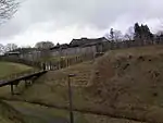
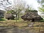
| Battle of Noheji cemetery 野辺地戦争戦死者の墓所 Noheji-sensō senshisha no bosho | Noheji | 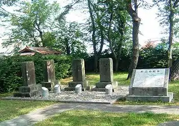 | 40°52′16″N 141°06′34″E | |||
| Nakano Ichirizuka 一里塚 ichirizuka | Sannohe | in Nakano; both mounds survive | 40°21′01″N 141°15′43″E | |||
| Tonai Mass Graves and Memorial Stele 斗内千人塚 墳丘 供養塔 Tonai senninzuka funkyū kuyōtō | Sannohe | from the great famine of 1783-4 (天明の大飢饉) | 40°21′34″N 141°12′25″E | |||
| Memorial Stele and Platform for the Starved 餓死萬霊等供養塔及び戒壇石 Gashi banrei-tō kuyōtō oyobi kaidanseki | Hachinohe | from the 1780s famine; in Teranoue | 40°29′55″N 141°31′35″E | |||
| Nakasato Castle ruins 中里城遺跡 Nakasato-jō iseki | Nakadomari | 40°58′13″N 140°26′30″E | ||||
| Tairadate Battery ruins 平舘台場跡 Tairadate daiba ato | Sotogahama | 41°10′28″N 140°38′34″E | ||||
Municipal Historic Sites
As of 1 May 2018, a further ninety-two Sites have been designated as being of municipal importance.[10]
See also
References
- "Cultural Properties for Future Generations". Agency for Cultural Affairs. Retrieved 19 July 2019.
- 史跡名勝天然記念物 [Number of Monuments of Japan by Prefecture] (in Japanese). Agency for Cultural Affairs. 1 July 2019. Retrieved 19 July 2019.
- "Database of National Cultural Properties: 史跡名勝天然記念物 (史跡, 特別史跡 北海道)" (in Japanese). Agency for Cultural Affairs. Archived from the original on 30 June 2019. Retrieved 19 July 2019.
- 国・県指定文化財一覧 [List of National and Prefectural Cultural Properties] (in Japanese). Aomori Prefecture. 26 March 2019. Retrieved 19 July 2019.
- "Jômon Archaeological Sites in Hokkaidô, Northern Tôhoku, and other regions". UNESCO. Retrieved 13 June 2012.
- 「北海道・北東北を中心とした縄文遺跡群」の世界文化遺産登録をめざして [Towards World Heritage Inscription of "Jōmon Archaeological Sites in Hokkaidō, Northern Tōhoku, and other regions"] (in Japanese). Hokkaidō Government Board of Education. Archived from the original on 8 May 2013. Retrieved 13 June 2012.
- 垂柳遺跡 [Tareyanagi Site] (in Japanese). Aomori Prefecture. Retrieved 13 June 2012.
- 陸奥国是川遺跡出土品 [Excavated Artifacts from the Korekawa Site] (in Japanese). Agency for Cultural Affairs. Retrieved 13 June 2012.
- 都道府県別指定等文化財件数(都道府県分) [Number of Prefectural Cultural Properties by Prefecture] (in Japanese). Agency for Cultural Affairs. 1 May 2018. Retrieved 15 June 2019.
- 都道府県別指定等文化財件数(市町村分) [Number of Municipal Cultural Properties by Prefecture] (in Japanese). Agency for Cultural Affairs. 1 May 2018. Retrieved 19 July 2019.
External links
| Wikimedia Commons has media related to National historic sites in Aomori prefecture. |
- (in Japanese) Cultural Properties of Aomori Prefecture
This article is issued from Wikipedia. The text is licensed under Creative Commons - Attribution - Sharealike. Additional terms may apply for the media files.