List of Old San Antonio Road DAR markers
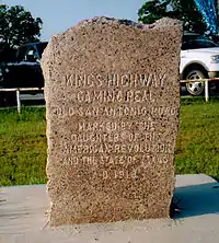
Following is a list of granite markers placed by the Texas Society Daughters of the American Revolution that designate one of the main routes of the Old San Antonio Road through Texas as surveyed in 1915 and placed in 1918. There were never any markers numbered 103-107 because of a numbering error by the surveyor.
As of October 2015, 110 of the 123 markers have been documented.[1] This includes 106 that have been documented since 2013 and 4 more that were documented circa 1995 and are known or assumed to still exist. 13 markers have never been documented.
Most of the stones have been moved to accommodate highway construction, ranching operations, or to get them off of private land and make them accessible to the public. As of 2015, only 34 of the 110 documented markers were within 100 feet of their original 1918 locations.[1]
| Marker # | Latitude | Longitude | County | Date last documented | Image |
| 1 | 31.462148 | -93.753750 | Sabine County | Aug. 10, 2013 | |
| 2 | 31.44233 | -93.77390 | Sabine County | Aug. 10, 2013 | |
| 3 | 31.43275 | -93.84733 | Sabine County | Aug. 10, 2013 | |
| 4 | 31.475916 | -93.917280 | Sabine County | Aug. 10, 2013 | |
| 5 | unknown | unknown | Sabine County | 1918 | |
| 6 | 31.511393 | -94.0488556 | San Augustine County | Aug. 10, 2013 | |
| 7 | 31.522973 | -94.115937 | San Augustine County | Aug. 10, 2013 | |
| 8 | 31.52585 | -94.19386 | San Augustine County | Aug. 10, 2013 | |
| 9 | 31.505546 | -94.270636 | San Augustine County | Aug. 10, 2013 | |
| 10 | 31.5046023 | -94.307046 | Nacogdoches County | Aug. 10, 2013 | |
| 11 | 31.52312 | -94.36872 | Nacogdoches County | Aug. 31, 2013 | |
| 12 | 31.565295 | -94.48926 | Nacogdoches County | Aug. 31, 2013 | |
| 13 | unknown | unknown | Nacogdoches County | 1918 | |
| 14 | 31.59971 | -94.61390 | Nacogdoches County | Aug. 10, 2013 | |
| 15 | 31.60285 | -94.65449 | Nacogdoches County | Aug. 10, 2013 | |
| 16 | 31.626144 | -94.731591 | Nacogdoches County | Aug. 10, 2013 | |
| 17 | 31.658169 | -94.801413 | Nacogdoches County | Aug. 31, 2013 | |
| 18 | 31.67326 | -94.87796 | Nacogdoches County | Aug. 31, 2013 | |
| 19 | unknown | unknown | Cherokee County | 1918 | |
| 20 | 31.654495 | -95.038107 | Cherokee County | Sep. 30, 2013 | |
| 21 | 31.650664 | -95.073025 | Cherokee County | Sep. 30, 2013 | |
| 22 | 31.604941 | -95.139407 | Cherokee County | Sep. 30, 2013 | |
| 23 | 31.576121 | -95.168511 | Houston County | Oct. 26, 2013 | |
| 24 | 31.526760 | -95.247896 | Houston County | Oct. 26, 2013 | |
| 25 | 31.493704 | -95.273708 | Houston County | Oct. 26, 2013 | |
| 26 | 31.432620 | -95.321598 | Houston County | Oct. 26, 2013 | |
| 27 | 31.376477 | -95.373935 | Houston County | Oct. 26, 2013 | |
| 28 | 31.314600 | -95.419851 | Houston County | Oct. 26, 2013 | |
| 29 | 31.296459 | -95.496690 | Houston County | Nov. 16, 2013 | |
| 30 | 31.247057 | -95.566903 | Houston County | Nov. 16, 2013 | |
| 31 | 31.204458 | -95.626198 | Houston County | Nov. 16, 2013 | |
| 32 | 31.142759 | -95.667619 | Houston County | Nov. 16, 2013 | |
| 33 | 31.063904 | -95.716535 | Madison County | Feb. 22, 2014 | |
| 34 | 31.024622 | -95.752205 | Madison County | Mar. 22, 2014 | |
| 35 | 31.059346 | -95.827645 | Madison County | Mar. 22, 2014 | |
| 36 | 31.083452 | -95.926091 | Madison County | Mar. 22, 2014 | |
| 37 | 31.076820 | -96.002642 | Leon-Madison County line | Mar. 22, 2014 | |
| 38 | 31.037200 | -96.098010 | Leon-Madison County line | Mar. 22, 2014[Note 1][5] | |
| 39 | unknown | unknown | Leon-Madison County line | 1918[Note 1] | |
| 40 | 30.99205 | -96.186232 | Leon-Madison County line | Mar. 22, 2014 | |
| 41 | 30.971051 | -96.248107 | Brazos-Robertson County line | Mar. 22, 2014 | |
| 42 | 30.934035 | -96.315954 | Brazos-Robertson County line | Apr. 19, 2014 | |
| 43 | 30.880590 | -96.370144 | Brazos-Robertson County line | Mar. 22, 2014 | |
| 44 | 30.820374 | -96.412801 | Brazos-Robertson County line | Apr. 19, 2014 | |
| 45 | 30.755733 | -96.451097 | Brazos-Robertson County line | Apr. 19, 2014 | |
| 46 | 30.702818 | -96.488081 | Brazos County | Apr. 19, 2014 | |
| 47 | 30.645595 | -96.505614 | Brazos County | Apr. 19, 2014 | |
| 48 | 30.624438 | -96.54463 | Burleson County | May 10, 2014 | |
| 49 | unknown | unknown | Burleson County | 1918 | |
| 50 | 30.596100 | -96.610539 | Burleson County | Apr. 19, 2014 | |
| 51 | 30.562824 | -96.668192 | Burleson County | May 10, 2014 | |
| 52 | 30.525363 | -96.710137 | Burleson County | May 10, 2014 | |
| 53 | 30.471872 | -96.768686 | Burleson County | May 10, 2014 | |
| 54 | 30.435223 | -96.798796 | Burleson County | May 10, 2014 | |
| 55 | 30.405617 | -96.818384 | Lee County | May 31, 2014 | |
| 56 | 30.368932 | -96.873518 | Lee County | May 31, 2014 | |
| 57 | 30.322003 | -96.926998 | Lee County | May 31, 2014 | |
| 57B | 30.291272 | -96.960875 | Lee County | May 31, 2014 | |
| 58 | 30.262832 | -96.974243 | Lee County | May 31, 2014 | |
| 59 | 30.231695 | -97.025965 | Lee County | May 31, 2014 | |
| 60 | 30.229620 | -97.073668 | Bastrop County | May 31, 2014 | |
| 61 | 30.214017 | -97.117281 | Bastrop County | June 21, 2014 | |
| 62 | 30.157091 | -97.216053 | Bastrop County | May 31, 2014 | |
| 63 | 30.112564 | -97.290489 | Bastrop County | May 31, 2014 | |
| 64 | 30.110671 | -97.315175 | Bastrop County | May 31, 2014 | |
| 65 | 30.105287 | -97.318553 | Bastrop County | June 21, 2014 | |
| 66 | 30.110234 | -97.403396 | Bastrop County | July 12, 2014 | |
| 67 | 30.095981 | -97.465165 | Bastrop County | July 12, 2014 | |
| 68 | unknown | unknown | Bastrop County | 1918 | |
| 69 | unknown | unknown | Caldwell County | 1918 | |
| 70 | 30.023080 | -97.707887 | Caldwell County | Aug. 2, 2014 | |
| 71 | 29.982066 | -97.763209 | Caldwell-Hays County line | Jul. 12, 2014 | |
| 72 | 29.934476 | -97.818236 | Caldwell-Hays County line | Jul. 12, 2014 | |
| 73 | 29.902699 | -97.867914 | Caldwell-Hays County line | Jul. 12, 2014 | |
| 74 | 29.842490 | -97.913034 | Hays County | Aug. 2, 2014 | |
| 75 | 29.813210 | -97.967469 | Hays County | Aug. 2, 2014 | |
| 76 | 29.794372 | -98.013933 | Comal County | Aug. 2, 2014 | |
| 77 | 29.759950 | -98.049333 | Comal County | Oct. 19, 2014 | |
| 78 | 29.695467 | -98.113737 | Comal County | Aug. 23, 2014 | |
| 79 | 29.662083 | -98.186333 | Comal County | Aug. 23, 2014 | |
| 80 | 29.638384 | -98.260415 | Comal County | Aug. 23, 2014 | |
| 81 | 29.604217 | -98.328317 | Bexar County | Aug. 23, 2014 | |
| 82 | 29.563304 | -98.391343 | Bexar County | Sep. 20, 2014 | |
| 83 | 29.515267 | -98.453583 | Bexar County | Sep. 20, 2014 | |
| 84 | 29.446017 | -98.503417 | Bexar County | Sep. 20, 2014 | |
| 85 | 29.378283 | -98.489167 | Bexar County | Sep. 20, 2014 | |
| 86 | 29.320895 | -98.455218 | Bexar County | Nov. 8, 2014 | |
| 87 | 29.289899 | -98.502535 | Bexar County | Mar. 28, 2015 | |
| 88 | 29.263450 | -98.491092 | Bexar County | Mar. 28, 2015 | |
| 89 | 29.166898 | -98.500884 | Bexar County | Aug. 7, 2015 | |
| 90 | 29.145066 | -98.497409 | Atascosa County | Mar. 28, 2015 | |
| 91 | 29.127383 | -98.495750 | Atascosa County | Mar. 28, 2015 | |
| 92 | unknown | unknown | Atascosa County | 1995 (est.) | |
| 93 | 28.956539 | -98.601730 | Atascosa County | Mar. 28, 2015 | |
| 94 | 28.916013 | -98.596652 | Atascosa County | Mar. 28, 2015 | |
| 95 | unknown | unknown | Atascosa County | 1918 | |
| 96 | 28.835907 | -98.689757 | Atascosa County | Mar. 28, 2015 | |
| 97 | 28.782667 | -98.740333 | Atascosa County | Mar. 28, 2015 | |
| 98 | 28.708980 | -98.786671 | Atascosa County | Mar. 28, 2015 | |
| 99 | unknown | unknown | Frio County | 1995 (est.) | |
| 100 | unknown | unknown | La Salle County | 1918 | |
| 101 | 28.462947 | -98.816203 | La Salle County | April 25, 2015 | |
| 102 | 28.436380 | -98.879290 | La Salle County | April 25, 2015 | |
| 108 | 28.443396 | -98.932342 | La Salle County | Aug. 9, 2015 | |
| 109 | 28.465673 | -99.000933 | La Salle County | June 6, 2015 | |
| 110 | 28.464793 | -99.110030 | La Salle County | June 6, 2015 | |
| 111 | 28.450900 | -99.171267 | La Salle County | June 6, 2015 | |
| 112 | 28.436930 | -99.233853 | La Salle County | June 6, 2015 | |
| 113 | unknown | unknown | La Salle County | 1918 | |
| 114 | 28.280443 | -99.285313 | La Salle County | Aug. 8, 2015 | |
| 115 | 28.294548 | -99.395127 | Dimmit County | July 11, 2015 | |
| 116 | 28.311595 | -99.465727 | Dimmit County | July 11, 2015 | |
| 117 | 28.331864 | -99.564784 | Dimmit County | July 11, 2015 | |
| 118 | 28.351605 | -99.613910 | Dimmit County | July 11, 2015 | |
| 119 | 28.31967 | -99.7025 | Dimmit County | 1995 (est.) | |
| 120 | 28.275168 | -99.836681 | Dimmit County | Aug. 8, 2015 | |
| 121 | 28.26567 | -99.91798 | Dimmit County | Aug. 8, 2015 | |
| 122 | 28.256849 | -99.963027 | Dimmit County | Aug. 8, 2015 | |
| 123 | 28.270116 | -100.019254 | Dimmit County | Aug. 8, 2015 | |
| 124 | 28.2727 | -100.07275 | Dimmit County | 1995 (est.) | |
| 125 | unknown | unknown | Maverick County | 1918 | |
| 126 | unknown | unknown | Maverick County | 1918 | |
| 127 | unknown | unknown | Maverick County | 1918 | |
| 128 | unknown | unknown | Maverick County | 1918 | |
Notes
- There is a granite marker about halfway between the original locations of Marker #38 and Marker #39. It is unknown which marker this one is and which one is missing.
References
- "Summary of the Old San Antonio Road Markers". TexasCounties.Net.
- A Tour of the Old San Antonio Road
- Old San Antonio Road DAR Marker Information Site
- Zivley, V.N. Field Notes and Detail Map of the Kings Highway. AD 1915-16. Texas State Library and Archives Commission
- The Old San Antonio Road Posts and Markers on the Leon-Madison County Line