List of cultural property of national significance in Switzerland: Basel-Stadt
This list contains all cultural property of national significance (class A) in the canton of Basel-Stadt from the 2009 Swiss Inventory of Cultural Property of National and Regional Significance. It is sorted by municipality and contains 70 individual buildings, 32 collections and 3 archaeological finds.
The geographic coordinates provided are in the Swiss coordinate system as given in the Inventory.
Basel
| KGS No.? |
Picture | Name | Street Address | CH1903 X coordinate | CH1903 Y coordinate | Location |
|---|---|---|---|---|---|---|
| 1551 | 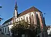 Old Catholic Prediger Church |
 Totentanz 19 | 611.044 | 267.876 | 47.561502°N 7.585378°E |
| 1553 | 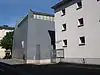 Anatomical Museum of the University Basel |
 Pestalozzistrasse 20 | 610.632 | 268.226 | 47.564657°N 7.579912°E |
| 1555 | 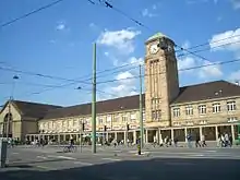 Badischer Bahnhof (Train Station) with Fountain |
 Schwarzwaldallee 200 | 612.663 | 268.526 | 47.567319°N 7.606908°E |
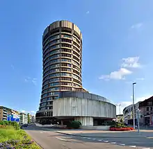
| 8895 | Bank for International Settlements | Centralbahnplatz 2 | 611.511 | 266.395 | 47.548174°N 7.591545°E | |
| 1564 8523 |
 Berri-Villen and Museum of Ancient Art and Ludwig Collection |
 St Alban-Graben 5 – 7 | 611.648 | 267.083 | 47.55436°N 7.593383°E |
| 1556 |  Bischofshof with Collegiate church |
 Rittergasse 1 | 611.607 | 267.271 | 47.556051°N 7.592843°E |
| 1557 | .jpg.webp) Blaues Haus (Reichensteinerhof) |
Blaues Haus (Reichensteinerhof) | Rheinsprung 16 / Martinsgasse 1 | 611.334 | 267.516 | 47.558259°N 7.589222°E |
| 1558 | Bruderholzschul House |
Bruderholzschul House | Fritz-Hauser-Strasse 20 | 611.909 | 264.593 | 47.53196°N 7.596784°E |
| 1559 |  Brunschwiler House |
 Hebelstrasse 15 | 610.815 | 267.777 | 47.560615°N 7.582333°E |
| 1560 | 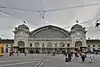 Bundesbahnhof SBB (Train Station) |
 Centralbahnstrasse 12 – 26 | 611.375 | 266.322 | 47.54752°N 7.589737°E |
| 1561 |  Bürgerspital |
 Spitalstrasse 17 – 21 | 610.877 | 267.983 | 47.562467°N 7.583162°E |
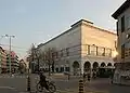
| 1562 |  Café Spitz (Merianflügel) |
 Greifengasse 2 | 611.486 | 267.781 | 47.56064°N 7.591249°E |
| 8839 |  Coop Schweiz Central Archive |
Thiersteinerallee 14 | 611.985 | 265.714 | 47.542041°N 7.597823°E |
| 10540 |  Depot of the Archäologischen Bodenforschung des Kantons (Cantonal Archeological Department) |
Lyon-Strasse 41 | 612.620 | 264.729 | 47.53317°N 7.606229°E |
| 1563 |  Domhof |
 Münsterplatz 10 – 12 | 611.522 | 267.238 | 47.555756°N 7.591713°E |
| 1565 8522 |
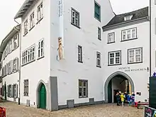
 Former Franciscan Barefoot Order Church and Basel Historical Museum |
 Barfüsserplatz 7 | 611.398 | 267.114 | 47.554643°N 7.590062°E |
| 1569 8533 |
 Former Gallizian Paper Mill and Swiss Museum for Paper, Writing and Printing |
St. Alban-Tal 37 | 612.404 | 267.122 | 47.554696°N 7.603427°E |
| 1566 |  Former Carthusian House of St Margarethental |
 Theodorskirchplatz 7 | 611.880 | 267.518 | 47.558268°N 7.596477°E |
| 1585 | Former Klingental-Kaserne with Klingental Church | Kasernenstrasse 23 | 611.367 | 267.936 | 47.562036°N 7.589671°E | |
| 1673 |  Fasnachtsbrunnen (Fountain) |
 Theaterplatz | 611.436 | 267.001 | 47.553626°N 7.590564°E |
| 1567 | 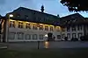 Feuerschützenhaus (Fire Station) |
 Schützenmattstrasse 56 | 610.453 | 266.997 | 47.553606°N 7.577505°E |
| 9153 |  Company Archive of Novartis |
 Fabrikstrasse 2 | 610.741 | 269.129 | 47.572776°N 7.581383°E |
| 1568 |  Fischmarktbrunnen (fountain) |
 Am Fischmarkt | 611.165 | 267.623 | 47.559225°N 7.58698°E |
| 1570 | Gasfabrik Celtic Settlement |
Voltastrasse | 610.758 | 269.072 | 47.572263°N 7.581607°E | |
| 1571 | 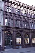 Geltenzunft |
 Marktplatz 13 | 611.273 | 267.469 | 47.557838°N 7.588411°E |
| 1690 | 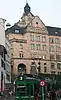 Gymnasium (School) am Kohlenberg (St Leonhard) |
 Kohlenberg 17 | 611.213 | 267.063 | 47.554187°N 7.587603°E |
| 1695 | 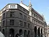 Hauptpost (Main Post Office) |
 Gerbergasse 13 / Freie Strasse 12 | 611.305 | 267.401 | 47.557226°N 7.588834°E |
| 1583 8617 |
 House zum Kirschgarten, part of the Basel Historical Museum |
 Elisabethenstrasse 27 | 611.491 | 266.829 | 47.552078°N 7.59129°E |
| 1575 |  House zum Raben |
 Aeschenvorstadt 15 / Picassoplatz 9 | 611.611 | 266.952 | 47.553182°N 7.592888°E |
| 9283 8803 |
Historic Archive Roche and Industrial Complex Hoffmann-La Roche |
Historic Archive Roche and Industrial Complex Hoffmann-La Roche | Grenzacherstrasse 183 | 612.565 | 267.635 | 47.559307°N 7.605581°E |
| 1579 |  Hohenfirstenhof |
 Rittergasse 19 | 611.698 | 267.236 | 47.555735°N 7.594051°E |
| 1580 |  Holsteinerhof |
 Hebelstrasse 30 | 610.756 | 267.826 | 47.561057°N 7.58155°E |
| 8530 | 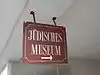 Jewish Museum of Switzerland |
 Kornhausgasse 8 | 610.891 | 267.317 | 47.556477°N 7.583332°E |
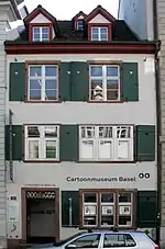
| 1606 | Caricature & Cartoon Museum Basel | St Alban-Vorstadt 28 | 611.871 | 267.100 | 47.554508°N 7.596346°E | |
| 9152 | Karl Barth-Archive | Bruderholzallee 26 | 611.190 | 264.878 | 47.534536°N 7.587243°E | |
| 1582 |  Catholic Church of St Antonius |
 Kannenfeldstrasse 35 | 610.116 | 268.142 | 47.563909°N 7.573054°E |
| 9377 | 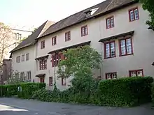 Kleines Klingental (Lower Klingen Valley) with Museum Klingental |
 Unterer Rheinweg 17 a – 27 | 611.306 | 268.053 | 47.563089°N 7.588864°E |
| 1586 8618 |
 Art Museum with Copperplate Collection |
 St Alban-Graben 16 | 611.695 | 267.077 | 47.554305°N 7.594007°E |
| 1587 | 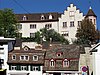 Lohnhof (Former Augustinians Collegiate Church) |
 Kohlenberg 20 | 611.222 | 267.123 | 47.554727°N 7.587724°E |
| 8910 | 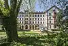 Mission 21, Archive of the evangelischen Missionswerks Basel |
 Missionsstrasse 21 | 610.541 | 267.615 | 47.559163°N 7.578689°E |
| 1588 | 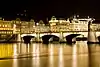 Mittlere Rhein Brücke (Mid-Rhine Bridge) |
 Eisengasse / Greifengasse | 611.372 | 267.726 | 47.560147°N 7.589733°E |
| 1597 | 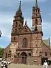 Münster (Cathedral) with Kreuzgängen and Pfalz |
 Münsterplatz 9 | 611.544 | 267.297 | 47.556286°N 7.592007°E |
| 9592 | 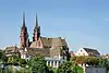 Münsterhügel / Old City (Late La Tène and medieval settlement) |
 611.500 | 267.300 | 47.556314°N 7.591422°E | |
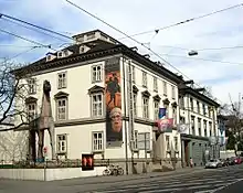
| 1591 8525 8526 |
Natural History Museum of Basel and the Museum of Cultures Basel | Augustinergasse 2 | 611.425 | 267.450 | 47.557664°N 7.59043°E | |
| 8524 |  Museum of Contemporary Art (Basel) with E. Hoffmann Collection |
 St Alban-Rheinweg 60 | 612.253 | 267.111 | 47.5546°N 7.601421°E |
| 8531 | 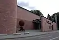 Museum Jean Tinguely in Basel |
 Paul Sacher-Anlage 2 | 613.064 | 267.613 | 47.5591°N 7.61221°E |
| 1605 | 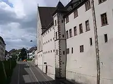 Music Museum (Basel), part of the Basel Historical Museum |
 Im Lohnhof 9 | 611.270 | 267.126 | 47.554753°N 7.588362°E |
| 1771 | 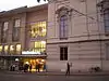 Musiksaal (Music Hall) |
 Steinenberg 14 | 611.346 | 267.069 | 47.554239°N 7.58937°E |
| 8527 | Pharmacy Museum of the Universität Basel | Totengässlein 3 | 611.122 | 267.551 | 47.558578°N 7.586407°E | |
| 8528 | 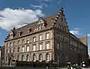 Poster Collection of the Schule für Gestaltung |
 Spalenvorstadt 2 | 610.942 | 267.423 | 47.55743°N 7.584012°E |
| 1602 |  Ramsteinerhof |
 Rittergasse 7 | 611.665 | 267.252 | 47.555879°N 7.593613°E |
| 1603 |  Rathaus (Town council house) with Standbild by Munatius Plancus |
 Marktplatz 9 | 611.256 | 267.503 | 47.558144°N 7.588186°E |
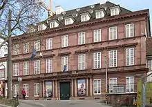
| 1592 |  Reformed Elisabethen Church |
 Elisabethenstrasse 14 | 611.486 | 266.899 | 47.552708°N 7.591226°E |
| 1593 |  Reformed Johannes Church |
 Mühlhauserstrasse 145 | 610.258 | 268.343 | 47.565715°N 7.574946°E |
| 1595 |  Former Reformed Leonhards Church |
 Leonhardskirchplatz 10 | 611.226 | 267.156 | 47.555023°N 7.587778°E |
| 1596 | 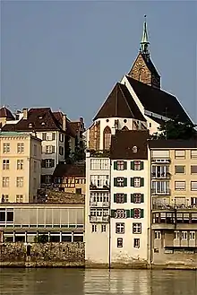 Reformed Martins Church |
 Martinskirchplatz 4 | 611.279 | 267.591 | 47.558935°N 7.588493°E |
| 1598 | 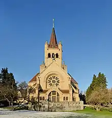 Pauluskirche (Basel), Reformed, also called Paulus Church |
 Steinenring 20 | 610.517 | 266.782 | 47.551671°N 7.57835°E |
| 1599 | 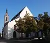 Reformed Peters Church |
 Peterskirchplatz 7 | 611.009 | 267.626 | 47.559254°N 7.584907°E |
| 1600 | 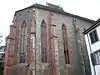 Reformed St Alban's Church |
 St. Alban-Kirchrain 11 | 612.211 | 267.092 | 47.55443°N 7.600863°E |
| 1601 | 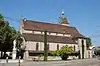 Reformed Theodors Church |
 Theodorskirchplatz 5 | 611.949 | 267.576 | 47.558788°N 7.597395°E |
| 9812 |  Rundhof Building of the Schweizerischen Mustermesse |
 Messeplatz 9 | 612.258 | 268.217 | 47.564547°N 7.601518°E |
| 1604 |  Safranzunft |
 Gerbergasse 11 | 611.262 | 267.408 | 47.557289°N 7.588263°E |
| 1607 | 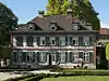 Sandgrube |
 Riehenstrasse 154 | 612.596 | 268.237 | 47.564721°N 7.60601°E |
| 1608 | Gundeldingen Castle | Gundeldingerstrasse 280 | 611.554 | 265.480 | 47.539944°N 7.592092°E | |
| 1609 |  Schönes Haus and Schöner Hof |
 Nadelberg 6 | 611.051 | 267.526 | 47.558354°N 7.585463°E |
| 9393 | 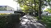 School House Wasgenring |
 Welschmattstrasse 30 | 609.252 | 267.982 | 47.562483°N 7.56157°E |
| 8812 | 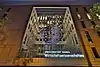 Schweizerisches Wirtschaftsarchiv |
 Peter Merian-Weg 6 | 611.897 | 266.080 | 47.545334°N 7.596664°E |
| 1614 | 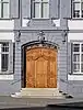 Seidenhof with Standbild Rudolf von Habsburg |
 Blumenrain 34 | 611.119 | 267.869 | 47.561438°N 7.586375°E |
| 1615 |  Sculpture Hall |
 Mittlere Strasse 17 | 610.582 | 267.767 | 47.560529°N 7.579237°E |
| 1616 | 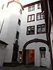 Spalenhof |
 Spalenberg 12 / Pfeffergässlein 25 | 611.120 | 267.409 | 47.557301°N 7.586376°E |
| 1618 | 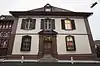 Spiesshof |
 Heuberg 7 | 611.075 | 267.311 | 47.55642°N 7.585776°E |
| 8529 | .JPG.webp) Sport Museum Schweiz |
Sport Museum Schweiz | Missionsstrasse 28 | 610.483 | 267.692 | 47.559856°N 7.57792°E |
| 8788 | 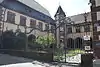 Cantonal Archive of Basel-Stadt |
 Martinsgasse 2 | 611.305 | 267.546 | 47.55853°N 7.588838°E |
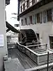
| 10144 | 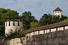 City Fortifications |
 611.000 | 267.000 | 47.553624°N 7.584772°E | |
| 1623 |  Stadthaus (Former Post) |
 Stadthausgasse 13 / | 611.142 | 267.561 | 47.558667°N 7.586673°E |
| 1625 | 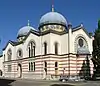 Synagoge |
 Eulerstrasse 2 | 610.827 | 267.085 | 47.554392°N 7.582476°E |
| 9168 | 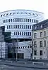 UBS AG, Group Historical Archives |
 Aeschenplatz 6 | 611.943 | 266.766 | 47.551503°N 7.597293°E |
| 1627 8838 9326 |
 University Library and Public Library with Handwritten Record Section and Music Collection |
Schönbeinstrasse 18 | 610.708 | 267.681 | 47.559754°N 7.580909°E |
| 1629 | 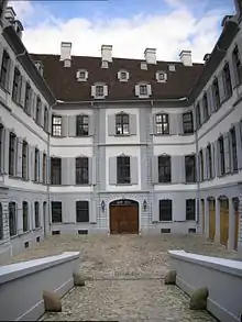 Weisses Haus (Wendelstörferhof) |
 Martinsgasse 3 | 611.349 | 267.492 | 47.558043°N 7.589421°E |
| 1630 | 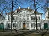 Wildtsches House |
 Petersplatz 13 | 610.881 | 267.665 | 47.559607°N 7.583207°E |
| 1631 | 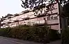 House Zum Neuen Singer |
 Speiserstrasse 98 | 612.996 | 266.241 | 47.546762°N 7.611267°E |
| 1894 |  Wolfgottesacker |
 Münchensteinerstrasse 99 | 612.688 | 265.417 | 47.539357°N 7.607152°E |
| 1633 | 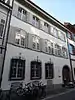 Zerkindenhof |
 Nadelberg 10 | 611.045 | 267.503 | 47.558147°N 7.585382°E |
| 10470 |  Zoological Garden |
 Birsigstrasse 51 | 610.555 | 266.290 | 47.547246°N 7.578843°E |
| Unknown | ISOS Stadt: Basel |
Bettingen
| KGS No.? |
Picture | Name | Street Address | CH1903 X coordinate | CH1903 Y coordinate | Location |
|---|---|---|---|---|---|---|
| Unknown | ISOS Spezialfall: St. Chrischona |
Riehen
| KGS No.? |
Picture | Name | Street Address | CH1903 X coordinate | CH1903 Y coordinate | Location |
|---|---|---|---|---|---|---|
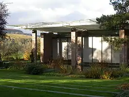
| 8532 | Beyeler Foundation | Baselstrasse 101 | 615.961 | 270.784 | 47.587554°N 7.650814°E | |
| 1915 | 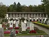 Cemetery am Hörnli with Crematorium |
 Hörnliallee 70 | 615.155 | 268.399 | 47.566124°N 7.640019°E |
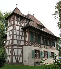
| 1901 | 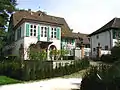 New and Old Wenkenhof with Park |
 616.121 | 269.375 | 47.574878°N 7.65289°E | |
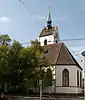
| 1900 | Reformed Village Church of St Martin with Meierhof and Ring Wall |
Kirchplatz 5 | 615.815 | 270.478 | 47.584806°N 7.648863°E | |
| 1902 8551 |
 Wettsteinhäuser (Toy Museum and Village Museum) and the Toy Museum Collection |
Baselstrasse 30 | 615.855 | 270.371 | 47.583843°N 7.64939°E |
| 1903 | 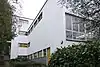 Colnaghi House |
 Wenkenstrasse 81 | 616.142 | 269.715 | 47.577936°N 7.653182°E |
| 1904 | 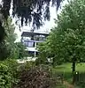 Huber House |
 Hackbergstrasse 29 | 615.766 | 269.236 | 47.573637°N 7.648167°E |
| 1905 | 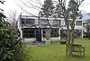 Schaeffer-von Déchend House |
 Sandreuterweg 44 | 616.298 | 269.906 | 47.57965°N 7.655262°E |
| Unknown | ISOS Verstädtertes Village: Riehen |
References
- All entries, addresses and coordinates are from: "Kantonsliste A-Objekte". KGS Inventar (in German). Federal Office of Civil Protection. 2009. Archived from the original on 28 June 2010. Retrieved 25 April 2011.
External links
- Swiss Inventory of Cultural Property of National and Regional Significance, 2009 edition:
- "Revision of the PCP Inventory (Revision des KGS-Inventars)". KGS Forum. Federal Office of Civil Protection (13/2008). 2008. Archived from the original on 5 May 2011. Retrieved 25 April 2011.
| Wikimedia Commons has media related to Cultural properties of national significance in the canton of Basel-Stadt. |
This article is issued from Wikipedia. The text is licensed under Creative Commons - Attribution - Sharealike. Additional terms may apply for the media files.