List of cultural property of national significance in Switzerland: Bern A-M
This list contains about half of the cultural property of national significance (class A) in the canton of Bern from the 2009 Swiss Inventory of Cultural Property of National and Regional Significance. It is sorted by municipality and contains 345 individual buildings, 43 collections, 30 archaeological finds and 4 other, special sites or objects.
The geographic coordinates provided are in the Swiss coordinate system as given in the Inventory.
Aarberg
| KGS No.? |
Picture | Name | Street Address | CH1903 X coordinate | CH1903 Y coordinate | Location |
|---|---|---|---|---|---|---|
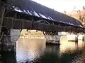
| 578 | 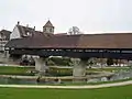 Covered Wooden Bridge |
 Stadtplatz / Murtenstrasse | 587.520 | 210.300 | 47.043613°N 7.274416°E |
| 9766 | 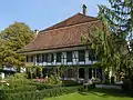 Liechti House |
 Murtenstrasse 6 | 587.379 | 210.295 | 47.043566°N 7.272561°E |
| Unknown | ISOS Kleinstadt / Flecken: Aarberg |
Aarwangen
| KGS No.? |
Picture | Name | Street Address | CH1903 X coordinate | CH1903 Y coordinate | Location |
|---|---|---|---|---|---|---|
| 9191 | 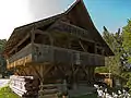 Speicher (Warehouse) |
 Meiniswilstrasse 66 B | 622.800 | 231.180 | 47.23115°N 7.739709°E |
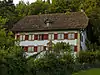
| 587 | 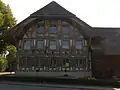 Tierli House |
 Jurastrasse 3 | 625.004 | 232.188 | 47.240137°N 7.768868°E |
| Unknown | ISOS hamlet: Meiniswil | |||||
| Unknown | 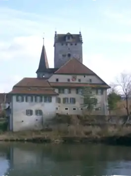 ISOS Spezialfall: Aarwangen Castle / Schürhof |
Aegerten
| KGS No.? |
Picture | Name | Street Address | CH1903 X coordinate | CH1903 Y coordinate | Location |
|---|---|---|---|---|---|---|
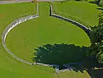
| 10483 |  Goldhubel, Early Medieval Earthen Fortress |
587.800 | 218.480 | 47.117197°N 7.27788°E |
Allmendingen
| KGS No.? |
Picture | Name | Street Address | CH1903 X coordinate | CH1903 Y coordinate | Location |
|---|---|---|---|---|---|---|
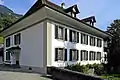
| 591 |  Noble's Manor House, Alter Sandacker |
 Sandacherweg 12 | 606.702 | 196.064 | 46.915642°N 7.526617°E |
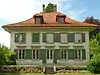
| 11714 |  Villa |
 Bergliweg 11 | 605.944 | 195.651 | 46.911934°N 7.516661°E |
Amsoldingen
| KGS No.? |
Picture | Name | Street Address | CH1903 X coordinate | CH1903 Y coordinate | Location |
|---|---|---|---|---|---|---|
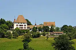
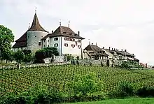
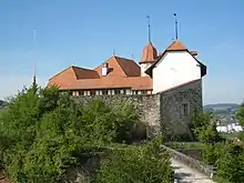
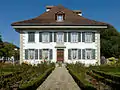
| 594 | 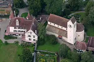 Former Collegiate Church of St. Mauritius and Amsoldingen Castle |
 Chorherrengasse 4 | 610.719 | 175.119 | 46.727182°N 7.578859°E |
Arni
| KGS No.? |
Picture | Name | Street Address | CH1903 X coordinate | CH1903 Y coordinate | Location |
|---|---|---|---|---|---|---|
| Unknown | ISOS hamlet: Hämlismatt |
Attiswil
| KGS No.? |
Picture | Name | Street Address | CH1903 X coordinate | CH1903 Y coordinate | Location |
|---|---|---|---|---|---|---|
| Unknown | ISOS Village: Attiswil |
Bätterkinden
| KGS No.? |
Picture | Name | Street Address | CH1903 X coordinate | CH1903 Y coordinate | Location |
|---|---|---|---|---|---|---|
| 9192 | 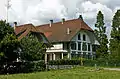 Farm House |
 Solothurnstrasse 39 | 607.434 | 220.800 | 47.138136°N 7.536632°E |
| 598 | 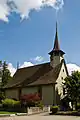 Village Church |
 Bernstrasse 15 | 607.720 | 219.790 | 47.129048°N 7.540385°E |
Belp
| KGS No.? |
Picture | Name | Street Address | CH1903 X coordinate | CH1903 Y coordinate | Location |
|---|---|---|---|---|---|---|
| 9065 | 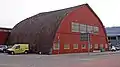 Bider-Hangar |
 Flugplatz 936 / Flugplatzstrasse 47 | 604.786 | 195.858 | 46.913806°N 7.501463°E |
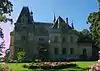
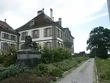
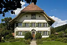
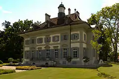
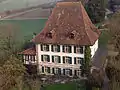
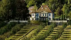
| 605 | 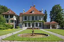 Oberried Estate with Associated Buildings |
 Seftigenstrasse 118, 120 | 604.269 | 193.065 | 46.888685°N 7.49465°E |
Bern
| KGS No.? |
Picture | Name | Street Address | CH1903 X coordinate | CH1903 Y coordinate | Location |
|---|---|---|---|---|---|---|
| 666 | 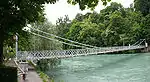 Altenbergsteg |
 600.750 | 199.900 | 46.950181°N 7.448489°E | |
| 9554 | Old City of Bern | 600.660 | 199.650 | 46.947932°N 7.447307°E | ||
| 611 | 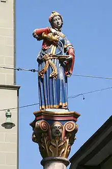 Anna-Seiler-Brunnen Fountain |
 Marktgasse | 600.448 | 199.678 | 46.948185°N 7.444522°E |
| 612 | Bärengraben | Grosser Muristalden 4 | 601.598 | 199.660 | 46.948021°N 7.459627°E | |
| 8559 |  Bernische Stiftung für angewandte Kunst and Gestaltung |
 Morillonstrasse 87 | 599.790 | 197.806 | 46.931346°N 7.43588°E |
| 9296 | .jpg.webp) Bibliothek am Guisanplatz (Former Confederation Military Library) |
Bibliothek am Guisanplatz (Former Confederation Military Library) |
Papiermühlestrasse 21 a | 601.858 | 200.910 | 46.959264°N 7.463048°E |
| 8571 | Botanical Garden of the Universität Bern | Altenbergrain 21 | 600.520 | 200.262 | 46.953438°N 7.445468°E | |
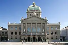
| 615 | Bundeshaus | Bundesplatz / Bundesgasse 1–9 | 600.423 | 199.519 | 46.946754°N 7.444193°E | |
| 8470 | 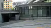 Bundeskunstsammlung |
 Monbijoustrasse 51 A | 599.807 | 198.966 | 46.94178°N 7.436102°E |
| 616 | 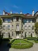 Burgerhaus |
 Amthausgasse 5 | 600.591 | 199.572 | 46.947231°N 7.4464°E |
| 617 | 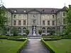 Burgerspital |
 Bubenbergplatz 4 | 600.060 | 199.620 | 46.947663°N 7.439425°E |
| 8996 | Casino | Herrengasse 25 | 600.766 | 199.547 | 46.947006°N 7.448699°E | |
| 679 | Christ-Catholic Church of St. Peter and Paul | Rathausgasse 2 | 601.000 | 199.730 | 46.948652°N 7.451773°E | |
| 681 | 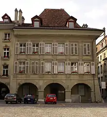 Diesbach House |
 Münstergasse 2 | 601.031 | 199.615 | 46.947617°N 7.45218°E |
| 9013 | 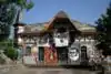 Reitschule (Former Municipal School) |
 Schützenmattstrasse 7 | 600.155 | 200.210 | 46.95297°N 7.440673°E |
| 632 | .jpg.webp) Former Kornhaus (Former Granary, now a Museum) |
Former Kornhaus (Former Granary, now a Museum) | Kornhausplatz 18 | 600.659 | 199.747 | 46.948805°N 7.447294°E |
| 683 | 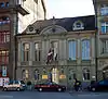 Former Rathaus des Äusseren Standes (Council House of the Outer Territories) |
 Zeughausgasse 17 | 600.554 | 199.743 | 46.948769°N 7.445914°E |
| 8984 |  Federal Alcohol Department Building |
 Länggassstrasse 31 | 599.514 | 200.239 | 46.953231°N 7.432253°E |
| 619 |  Eidgenössische Münzstätte (Federal Mint) |
 Bernastrasse 28 | 600.757 | 198.833 | 46.940583°N 7.448579°E |
| 686 |  Federal Tariff Department Building |
 Monbijoustrasse 40 | 599.764 | 199.008 | 46.942158°N 7.435538°E |
| 10468 |  Elfenau Park |
 Elfenauweg 91–94 | 602.047 | 197.951 | 46.932647°N 7.465518°E |
| 620 | Engehalbinsel Iron Age Oppidum / Roman Vicus | 600.840 | 203.615 | 46.983598°N 7.449678°E | ||
| 621 | Erlacherhof | Junkerngasse 47 | 601.146 | 199.588 | 46.947374°N 7.45369°E | |
| 9396 | Felsenau Viadukt |
Felsenau Viadukt | Autobahn A1 | 600.670 | 202.010 | 46.969161°N 7.447441°E |
| 9193 |  Fischer’sche Post House |
 Postgasse 64 | 601.129 | 199.745 | 46.948786°N 7.453467°E |
| 10467 |  Garden of Villa Bomonti |
 Kalcheggweg 12 | 601.997 | 198.679 | 46.939195°N 7.464864°E |
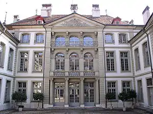
| 691 |  Generaldirektion SBB-CFF-FFS (Head Offices of the Federal Railway) |
Hochschulstrasse 6 | 599.872 | 199.891 | 46.950101°N 7.436956°E |
| 622 |  Gerechtigkeitsbrunnen (fountain) |
 Gerechtigkeitsgasse | 601.172 | 199.685 | 46.948247°N 7.454032°E |
| 11620 | 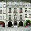 Gesellschaftshaus zu Pfistern |
 Kramgasse 9 | 600.996 | 199.640 | 46.947842°N 7.45172°E |
| 623 | 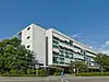 Gewerbeschule |
 Lorrainestrasse 1 | 600.476 | 200.407 | 46.954742°N 7.44489°E |
| 693 | Halenbrücke (bridge) (shared with Kirchlindach) |
Halenbrücke (bridge) (shared with Kirchlindach) | Halenstrasse | 598.450 | 202.280 | 46.971588°N 7.418269°E |
| 624 | 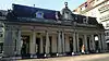 Hauptwache |
 Theaterplatz 13 | 600.669 | 199.570 | 46.947213°N 7.447425°E |
| 696 | 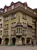 House |
 Bim Zytglogge 1 | 600.710 | 199.642 | 46.94786°N 7.447963°E |
| 9113 | 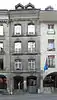 House |
 Gerechtigkeitsgasse 33 | 601.192 | 199.679 | 46.948193°N 7.454295°E |
| 694 | 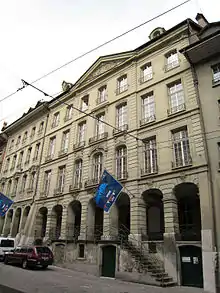 House |
 Gerechtigkeitsgasse 40 | 601.213 | 199.715 | 46.948516°N 7.454571°E |
| 695 |  House |
 Gerechtigkeitsgasse 42 | 601.199 | 199.711 | 46.94848°N 7.454387°E |
| 9194 |  House |
 Gerechtigkeitsgasse 44 | 601.189 | 199.708 | 46.948453°N 7.454255°E |
| 9195 | 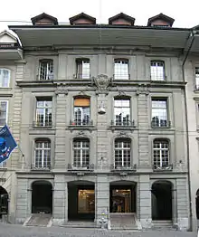 House |
 Gerechtigkeitsgasse 52 | 601.160 | 199.701 | 46.948391°N 7.453874°E |
| 11785 |  House |
 Gerechtigkeitsgasse 81 | 601.052 | 199.646 | 46.947896°N 7.452456°E |
| 9120 |  House |
 Herrengasse 4 | 600.889 | 199.556 | 46.947087°N 7.450314°E |
| 742 |  House |
 Herrengasse 23 | 600.822 | 199.543 | 46.94697°N 7.449434°E |
| 11716 |  House |
 Junkerngasse 32 | 601.150 | 199.666 | 46.948076°N 7.453743°E |
| 9119 |  House |
 Junkerngasse 39 | 601.196 | 199.626 | 46.947716°N 7.454347°E |
| 9109 |  House |
 Kramgasse 7 | 601.006 | 199.640 | 46.947842°N 7.451851°E |
| 9122 |  House |
 Münstergasse 26 | 600.934 | 199.639 | 46.947833°N 7.450906°E |
| 9110 |  House |
 Münstergasse 30 | 600.925 | 199.608 | 46.947554°N 7.450787°E |
| 9145 |  Houses |
 Spitalgasse 36 | 600.220 | 199.662 | 46.948041°N 7.441527°E |
| 8840 |  Historic Archive and Library PTT |
 Viktoriastrasse 21 | 601.445 | 200.256 | 46.953382°N 7.45762°E |
| 8508 | Historisches Museum | Helvetiaplatz 5 | 600.811 | 199.105 | 46.94303°N 7.449289°E | |
| 9166 |  Hochschule der Künste (Liberal Arts University) Archive and Musical Collection |
Papiermühlestrasse 13 | 601.596 | 200.506 | 46.955631°N 7.459604°E |
| 628 | 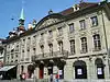 Hôtel de Musique (Café du Théâtre) |
 Theaterplatz 7 | 600.683 | 199.604 | 46.947519°N 7.447609°E |
| 629 | Käfigturm | 600.400 | 199.684 | 46.948239°N 7.443891°E | ||
| 630 |  Kantonale Militäranstalten (Cantonal Military Institute) |
 Papiermühlestrasse 15 | 601.544 | 200.666 | 46.95707°N 7.458922°E |
| 699 |  Catholic Church of Bruder Klaus |
 Ostring 1 | 602.110 | 199.040 | 46.942442°N 7.46635°E |
| 700 |  KA-WE-DE (Open Air Swimming Pool) |
 Jubiläumsstrasse 101 | 600.642 | 198.246 | 46.935303°N 7.447068°E |
| 631 |  Kindlifresserbrunnen (fountain) |
 Kornhausplatz | 600.667 | 199.696 | 46.948346°N 7.447399°E |
| 9118 |  Kirchberger House |
 Kramgasse 61 | 600.816 | 199.639 | 46.947833°N 7.449356°E |
| 701 | 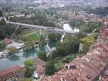 Kirchenfeldbrücke (bridge) |
 Casinoplatz / | 600.765 | 199.360 | 46.945324°N 7.448685°E |
| 702 | Kornhausbrücke (bridge) |
Kornhausbrücke (bridge) | Kornhausstrasse | 600.760 | 199.990 | 46.950991°N 7.448621°E |
| 633 | 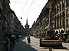 Kreuzgassbrunnen (fountain) |
 Kramgasse | 601.016 | 199.656 | 46.947986°N 7.451983°E |
| 634 | 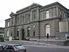 Kunstmuseum und Kunsthistorisches Seminar (Art Museum and Art History Center of Bern) |
Hodlerstrasse 12 | 600.338 | 200.022 | 46.951279°N 7.443077°E |
| 635 |  Läuferbrunnen (fountain) |
 Läuferplatz | 601.451 | 199.829 | 46.949541°N 7.457697°E |
| 8488 |  Lichtspiel-Kinemathek |
 Bahnstrasse 21 | 598.189 | 199.702 | 46.948398°N 7.414849°E |
| 712 |  Loryspital |
 Freiburgstrasse 41 G | 598.684 | 199.360 | 46.945323°N 7.421352°E |
| 636 | 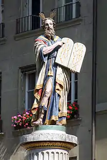 Mosesbrunnen (fountain) |
 Münsterplatz | 600.905 | 199.587 | 46.947365°N 7.450525°E |
| 9196 |  Münster (Cathedral) Platform |
 Münstergasse / Plattform | 601.000 | 199.530 | 46.946853°N 7.451772°E |
| 8510 |  Museum für Kommunikation |
 Helvetiastrasse 16 | 600.899 | 198.970 | 46.941815°N 7.450445°E |
| 8541 |  Naturhistorisches Museum der Burgergemeinde Bern |
 Bernastrasse 15 | 600.773 | 199.002 | 46.942103°N 7.44879°E |
| 638 | Neubrügg (bridge) (shared with Kirchlindach) |
Neubrügg (bridge) (shared with Kirchlindach) | Neubrückstrasse / Stuckishausstrasse | 599.200 | 202.520 | 46.973748°N 7.428124°E |
| 716 |  Nydeggbrücke (bridge) |
 601.540 | 199.705 | 46.948426°N 7.458866°E | |
| 639 | 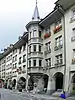 Oberes Mayhaus (Erkerhaus) |
 Münstergasse 62 | 600.788 | 199.607 | 46.947546°N 7.448988°E |
| 640 | 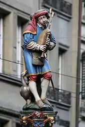 Pfeiferbrunnen (fountain) |
 Spitalgasse | 600.279 | 199.660 | 46.948023°N 7.442302°E |
| 9015 |  Primarschule Stapfenacker (Primary School of Stapfenacker) |
Brünnenstrasse 40 | 595.822 | 199.267 | 46.944474°N 7.383761°E |
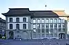
| 645 | 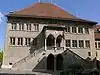 Rathaus (Town council house) with City-State's Kanzlei |
 Rathausplatz 2 | 601.043 | 199.728 | 46.948634°N 7.452338°E |
| 641 | 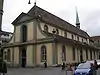 Swiss Reformed Französische Church |
 Nägeligasse 1 A / Predigergasse 1 | 600.597 | 199.791 | 46.949201°N 7.446479°E |
| 642 | 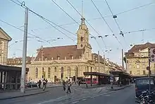 Swiss Reformed Heiliggeist Church |
 Spitalgasse 44 | 600.164 | 199.643 | 46.94787°N 7.440791°E |
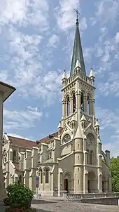
| 720 | 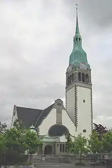 Swiss Reformed Paulus Church |
 Freiestrasse 8 | 599.357 | 200.198 | 46.952862°N 7.43019°E |
| 643 | Münster (Cathedral) |
Münster (Cathedral) | Münstergasse 7 | 600.979 | 199.588 | 46.947374°N 7.451497°E |
| 646 | 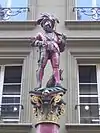 Ryfflibrunnen (Fountain) |
 Aarbergergasse | 600.299 | 199.832 | 46.94957°N 7.442565°E |
| 8894 | 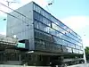 Historic collection of the SBB-CFF-FFS |
 Bollwerk 12 | 600.137 | 199.978 | 46.950883°N 7.440437°E |
| 647 | Wittigkofen Castle | Melchenbühlweg 137 | 603.296 | 199.047 | 46.942501°N 7.481927°E | |
| 721 | Holligen Castle | Holligenstrasse 44 | 598.473 | 199.161 | 46.943532°N 7.418581°E | |
| 648 | 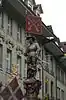 Schützenbrunnen (fountain) |
 Marktgasse | 600.586 | 199.650 | 46.947933°N 7.446335°E |
| 715 | 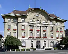 Schweizerische Nationalbank Swiss National Bank |
Bundesplatz 1 | 600.480 | 199.570 | 46.947213°N 7.444942°E |
| 649 | Schweizerische Nationalbibliothek Swiss National Library |
Schweizerische Nationalbibliothek Swiss National Library |
Hallwylstrasse 15 | 600.786 | 198.896 | 46.94115°N 7.44896°E |
| 650 |  Schweizerische Theatersammlung |
 Schanzenstrasse 15 | 599.838 | 199.772 | 46.94903°N 7.436509°E |
| 8821 | 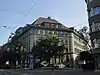 Schweizerischer Gewerkschaftsband (SGB) |
 Monbijoustrasse 61 | 599.799 | 198.917 | 46.941339°N 7.435997°E |
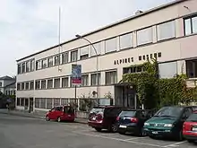
| 8542 | Swiss Alpine Museum | Helvetiaplatz 4 | 600.727 | 199.215 | 46.944019°N 7.448186°E | |
| 614 | 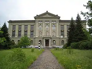 Schweizerisches Bundesarchiv Federal Archives of Switzerland |
Archivstrasse 24 | 600.612 | 198.812 | 46.940395°N 7.446675°E |
| 652 |  Simsonbrunnen (fountain) |
 Kramgasse | 600.896 | 199.650 | 46.947932°N 7.450406°E |
| 9165 | 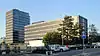 SRG SSR idée suisse Swiss Broadcasting Corporation |
Zentralarchiv der Generaldirektion Giacomettistrasse 3 | 602.672 | 199.228 | 46.944131°N 7.473732°E |
| 8801 |  Staatsarchiv des Kantons Bern |
 Falkenplatz 4 | 599.880 | 199.979 | 46.950892°N 7.437061°E |
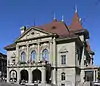
| 729 | 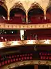 Stadttheater Bern City Theater |
 Kornhausplatz 20 | 600.680 | 199.804 | 46.949318°N 7.447569°E |
| 655 | Stift (college of canons) | Münsterplatz 1 | 600.947 | 199.545 | 46.946988°N 7.451076°E | |
| 730 | 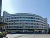 Suva House |
 Laupenstrasse 9 | 599.800 | 199.552 | 46.947051°N 7.43601°E |
| 9778 |  Tscharner House |
 Kramgasse 54 | 600.846 | 199.667 | 46.948085°N 7.44975°E |
| 657 |  Tscharner House |
 Münsterplatz 12 | 600.908 | 199.564 | 46.947159°N 7.450564°E |
| 733 | 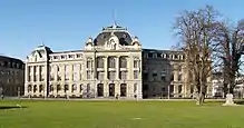 University of Bern, Main Building |
 Hochschulstrasse 4 | 599.969 | 199.916 | 46.950326°N 7.43823°E |
| 627 | 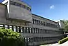 University of Bern, Institute |
 Baltzerstrasse 1–5 | 599.212 | 200.060 | 46.95162°N 7.428286°E |
| 9297 | 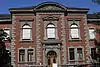 University of Bern Institute for Medical History |
 Bühlstrasse 26 | 599.334 | 200.035 | 46.951396°N 7.429889°E |
| 654 9325 |
 University Library (Former City and University Library) |
 Münstergasse 61 | 600.791 | 199.585 | 46.947348°N 7.449027°E |
| 734 |  Unteres Mayhaus |
 Münstergasse 6 | 601.009 | 199.613 | 46.947599°N 7.451891°E |
| 659 | Untertorbrücke (bridge) and Felsenburg (castle on the far side of the Aare river) |
Klösterlistutz 2 | 601.510 | 199.815 | 46.949415°N 7.458472°E | |
| 660 |  Vennerbrunnen (fountain) |
 Rathaus (Town council house)platz | 601.047 | 199.704 | 46.948418°N 7.45239°E |
| 737 |  Viktoria-Spital |
 Sonnenbergstrasse 14 | 600.863 | 200.170 | 46.95261°N 7.449974°E |
| 738 |  The Villas on Thunplatz |
 Alpenstrasse 35 / Kirchfeldstrasse 88, 90 / Thunstrasse 52, 55, 59–61, 63 |
601.592 | 198.806 | 46.940339°N 7.459546°E |
| 662 |  Von Wattenwyl House (also known as Frisching House) |
 Junkerngasse 59 | 601.085 | 199.598 | 46.947464°N 7.452889°E |
| 663 |  Waldau, formerly a Quarantine Building |
 Bolligenstrasse 133 | 603.534 | 201.582 | 46.965302°N 7.485072°E |
| 656 | 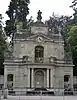 Wasserschloss am Thunplatz |
 601.540 | 198.800 | 46.940285°N 7.458863°E | |
| 664 |  Zähringerbrunnen (fountain) |
 Kramgasse | 600.803 | 199.649 | 46.947923°N 7.449185°E |
| 9111 |  Zeerleder House |
 Junkerngasse 51 | 601.113 | 199.603 | 46.947509°N 7.453257°E |
| 665 | 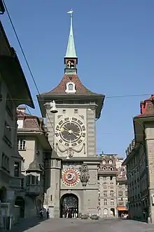 Zeitglockenturm (Clock Tower) |
 600.700 | 199.662 | 46.94804°N 7.447832°E | |
| 8561 | Zentrum Paul Klee | Monument im Fruchtland | 602.715 | 199.785 | 46.949142°N 7.4743°E | |
| 749 |  Zunfthaus zu Kaufleuten (Merchants' Guild House) |
Kramgasse 29 | 600.922 | 199.639 | 46.947833°N 7.450748°E |
| Unknown | UNESCO World Heritage Site: Old City of Bern (since 1983) | |||||
| Unknown | ISOS Verstädtertes Village: Bümpliz-Bethlehem |
ISOS Verstädtertes Village: Bümpliz-Bethlehem | ||||
| Unknown | ISOS hamlet: Niederbottigen | |||||
| Unknown | ISOS hamlet: Riedern | |||||
| Unknown | ISOS hamlet: Riedbach (gemeinsam with Frauenkappelen) | |||||
| Unknown | ISOS Spezialfall: Waldau |

Biel/Bienne
| KGS No.? |
Picture | Name | Street Address | CH1903 X coordinate | CH1903 Y coordinate | Location |
|---|---|---|---|---|---|---|
| 754 |  Alte Krone |
 Obergasse 1 | 585.419 | 221.238 | 47.141957°N 7.246417°E |
| Unknown |  Atelier Robert (Artist's Studio) |
 Paul Robert-Weg 11 | 586.191 | 222.310 | 47.151616°N 7.256562°E |
| 776 | 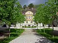 Former Manor House of Rockhall |
 Seevorstadt 103 | 585.125 | 221.060 | 47.140349°N 7.242548°E |
| 766 | 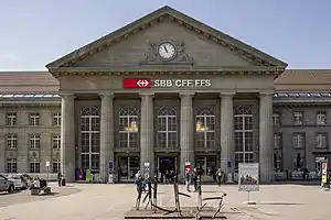 Main Train Station |
 Bahnhofplatz 4 | 585.156 | 220.241 | 47.132983°N 7.242983°E |
| 768 | 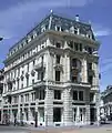 Jordi-Kocher House |
 Zentralstrasse 45 | 585.423 | 220.720 | 47.137298°N 7.246487°E |
| 773 | 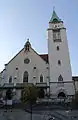 Catholic Parish Church of St. Maria Immaculata |
 Juravorstadt 45 | 585.700 | 221.550 | 47.14477°N 7.250112°E |
| 774 |  Kongresshaus (Convention Center) |
 Zentralstrasse 60 | 585.530 | 220.450 | 47.134872°N 7.247906°E |
| 775 | 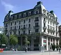 Kontrollgebäude |
 Zentralstrasse 45 | 585.485 | 220.683 | 47.136966°N 7.247305°E |
| 8543 8544 |
 Museum Neuhaus and the Robert Foundation Collection |
 Schüsspromenade 26 | 585.087 | 220.895 | 47.138864°N 7.242052°E |
| 8548 | 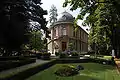 Museum Schwab |
 Seevorstadt 50 | 585.027 | 220.866 | 47.138602°N 7.241262°E |
| 753 | Swiss Reformed City Church of Biel | Ring 2 | 585.430 | 221.180 | 47.141436°N 7.246564°E | |
| 764 | 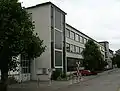 Administration Building and Montage Hall for General Motors |
 Salzhausstrasse 21 | 585.193 | 219.930 | 47.130187°N 7.243481°E |
| 789 | 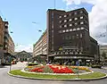 Volkshaus Building |
 Bahnhofstrasse 11 | 585.211 | 220.401 | 47.134424°N 7.243703°E |
| 762 | 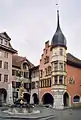 Waldleute Zunft Building |
 Ring 8 | 585.437 | 221.198 | 47.141598°N 7.246656°E |
| Unknown | ISOS Stadt: Biel / Bienne | |||||
| Unknown | 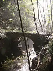 ISOS Spezialfall: Taubenlochschlucht |
Bleienbach
| KGS No.? |
Picture | Name | Street Address | CH1903 X coordinate | CH1903 Y coordinate | Location |
|---|---|---|---|---|---|---|
| Unknown | ISOS Village: Bleienbach |
Blumenstein
| KGS No.? |
Picture | Name | Street Address | CH1903 X coordinate | CH1903 Y coordinate | Location |
|---|---|---|---|---|---|---|
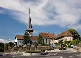
| 794 | 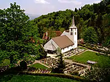 Swiss Reformed Church |
 Kirchenstrasse 26 / Blumensteinchilchen 167 | 605.762 | 174.979 | 46.725984°N 7.514012°E |
| Unknown | ISOS hamlet: Churches of Blumenstein/Wäsemli/Eschli |
Bönigen
| KGS No.? |
Picture | Name | Street Address | CH1903 X coordinate | CH1903 Y coordinate | Location |
|---|---|---|---|---|---|---|
| Unknown | ISOS Village: Bönigen |
Bolligen
| KGS No.? |
Picture | Name | Street Address | CH1903 X coordinate | CH1903 Y coordinate | Location |
|---|---|---|---|---|---|---|
| 9201 | 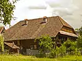 Kleingewerbler House |
 Eisengasse 31 | 604.279 | 202.592 | 46.974383°N 7.494871°E |
| 798 |  Wegmühle |
 Bolligenstrasse 70–84 | 604.409 | 201.997 | 46.96903°N 7.496573°E |
| Unknown | ISOS Spezialfall: Worbletal |
Boltigen
| KGS No.? |
Picture | Name | Street Address | CH1903 X coordinate | CH1903 Y coordinate | Location |
|---|---|---|---|---|---|---|
| 9202 | 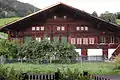 Farm House |
 Adlemsried 85 | 596.824 | 165.321 | 46.639122°N 7.397158°E |
| 9770 | 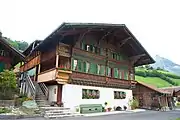 Farm House |
 Weissenbach 543 | 595.108 | 161.702 | 46.606557°N 7.374785°E |
| 9555 |  Ranggiloch (Mesolithic Site) |
 592.375 | 164.925 | 46.635524°N 7.339059°E | |
| Unknown |  ISOS Village: Boltigen |
 ||||
| Unknown | ISOS hamlet: Adlemsried |
Bowil
| KGS No.? |
Picture | Name | Street Address | CH1903 X coordinate | CH1903 Y coordinate | Location |
|---|---|---|---|---|---|---|
| 9203 |  Hochstud House |
 Oberhofen, Sagistrasse 3 | 619.334 | 194.497 | 46.901299°N 7.692375°E |
Bremgarten
| KGS No.? |
Picture | Name | Street Address | CH1903 X coordinate | CH1903 Y coordinate | Location |
|---|---|---|---|---|---|---|
| 806 | Castle | Aeschenbrunnmattstrasse 2 | 600.354 | 202.944 | 46.977563°N 7.44329°E | |
| Unknown | ISOS Spezialfall: Bremgarten bei Bern |
Brienz
| KGS No.? |
Picture | Name | Street Address | CH1903 X coordinate | CH1903 Y coordinate | Location |
|---|---|---|---|---|---|---|
| 9556 | Axalp, Abandoned Medieval / Early Modern Alpine Village | 645.730 | 172.125 | 46.698768°N 8.036548°E | ||
| 810 | 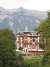 Hotel Complex Giessbach |
 Giessbach 1201, 1202 | 644.697 | 176.192 | 46.735422°N 8.023439°E |
| Unknown | ISOS Verstädtertes Village: Brienz (BE) |
ISOS Verstädtertes Village: Brienz (BE) | 644.697 | 176.192 | 46.735422°N 8.023439°E | |
| Unknown | ISOS Spezialfall: Hotel Giessbach |
Brienzwiler
| KGS No.? |
Picture | Name | Street Address | CH1903 X coordinate | CH1903 Y coordinate | Location |
|---|---|---|---|---|---|---|
| 8545 |  |
Schweizerisches Freilichtmuseum Ballenberg Swiss Open Air Museum, Ballenberg Shared With Hofstetten |
649.500 | 177.800 | 46.749547°N 8.08645°E | |
| Unknown | ISOS Village: Brienzwiler |
Brüttelen
| KGS No.? |
Picture | Name | Street Address | CH1903 X coordinate | CH1903 Y coordinate | Location |
|---|---|---|---|---|---|---|
| Unknown | ISOS hamlet: Gäserz |
Büren an der Aare
| KGS No.? |
Picture | Name | Street Address | CH1903 X coordinate | CH1903 Y coordinate | Location |
|---|---|---|---|---|---|---|
| 822 | Castle | Hauptgasse 7 | 594.901 | 221.013 | 47.140074°N 7.37142°E | |
| Unknown |  ISOS Kleinstadt / Flecken: Büren an der Aare |
Burgdorf
| KGS No.? |
Picture | Name | Street Address | CH1903 X coordinate | CH1903 Y coordinate | Location |
|---|---|---|---|---|---|---|
| 9557 | 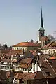 Altstadt, Medieval and Early Modern City and Castle |
 614.290 | 211.680 | 47.05599°N 7.626719°E | |
| 829 |  Former Grosse Apotheke and Diesbacher House |
 Hohengasse 19, 21 | 614.338 | 211.729 | 47.05643°N 7.627352°E |
| 9147 |  Former Mädchenschule (Girls' School) |
 Neuengasse 5 | 614.167 | 211.626 | 47.055507°N 7.625098°E |
| 9211 |  Former Niederspital (Hospital) |
 Metzgergasse 15 | 614.335 | 211.813 | 47.057185°N 7.627315°E |
| 9212 | .jpg.webp) Gehöft Grafenscheuren |
Gehöft Grafenscheuren | Grafenscheuren 1–10 | 615.137 | 213.838 | 47.075382°N 7.637939°E |
| 838 | 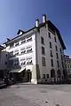 Grosshaus (Large House) |
 Hohengasse 4 / Kronenplatz 4 | 614.315 | 211.713 | 47.056286°N 7.627049°E |
| 839 | 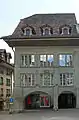 House zum Ochsen |
 Hohengasse 35 | 614.326 | 211.651 | 47.055728°N 7.627192°E |
| 9126 | Villa Schnell | Bernstrasse 53–57 | 613.749 | 211.299 | 47.052574°N 7.619587°E | |
| 843 | 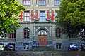 Kantonales Technikum (College) |
 Technikumstrasse 7 | 613.810 | 211.875 | 47.057754°N 7.620407°E |
| 844 | .jpg.webp) Leinenweberei (Linen Spinning Plant) Schmid with Villa |
Leinenweberei (Linen Spinning Plant) Schmid with Villa | Kirchbergstrasse 15 | 613.787 | 212.274 | 47.061344°N 7.620117°E |
| 8546 | Museum Franz Gertsch | Platanenstrasse 3 / Lyssachstrasse 3 | 614.170 | 211.895 | 47.057927°N 7.625146°E | |
| 826 | 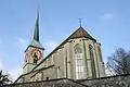 Swiss Reformed City Church |
 Kirchbühl 24 | 614.150 | 211.728 | 47.056425°N 7.624878°E |
| 11717 | Sammlung Historisches Armeematerial (Collection of Historical Military Equipment) (Shared between Thun, Burgdorf and Dübendorf in Zurich) |
615.000 | 210.200 | 47.042662°N 7.636015°E | ||
| 827 | Castle | Schlossgässli 1–4 | 614.476 | 211.544 | 47.054763°N 7.629163°E | |
| 832 | 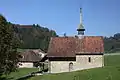 Quarantine House and Chapel |
 Kapellenweg 2 | 614.840 | 212.450 | 47.062904°N 7.633983°E |
| 850 | 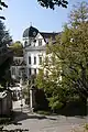 Villa Roth |
 Kreuzgraben 2 | 614.039 | 211.759 | 47.056706°N 7.623418°E |
| Unknown | ISOS Stadt: Burgdorf |
Burgistein
| KGS No.? |
Picture | Name | Street Address | CH1903 X coordinate | CH1903 Y coordinate | Location |
|---|---|---|---|---|---|---|
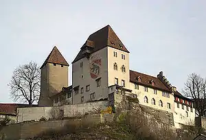
| 852 | Burgistein Castle | Schloss 163 | 605.090 | 181.784 | 46.787203°N 7.505297°E |
Champoz
| KGS No.? |
Picture | Name | Street Address | CH1903 X coordinate | CH1903 Y coordinate | Location |
|---|---|---|---|---|---|---|
| Unknown | ISOS village: Champoz |
Corgémont
| KGS No.? |
Picture | Name | Street Address | CH1903 X coordinate | CH1903 Y coordinate | Location |
|---|---|---|---|---|---|---|
| 9295 | 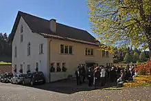 Bibliothèque De La Conférence Mennonite Suisse |
 Le Jean Guy | 578.500 | 228.959 | 47.211217°N 7.154838°E |
Cortébert
| KGS No.? |
Picture | Name | Street Address | CH1903 X coordinate | CH1903 Y coordinate | Location |
|---|---|---|---|---|---|---|
| Unknown | ISOS village: Cortébert |
Crémines
| KGS No.? |
Picture | Name | Street Address | CH1903 X coordinate | CH1903 Y coordinate | Location |
|---|---|---|---|---|---|---|
| Unknown | ISOS village: Crémines |
Därstetten
| KGS No.? |
Picture | Name | Street Address | CH1903 X coordinate | CH1903 Y coordinate | Location |
|---|---|---|---|---|---|---|
| 864 |  Farm House (1642) |
 Nidflue 309 | 605.293 | 168.003 | 46.663235°N 7.507796°E |
| 9213 |  Farm House Argel |
 Zur Obern 161 | 603.427 | 166.664 | 46.651202°N 7.483405°E |
| 862 | 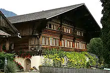 Knuttihaus im Moos |
 Moos 47 | 604.054 | 167.216 | 46.656164°N 7.4916°E |
| Unknown | ISOS hamlet: Nidflue | |||||
| Unknown | ISOS hamlet: Wiler | |||||
| Unknown | 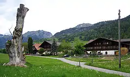 ISOS Spezialfall: Därstetten Church / Moos |
 ||||
| Unknown | ISOS Spezialfall: Weissenburg |
Deisswil
| KGS No.? |
Picture | Name | Street Address | CH1903 X coordinate | CH1903 Y coordinate | Location |
|---|---|---|---|---|---|---|
| Unknown | ISOS hamlet: Deisswil bei Münchenbuchsee |
Diemtigen
| KGS No.? |
Picture | Name | Street Address | CH1903 X coordinate | CH1903 Y coordinate | Location |
|---|---|---|---|---|---|---|
| 869 | Farm House | Oey, Sälbezen 714 | 611.213 | 166.926 | 46.653473°N 7.585121°E | |
| 9773 | Farm House | Trogmatte 32 | 609.620 | 166.411 | 46.648866°N 7.5643°E | |
| Unknown | 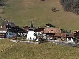 ISOS Village: Diemtigen |
Dotzigen
| KGS No.? |
Picture | Name | Street Address | CH1903 X coordinate | CH1903 Y coordinate | Location |
|---|---|---|---|---|---|---|
| 875 | 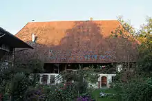 Mill |
 Lyssstrasse 24 | 593.120 | 218.501 | 47.117463°N 7.34798°E |
Dürrenroth
| KGS No.? |
Picture | Name | Street Address | CH1903 X coordinate | CH1903 Y coordinate | Location |
|---|---|---|---|---|---|---|
| 876 | Farmhouse im Feld | Feld 93 | 626.873 | 214.593 | 47.081802°N 7.792505°E | |
| 9214 | 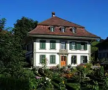 Gärbihof |
 Gärbihof 1–9 | 626.206 | 215.459 | 47.089618°N 7.783772°E |
| 877 | 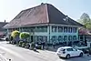 Gasthof Bären |
 Dorfstrasse 17 | 626.746 | 215.510 | 47.090055°N 7.790886°E |
| 9777 | 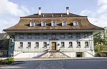 Gasthof Kreuz |
 Dorfstrasse 20 | 626.788 | 215.484 | 47.089819°N 7.791438°E |
| Unknown | ISOS Village: Dürrenroth |
Eggiwil
| KGS No.? |
Picture | Name | Street Address | CH1903 X coordinate | CH1903 Y coordinate | Location |
|---|---|---|---|---|---|---|
| 9215 | .JPG.webp) Farm House Inner-Zimmertsei |
Farm House Inner-Zimmertsei | Inner-Zimmerzei 688–692 | 625.818 | 193.731 | 46.894189°N 7.777426°E |
| 9558 | .JPG.webp) Schweinsberg (An Earthwork from an Undetermined Era) |
Schweinsberg (An Earthwork from an Undetermined Era) | 626.160 | 194.150 | 46.897944°N 7.781938°E |
Epsach
| KGS No.? |
Picture | Name | Street Address | CH1903 X coordinate | CH1903 Y coordinate | Location |
|---|---|---|---|---|---|---|
| Unknown | ISOS Village: Epsach |
Erlach
| KGS No.? |
Picture | Name | Street Address | CH1903 X coordinate | CH1903 Y coordinate | Location |
|---|---|---|---|---|---|---|
| 8983 | 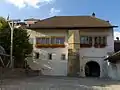 Rathaus (Town council house) |
 Altstadt 1 | 573.976 | 210.464 | 47.044695°N 7.096187°E |
| 888 | Erlach Castle | Altstadt 28 | 573.832 | 210.447 | 47.044537°N 7.094293°E | |
| Unknown | ISOS Kleinstadt / Flecken: Erlach |
Erlenbach
| KGS No.? |
Picture | Name | Street Address | CH1903 X coordinate | CH1903 Y coordinate | Location |
|---|---|---|---|---|---|---|
| 9216 | 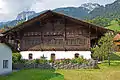 Agenstein House |
 Dorf 321 | 608.791 | 167.666 | 46.660166°N 7.553495°E |
| 9779 | Rectory | Pfrandhubel 363 | 608.642 | 167.772 | 46.661122°N 7.55155°E | |
| 9527 | 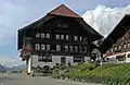 Platz House |
 Platz 317 | 608.619 | 167.673 | 46.660232°N 7.551248°E |
| 891 | 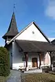 Swiss Reformed Church |
 608.680 | 167.750 | 46.660924°N 7.552046°E | |
| 9217 | 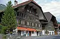 Ründi House |
 Dorf 305 | 608.794 | 167.740 | 46.660832°N 7.553535°E |
| Unknown | ISOS Village: Erlenbach im Simmental | |||||
| Unknown | ISOS hamlet: Balzenberg |
Ersigen
| KGS No.? |
Picture | Name | Street Address | CH1903 X coordinate | CH1903 Y coordinate | Location |
|---|---|---|---|---|---|---|
| 9209 | 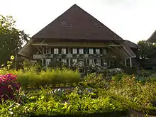 Gehöft |
 Unterdorf 9, 10 | 613.079 | 218.625 | 47.118485°N 7.610981°E |
| Unknown | ISOS Village: Niederösch | |||||
| Unknown | ISOS hamlet: Oberösch |
Ferenbalm
| KGS No.? |
Picture | Name | Street Address | CH1903 X coordinate | CH1903 Y coordinate | Location |
|---|---|---|---|---|---|---|
| 893 | 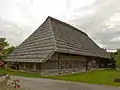 Althus Jerisberghof |
 Jerisberghof 133 | 582.888 | 200.829 | 46.958318°N 7.213822°E |
| 9218 | 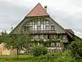 Farm House |
 Statthalterhof | 582.949 | 200.801 | 46.958067°N 7.214625°E |
| 10460 | 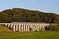 Railroad-Viaduct BN over the Saane |
 585.135 | 198.290 | 46.935533°N 7.243426°E | |
| 9912 |  Ofen House |
 Jerisberghof 132 | 582.910 | 200.852 | 46.958525°N 7.214111°E |
| Unknown | ISOS Village: Gammen | |||||
| Unknown | ISOS hamlet: Jerisberghof |
Fraubrunnen
| KGS No.? |
Picture | Name | Street Address | CH1903 X coordinate | CH1903 Y coordinate | Location |
|---|---|---|---|---|---|---|
| 1040 |  Swiss Reformed Church |
 Chilchrain 15 | 604.230 | 217.305 | 47.106727°N 7.494364°E |
| Unknown | ISOS Village: Limpach | |||||
| Unknown | ISOS Village: Büren zum Hof | |||||
| Unknown | ISOS Village: Mülchi |
Frauenkappelen
| KGS No.? |
Picture | Name | Street Address | CH1903 X coordinate | CH1903 Y coordinate | Location |
|---|---|---|---|---|---|---|
| Unknown | ISOS hamlet: Riedbach (Shared with Bern) | |||||
| Unknown | ISOS hamlet: Wolei |
Frutigen
| KGS No.? |
Picture | Name | Street Address | CH1903 X coordinate | CH1903 Y coordinate | Location |
|---|---|---|---|---|---|---|
| Unknown | ISOS hamlet: Kanderbrück | |||||
| Unknown | ISOS Spezialfall: Rybrügg / Hasli |
Gals
| KGS No.? |
Picture | Name | Street Address | CH1903 X coordinate | CH1903 Y coordinate | Location |
|---|---|---|---|---|---|---|
| 9559 | Jolimont & Chlosterwald (Prehistoric Burial Mounds) |
572.350 | 209.060 | 47.032001°N 7.074876°E | ||
| 9219 | 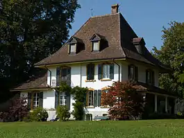 Jolimont-Gut |
 Jolimont 103 | 573.043 | 209.803 | 47.038712°N 7.083949°E |
| Unknown | ISOS Village: Gals | |||||
| Unknown | ISOS Spezialfall: Jolimont-Gut |
Gampelen
| KGS No.? |
Picture | Name | Street Address | CH1903 X coordinate | CH1903 Y coordinate | Location |
|---|---|---|---|---|---|---|
| 908 | Rectory | Oberdorfstrasse 11 | 571.215 | 207.280 | 47.015941°N 7.060057°E |
Gerzensee
| KGS No.? |
Picture | Name | Street Address | CH1903 X coordinate | CH1903 Y coordinate | Location |
|---|---|---|---|---|---|---|
| 912 | 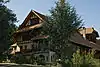 The Freiherr's Farm House of Rütimatt |
 Rütigässli 12 | 608.373 | 188.441 | 46.847052°N 7.548413°E |
| Unknown | ISOS Village: Gerzensee | |||||
| Unknown | ISOS hamlet: Vordere Chlapf |
Grandval
| KGS No.? |
Picture | Name | Street Address | CH1903 X coordinate | CH1903 Y coordinate | Location |
|---|---|---|---|---|---|---|
| 916 | Maison De La Dîme | Place Du Banneret Wisard 4 | 598.949 | 236.808 | 47.282164°N 7.424746°E | |
| 918 | .jpg.webp) Maison du Banneret Wisard |
Maison du Banneret Wisard | Place du Banneret Wisard 3 | 598.974 | 236.793 | 47.282029°N 7.425076°E |
| Unknown | (Suite) ISOS Village: Grandval |
Grindelwald
| KGS No.? |
Picture | Name | Street Address | CH1903 X coordinate | CH1903 Y coordinate | Location |
|---|---|---|---|---|---|---|
| 10421 | 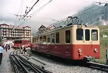 Jungfraubahn (Mountain Railway) |
 645.000 | 163.000 | 46.616736°N 8.026111°E | |
| Unknown | 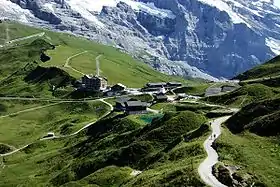 |
ISOS Spezialfall: Kleine Scheidegg (Shared between Grindelwald and Lauterbrunnen) |
Grosshöchstetten
| KGS No.? |
Picture | Name | Street Address | CH1903 X coordinate | CH1903 Y coordinate | Location |
|---|---|---|---|---|---|---|
| 1211 |  Castle and Park |
 Schlossweg 8–10, Schlosswil | 612.903 | 195.232 | 46.908067°N 7.607996°E |
Gsteig bei Gstaad
| KGS No.? |
Picture | Name | Street Address | CH1903 X coordinate | CH1903 Y coordinate | Location |
|---|---|---|---|---|---|---|
| 9220 | Farm House | Saali 594 | 587.110 | 138.818 | 46.400596°N 7.27103°E | |
| 9771 | Farm House | Feutersoey, Zelg 408 | 586.872 | 140.094 | 46.412069°N 7.267899°E | |
| Unknown | ISOS Village: Gsteig |
Gsteigwiler
| KGS No.? |
Picture | Name | Street Address | CH1903 X coordinate | CH1903 Y coordinate | Location |
|---|---|---|---|---|---|---|
| Unknown | ISOS Village: Gsteig bei Interlaken |
Guggisberg
| KGS No.? |
Picture | Name | Street Address | CH1903 X coordinate | CH1903 Y coordinate | Location |
|---|---|---|---|---|---|---|
| 9221 |  Trifelers Babis Stöckli |
 Dorf 74 | 591.666 | 179.534 | 46.766931°N 7.329535°E |
| Unknown | ISOS Village: Guggisberg |
Guttannen
| KGS No.? |
Picture | Name | Street Address | CH1903 X coordinate | CH1903 Y coordinate | Location |
|---|---|---|---|---|---|---|
| 9044 | 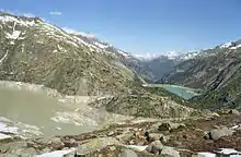 Grimselstaumauer and Hospice |
 Spittelnollen | 668.307 | 158.263 | 46.572151°N 8.329659°E |
Hagneck
| KGS No.? |
Picture | Name | Street Address | CH1903 X coordinate | CH1903 Y coordinate | Location |
|---|---|---|---|---|---|---|
| Unknown | ISOS Spezialfall: Elektrizitätswerk Hagneck |
Hasle
| KGS No.? |
Picture | Name | Street Address | CH1903 X coordinate | CH1903 Y coordinate | Location |
|---|---|---|---|---|---|---|
| 930 | 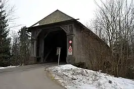 Wooden Bridge |
 Brückenstrasse / Winterseistrasse (Shared with Rüegsau) | 615.980 | 207.785 | 47.020916°N 7.648825°E |
| Unknown | ISOS Village: Goldbach | |||||
| Unknown | ISOS hamlet: Bigel |
Häutligen
| KGS No.? |
Picture | Name | Street Address | CH1903 X coordinate | CH1903 Y coordinate | Location |
|---|---|---|---|---|---|---|
| Unknown | ISOS Village: Häutligen |
Heimiswil
| KGS No.? |
Picture | Name | Street Address | CH1903 X coordinate | CH1903 Y coordinate | Location |
|---|---|---|---|---|---|---|
| 934 | Eidgenössisches Mikrofilmarchiv (Federal Microfilm Archive) |
Ried | 615.780 | 210.580 | 47.046062°N 7.646291°E | |
| 935 | 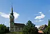 Church and Rectory |
 Oberdorf | 616.819 | 212.699 | 47.065097°N 7.660043°E |
| Unknown | ISOS hamlet: Guetisberg |
Herzogenbuchsee
| KGS No.? |
Picture | Name | Street Address | CH1903 X coordinate | CH1903 Y coordinate | Location |
|---|---|---|---|---|---|---|
| 937 | 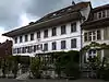 Gasthof Kreuz |
 Kirchgasse 1 | 620.326 | 226.363 | 47.187904°N 7.706823°E |
| 9234 | 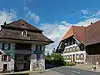 Mill and Buildings in the village of Oberönz |
 Bernstrasse 67 | 619.282 | 225.372 | 47.179021°N 7.693006°E |
| Unknown | ISOS Verstädtertes Village: Herzogenbuchsee |
Hilterfingen
| KGS No.? |
Picture | Name | Street Address | CH1903 X coordinate | CH1903 Y coordinate | Location |
|---|---|---|---|---|---|---|
| 940 | Hünegg Castle | Staatsstrasse 52 | 616.531 | 176.312 | 46.737794°N 7.654931°E |
Hindelbank
| KGS No.? |
Picture | Name | Street Address | CH1903 X coordinate | CH1903 Y coordinate | Location |
|---|---|---|---|---|---|---|
| 943 |  Church |
 Kirchweg 1 | 607.707 | 210.084 | 47.041743°N 7.540048°E |
| 9780 | Rectory | Kirchweg 3 | 607.667 | 210.096 | 47.041852°N 7.539522°E | |
| 942 | Hindelbank Castle | von Erlachweg 2 | 607.784 | 209.145 | 47.033296°N 7.541045°E | |
| Unknown | ISOS Spezialfall: Castle |
Hofstetten
| KGS No.? |
Picture | Name | Street Address | CH1903 X coordinate | CH1903 Y coordinate | Location |
|---|---|---|---|---|---|---|
| 813 | 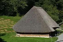 |
Schweizerisches Freilichtmuseum Ballenberg (Shared with Brienzwiler) |
649.500 | 177.800 | 46.749547°N 8.08645°E |
Huttwil
| KGS No.? |
Picture | Name | Street Address | CH1903 X coordinate | CH1903 Y coordinate | Location |
|---|---|---|---|---|---|---|
| Unknown | ISOS Kleinstadt / Flecken: Huttwil |
Innertkirchen
| KGS No.? |
Picture | Name | Street Address | CH1903 X coordinate | CH1903 Y coordinate | Location |
|---|---|---|---|---|---|---|
| 9223 | 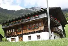 Feldhaus |
 Wyler Sunnsiten, Feldweg 6 | 661.625 | 173.430 | 46.709228°N 8.244535°E |
| 9914 | 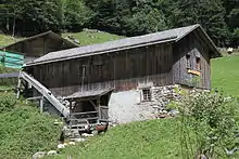 Saw Mill |
 Mühletal, Uesers Milital 642 B | 663.250 | 174.060 | 46.714743°N 8.265871°E |
Ins
| KGS No.? |
Picture | Name | Street Address | CH1903 X coordinate | CH1903 Y coordinate | Location |
|---|---|---|---|---|---|---|
| 953 | 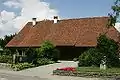 Albert Anker House |
 Müntschemiergasse 7 | 574.822 | 206.082 | 47.005312°N 7.107562°E |
| 10491 | .jpg.webp) Farm House (Himmelriich) |
Farm House (Himmelriich) | Rebstockweg 7 | 574.691 | 206.341 | 47.007637°N 7.105825°E |
| 950 | .jpg.webp) Fenis (Earthen Fortifications) |
Fenis (Earthen Fortifications) | 575.280 | 208.190 | 47.024291°N 7.11347°E | |
| Unknown | ISOS Village: Ins |
Interlaken
| KGS No.? |
Picture | Name | Street Address | CH1903 X coordinate | CH1903 Y coordinate | Location |
|---|---|---|---|---|---|---|
| 960 | _047.JPG.webp) Former Monastery Building |
Former Monastery Building | Schloss 5–17 | 632.525 | 170.725 | 46.686949°N 7.8638°E |
| 957 | 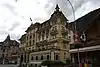 Hotel Royal-St. Georges |
 Höheweg 139 | 632.436 | 170.928 | 46.68878°N 7.862651°E |
| 955 | 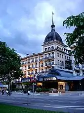 Hotel Victoria-Jungfrau |
 Höheweg 41 | 631.987 | 170.678 | 46.686552°N 7.856764°E |
| 954 |  Kursaal |
 Strandbadstrasse 44 | 632.094 | 170.903 | 46.688571°N 7.858179°E |
| Unknown | ISOS Verstädtertes Village: Interlaken |
Iseltwald
| KGS No.? |
Picture | Name | Street Address | CH1903 X coordinate | CH1903 Y coordinate | Location |
|---|---|---|---|---|---|---|
| Unknown |  ISOS Village: Iseltwald |
Ittigen
| KGS No.? |
Picture | Name | Street Address | CH1903 X coordinate | CH1903 Y coordinate | Location |
|---|---|---|---|---|---|---|
| 8780 | 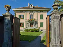 Gosteli Foundation, Archive of the History of the Swiss Feminist Movement |
 Altikofenstrasse 186 | 601.813 | 203.191 | 46.979782°N 7.462466°E |
| Unknown | ISOS Spezialfall: Worbletal (Bolligen, Ittigen, Ostermundigen, Stettlen) |
Jegenstorf
| KGS No.? |
Picture | Name | Street Address | CH1903 X coordinate | CH1903 Y coordinate | Location |
|---|---|---|---|---|---|---|
| 965 | 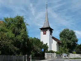 Swiss Reformed Church |
 Solothurnstrasse 1 | 605.195 | 211.030 | 47.050277°N 7.507005°E |
| 966 | Jegenstorf Castle | General-Guisanstrasse 1–5 | 605.394 | 210.758 | 47.047829°N 7.509621°E |
Kallnach
| KGS No.? |
Picture | Name | Street Address | CH1903 X coordinate | CH1903 Y coordinate | Location |
|---|---|---|---|---|---|---|
| Unknown | ISOS Spezialfall: Elektrizitätswerk Kallnach |
Kandergrund
| KGS No.? |
Picture | Name | Street Address | CH1903 X coordinate | CH1903 Y coordinate | Location |
|---|---|---|---|---|---|---|
| 969 | Felsenburg | 618.000 | 153.427 | 46.531894°N 7.673257°E |
Kandersteg
| KGS No.? |
Picture | Name | Street Address | CH1903 X coordinate | CH1903 Y coordinate | Location |
|---|---|---|---|---|---|---|
| 972 | 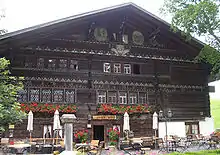 Gasthof Ruedihaus (Hotel & Restaurant) |
 Hinder De Büele 246 A | 617.557 | 148.492 | 46.487513°N 7.667295°E |
Kehrsatz
| KGS No.? |
Picture | Name | Street Address | CH1903 X coordinate | CH1903 Y coordinate | Location |
|---|---|---|---|---|---|---|
| 973 | 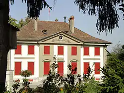 Landsitz Lohn |
 Lohnweg 2 | 602.745 | 195.290 | 46.908708°N 7.474667°E |
Kiesen
| KGS No.? |
Picture | Name | Street Address | CH1903 X coordinate | CH1903 Y coordinate | Location |
|---|---|---|---|---|---|---|
| 9781 | 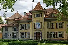 Schlossgut |
 Bernstrasse 6 | 611.254 | 185.563 | 46.821121°N 7.586114°E |
Kirchberg
| KGS No.? |
Picture | Name | Street Address | CH1903 X coordinate | CH1903 Y coordinate | Location |
|---|---|---|---|---|---|---|
| 978 | 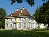 Kleehof (Dubois- Oder Tschiffeligut) |
 Chleehof 2–10 | 610.656 | 215.820 | 47.093298°N 7.578987°E |
| Unknown | ISOS hamlet: Bütikofen |
Kirchdorf
| KGS No.? |
Picture | Name | Street Address | CH1903 X coordinate | CH1903 Y coordinate | Location |
|---|---|---|---|---|---|---|
| 9208 | 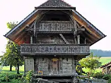 Granary |
 Filgesse 31, Mühledorf | 607.504 | 186.039 | 46.825456°N 7.53698°E |
| Unknown | ISOS Village: Kirchdorf |
Kirchlindach
| KGS No.? |
Picture | Name | Street Address | CH1903 X coordinate | CH1903 Y coordinate | Location |
|---|---|---|---|---|---|---|
| 10504 | Halenbrücke (Bridge, shared with Bern) |
Halenbrücke (Bridge, shared with Bern) | Halenstrasse | 598.450 | 202.280 | 46.971588°N 7.418269°E |
| 10503 | Neubrügg (Bridge, shared with Bern) | Stuckishausstrasse / Neubrückstrasse | 599.200 | 202.520 | 46.973748°N 7.428124°E | |
| 985 | 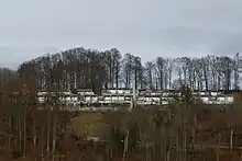 Siedlung Halen (Settlement) |
 Herrenschwanden | 598.080 | 202.390 | 46.972577°N 7.413406°E |
| Unknown | ISOS Spezialfall: Siedlung Halen |
Köniz
| KGS No.? |
Picture | Name | Street Address | CH1903 X coordinate | CH1903 Y coordinate | Location |
|---|---|---|---|---|---|---|
| 988 |  Farm House |
 Herzwilstrasse 175 | 595.594 | 196.041 | 46.915454°N 7.380798°E |
| 9560 |  Chly-Wabere (Roman Era Farmhouse) |
 601.865 | 196.380 | 46.918516°N 7.463121°E | |
| 987 | Former Commandry with Castle, Church and Outbuildings | Muhlernstrasse 1–15 | 598.114 | 196.644 | 46.92089°N 7.413877°E | |
| 994 |  Herrenstock |
 Niederscherli, Schwarzenburgstrasse 810 | 596.148 | 192.645 | 46.88491°N 7.388099°E |
| 992 |  Hof Burren |
 Mengestorf, Mengestorfbergstrasse 191, 193 | 596.124 | 194.235 | 46.899212°N 7.387771°E |
| 990 |  Noble's Wooden House |
 Grossgschneit, Grossgschneitstrasse 30 | 595.269 | 191.149 | 46.871447°N 7.376582°E |
| 989 | 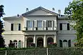 Villa Morillon |
 Morillonstrasse 45 | 599.795 | 198.050 | 46.93354°N 7.435945°E |
| Unknown | ISOS hamlet: Gurtendörfli | |||||
| Unknown | ISOS hamlet: Herzwil | |||||
| Unknown | ISOS hamlet: Liebewil | |||||
| Unknown | ISOS hamlet: Mengestorf |
Koppigen
| KGS No.? |
Picture | Name | Street Address | CH1903 X coordinate | CH1903 Y coordinate | Location |
|---|---|---|---|---|---|---|
| 9224 | 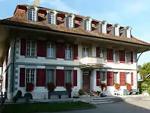 Former Gasthof Bären with Outbuildings in the Hamlet of St. Niklaus |
Bern-Zürichstrasse 28 | 613.278 | 219.955 | 47.130444°N 7.613642°E |
La Ferrière
| KGS No.? |
Picture | Name | Street Address | CH1903 X coordinate | CH1903 Y coordinate | Location |
|---|---|---|---|---|---|---|
| 9526 | Maison Gagnebin | Le Pavillon | 558.619 | 221.477 | 47.142974°N 6.893102°E |
La Neuveville
| KGS No.? |
Picture | Name | Street Address | CH1903 X coordinate | CH1903 Y coordinate | Location |
|---|---|---|---|---|---|---|
| 1105 | 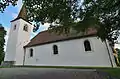 Blanche Église Réformée (White Church) |
Chemin De La Blanche Eglise 2 | 574.055 | 212.650 | 47.064361°N 7.097101°E |
| 1107 | 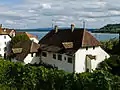 Cour Gléresse / Hof Ligerz |
 Route de Bienne 66 | 576.840 | 214.752 | 47.083372°N 7.133655°E |
| 1104 | 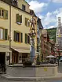 Fontaines Des Bannerets |
 Rue Du Marché | 573.703 | 212.546 | 47.063412°N 7.092474°E |
| 9916 | 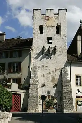 City fortifications |
 573.686 | 212.456 | 47.062602°N 7.092255°E | |
| 1109 | 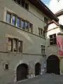 Hôtel de Ville |
 Ruelle de l’Hôtel de Ville 11 | 573.736 | 212.584 | 47.063755°N 7.092906°E |
| 1111 | 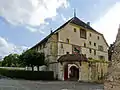 Maison de Berne |
 Rue du port 14 | 573.739 | 212.402 | 47.062118°N 7.092956°E |
| 1110 | 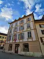 Maison des Dragons |
 Rue du Marché 27 | 573.749 | 212.475 | 47.062775°N 7.093083°E |
| Unknown | ISOS petite ville / bourg: La Neuveville | |||||
| Unknown | ISOS hameau: Chavannes |
Langenthal
| KGS No.? |
Picture | Name | Street Address | CH1903 X coordinate | CH1903 Y coordinate | Location |
|---|---|---|---|---|---|---|
| 1011 | 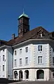 Kaufhaus |
 Marktgasse 13 | 626.574 | 229.104 | 47.212336°N 7.789421°E |
| 1009 | 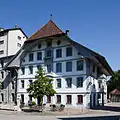 Mill |
 Mühleweg 23 | 626.785 | 229.363 | 47.214657°N 7.792222°E |
| 9572 | Unterhard archeological site with Graves and Settlements from Various Epochs |
626.300 | 231.100 | 47.230301°N 7.785921°E | ||
| Unknown | ISOS Kleinstadt / Flecken: Langenthal | |||||
| Unknown | ISOS hamlet: Chlyrot |
Langnau
| KGS No.? |
Picture | Name | Street Address | CH1903 X coordinate | CH1903 Y coordinate | Location |
|---|---|---|---|---|---|---|
| 1015 | 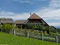 Farm House Dürsrüti |
 Unter-Dürsrüti 391 | 625.086 | 199.869 | 46.949429°N 7.768159°E |
| 1012 | 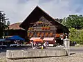 Chüechli House |
 Bärenplatz 2 | 626.340 | 199.105 | 46.942508°N 7.784587°E |
| 1018 |  Swiss Reformed Church |
 Bärenplatz 5 | 626.380 | 199.026 | 46.941796°N 7.785108°E |
| Unknown | ISOS Verstädtertes Village: Langnau im Emmental |
Lauenen
| KGS No.? |
Picture | Name | Street Address | CH1903 X coordinate | CH1903 Y coordinate | Location |
|---|---|---|---|---|---|---|
| 1021 | 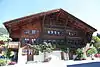 Former Farm House with Mill |
 Dorf 247 | 591.075 | 141.462 | 46.424444°N 7.322536°E |
Laupen
| KGS No.? |
Picture | Name | Street Address | CH1903 X coordinate | CH1903 Y coordinate | Location |
|---|---|---|---|---|---|---|
| 1023 | Laupen Castle | Schloss 1 | 584.996 | 194.584 | 46.902194°N 7.241723°E | |
| Unknown | ISOS Kleinstadt / Flecken: Laupen |
Lauperswil
| KGS No.? |
Picture | Name | Street Address | CH1903 X coordinate | CH1903 Y coordinate | Location |
|---|---|---|---|---|---|---|
| 1027 |  Farm House |
 Chalchmatt 19/23 | 622.844 | 202.189 | 46.970379°N 7.738826°E |
| 1026 |  Church |
 Dorf 45 | 623.046 | 201.731 | 46.966252°N 7.741457°E |
| Unknown | ISOS hamlet: Längenbach | |||||
| Unknown | ISOS hamlet: Witenbach |
Lauterbrunnen
| KGS No.? |
Picture | Name | Street Address | CH1903 X coordinate | CH1903 Y coordinate | Location |
|---|---|---|---|---|---|---|
| 9918 |  Luftseilbahn Stechelberg – Schilthorn (Aerial lift) |
 635.000 | 160.000 | 46.590348°N 7.895336°E | |
| 9573 |  Trachsellauenen, Medieval/Early Modern Silver Mine |
 635.500 | 152.600 | 46.523756°N 7.901291°E | |
| Unknown | ISOS hamlet: Gimmelwald | |||||
| Unknown | ISOS Spezialfall: Kleine Scheidegg (Grindelwald, Lauterbrunnen) |
Leuzigen
| KGS No.? |
Picture | Name | Street Address | CH1903 X coordinate | CH1903 Y coordinate | Location |
|---|---|---|---|---|---|---|
| Unknown | ISOS Village: Leuzigen |
Ligerz
| KGS No.? |
Picture | Name | Street Address | CH1903 X coordinate | CH1903 Y coordinate | Location |
|---|---|---|---|---|---|---|
| 9204 |  Aarberger House |
 Hauptstrasse 19 | 577.064 | 214.922 | 47.084909°N 7.136596°E |
| 1038 |  Gaberel House Nr. 53 |
 Dorfgasse 20 | 577.119 | 214.955 | 47.085208°N 7.137318°E |
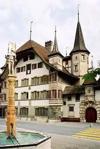
| 1037 |  Church |
 Charrière 12 | 576.976 | 215.029 | 47.085868°N 7.135431°E |
| Unknown | ISOS Village: Ligerz | |||||
| Unknown | ISOS hamlet: Bipschal |
Lotzwil
| KGS No.? |
Picture | Name | Street Address | CH1903 X coordinate | CH1903 Y coordinate | Location |
|---|---|---|---|---|---|---|
| 9205 | 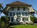 Farm House Ingold-Hof |
 Huttwilstrasse 5 | 626.739 | 226.627 | 47.19005°N 7.791452°E |
| 1041 | Rectory | Kirchgasse 3 | 626.587 | 226.709 | 47.190794°N 7.789452°E |
Lüscherz
| KGS No.? |
Picture | Name | Street Address | CH1903 X coordinate | CH1903 Y coordinate | Location |
|---|---|---|---|---|---|---|
| 9574 | Schaltenrain / Grossholz Hallstatt era burial mounds |
577.170 | 208.730 | 47.029216°N 7.138304°E |
Lützelflüh
| KGS No.? |
Picture | Name | Street Address | CH1903 X coordinate | CH1903 Y coordinate | Location |
|---|---|---|---|---|---|---|
| 1045 | 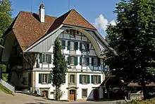 Former Mill (Kulturmühle) |
 Mühlegasse 29 | 619.451 | 206.026 | 47.005001°N 7.694404°E |
| 1046 | Rectory | Rainbergliweg 2 | 618.912 | 206.443 | 47.008767°N 7.687334°E | |
| Unknown | ISOS Village: Lützelflüh | |||||
| Unknown | ISOS Village: Trachselwald (Lützelflüh, Trachselwald) | |||||
| Unknown | ISOS Village: Trachselwald (Lützelflüh, Trachselwald) | |||||
| Unknown | ISOS hamlet: Flüelen | |||||
| Unknown | ISOS hamlet: Schufelbüel | |||||
| Unknown | ISOS hamlet: Waldhaus |
Lyssach
| KGS No.? |
Picture | Name | Street Address | CH1903 X coordinate | CH1903 Y coordinate | Location |
|---|---|---|---|---|---|---|
| Unknown | ISOS Village: Lyssach |
Mattstetten
| KGS No.? |
Picture | Name | Street Address | CH1903 X coordinate | CH1903 Y coordinate | Location |
|---|---|---|---|---|---|---|
| 9493 |  Dorfbrunnen (fountain) |
 Jegenstorfstrasse | 605.699 | 208.781 | 47.030043°N 7.51361°E |
Meienried
| KGS No.? |
Picture | Name | Street Address | CH1903 X coordinate | CH1903 Y coordinate | Location |
|---|---|---|---|---|---|---|
| Unknown | ISOS Spezialfall: Meienried |
Meiringen
| KGS No.? |
Picture | Name | Street Address | CH1903 X coordinate | CH1903 Y coordinate | Location |
|---|---|---|---|---|---|---|
| 9050 | 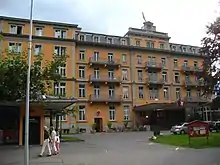 Hotel Sauvage |
 Bahnhofstrasse 30 | 657.270 | 175.312 | 46.726545°N 8.187821°E |
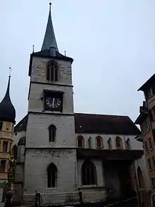
| 1059 |  Swiss Reformed Church with Outbuildings |
 Bei der Kirche 2–6 | 657.370 | 175.650 | 46.729577°N 8.189171°E |
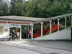
| 9921 | Reichenbachfall-Bahn | 657.000 | 175.000 | 46.723762°N 8.18425°E | ||
| Unknown | ISOS Verstädtertes Village: Meiringen | |||||
| Unknown | ISOS hamlet: Brünigen |
Melchnau
| KGS No.? |
Picture | Name | Street Address | CH1903 X coordinate | CH1903 Y coordinate | Location |
|---|---|---|---|---|---|---|
| 9207 | Käserstock | Dorfstrasse 78 | 631.284 | 225.755 | 47.182007°N 7.851361°E | |
| 9206 | Stock des Birlihofs | Birlihof 121 A | 630.501 | 225.514 | 47.179876°N 7.841015°E |
Moosseedorf
| KGS No.? |
Picture | Name | Street Address | CH1903 X coordinate | CH1903 Y coordinate | Location |
|---|---|---|---|---|---|---|
| 1069 | Moosbühl (Paleolithic Settlement) | 603.935 | 206.995 | 47.013991°N 7.490388°E | ||
| Unknown | ISOS Spezialfall: Im Sand |
Mötschwil
| KGS No.? |
Picture | Name | Street Address | CH1903 X coordinate | CH1903 Y coordinate | Location |
|---|---|---|---|---|---|---|
| Unknown | ISOS hamlet: Mötschwil |
Moutier
| KGS No.? |
Picture | Name | Street Address | CH1903 X coordinate | CH1903 Y coordinate | Location |
|---|---|---|---|---|---|---|
| 1072 | 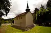 De Chalière Cemetery Chapel |
 Rue Du Chalière 14 | 594.145 | 235.860 | 47.273612°N 7.361261°E |
| Unknown | ISOS village urbanisé: Moutier |
Mühleberg
| KGS No.? |
Picture | Name | Street Address | CH1903 X coordinate | CH1903 Y coordinate | Location |
|---|---|---|---|---|---|---|
| 1081 | Railroad-Viaduct BN over the Saane (Shared with Ferenbalm) | Gümmenenau | 585.135 | 198.290 | 46.935533°N 7.243426°E | |
| Unknown | ISOS Spezialfall: Kraftwerk Mühleberg |
Münchenbuchsee
| KGS No.? |
Picture | Name | Street Address | CH1903 X coordinate | CH1903 Y coordinate | Location |
|---|---|---|---|---|---|---|
| 9497 | Badeanstalt Hofwil (Swimming Facility) |
Badeanstalt Hofwil (Swimming Facility) | Hofwilstrasse | 602.071 | 207.911 | 47.022238°N 7.465878°E |
| 1088 | 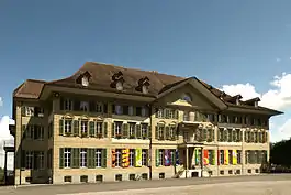 Hofwil Institution |
 601.816 | 207.706 | 47.020395°N 7.462523°E | |
| 10548 | Hofwil Castle | Hofwilstrasse 36 | 601.703 | 207.777 | 47.021034°N 7.461037°E | |
| Unknown | ISOS Spezialfall: Hofwil |
Münchenwiler
| KGS No.? |
Picture | Name | Street Address | CH1903 X coordinate | CH1903 Y coordinate | Location |
|---|---|---|---|---|---|---|
| 1089 | 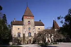 Castle with Park |
 Kühergasse 7 | 576.255 | 195.720 | 46.912157°N 7.126946°E |
| Unknown | ISOS Village: Münchenwiler |
Münsingen
| KGS No.? |
Picture | Name | Street Address | CH1903 X coordinate | CH1903 Y coordinate | Location |
|---|---|---|---|---|---|---|
| 10556 | 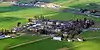 Münsingen Clinic Building |
 Hunzikenstrasse 1 | 608.728 | 192.160 | 46.880501°N 7.553138°E |
| 1093 | Rectory | Pfarrstutz | 609.246 | 191.982 | 46.878893°N 7.55993°E | |
| 9038 | Produktions- and Verwaltungsanlage USM (USM Factory and Corporate Offices) |
Produktions- and Verwaltungsanlage USM (USM Factory and Corporate Offices) |
609.665 | 190.550 | 46.866006°N 7.565397°E | |
| Unknown | ISOS Spezialfall: Anstalt Münsingen |
Muri bei Bern
| KGS No.? |
Picture | Name | Street Address | CH1903 X coordinate | CH1903 Y coordinate | Location |
|---|---|---|---|---|---|---|
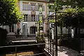
| 1097 | 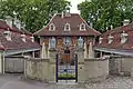 Hofgut |
 Vordere Dorfgasse 12–20 | 605.596 | 198.075 | 46.933742°N 7.512123°E |
| 1098 | Gümligen Castle | Dorfstrasse 107 | 605.830 | 198.181 | 46.934693°N 7.515197°E |
References
- All entries, addresses and coordinates are from: "Swiss inventory of cultural property of national and regional significance". A-Objects. Federal Office for Cultural Protection (BABS). 1 January 2017. Retrieved 6 September 2017.
External links
- Swiss Inventory of Cultural Property of National and Regional Significance, 2009 edition:
- "Revision of the PCP Inventory (Revision des KGS-Inventars)". KGS Forum. Federal Office of Civil Protection (13/2008). 2008. Archived from the original on 5 May 2011. Retrieved 25 April 2011.
| Wikimedia Commons has media related to Cultural properties of national significance in the canton of Bern. |
This article is issued from Wikipedia. The text is licensed under Creative Commons - Attribution - Sharealike. Additional terms may apply for the media files.