Llynclys
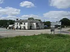
Llynclys (English: /ˈlʌŋklɪs/,[1] Welsh pronunciation: [ˈɬɨːnklɨːs])) is a small village in Shropshire, England, in the civil parish of Llanyblodwel. It lies north of Pant at the crossroads of the A483 and B4396, where there are several houses and a pub, the White Lion.
Llynclys
| |
|---|---|
 The White Lion at Llynclys | |
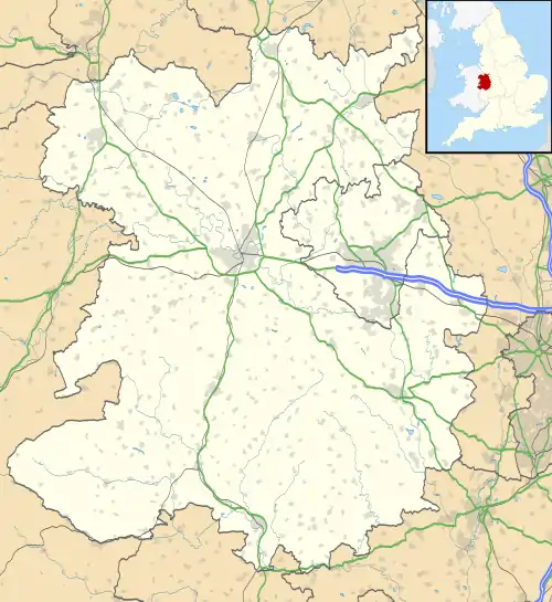
 Llynclys Location within Shropshire | |
| OS grid reference | SJ284239 |
| • London | 155 mi (249 km) SE |
| Civil parish | |
| Unitary authority | |
| Ceremonial county | |
| Region | |
| Country | England |
| Sovereign state | United Kingdom |
| Post town | OSWESTRY |
| Postcode district | SY10 |
| Dialling code | 01691 |
| Police | West Mercia |
| Fire | Shropshire |
| Ambulance | West Midlands |
| UK Parliament | |
The name Llynclys is based on the Welsh word for lake, llyn, and Llynclys Pool still lies near to the village. The -clys element was in the past thought to be derived from llys, "palace" or "court", and the lake, supposed to be of extraordinary depth, was said to contain a drowned city or palace with various legends attached to it.[2][3]
Much of the area around Llynclys Hill to the west is common land; there are a number of cottages and smallholdings probably built by workers in the area's lead mines and limestone quarries.[3] Llynclys Common, from which there are fine views, is home to eight varieties of orchid and the brown argus butterfly.[3]
Llynclys was formerly on the Cambrian Railways line from Oswestry to Welshpool. The Cambrian Railways Trust are now re-building sections of the line as a heritage railway. Llynclys South railway station is in operation, whilst the original Llynclys station remains unused of 2010.
References
- Wells, John (15 January 2010). "Ruyton how many?". John Wells's phonetic blog. Retrieved 5 March 2010.
- Simpson, Jacqueline (1976). The Folklore of the Welsh Border. Lanham: Rowman & Littlefield. p. 23. ISBN 0874718376.
- Raven, Michael (2005). A Guide to Shropshire. p. 116. ISBN 0906114349.
