Grade I listed buildings in Shropshire
There are over 9000 Grade I listed buildings in England. This page is a list of these buildings in the county of Shropshire, by district.
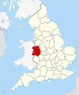
Shropshire shown within England
Shropshire
| Name | Location | Type | Completed [note 1] | Date designated | Grid ref.[note 2] Geo-coordinates |
Entry number [note 3] | Image |
|---|---|---|---|---|---|---|---|
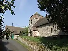
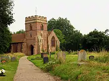
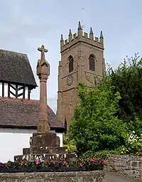
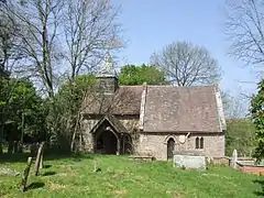
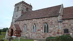
| Church of the Holy Trinity | Holdgate, Abdon | Church | 12th century | 12 November 1954 | SO5616589591 52°30′09″N 2°38′50″W |
1383399 | |
| Acton Burnell Castle | Acton Burnell | Fortified Manor House | 1284-1285 | 13 June 1958 | SJ5338201898 52°36′46″N 2°41′24″W |
1366722 | |
| Church of St Mary | Acton Burnell | Parish Church | 1250-1280 | 13 June 1958 | SJ5334901932 52°36′47″N 2°41′25″W |
1366700 | |
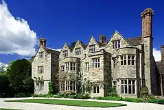
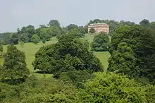
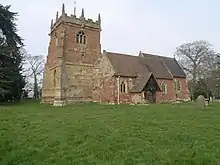
| Acton Round Hall | Acton Round | House | Queen Anne | 29 November 1951 | SO6360895578 52°33′25″N 2°32′18″W |
1053221 | 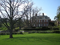 Acton Round Hall |
| Church of Saint Peter | Adderley | Parish Church | 1635-7 | 10 February 1959 | SJ6610539533 52°57′08″N 2°30′21″W |
1055290 | |
| Wattlesborough Castle, Remains Of, Adjoining Wattlesborough to North West | Alberbury with Cardeston | Castle | Late 13th century | 29 January 1952 | SJ3550812621 52°42′27″N 2°57′21″W |
1366883 | 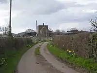 Wattlesborough Castle, Remains Of, Adjoining Wattlesborough to North West |
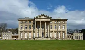
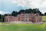
| Attingham Park | Atcham | Country House | 1783-1785 | 29 January 1952 | SJ5498909891 52°41′05″N 2°40′02″W |
1055094 | |
| Church of St Eata | Atcham | Parish Church | 12th century | 13 June 1958 | SJ5409509194 52°40′43″N 2°40′49″W |
1176664 | |
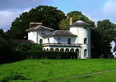
| Cronkhill | Cronkhill, Atcham | House | 17th century | 29 January 1952 | SJ5357708283 52°40′13″N 2°41′17″W |
1176915 | |
| Longner Hall and Short Section of Forecourt Wall Adjoining to North West | Longner, Atcham | House | 1803 | 29 January 1952 | SJ5287011076 52°41′43″N 2°41′56″W |
1055105 | 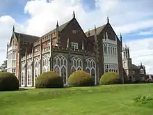 Longner Hall and Short Section of Forecourt Wall Adjoining to North West |
| Benthall Hall | Benthall, Barrow | House | Late 16th century | 24 October 1950 | SJ6580402609 52°37′13″N 2°30′24″W |
1176832 | |
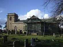
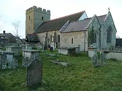
| Church of St Giles | Barrow | Church | Developed between C8 and c1100 | 24 October 1950 | SO6579099983 52°35′48″N 2°30′23″W |
1367837 | |
| Church of St Leonard | Linley, Barrow | Church | Late 12th century | 24 October 1950 | SO6866098505 52°35′00″N 2°27′50″W |
1176860 | |
| Church of All Saints | Berrington | Parish Church | 13th century | 13 June 1958 | SJ5304206860 52°39′27″N 2°41′44″W |
1176997 | |
| Cross in Churchyard of Church of St Mary | Bitterley | Cross | 14th century | 12 November 1954 | SO5708777296 52°23′31″N 2°37′55″W |
1383653 | |
| Bishop Percy's House | Bridgnorth | Timber Framed House | 1580 | 18 July 1949 | SO7180893088 52°32′06″N 2°25′01″W |
1367867 |  Bishop Percy's House |
| Church of St Mary the Virgin | Bromfield | House | 16th century | 12 November 1954 | SO4819976810 52°23′13″N 2°45′45″W |
1291888 | |
| Abbey House with attached 5 Bay Arcade, incorporating Dovecote | Buildwas | Abbey | 13th century | 24 February 1986 | SJ6436404354 52°38′09″N 2°31′41″W |
1366862 |  Abbey House with attached 5 Bay Arcade, incorporating Dovecote |
| Buildwas Abbey Comprising Guardianship Monument and Part of Claustral Ranges in Grounds of Abbey House | Buildwas | Abbey | 1135 | 13 June 1958 | SJ6432204301 52°38′07″N 2°31′43″W |
1175126 |  Buildwas Abbey Comprising Guardianship Monument and Part of Claustral Ranges in Grounds of Abbey House |
| Church of St Mary | Burford | Church | 12th century | 12 November 1954 | SO5832568028 52°18′32″N 2°36′46″W |
1383422 | |
| Church of St James | Cardington | Parish Church | 12th century | 13 June 1958 | SO5063495149 52°33′07″N 2°43′46″W |
1366702 | |
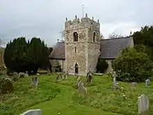
| Plaish Hall | Plaish, Cardington | House | 15th century | 29 January 1952 | SO5301896480 52°33′51″N 2°41′40″W |
1307552 | .jpg.webp) Plaish Hall |
| Church of St Peter | Chelmarsh | Church | 12th century | 9 March 1970 | SO7205587847 52°29′16″N 2°24′47″W |
1188126 | |
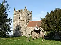
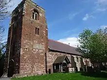
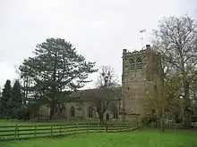
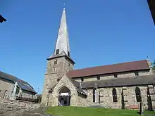
| Church of St Michael | Chirbury, Chirbury with Brompton | Church | Late C12-1536 | 21 March 1968 | SO2613198513 52°34′46″N 3°05′30″W |
1055048 | 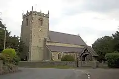 Church of St Michael |
| Remains of Compound Pier approx. 20 Metres North East of Chancel of Church of St Michael | Chirbury, Chirbury with Brompton | Structure | Late 13th century | 21 March 1968 | SO2615298546 52°34′47″N 3°05′29″W |
1055050 |  |
| Church of St Lawrence | Church Stretton | Church | 12th century | 4 July 1952 | SO4523993675 52°32′17″N 2°48′32″W |
1383267 | |
| Church of All Saints | Claverley | Church | Norman | 9 March 1970 | SO7926493425 52°32′18″N 2°18′26″W |
1188258 | |
| Ludstone Hall | Claverley | Moated house | c. 1607 | 29 November 1951 | SO7999994483 52°32′52″N 2°17′47″W |
1053874 | 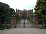 Ludstone Hall |
| Church of St Mary | Cleobury Mortimer | Church | 12th century | 12 November 1954 | SO6740075791 52°22′45″N 2°28′49″W |
1383457 | |
| Mawley Hall | Cleobury Mortimer | Country House | c. 1730 | 12 November 1954 | SO6886075258 52°22′28″N 2°27′32″W |
1383432 | |
| Remains of Clun Castle | Clun | Castle | 1090-1110 | 1 December 1951 | SO2983880978 52°25′20″N 3°01′59″W |
1295475 | 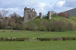 Remains of Clun Castle |
| Church of St Swithun | Clunbury | Church | 18th century | 21 March 1968 | SO3709480657 52°25′13″N 2°55′35″W |
1367001 | |
| Condover Hall | Condover | Country House | 1598 | 3 November 1955 | SJ4952105658 52°38′47″N 2°44′51″W |
1055706 | |
| Main Gateway and Gates to Condover Hall | Condover | Gate | c. 1598 | 10 March 1986 | SJ4962605740 52°38′49″N 2°44′46″W |
1055707 | .jpg.webp) Main Gateway and Gates to Condover Hall |
| Church of St Peter | Cound | Parish Church | 13th century | 13 June 1958 | SJ5582304996 52°38′27″N 2°39′15″W |
1055560 | |
| Cound Hall | Cound | Country House | 1704 | 13 June 1958 | SJ5607405329 52°38′38″N 2°39′02″W |
1177385 | |
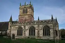
| Church of St John the Baptist | Stokesay, Craven Arms | Church | 19th century | 12 November 1954 | SO4358681741 52°25′51″N 2°49′52″W |
1269934 | 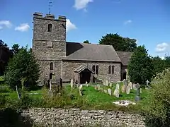 Church of St John the Baptist |
| Stokesay Castle and Gatehouse Including Moat Retaining Walls | Stokesay, Craven Arms | Cross Wing House | c1391-1400 | 12 November 1954 | SO4356181695 52°25′49″N 2°49′53″W |
1269939 |  Stokesay Castle and Gatehouse Including Moat Retaining Walls |
| Church of St Edith | Eaton-under-Heywood | Church | 12th century | 12 November 1954 | SO4998690006 52°30′20″N 2°44′18″W |
1383306 | |
| Church of St Mary | Ellesmere | Church | Norman | 19 March 1951 | SJ4028034826 52°54′27″N 2°53′22″W |
1055505 | |
| Church of Saint Andrew | Great Ness | Parish Church | 13th century | 27 May 1953 | SJ3976119033 52°45′56″N 2°53′39″W |
1295352 | |
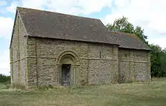
| Heath Chapel | Heath | Church | 12th century | 12 November 1954 | SO5573085621 52°28′00″N 2°39′11″W |
1383722 | |
| Church of St Luke | Hodnet | Church | 1673 | 10 February 1959 | SJ6124128600 52°51′13″N 2°34′37″W |
1366827 | |
| Hawkestone Hall | Hodnet | Country House | c. 1700 | 10 February 1959 | SJ5813829930 52°51′55″N 2°37′24″W |
1055335 | |
| Church of St John the Baptist | Hope Bagot | Church | 12th century | 12 November 1954 | SO5887974060 52°21′47″N 2°36′19″W |
1383523 | |
| Church of St Mary | Hopesay | Church | Mid 19th century | 28 May 1987 | SO3892683279 52°26′39″N 2°54′00″W |
1054961 | |
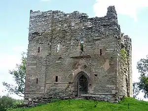
| Hopton Castle, Remains of | Hopton Castle | Castle | Early 14th century | 1 December 1951 | SO3669777938 52°23′45″N 2°55′54″W |
1054935 | |
| Church of St John the Baptist | Hughley | Parish Church | Late 17th century | 11 June 1958 | SO5648197935 52°34′39″N 2°38′37″W |
1366851 | 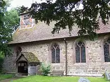 Church of St John the Baptist |
| Church of St John the Baptist | Kinlet | Church | 12th century | 9 March 1970 | SO7106681032 52°25′35″N 2°25′37″W |
1053830 | 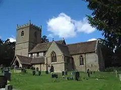 Church of St John the Baptist |
| Kinlet Hall (including Office Wings and Stables) | Kinlet | Country House/School | 1729 | 29 November 1951 | SO7083481182 52°25′40″N 2°25′49″W |
1053832 |  Kinlet Hall (including Office Wings and Stables) |
| Adcote and Adjoining Forecourt Walls | Little Ness | Country House | 1876-1881 | 2 July 1971 | SJ4184719391 52°46′08″N 2°51′48″W |
1055113 | 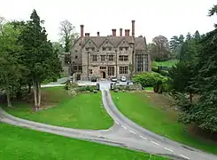 Adcote and Adjoining Forecourt Walls |
| Church of St Michael | Llanyblodwel | Parish Church | 12th century | 8 October 1959 | SJ2393822891 52°47′54″N 3°07′46″W |
1307719 | |
| Church of St Mary | Longnor | Parish Church | Early 18th century | 13 June 1958 | SJ4880500492 52°35′59″N 2°45′26″W |
1055588 | 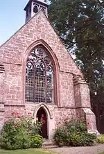 Church of St Mary |
| Longnor Hall | Longnor | Country House | 1670 | 29 January 1952 | SJ4859400504 52°36′00″N 2°45′37″W |
1366693 | 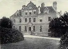 Longnor Hall |
| Church of St Michael | Loppington | Parish Church | 14th century | 28 October 1960 | SJ4716229276 52°51′30″N 2°47′10″W |
1056050 |  Church of St Michael |
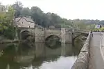
| Ludford Bridge | Ludford | Bridge | 15th century | 12 November 1954 | SO5125774210 52°21′50″N 2°43′02″W |
1281983 | |
| Broad Gate, including Broadgate Chambers and Attached Railings | Ludlow | House | C16-C18 | 15 April 1954 | SO5120474380 52°21′55″N 2°43′05″W |
1282001 |  Broad Gate, including Broadgate Chambers and Attached Railings |
| Castle House Flats | Ludlow | Flats | 1954 | 15 April 1954 | SO5092774627 52°22′03″N 2°43′20″W |
1202824 |  Castle House Flats |
| Church of St Laurence and Attached Railings | Ludlow | Parish Church | 13th century | 15 April 1954 | SO5116074712 52°22′06″N 2°43′07″W |
1202794 |  Church of St Laurence and Attached Railings |
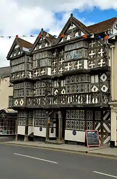
| Feathers Hotel | Ludlow | Jettied House | Earlier Core | 15 April 1954 | SO5124874753 52°22′07″N 2°43′03″W |
1282026 | |
| The Butter Cross | Ludlow | Market Hall | c. 1746 | 15 April 1954 | SO5113674657 52°22′04″N 2°43′09″W |
1289674 |  The Butter Cross |
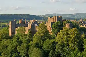
| Ludlow Castle | Ludlow | Bailey | 12th century | 15 April 1954 | SO5085774631 52°22′03″N 2°43′23″W |
1291698 | |
| The Guildhall and Adjoining Coachhouse | Ludlow | House | 1954 | 15 April 1954 | SO5100674512 52°21′59″N 2°43′15″W |
1211188 |  The Guildhall and Adjoining Coachhouse |
| The Reader's House | Ludlow | Timber Framed House | c. 1616 | 15 April 1954 | SO5119574733 52°22′06″N 2°43′06″W |
1220775 | .jpg.webp) The Reader's House |
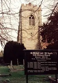
| Church of St Michael and All Angels | Lydbury North | Parish Church | Early 12th century | 21 March 1968 | SO3521186019 52°28′06″N 2°57′19″W |
1054540 |  Church of St Michael and All Angels |
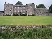
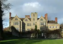
| Linley Hall | Linley, More | Country House | 1742-48 | 1 December 1951 | SO3461992893 52°31′48″N 2°57′55″W |
1054588 |  Linley Hall |
| Church of St Bartholomew | Moreton Corbet, Moreton Corbet and Lee Brockhurst | Parish Church | 12th century | 28 October 1960 | SJ5611523240 52°48′18″N 2°39′09″W |
1307235 |  Church of St Bartholomew |
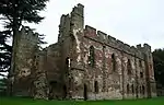
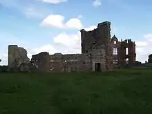
| Moreton Corbet Castle | Moreton Corbet, Moreton Corbet and Lee Brockhurst | Castle | c. 1200 | 28 October 1960 | SJ5612523131 52°48′14″N 2°39′08″W |
1366802 | |
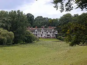
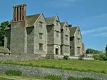
| The Old Manor House (Preston Hall) | Preston Brockhurst, Moreton Corbet and Lee Brockhurst | Country House | c. 1650 | 28 October 1960 | SJ5365124606 52°49′01″N 2°41′21″W |
1178096 |  The Old Manor House (Preston Hall) |
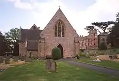
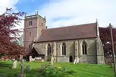
| Church of St Gregory | Morville | Church | Early Norman | 9 March 1970 | SO6696093896 52°32′31″N 2°29′19″W |
1053840 |  Church of St Gregory |
| Morville Hall | Morville | House | 16th century | 29 November 1951 | SO6684293996 52°32′34″N 2°29′25″W |
1053841 | |
| Church of Holy Trinity | Much Wenlock | Church | Norman | 24 October 1950 | SO6236699994 52°35′47″N 2°33′25″W |
1053793 |  Church of Holy Trinity |
| Priory House | Much Wenlock | House | Dissolution of the Monasteries | 24 October 1950 | SJ6251500022 52°35′48″N 2°33′17″W |
1053843 | |
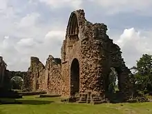
| Priory of St Milburga (ruins) | Much Wenlock | Chapter House | 12th century | 24 October 1950 | SJ6248600060 52°35′49″N 2°33′19″W |
1294473 |  Priory of St Milburga (ruins) |
| Church of St Michael | Munslow | Church | 12th century | 12 November 1954 | SO5211287720 52°29′07″N 2°42′24″W |
1383331 |  Church of St Michael |
| Llwyd Mansion | Oswestry | Jettied House | Mid to late 15th century | 10 September 1951 | SJ2907229620 52°51′34″N 3°03′18″W |
1054299 |  Llwyd Mansion |
| Church of St Michael | Pitchford | Parish Church | 12th century | 13 June 1958 | SJ5275404286 52°38′03″N 2°41′58″W |
1177813 | 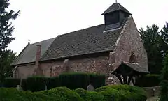 Church of St Michael |
| Pitchford Hall | Pitchford | House | 14th century or 15th century | 29 January 1952 | SJ5278204237 52°38′02″N 2°41′57″W |
1177907 | |
| Barn Approximately 20m South West of Bank Farmhouse | Pontesbury | Barn | 17th century | 10 March 1986 | SJ3867604016 52°37′50″N 2°54′27″W |
1366665 | |
| Church of All Saints | Richard's Castle | Parish Church | 1892 | 28 October 1969 | SO4943170658 52°19′54″N 2°44′37″W |
1383775 | 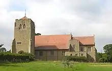 Church of All Saints |
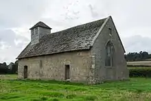
| Langley Chapel | Langley, Ruckley and Langley | Chapel | c. 1564 | 13 June 1958 | SJ5383900091 52°35′48″N 2°40′59″W |
1052167 | |
| Wilderhope Manor | Rushbury | Manor House | Late 16th century | 12 November 1954 | SO5452792879 52°31′55″N 2°40′18″W |
1383384 | |
| Church of St Mary | Selattyn, Selattyn and Gobowen | Parish Church | 13th century | 8 October 1959 | SJ2663934026 52°53′55″N 3°05′31″W |
1367376 | 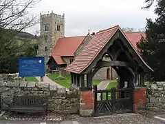 Church of St Mary |
| Church of St Mary the Virgin | Shawbury | Parish Church | Late 12th century | 28 October 1960 | SJ5591821177 52°47′11″N 2°39′18″W |
1055376 | 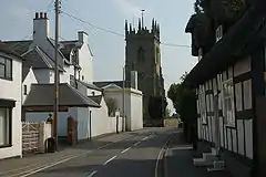 Church of St Mary the Virgin |
| Chest Tomb Approximately 1 Metre to South of South Chapel of Church of St Andrew | Shifnal | Chest Tomb | Late 18th century | 29 August 1984 | SJ7470207478 52°39′52″N 2°22′32″W |
1053624 |  Chest Tomb Approximately 1 Metre to South of South Chapel of Church of St Andrew |
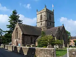
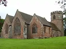
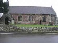
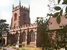
| Church of St Andrew | Shifnal | Parish Church | 12th century | 26 May 1955 | SJ7468807491 52°39′52″N 2°22′33″W |
1367657 |  Church of St Andrew |
| Shipton Hall | Shipton | House | About 1549 | 29 November 1951 | SO5617491943 52°31′25″N 2°38′51″W |
1294246 | |
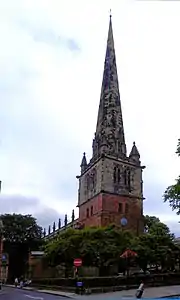
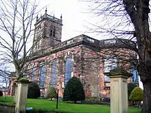
| Abbey Church of the Holy Cross | Shrewsbury | Abbey | Late C11-Early 12th century | 10 January 1953 | SJ4984412474 52°42′27″N 2°44′38″W |
1246392 | |
| Church of St Chad | Shrewsbury | Parish Church | 1790-92 | 10 January 1953 | SJ4881912431 52°42′26″N 2°45′32″W |
1344941 | |
| Church of St Mary | Shrewsbury | Parish Church | 12th century | 10 January 1953 | SJ4933612605 52°42′31″N 2°45′05″W |
1344964 | |
| Council House Gatehouse and Gateway | Shrewsbury | Timber Framed House | Early 16th century | 10 January 1953 | SJ4941112734 52°42′36″N 2°45′01″W |
1247157 | 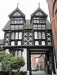 Council House Gatehouse and Gateway |
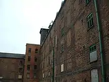
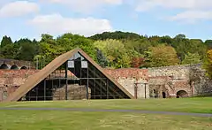
| Former Ditherington Flax Mill and attached former Malting Kiln | Ditherington, Shrewsbury | Mill | 1897-1898 | 10 January 1953 | SJ4987413830 52°43′11″N 2°44′37″W |
1270576 | |
| Library | Shrewsbury | Library | 1595 | 10 January 1953 | SJ4936512799 52°42′38″N 2°45′03″W |
1271288 | |
| Old Market Hall | Shrewsbury | Court House | 1596 | 10 January 1953 | SJ4912412458 52°42′27″N 2°45′16″W |
1254925 | |
| Refectory Pulpit Approximately 40 Metres South of Abbey House | Shrewsbury | Refectory | 14th century | 10 January 1953 | SJ4985212423 52°42′26″N 2°44′37″W |
1246393 |  Refectory Pulpit Approximately 40 Metres South of Abbey House |
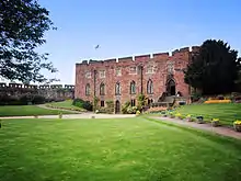
| Shrewsbury Castle | Shrewsbury | Bailey | 1164-1300 | 10 January 1953 | SJ4944012881 52°42′40″N 2°44′59″W |
1246877 | |
| The Abbot's House | Shrewsbury | Jettied House | Late 15th century | 10 January 1953 | SJ4923112535 52°42′29″N 2°45′10″W |
1246543 | 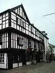 The Abbot's House |
| The Lion Hotel | Shrewsbury | Timber Framed House | Late 15th century | 10 January 1953 | SJ4931412340 52°42′23″N 2°45′06″W |
1255164 | 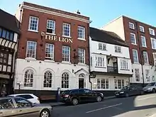 The Lion Hotel |
| The Trotting Horse Building | Shrewsbury | Jettied House | Late 16th century | 19 September 1972 | SJ4933512319 52°42′22″N 2°45′05″W |
1246462 |  The Trotting Horse Building |
| 71, 72 and 73 Wyle Cop | Shrewsbury | Hall House | Mid 15th century | 10 January 1953 | SJ4934912329 52°42′22″N 2°45′04″W |
1255124 | 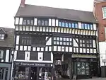 71, 72 and 73 Wyle Cop |
| Church of St Martin | St Martin's | Parish Church | 13th century | 8 October 1959 | SJ3225436305 52°55′12″N 3°00′33″W |
1367347 | 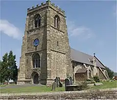 Church of St Martin |
| Church of St Peter | Stanton Lacy | Parish Church | c. 1050 | 12 November 1954 | SO4954978826 52°24′18″N 2°44′35″W |
1269832 | .jpg.webp) Church of St Peter |
| Church of St Andrew | Stanton upon Hine Heath | Parish Church | 12th century | 28 October 1960 | SJ5680923790 52°48′36″N 2°38′32″W |
1188128 | 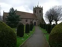 Church of St Andrew |
| Church of St Mary | Stottesdon | Church | Pre Conquest | 9 March 1970 | SO6724782886 52°26′35″N 2°29′00″W |
1189978 | 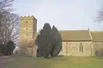 Church of St Mary |
| Church of St Bartholomew | Tong | Parish Church | c. 1260 | 26 May 1955 | SJ7956707386 52°39′50″N 2°18′13″W |
1053606 | |
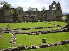
| Haughmond Abbey | Uffington | Abbey | 1130 | 17 February 1985 | SJ5417915119 52°43′54″N 2°40′48″W |
1052157 | |
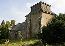
| Former Church of St Michael | Upton Cressett | Church | Medieval | 9 March 1970 | SO6559892456 52°31′44″N 2°30′31″W |
1367566 | |
| Gatehouse at Upton Cressett Hall | Upton Cressett | Gatehouse | Elizabethan | 29 November 1951 | SO6558592407 52°31′41″N 2°30′31″W |
1053757 | |
| Upton Cressett Hall | Upton Cressett | Aisled Hall House | Medieval | 29 November 1951 | SO6558492402 52°31′42″N 2°30′31″W |
1190045 | |
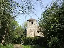
| Church of St Mary | Edstaston, Wem Rural | Chapel of Ease | Late 12th century | 28 October 1960 | SJ5177031975 52°52′59″N 2°43′05″W |
1236691 | |
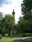
| The Obelisk, Hawkstone Park | Hawkstone Park, Weston-under-Redcastle | Column | 1795 | 28 October 1960 | SJ5790429222 52°51′32″N 2°37′36″W |
1264272 | |
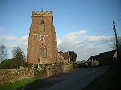
| Church of Saint Alkmund | Whitchurch | Church | 1089 | 1 May 1951 | SJ5409641713 52°58′15″N 2°41′06″W |
1177510 | |
| Domestic Chapel Approximately 350 Metres South of Halston Hall | Whittington | Domestic Chapel | Early 16th century | 8 October 1959 | SJ3388331297 52°52′30″N 2°59′02″W |
1367397 | |
| Halston Hall including attached Flanking Walls and Balustrade to Rear | Whittington | Country House | c. 1690 | 19 January 1952 | SJ3392631653 52°52′42″N 2°59′00″W |
1054216 | |
| Whittington Castle | Whittington | Castle | Late 11th century or 12th century | 8 October 1959 | SJ3261531148 52°52′25″N 3°00′09″W |
1178307 | |
| Whitton Court | Whitton | Courtyard House | 19th century | 12 November 1954 | SO5788373470 52°21′28″N 2°37′11″W |
1383591 | |
| Davenport House | Worfield | Country House | 1726 | 29 November 1951 | SO7535795437 52°33′22″N 2°21′54″W |
1053732 | 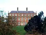 Davenport House |
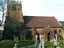
| Church of All Saints | Worthen, Worthen with Shelve | Parish Church | Late 12th century | 21 March 1968 | SJ3283504682 52°38′09″N 2°59′38″W |
1055014 | 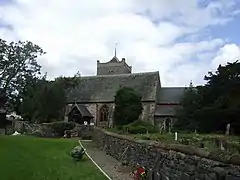 Church of All Saints |
| Church of St Andrew | Wroxeter, Wroxeter and Uppington | Cross | 17th century | 13 June 1958 | SJ5633008247 52°40′13″N 2°38′50″W |
1224008 |
.jpg.webp)


.jpg.webp)


.jpg.webp)

Telford and Wrekin

.jpg.webp)

See also
- Grade I listed churches in Shropshire
- Category:Grade I listed buildings in Shropshire
Notes
- The date given is the date used by Historic England as significant for the initial building or that of an important part in the structure's description.
- Sometimes known as OSGB36, the grid reference is based on the British national grid reference system used by the Ordnance Survey.
- The "List Entry Number" is a unique number assigned to each listed building and scheduled monument by Historic England.
References
External links
![]() Media related to Grade I listed buildings in Shropshire at Wikimedia Commons
Media related to Grade I listed buildings in Shropshire at Wikimedia Commons
This article is issued from Wikipedia. The text is licensed under Creative Commons - Attribution - Sharealike. Additional terms may apply for the media files.