Loburn
Loburn is a rural community in North Canterbury, New Zealand. It is located ten kilometres northwest of Rangiora and nearly 50 kilometres north of Christchurch.
Loburn | |
|---|---|
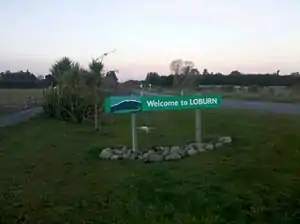 Welcome sign to Loburn, looking east towards Loburn School (2013). | |
 Loburn | |
| Coordinates: 43°15′S 172°32′E | |
| Country | |
| Region | Canterbury |
| Territorial authority | Waimakariri District |
| Electorates | Kaikoura Te Tai Tonga (Maori electorate)[1] |
| Elevation (Loburn Abbey Airfield)[2] | 116 m (380 ft) |
| Population (2013 Census) | |
| • Rural | 2,187[3] |
| Time zone | UTC+12 (NZST) |
| • Summer (DST) | UTC+13 (NZDT) |
| Postcode | 7472 |
| Area code(s) | 03 |
Loburn is a small community, with no shops. Local industries include a cheese factory and orchards. Farms in the community include those raising sheep, cattle and emu.[4]
Geography
Loburn is located close to the northernmost extreme of the Canterbury Plains. It is bounded to the south and west by the Ashley and Okuku rivers, respectively. To the north it is bounded by the foothills, Mount Grey / Maukatere (933m)[5] and Mt Karetu (972m)[6] and bounded to the east by the Ashley forest.
The Loburn-Ashley fault zone is located from the northern banks of the Ashley River through to about Hodgsons road in the north, it runs parallel to the Ashley river. The Loburn fault, which runs along the south side of Hodgsons Road, is responsible for various terraced abandoned stream channels, wedge structures and scarps, notably Round Hill.[7] The topography in Loburn is generally flat with gently rolling hills, altitude gradually decreases southwards from the foothills.
Education
Loburn has two schools.
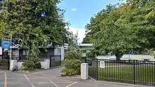
Loburn School (est. 1869) is a decile 9 state co-educational primary school[8] with a role of 158 students (as of March 2020).[9] The principal is Stuart Priddy.[10]
North Loburn School (est. 1882) is a decile 9 state co-educational primary school[11] with a role of 117 students (as of March 2020).[9] The principal is Darryn Ward.
Demographics
| Census | Pop. | ±% |
|---|---|---|
| 1901[12] | 537 | — |
| 1996[13] | 1,032 | +92.2% |
| 2001[13] | 1,197 | +16.0% |
| 2006[14] | 1,584 | +32.3% |
| 2013[3] | 2,187 | +38.1% |
| 2018[15] | 2,470 | +12.9% |
References
- "Find my Electorate | Electoral Commission". Elections.org.nz. Archived from the original on 8 February 2013. Retrieved 1 February 2014.
- Loburn Abbey Airfield Flyin (16 February 2013). "Loburn Abbey fly-in". Aircraft-r-us.com. Retrieved 1 February 2014.
- "QuickStats about Loburn". Retrieved 25 May 2017.
- Cross, Tracy-Anne et al. 2005 p.46 North Canterbury: An Analysis of the Current Economic Base of the Region Archived 14 October 2008 at the Wayback Machine
- "Mount Grey/Maukatere, Canterbury". topomap.co.nz.
- "Mount Karetu, Canterbury". topomap.co.nz.
- "Paleoseismicity of the Ashley and Loburn Faults, North Canterbury, New Zealand. (pages 42-54)" (PDF). Earthquake Commission Research Foundation. Retrieved 16 December 2013.
- "Loburn School Website". Loburn.ultranet.school.nz. 17 December 2013. Archived from the original on 13 November 2013. Retrieved 1 February 2014.
- "New Zealand Schools Directory". New Zealand Ministry of Education. Retrieved 26 April 2020.
- "Loburn School 2012 ERO Report". Ero.govt.nz. Archived from the original on 24 September 2015. Retrieved 1 February 2014.
- "North Loburn School Website". Northloburn.school.nz. Retrieved 1 February 2014.
- Cyclopedia Company Limited. "Loburn | NZETC". Nzetc.victoria.ac.nz. Retrieved 1 February 2014.
- "Loburn Community Profile(published)". .stats.govt.nz. 30 May 2003. Retrieved 1 February 2014.
- "QuickStats About Loburn - Statistics New Zealand". Stats.govt.nz. Retrieved 1 February 2014.
- "Area Unit Population Projections (Waimakariri & Selwyn Districts), by broad age group, 2013(base)-2043 update". Christchurch City Council. Retrieved 9 June 2018.