Waimakariri District
Waimakariri District is a local government district, located in the Canterbury region of New Zealand's South Island. It is named after the Waimakariri River, which forms the district's southern boundary, separating it from Christchurch City and the Selwyn District. It is bounded in the north by the Hurunui District and in the east by the Pacific Ocean.
Waimakariri District | |
|---|---|
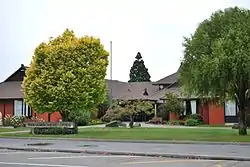 Council offices in Rangiora | |
Coat of arms | |
 | |
| Country | |
| Island | South Island (Te Waipounamu) |
| Region | Canterbury |
| District | Waimakariri District Council |
| Wards | Kaiapoi-Woodend Oxford-Ohoka Rangiora-Ashley |
| Named for | Waimakariri River |
| Seat | Rangiora |
| Towns | List
|
| Government | |
| • Mayor | Dan Gordon |
| • Deputy Mayor | Neville Atkinson |
| Area | |
| • Total | 2,219 km2 (857 sq mi) |
| Population (June 2020)[1] | |
| • Total | 64,700 |
| • Density | 29/km2 (76/sq mi) |
| Demonym(s) | Waimakaririan |
| Time zone | UTC+12 (NZST) |
| • Summer (DST) | UTC+13 (NZDT) |
| Postcode(s) | |
| Area Code | 03 |
| Website | www |
The district was established on 1 April 1989 following the merger of Rangiora District and Eyre County. The district covers 2,219 square kilometres (857 sq mi), and is home to 64,700 people.[1] Rangiora is the district seat and largest town, with other major towns including Kaiapoi, Oxford, Pegasus and Woodend.
The current district mayor is Dan Gordon, who was elected in the 2019 local body elections.[2]
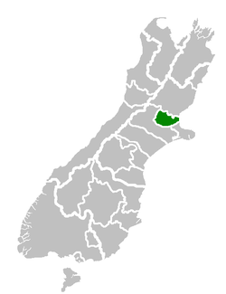
Location of the Waimakariri District
The Waimakariri District lies to the north of the Waimakariri River in North Canterbury. The major urban areas are Rangiora and Kaiapoi, which are respectively about 30 and 20 minutes travelling time by car from the centre of Christchurch City.
There are other urban settlements including Woodend and Oxford, as well as a number of village and beach settlements.
The District occupies some 225,000 hectares, and extends from Pegasus Bay in the east to the Puketeraki Range in the west. It is bounded to the north by the Hurunui District.
History
In pre-European times there were several important Ngai Tahu settlements in the area now occupied by the Waimakariri District. The centre of Ngai Tahu was the pa of Taurakautahi, known as Kaiapoi. Today, the hapu Ngai Tuahuriri is based at Tuahiwi, to the north of Kaiapoi. People who identify themselves as having NZ Maori ancestry presently represent 8.5% of the District's population, and most of these people live in the eastern part of the District.
During the early years of European settlement, Kaiapoi developed as a river port. Rangiora was the area's main market town, and the development of Oxford was based on timber milling. The roles of the District's main urban areas have changed during recent years, mainly as the result of the rapid population growth.
During the colonial era the area was also known as Courtenay,[3] but the Maori name Waimakariri ultimately prevailed. The township of Courtenay is today part of the Selwyn District. The name Waimakariri translates from Te Reo Māori to 'cold water', referring to the snow melt source of the river in the Southern Alps.
European settlement concentrated on the fertile soils of the plains. Until the middle of the 20th century extensive agricultural and pastoral farming predominated. More recently, horticultural and forestry have gained in importance. Today some 11% of the District's labour force is now involved with agriculture, forestry and fishing.
Demography
The Waimakariri District has a population of 64,700 (as of June 2020).[1] The district has experienced a rapidly growing population that is predicted to continue to increase. Despite rapid growth, Waimakariri has retained its rural/small town character and a high proportion of residents are involved in an extensive range of community and recreational organisations.
| Year | Pop. | ±% p.a. |
|---|---|---|
| 1991 | 27,884 | — |
| 1996 | 32,346 | +3.01% |
| 2001 | 36,900 | +2.67% |
| 2006 | 42,834 | +3.03% |
| 2013 | 49,989 | +2.23% |
| 2018 | 59,502 | +3.55% |
| Source: [4][5][6] | ||
Waimakariri District had a population of 59,502 at the 2018 New Zealand census, an increase of 9,513 people (19.0%) since the 2013 census, and an increase of 16,668 people (38.9%) since the 2006 census. There were 22,026 households. There were 29,247 males and 30,258 females, giving a sex ratio of 0.97 males per female. Of the total population, 11,412 people (19.2%) were aged up to 15 years, 9,675 (16.3%) were 15 to 29, 27,174 (45.7%) were 30 to 64, and 11,241 (18.9%) were 65 or older.
Ethnicities were 92.9% European/Pākehā, 8.6% Māori, 1.4% Pacific peoples, 2.9% Asian, and 1.8% other ethnicities (totals add to more than 100% since people could identify with multiple ethnicities). At 92.9%, the Waimakariri District has the highest proportion of Europeans of all teritiorial authorities in New Zealand.
The proportion of people born overseas was 17.6%, compared with 27.1% nationally.
Although some people objected to giving their religion, 53.9% had no religion, 36.0% were Christian, and 2.6% had other religions.
Of those at least 15 years old, 7,080 (14.7%) people had a bachelor or higher degree, and 10,050 (20.9%) people had no formal qualifications. The median income was $33,600. The employment status of those at least 15 was that 23,925 (49.8%) people were employed full-time, 7,806 (16.2%) were part-time, and 1,305 (2.7%) were unemployed.[6]
Urban areas and settlements
The Waimakariri district has five towns with a population over 1,000. Together they are home to 63.1% of the district's population.[1]
| Urban area | Population
(June 2020)[1] |
% of district |
|---|---|---|
| Rangiora | 19,250 | 29.8% |
| Kaiapoi | 12,850 | 19.9% |
| Pegasus | 3,360 | 5.2% |
| Woodend | 2,970 | 4.6% |
| Oxford | 2,370 | 3.7% |
Other settlements and localities in the district include:
|
|
|
Economy
A large portion of the Waimakariri District has fertile flat land, or highly productive rolling downs. Much of the land to the east of Rangiora is reclaimed swamp, which is still subject to poor drainage and occasional flooding.
The north-western portion of the District is hill and high country. These hills, including Mt Oxford, Mt Richardson, Mt Thomas and Mt Grey, dominate the District's western landscape.
Historically the District was dominated by extensive agricultural and pastoral farming activity with few major industries. More recently many new small holdings have been created; some of these are used for full-time or part-time horticultural enterprises, including vegetable and flower growing.
The District has a few major industries. A large fibreboard plant at Sefton draws on local wood resources. The other industries are mainly small-scale service and processing enterprises, some of which also use local wood resources.
The Waimakariri District has a high standard of communications. The South Island Main Trunk Railway and State Highway 1 cross the eastern portion of the District. The District also has an airfield at Rangiora, and is close to the Christchurch International Airport. Telecommunications are continually being upgraded.
Recreation
The District offers a wide range of recreation. It has sandy beaches, estuaries, river gorges and braided rivers, which offer a range of choices for fishing, boating and rafting.
The famous Waimakariri River provides opportunities to jet boat, kayak and fish, and sandy beaches are nearby. The District also offers the opportunity to enjoy sailing on Pegasus Lake, horse riding, farm tours and weekly farmers' markets.
The foothills and mountains offer a variety of tramping experiences which complement a growing range of walking trails and formal recreational areas throughout the District.
Education
The Waimakariri District is served by 20 state and three state-integrated primary schools, as well as two area schools covering years 1–13, one in Oxford and one in Rangiora (Rangiora New Life), and two secondary schools: Rangiora High School and Kaiapoi High School. Many of the primary schools are well supported by the community, and an increasing number of pre-schools have begun to open in the District.
References
- "Population estimate tables - NZ.Stat". Statistics New Zealand. Retrieved 22 October 2020.
- "Waimakariri District Council 2019 Triennial Elections Declaration of Result" (PDF). Waimakariri District Council. Retrieved 7 November 2019.
- "What's In A Name? Geographic Board's Work". Evening Post. 27 April 1934. Retrieved 24 June 2018.
- "Waimakariri District (Census 96) (1996 Census of Population and Dwellings)". .stats.govt.nz. Retrieved 2015-07-10.
- "StatsMaps - 2013 Census population and dwelling map". Retrieved 11 December 2013.
- "Statistical area 1 dataset for 2018 Census". Statistics New Zealand. March 2020. Waimakariri District (059). 2018 Census place summary: Waimakariri District
External links
| Wikimedia Commons has media related to Waimakariri District. |