Longsheng, Guangxi
Longsheng (simplified Chinese: 龙胜镇; traditional Chinese: 龍勝鎮; pinyin: Lóngshèng Zhèn) is a town in Longsheng Various Nationalities Autonomous County, Guangxi, China.[1] As of the 2018 census it had a population of 37,000 and an area of 320-square-kilometre (120 sq mi).
Longsheng Town
龙胜镇 | |
|---|---|
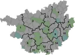 Longsheng Town Location in Guangxi | |
| Coordinates: 25°47′52″N 110°00′16″E | |
| Country | China |
| Autonomous region | Guangxi |
| Prefecture | Guilin |
| Autonomous county | Longsheng Various Nationalities Autonomous County |
| Area | |
| • Total | 320 km2 (120 sq mi) |
| Population (2018) | |
| • Total | 37,000 |
| • Density | 120/km2 (300/sq mi) |
| Time zone | UTC+08:00 (China Standard) |
| Postal code | 541700 |
| Area code(s) | 0773 |
Administrative division
As of 2016, the town is divided into fourteen villages and four communities:
- Chengnan Community (城南社区)
- Chengbei Community (城北社区)
- Guilong Community (桂龙社区)
- Chengxi Community (城西社区)
- Chengguan (城关村)
- Shuanghe (双河村)
- Lehuang (勒黄村)
- Duping (都坪村)
- Pingye (平野村)
- Chonglou 崇楼村()
- Lingtian (岭田村)
- Shangmeng (上孟村)
- Jinche (金车村)
- Guaijiang (拐江村)
- Shuangdong (双洞村)
- Rixin (日新村)
- Shandong (山东村)
- Nanmen (南门村)
History
In 1742, Longsheng was formed as a city after suppressing the rebellion led by Wu Jinyin (吴金银).
In 1945, it was known as "Rixin Street" (日新街).
After the establishment of the Communist State, its name was replaced by Rixin Town (日新镇) in 1958 and Chengguan Town (城关镇) in 1963. In February 1964, it was renamed "Longsheng Town Commune" (龙胜镇公社). In November 1979, its name was changed to "Longsheng Town".
Geography
Longsheng is located in central Longsheng Various Nationalities Autonomous County. It is surrounded by Lejiang Town on the north, Sishui Township on the northeast, Piaoli Town on the west, Sanmen on the southwest, Longji Town on the southeast, and Lingui District on the south.
The Xun River flows through the town west to northeast.
The Heping River (和平河) and Pingye River (平野河) run through the town.
The town enjoys a subtropical monsoon climate, with an average annual temperature of 18.1 °C (64.6 °F). The highest temperature is 26.8 °C (80.2 °F), and the lowest temperature is 7.7 °C (45.9 °F).
Transportation
The China National Highway 321, commonly referred to as "G321", is a west-southeast highway passing through commercial and residential area west of the town limits.
The G65 Baotou–Maoming Expressway, more commonly known as "Bao-Mao Expressway", runs west to southeast of the town.
References
- Yang Tongming 2007, pp. 13-21.
Bibliography
- Yang Tongming, ed. (2007). "Administrative divisions" 行政区划. 《龙胜各族自治县概况》 [General Situation of Longsheng Various Nationalities Autonomous County] (in Chinese). Beijing: Nationalities Publishing House. ISBN 978-7-105-08630-6.CS1 maint: ref=harv (link)
