Madi Township
Madi Township (simplified Chinese: 马堤乡; traditional Chinese: 馬堤鄉; pinyin: Mǎdī Xiāng) is a township in Longsheng Various Nationalities Autonomous County, Guangxi, China.[1] As of the 2018 census it had a population of 15,100 and an area of 141.48-square-kilometre (54.63 sq mi).
Madi Township
马堤乡 | |
|---|---|
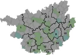 Madi Township Location in Guangxi | |
| Coordinates: 25°55′40″N 110°06′37″E | |
| Country | China |
| Autonomous region | Guangxi |
| Prefecture | Guilin |
| Autonomous county | Longsheng Various Nationalities Autonomous County |
| Area | |
| • Total | 141.48 km2 (54.63 sq mi) |
| Elevation | 600 m (2,000 ft) |
| Population (2018) | |
| • Total | 15,100 |
| • Density | 110/km2 (280/sq mi) |
| Time zone | UTC+08:00 (China Standard) |
| Postal code | 541708 |
| Area code(s) | 0773 |
Etymology
Madi Township, formerly known as "Mati Township" (马蹄乡; 'Horseshoe Township'), because a large stone like horseshoe in the township.
Administrative division
As of 2016, the township is divided into eight villages:
- Madi (马堤村)
- Niutou (牛头村)
- Baiwan (百湾村)
- Zhangjia (张家村)
- Longjia (龙家村)
- Furong (芙蓉村)
- Lishi (里市村)
- Dongsheng (东升村)
History
It was incorporated as a township in 1984.
Geography
Madi Township is situated at northeastern Longsheng Various Nationalities Autonomous County. It borders Chengbu Miao Autonomous County in the north, Jiangdi Township in the east, Sishui Township in the south, and Weijiang Township in the west.
Economy
The economy is supported primarily by farming and ranching.
Transportation
The Provincial Highway S219 is a south-north highway in the town.
References
- Yang Tongming 2007, pp. 13-21.
Bibliography
- Yang Tongming, ed. (2007). "Administrative divisions" 行政区划. 《龙胜各族自治县概况》 [General Situation of Longsheng Various Nationalities Autonomous County] (in Chinese). Beijing: Nationalities Publishing House. ISBN 978-7-105-08630-6.CS1 maint: ref=harv (link)