Piaoli
Piaoli (simplified Chinese: 瓢里镇; traditional Chinese: 瓢裡鎮; pinyin: Piáolǐ Zhèn) is a town in Longsheng Various Nationalities Autonomous County, Guangxi, China.[1] As of the 2018 census it had a population of 14,944 and an area of 207.82-square-kilometre (80.24 sq mi).
Piaoli Town
瓢里镇 | |
|---|---|
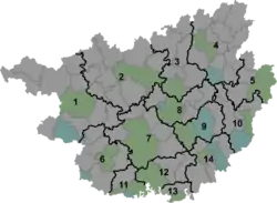 Piaoli Town Location in Guangxi | |
| Coordinates: 25°50′59″N 109°50′19″E | |
| Country | China |
| Autonomous region | Guangxi |
| Prefecture | Guilin |
| Autonomous county | Longsheng Various Nationalities Autonomous County |
| Area | |
| • Total | 207.82 km2 (80.24 sq mi) |
| Population (2018) | |
| • Total | 14,944 |
| • Density | 72/km2 (190/sq mi) |
| Time zone | UTC+08:00 (China Standard) |
| Postal code | 541702 |
| Area code(s) | 0773 |
Administrative division
As of 2016, the town is divided into ten villages and one community:
- Piaolijie Community (瓢里街社区)
- Dayun (大云村)
- Shangtang (上塘村)
- Piaoli (瓢里村)
- Jiaozhou (交洲村)
- Liuman (六漫村)
- Jiequan (界泉村)
- Silong (思陇村)
- Meidong (梅洞村)
- Pingling (坪岭村)
- Menghua (孟化村)
History
In early Qing dynasty (1644–1911), it belonged to Piaolixun (瓢里汛) and Piaolitang (瓢里塘). In late Qing dynasty, it came under the jurisdiction of Xituan (西团).
In the Republic of China, it was under the jurisdiction of the West District (正威乡), and then Zhengwei Township (西区正威乡), and finally Zhenxi Township (镇西乡).
In 1994, it was upgraded to a town.
Geography
The town is located in northwestern Longsheng Various Nationalities Autonomous County. It borders Tongdao Dong Autonomous County in the northwest, Longsheng Town in the east, Sanmen Town in the south, and Sanjiang Dong Autonomous County and Tongdao Dong Autonomous County in the west.
The Xun River runs through the town west to southeast.
Economy
The economy of the town is supported primarily by farming, ranching and mineral resources. The region are rich in manganese and quartz.
Tourist attractions
Yulongtan Scenic Spot (玉龙滩旅游风景区) is a famous scenic spot in the town.
Transportation
The G65 Baotou–Maoming Expressway, more commonly known as "Bao-Mao Expressway", passes west to southeast of the town.
The China National Highway 321, commonly referred to as "G321", is a west-southeast highway passing through the town.
References
- Yang Tongming 2007, pp. 13-21.
Bibliography
- Yang Tongming, ed. (2007). "Administrative divisions" 行政区划. 《龙胜各族自治县概况》 [General Situation of Longsheng Various Nationalities Autonomous County] (in Chinese). Beijing: Nationalities Publishing House. ISBN 978-7-105-08630-6.CS1 maint: ref=harv (link)