Louds Island
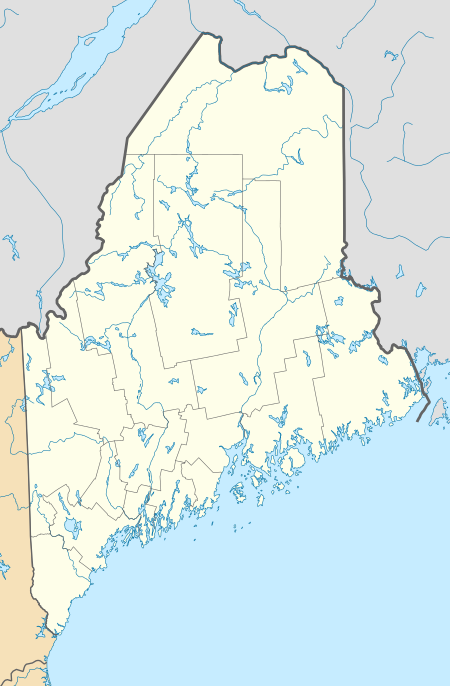
Louds Island, also once known as Muscongus Island, is an island in Muscongus Bay off the coast of Round Pond, a village of Bristol, Maine. It is also an unorganized territory of Maine. It is approximately 3 miles (4.8 km) long and 1 mile (1.6 km) wide at its widest point. The island did not have a flush toilet until 2009.[1] The 2010 Census lists Louds Island with a population of zero. It is part of the unorganized territory of Lincoln County.
Louds Island, Maine | |
|---|---|
 Louds Island, Maine Location within the state of Maine | |
| Coordinates: 43°55′47″N 69°26′04″W | |
| Country | United States |
| State | Maine |
| County | Lincoln |
| Area | |
| • Total | 15.0 sq mi (38.8 km2) |
| • Land | 1.6 sq mi (4.0 km2) |
| • Water | 13.4 sq mi (34.7 km2) |
| Population (2010) | |
| • Total | 0 |
| Time zone | UTC-5 (Eastern (EST)) |
| • Summer (DST) | UTC-4 (EDT) |
| ZIP code | 04564 |
| Area code(s) | 207 |
| FIPS code | 23-41280 |
| GNIS feature ID | 1954727 |
History
According to island chronicler Charles McLane, Louds seceded from the town of Bristol and also the United States in the early 1860s—although there are differing versions of exactly why. McLane says "the secession, in any case, was real enough and Louds has remained townless to the present day and remained stateless until the early 1900s."[2]
Louds Island hosted a "vigorous settlement that peaked in the post-Civil war era," but its year-round community dwindled over the next century. Its school closed in 1962 and the last of the year-round residents departed soon thereafter. Since then Louds has hosted only summer rusticators.[2] As of the 2010 census there were 43 housing units on the island, all for seasonal or vacation use.[3] The Loudville Church, located near the center of the island, is listed on the National Register of Historic Places; it was built in 1913 using lumber from a schoolhouse originally on the forcibly evicted settlement of Malaga Island in Phippsburg.
Geography
According to the United States Census Bureau, the unorganized territory has a total area of 15.0 square miles (38.8 km²), of which 1.6 square miles (4.0 km²) is land and 13.4 square mile (34.7 km²) is water (90%).[4] The island itself is 3 miles (4.8 km) long and 1 mile (1.6 km) wide at its widest point.
| Historical population | |||
|---|---|---|---|
| Census | Pop. | %± | |
| 2010 | 0 | — | |
| 2014 (est.) | 0 | [5] | |
| U.S. Decennial Census[6] | |||
See also
References
- A Historic First On Louds Island Lincoln County News Online, July 8, 2009
- McLane, Charles (1992). Islands of the Mid-Maine Coast. III. Island Institute. p. 192. ISBN 0-933858-00-0.
- "Profile of General Population and Housing Characteristics: 2010 Demographic Profile Data (DP-1): Louds Island UT, Lincoln County, Maine". U.S. Census Bureau, American Factfinder. Retrieved March 3, 2020.
- "U.S. Gazetteer Files 2019". United States Census Bureau. Retrieved July 13, 2020.
- "Annual Estimates of the Resident Population for Incorporated Places: April 1, 2010 to July 1, 2014". Archived from the original on May 23, 2015. Retrieved June 4, 2015.
- "Census of Population and Housing". Census.gov. Retrieved June 4, 2015.
Municipalities and communities of Lincoln County, Maine, United States | ||
|---|---|---|
| Towns | 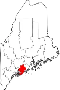 Lincoln County map | |
| Plantation | ||
| Unorganized territories | ||
| CDPs | ||
| Other villages | ||
| ||