Cumberland County, Maine
Cumberland County is a county in the U.S. state of Maine. As of the 2010 census, the population was 281,674,[1] making it the most populous county in Maine. Its county seat is Portland.[2] Cumberland County was founded in 1760 from a portion of York County, Province of Massachusetts Bay, and named for William, Duke of Cumberland, a son of King George II.[3]
Cumberland County | |
|---|---|
 The Portland Head Light lighthouse in Cape Elizabeth | |
 Seal | |
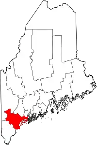 Location within the U.S. state of Maine | |
 Maine's location within the U.S. | |
| Coordinates: 43°47′04″N 70°19′41″W | |
| Country | |
| State | |
| Founded | November 1, 1760 |
| Named for | Prince William, Duke of Cumberland |
| Seat | Portland |
| Largest city | Portland |
| Area | |
| • Total | 1,217 sq mi (3,150 km2) |
| • Land | 835 sq mi (2,160 km2) |
| • Water | 382 sq mi (990 km2) 31%% |
| Population (2010) | |
| • Total | 281,674 |
| • Estimate (2019) | 295,003 |
| • Density | 230/sq mi (89/km2) |
| Time zone | UTC−5 (Eastern) |
| • Summer (DST) | UTC−4 (EDT) |
| Congressional district | 1st |
| Website | www |
Cumberland County has the deepest and second-largest body of water in the state, Sebago Lake, which supplies tap water to most of the county. The county is the state's economic and industrial center, having the resources of the Port of Portland, the Maine Mall, and having corporate headquarters of major companies such as Fairchild Semiconductor, IDEXX Laboratories, Unum, and TD Bank.
Cumberland County is part of the Portland–South Portland, ME Metropolitan Statistical Area.
Geography
According to the U.S. Census Bureau, the county has a total area of 1,217 square miles (3,150 km2), of which 835 square miles (2,160 km2) is land and 382 square miles (990 km2) (31%) is water.[4]
Adjacent counties
- Androscoggin County – north
- Oxford County – northwest
- Sagadahoc County – northeast
- York County – southwest
Major highways
National protected area
Demographics
| Historical population | |||
|---|---|---|---|
| Census | Pop. | %± | |
| 1790 | 25,530 | — | |
| 1800 | 38,208 | 49.7% | |
| 1810 | 42,831 | 12.1% | |
| 1820 | 49,445 | 15.4% | |
| 1830 | 60,102 | 21.6% | |
| 1840 | 68,658 | 14.2% | |
| 1850 | 79,538 | 15.8% | |
| 1860 | 75,591 | −5.0% | |
| 1870 | 82,021 | 8.5% | |
| 1880 | 86,359 | 5.3% | |
| 1890 | 90,949 | 5.3% | |
| 1900 | 100,689 | 10.7% | |
| 1910 | 112,014 | 11.2% | |
| 1920 | 124,376 | 11.0% | |
| 1930 | 134,645 | 8.3% | |
| 1940 | 146,000 | 8.4% | |
| 1950 | 169,201 | 15.9% | |
| 1960 | 182,751 | 8.0% | |
| 1970 | 192,528 | 5.3% | |
| 1980 | 215,789 | 12.1% | |
| 1990 | 243,135 | 12.7% | |
| 2000 | 265,612 | 9.2% | |
| 2010 | 281,674 | 6.0% | |
| 2019 (est.) | 295,003 | [5] | 4.7% |
| U.S. Decennial Census[6] 1790–1960[7] 1900–1990[8] 1990–2000[9] 2010–2019[1] | |||
2000 census
As of the 2000 census, there were 265,612 people, 107,989 households, and 67,709 families living in the county. The population density was 318 people per square mile (123/km2). There were 122,600 housing units at an average density of 147 per square mile (57/km2). The racial makeup of the county was 95.74% White, 1.06% Black or African American, 0.29% Native American, 1.40% Asian, 0.04% Pacific Islander, 0.35% from other races, and 1.13% from two or more races. 0.95% of the population were Hispanic or Latino of any race.
There were 107,989 households, out of which 30.10% had children under the age of 18 living with them, 50.10% were married couples living together, 9.50% had a female householder with no husband present, and 37.30% were non-families. 28.40% of all households were made up of individuals, and 10.20% had someone living alone who was 65 years of age or older. The average household size was 2.38 and the average family size was 2.95.
In the county, the population was spread out, with 23.30% under the age of 18, 8.40% from 18 to 24, 31.30% from 25 to 44, 23.60% from 45 to 64, and 13.30% who were 65 years of age or older. The median age was 38 years. For every 100 females, there were 93.80 males. For every 100 females age 18 and over, there were 90.20 males.
The median income for a household in the county was $44,048, and the median income for a family was $54,485. Males had a median income of $35,850 versus $27,935 for females. The per capita income for the county was $23,949. About 5.20% of families and 7.90% of the population were below the poverty line, including 9.10% of those under age 18 and 7.40% of those age 65 or over.
19.6% were of English, 15.5% Irish, 9.6% French, 7.8% United States or American, 7.7% Italian, 6.3% French Canadian and 5.9% German ancestry according to Census 2000. 94.4% spoke English and 2.1% French as their first language.
2010 census
As of the 2010 United States Census, there were 281,674 people, 117,339 households, and 70,778 families living in the county.[10] The population density was 337.2 inhabitants per square mile (130.2/km2). There were 138,657 housing units at an average density of 166.0 per square mile (64.1/km2).[11] The racial makeup of the county was 92.8% white, 2.4% black or African American, 2.0% Asian, 0.3% American Indian, 0.6% from other races, and 1.8% from two or more races. Those of Hispanic or Latino origin made up 1.8% of the population.[10] In terms of ancestry, 22.7% were English, 21.1% were Irish, 9.0% were German, 8.4% were Italian, 6.0% were Scottish, 5.5% were French Canadian, and 4.4% were American.[12]
Of the 117,339 households, 28.3% had children under the age of 18 living with them, 46.8% were married couples living together, 9.7% had a female householder with no husband present, 39.7% were non-families, and 29.7% of all households were made up of individuals. The average household size was 2.32 and the average family size was 2.90. The median age was 41.0 years.[10]
The median income for a household in the county was $55,658 and the median income for a family was $71,335. Males had a median income of $48,158 versus $38,539 for females. The per capita income for the county was $31,041. About 6.9% of families and 10.5% of the population were below the poverty line, including 14.4% of those under age 18 and 7.5% of those age 65 or over.[13]
Government

Cumberland County is represented by county commissioners and the daily operations are run by a county manager. The county has several responsibilities, including running a Sheriff's department, the Cumberland County Jail, and a county court system. Cumberland County also has its own treasury department, emergency management agency and also has a district attorney office. The county also has a stake in the Cross Insurance Arena (formerly called the Cumberland County Civic Center), as well as programs in local economic development and tourism.
Cumberland County is divided into five districts of approximate equal population, each of which elects one county commissioner. The sheriff is elected countywide and runs the Cumberland County Sheriff's office and the Cumberland County Jail.
Politics
In 2012, the county voted 65% to legalize same-sex marriage.[14]
Voter registration
| Voter registration and party enrollment as of May 2019 [15] | |||||
|---|---|---|---|---|---|
| Democratic | 97,759 | 40.17% | |||
| Unenrolled | 80,276 | 32.99% | |||
| Republican | 55,163 | 22.67% | |||
| Green Independent | 10,128 | 4.16% | |||
| Libertarian | 20 | 0.01% | |||
| Total | 243,350 | 100% | |||
Due to its urban nature, Cumberland county is a Democratic party stronghold. Democrats dominate voter registration in the county, and the Democratic presidential nominee has won Cumberland County in every election since 1992.
| Year | Republican | Democratic | Third parties |
|---|---|---|---|
| 2020 | 30.8% 59,584 | 66.5% 128,759 | 2.8% 5,422 |
| 2016 | 33.6% 57,709 | 59.9% 102,981 | 6.5% 11,128 |
| 2012 | 35.3% 57,821 | 62.3% 101,950 | 2.5% 4,015 |
| 2008 | 34.2% 56,186 | 64.1% 105,218 | 1.7% 2,747 |
| 2004 | 40.1% 65,384 | 58.2% 94,846 | 1.7% 2,732 |
| 2000 | 41.1% 58,543 | 52.0% 74,203 | 6.9% 9,874 |
| 1996 | 32.9% 42,620 | 53.6% 69,496 | 13.5% 17,494 |
| 1992 | 32.3% 45,752 | 43.0% 60,781 | 24.7% 34,989 |
| 1988 | 52.9% 63,028 | 46.4% 55,220 | 0.7% 827 |
| 1984 | 56.8% 65,842 | 43.0% 49,894 | 0.3% 290 |
| 1980 | 42.6% 45,820 | 44.1% 47,337 | 13.3% 14,304 |
| 1976 | 49.6% 48,959 | 47.7% 47,007 | 2.7% 2,660 |
| 1972 | 60.6% 51,268 | 39.4% 33,326 | 0.0% 23 |
| 1968 | 41.4% 32,275 | 57.3% 44,697 | 1.4% 1,076 |
| 1964 | 30.5% 22,365 | 69.4% 50,844 | 0.1% 63 |
| 1960 | 58.5% 47,271 | 41.5% 33,553 | 0.0% 1 |
| 1956 | 71.9% 49,696 | 28.1% 19,438 | 0.0% 0 |
| 1952 | 69.2% 46,957 | 30.7% 20,831 | 0.2% 110 |
| 1948 | 60.7% 30,284 | 37.9% 18,913 | 1.4% 688 |
| 1944 | 52.2% 29,349 | 47.7% 26,857 | 0.1% 72 |
| 1940 | 52.5% 29,795 | 47.4% 26,911 | 0.1% 76 |
| 1936 | 55.6% 30,021 | 42.4% 22,895 | 2.1% 1,114 |
| 1932 | 60.8% 32,864 | 38.2% 20,655 | 1.0% 514 |
| 1928 | 67.7% 33,190 | 31.9% 15,648 | 0.3% 158 |
| 1924 | 73.3% 26,187 | 19.8% 7,078 | 6.9% 2,454 |
| 1920 | 69.2% 24,623 | 29.5% 10,484 | 1.3% 478 |
| 1916 | 53.6% 11,768 | 44.6% 9,795 | 1.8% 398 |
| 1912 | 25.0% 5,154 | 41.0% 8,480 | 34.0% 7,027 |
| 1908 | 61.8% 10,593 | 33.5% 5,735 | 4.7% 810 |
| 1904 | 62.1% 9,356 | 33.1% 4,989 | 4.7% 709 |
| 1900 | 58.5% 8,824 | 38.3% 5,770 | 3.0% 466 |
| 1896 | 65.3% 11,017 | 30.6% 5,175 | 4.0% 674 |
| 1892 | 51.8% 9,165 | 45.5% 8,050 | 2.6% 462 |
| 1888 | 53.8% 9,880 | 43.4% 7,975 | 2.7% 508 |
| 1884 | 50.4% 9,510 | 43.3% 8,170 | 6.2% 1,175 |
| 1880 | 50.7% 10,167 | 46.6% 9,339 | 2.6% 528 |
Communities
Cities
- Portland (county seat)
- South Portland
- Westbrook
Towns
Census-designated places
Other unincorporated communities
In popular culture
The fictional town of Jerusalem's Lot, featured in the vampire novel 'Salem's Lot by Stephen King, is situated in Cumberland County. King makes passing reference to other nearby towns and cities, including Portland, Falmouth, and Westbrook.
The video game Trauma Team takes place in Cumberland County in the year 2020, referencing Portland and Portland's Back Cove. Neither actual hospital housed in Portland is mentioned in-game; instead, a fictional trauma center called Resurgam First Care is fabricated for the plot (in real life, Portland's city motto is "Resurgam," Latin for "I will rise again"). Two other fictional places are mentioned that reference the county name: "Cumberland College" and "Cumberland Institute of Forensic Medicine".
References
- "State & County QuickFacts". United States Census Bureau. Archived from the original on July 9, 2011. Retrieved August 18, 2013.
- "Find a County". National Association of Counties. Archived from the original on 2011-05-31. Retrieved 2011-06-07.
- "Archived copy". Archived from the original on 2012-04-27. Retrieved 2012-05-05.CS1 maint: archived copy as title (link)
- "2010 Census Gazetteer Files". United States Census Bureau. August 22, 2012. Archived from the original on September 9, 2014. Retrieved September 7, 2014.
- "Population and Housing Unit Estimates". Retrieved July 31, 2019.
- "U.S. Decennial Census". United States Census Bureau. Retrieved September 7, 2014.
- "Historical Census Browser". University of Virginia Library. Retrieved September 7, 2014.
- "Population of Counties by Decennial Census: 1900 to 1990". United States Census Bureau. Retrieved September 7, 2014.
- "Census 2000 PHC-T-4. Ranking Tables for Counties: 1990 and 2000" (PDF). United States Census Bureau. Retrieved September 7, 2014.
- "DP-1 Profile of General Population and Housing Characteristics: 2010 Demographic Profile Data". United States Census Bureau. Archived from the original on 2020-02-13. Retrieved 2016-01-21.
- "Population, Housing Units, Area, and Density: 2010 - County". United States Census Bureau. Archived from the original on 2020-02-13. Retrieved 2016-01-21.
- "DP02 SELECTED SOCIAL CHARACTERISTICS IN THE UNITED STATES – 2006-2010 American Community Survey 5-Year Estimates". United States Census Bureau. Archived from the original on 2020-02-13. Retrieved 2016-01-21.
- "DP03 SELECTED ECONOMIC CHARACTERISTICS – 2006-2010 American Community Survey 5-Year Estimates". United States Census Bureau. Archived from the original on 2020-02-13. Retrieved 2016-01-21.
- "2016 Election Results: President Live Map by State, Real-Time Voting Updates". Election Hub. Retrieved 6 April 2018.
- Bureau of Corporations, Elections & Commissions (5 May 2019). "Registered & Enrolled Voters - Statewide" (PDF). Department of the Secretary of State, State of Maine. p. 10. Retrieved 13 November 2019.
- Leip, David. "Dave Leip's Atlas of U.S. Presidential Elections". uselectionatlas.org. Retrieved 6 April 2018.
External links
| Wikivoyage has a travel guide for Cumberland County (Maine). |
| Wikimedia Commons has media related to Cumberland County, Maine. |
Places adjacent to Cumberland County, Maine | ||||||||||
|---|---|---|---|---|---|---|---|---|---|---|
| ||||||||||
Municipalities and communities of Cumberland County, Maine, United States | ||
|---|---|---|
| Cities | Cumberland County map | |
| Towns | ||
| CDPs | ||
| Other villages | ||
| ||
Augusta (capital) | ||
| Topics |
| |
| Society | ||
| Regions | ||
| Counties | ||
| Cities | ||
| Largest towns | ||

| Authority control |
|---|