Māngere East
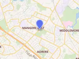
Mangere East (officially Māngere East), is a suburb of Auckland, New Zealand, under the governance of Auckland Council. It is located to the south of Favona, north of Papatoetoe, west of Middlemore, east of Māngere and Māngere Bridge, and southwest of Otahuhu.
Mangere East | |
|---|---|
Suburb | |
| |
| Country | New Zealand |
| Local authority | Auckland Council |
| Electoral ward | Manukau Ward |
| Local board | Māngere-Ōtāhuhu Local Board |
| Population (2018) | |
| • Total | 27,327 |
| Postcode(s) | 2024 |
| Favona | Ōtāhuhu | |
| Māngere |
|
Middlemore |
| Papatoetoe |
In 2019, the name of the suburb was officially gazetted as Māngere East.[1]
Demographics
| Year | Pop. | ±% p.a. |
|---|---|---|
| 2006 | 24,321 | — |
| 2013 | 25,074 | +0.44% |
| 2018 | 27,372 | +1.77% |
| Source: [2] | ||
Māngere East, comprising the statistical areas of Harania North, Sutton Park, Harania South, Massey Road West, Massey Road North, Massey Road South, Aorere North, Māngere East and Aorere Central, had a population of 27,372 at the 2018 New Zealand census, an increase of 2,298 people (9.2%) since the 2013 census, and an increase of 3,051 people (12.5%) since the 2006 census. There were 5,721 households. There were 13,641 males and 13,740 females, giving a sex ratio of 0.99 males per female, with 7,383 people (27.0%) aged under 15 years, 7,224 (26.4%) aged 15 to 29, 10,632 (38.8%) aged 30 to 64, and 2,145 (7.8%) aged 65 or older.
Ethnicities were 12.7% European/Pākehā, 15.9% Māori, 65.2% Pacific peoples, 20.1% Asian, and 1.1% other ethnicities (totals add to more than 100% since people could identify with multiple ethnicities).
The proportion of people born overseas was 41.7%, compared with 27.1% nationally.
Although some people objected to giving their religion, 15.1% had no religion, 63.1% were Christian, and 16.9% had other religions.
Of those at least 15 years old, 1,974 (9.9%) people had a bachelor or higher degree, and 4,461 (22.3%) people had no formal qualifications. The employment status of those at least 15 was that 9,780 (48.9%) people were employed full-time, 2,100 (10.5%) were part-time, and 1,269 (6.3%) were unemployed.[2]
Education
Kedgley Intermediate School is an intermediate school (years 7–8) with a roll of 766.[3]
Robertson Road School, Mangere East and Sutton Park School are full primary schools (years 1–8) with rolls of 511, 558 and 539 students, respectively.[4][5][6]
Kingsford and Papatoetoe North schools are contributing primary schools (years 1–6) with rolls of 344 and 781 students, respectively.[7][8]
St Mary MacKillop Catholic School is a state-integrated full primary school (years 1–8) with a roll of 317.[9]
De La Salle College is a state-integrated boys' Catholic secondary school (years 7–13) with a roll of 951.[10]
All these schools except De La Salle are coeducational. Rolls are as of March 2020.[11]
References
- "Place name detail: Māngere East". New Zealand Gazetteer. New Zealand Geographic Board. Retrieved 2 August 2019.
- "Statistical area 1 dataset for 2018 Census". Statistics New Zealand. March 2020. Harania North (150000), Sutton Park (150800), Harania South (151200), Massey Road West (151800), Massey Road North (152100), Massey Road South (152600), Aorere North (153200), Māngere East (153300) and Aorere Central (153600). 2018 Census place summary: Harania North 2018 Census place summary: Sutton Park 2018 Census place summary: Harania South 2018 Census place summary: Massey Road West 2018 Census place summary: Massey Road North 2018 Census place summary: Massey Road South 2018 Census place summary: Aorere North 2018 Census place summary: Māngere East 2018 Census place summary: Aorere Central
- Education Counts: Kedgley Intermediate
- Education Counts: Robertson Road School
- Education Counts: Mangere East School
- Education Counts: Sutton Park School
- Education Counts: Kingsford School
- Education Counts: Papatoetoe North School
- Education Counts: St Mary MacKillop Catholic School
- Education Counts: De La Salle College
- "New Zealand Schools Directory". New Zealand Ministry of Education. Retrieved 26 April 2020.
