Ōtāhuhu
Ōtāhuhu is a suburb of Auckland, New Zealand – 13 kilometres (8.1 mi) to the southeast of the CBD, on a narrow isthmus between an arm of the Manukau Harbour to the west and the Tamaki River estuary to the east. The isthmus is the narrowest connection between the North Auckland Peninsula and the rest of the North Island, being only some 1,200 metres (3,900 ft) wide at its narrowest point, between the Otahuhu Creek and the Mangere Inlet. As the southernmost suburb of the former Auckland City, it is considered part of South Auckland.
Ōtāhuhu | |
|---|---|
Suburb | |
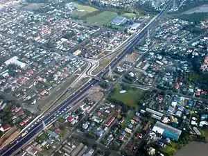 Part of eastern Ōtāhuhu from the air | |

| |
| Country | New Zealand |
| Local authority | Auckland Council |
| Electoral ward | Manukau Ward |
| Local board | Māngere-Ōtāhuhu Local Board |
| Population (2018) | |
| • Total | 15,165 |
| Train station(s) | Otahuhu railway station |
| Westfield | Mount Wellington | (Tamaki River), Pakuranga |
| (Mangere Inlet) |
|
(Tamaki River), East Tāmaki |
| Favona, Māngere East | Middlemore |
The suburb's name is taken from the Māori-language name of the volcanic cone known as Ōtāhuhu / Mount Richmond.[1] The name refers to "the place of Tāhuhu" — the eponymous ancestor, Tāhuhu-nui-a-Rangi, of Ngāi Tāhuhu.[2]
Demographics
| Year | Pop. | ±% p.a. |
|---|---|---|
| 2006 | 12,903 | — |
| 2013 | 13,566 | +0.72% |
| 2018 | 15,165 | +2.25% |
| Source: [3] | ||
Ōtāhuhu, comprising the statistical areas of Ōtāhuhu Industrial, Ōtāhuhu Central, Ōtāhuhu North, Ōtāhuhu East, Ōtāhuhu South West and Ōtāhuhu South, had a population of 15,165 at the 2018 New Zealand census, an increase of 1,599 people (11.8%) since the 2013 census, and an increase of 2,262 people (17.5%) since the 2006 census. There were 3,921 households. There were 7,815 males and 7,353 females, giving a sex ratio of 1.06 males per female, with 3,669 people (24.2%) aged under 15 years, 3,804 (25.1%) aged 15 to 29, 6,486 (42.8%) aged 30 to 64, and 1,194 (7.9%) aged 65 or older.
Ethnicities were 20.4% European/Pākehā, 15.3% Māori, 47.9% Pacific peoples, 28.8% Asian, and 1.7% other ethnicities (totals add to more than 100% since people could identify with multiple ethnicities).
The proportion of people born overseas was 46.1%, compared with 27.1% nationally.
Although some people objected to giving their religion, 21.0% had no religion, 51.2% were Christian, and 22.6% had other religions.
Of those at least 15 years old, 1,413 (12.3%) people had a bachelor or higher degree, and 2,574 (22.4%) people had no formal qualifications. The employment status of those at least 15 was that 5,496 (47.8%) people were employed full-time, 1,323 (11.5%) were part-time, and 777 (6.8%) were unemployed.[3]
History

The suburb was established in 1847 as a fencible settlement, where soldiers were given land with the implied understanding that in wartime, they would be raised as units to defend it (however, the eventual fighting a decade later used professional soldiers instead). Most early features from this time have disappeared, however, such as a stone bridge built by the fencibles that had to make way to a widening of Great South Road.[4]
Otahuhu was home to the country's first supermarket, and Otahuhu College, to which several famous personalities went, including heavyweight boxing champion David Tua, former prime minister David Lange, and ex-Manukau City Mayor, Sir Barry Curtis.
Local government
Otahuhu had a local government just like other suburbs of Auckland at that time. The local government was called Otahuhu Borough Council, which started in 1912 and merged into Auckland City Council in 1985, eventually amalgamated into Auckland Council in November 2010.
Mayors during Otahuhu Borough Council
- Alfred Sturges, 1912–1915
- James Atkinson, 1915–1917
- Alfred MacDonald, 1917–1921
- Robert Black Todd, 1921–1929
- Hubert Thomas Clements, 1929–1935
- Charles Robert Petrie, 1935–1944
- Albert Murdoch, 1944–1950
- James Deas, 1950–1954
- John "Jack" David Murdoch, 1954–1962
- Robert G. Ashby, 1962–1965
- Aubray Thayer Bedingfield, 1965–1970
- Claude H. D. Handisides, 1970–1977
- Niall Frederick Burgess, 1977–1985
Education
Otahuhu College is a secondary school (years 9–13) with a roll of 940.[5]
Otahuhu Intermediate is an intermediate school (years 7–8) with a roll of 335.[6]
Otahuhu School and Fairburn School are contributing primary schools (years 1–6) with rolls of 518 and 531 students, respectively.[7][8]
McAuley High School is a state-integrated Catholic girls secondary school (years 9–13) with a roll of 803.[9] St Joseph's School is a state-integrated Catholic full primary school (years 1–8) with a roll of 262.[10] The schools are across the street from each other.
King's College is a private Anglican secondary school (years 9–13) with a roll of 1108.[11] Years 9–11 are boys only, and years 12 and 13 are coeducational.
Mt Richmond School is a special school for students with intellectual disabilities. It has a roll of 175.[12]
All these schools except McAuley High School and King's College (as noted above) are coeducational. Rolls are as of March 2020.[13]
Transport
Otahuhu, in its position on a narrow section of the Auckland isthmus, is an important part of Auckland's southern transportation approaches for both road and rail, containing a combined bus interchange and Otahuhu railway station. The new bus-train interchange opened on 29 October 2016 as a joint Auckland Transport and New Zealand Transport Agency initiative costing NZ$28M.[14][15]
"The station is at the heart of the Southern New Network", said Auckland Transport’s Chief AT Metro Officer, Mark Lambert. "Auckland is moving towards a more connected network of local feeder services connecting with frequent bus and train services. Bus and train transport hubs like Otahuhu are at the heart of this transformation."[16]
The old bus interchange, which was badly neglected, and had received increased attention from early 2011 on for vandalism/graffiti prevention measures is now closed and a smaller bus stop has been installed on the main road near the town centre.[17]
The importance for transportation extended to pre-European times. The aptly named Portage Road runs across the isthmus in Otahuhu and was used by Māori to move their waka (canoes) between the Manukau and Waitemata harbours for raids and trading. In fact, the area, also known as Te Tō Waka, was considered the most important portage of all of New Zealand.[18][19]
Present day
Otahuhu nowadays is synonymous with industry and along with its neighbouring suburbs Favona, Māngere East, Mt Wellington, Penrose and Westfield forms an industrial conglomerate zone that spans much of the Mangere Inlet. The community and town centre flourishes as the crossroad to Central and South Auckland and is home to a sizable Pacific Island populace.
Sport and recreation
Otahuhu is home to the Otahuhu Rugby Football Club and the Otahuhu Leopards rugby league club.
References
- "NZGB decisions - September 2014". Retrieved 7 July 2020.
- New Zealand Government (7 November 2015). Ngāi Tai ki Tāmaki Deed of Settlement Documents (PDF). p. 2. Retrieved 7 July 2020.
- "Statistical area 1 dataset for 2018 Census". Statistics New Zealand. March 2020. Ōtāhuhu Industrial (149600), Ōtāhuhu Central (150100), Ōtāhuhu North (150300), Ōtāhuhu East (150900), Ōtāhuhu South West (151400) and Ōtāhuhu South (151900). 2018 Census place summary: Ōtāhuhu Industrial 2018 Census place summary: Ōtāhuhu Central 2018 Census place summary: Ōtāhuhu North 2018 Census place summary: Ōtāhuhu East 2018 Census place summary: Ōtāhuhu South West 2018 Census place summary: Ōtāhuhu South
- "Auckland: Soldiers of fortune". The New Zealand Herald. 26 August 2010. Retrieved 5 February 2011.
- Education Counts: Otahuhu College
- Education Counts: Otahuhu Intermediate
- Education Counts: Otahuhu School
- Education Counts: Fairburn School
- Education Counts: McAuley High School
- Education Counts: St Joseph's School
- Education Counts: King's College
- Education Counts: Mt Richmond School
- "New Zealand Schools Directory". New Zealand Ministry of Education. Retrieved 26 April 2020.
- "New Otahuhu Station and a New Network for South Auckland". Auckland Transport. Retrieved 25 October 2016.
- "New Otahuhu Station to open for new network". Stuff.co.nz. 27 October 2016. Retrieved 27 October 2016.
- "Auckland Transport – New Otahuhu Station and a New Network for south Auckland". Auckland Transport. 29 October 2016. Retrieved 5 February 2017.
- "Press release: Otahuhu Bus Station Clean Up Begins". Auckland Transport. 14 January 2011. Retrieved 17 January 2011.
- "Maori Tribal History – Hongi's Expeditions". Te Ara: The Encyclopedia of New Zealand. Retrieved 17 January 2011.
- "Other northern canoes – Te Tō Waka – the canoe portage". Te Ara: The Encyclopedia of New Zealand. Retrieved 17 January 2011.
External links
- Photographs of Otahuhu held in Auckland Libraries' heritage collections
