Maaraba, Daraa
Maaraba (Arabic: معربة, also spelled Ma'rabah) or Moraba (Turkish: Maraba)[2] is a village in southern Syria, administratively part of the Daraa Governorate, located east of Daraa. Nearby localities include Bosra to the east, Umm Walad to the north and Ghasm to the west.
Maaraba
معربة Ma'rabah Moraba | |
|---|---|
Village | |
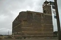 Old mosque of Maaraba, 2009 | |
 Maaraba | |
| Coordinates: 32°32′45″N 36°25′42″E | |
| Grid position | 284/217 |
| Country | |
| Governorate | Daraa |
| District | Daraa |
| Subdistrict | Bosra |
| Population (2010)[1] | |
| • Total | 12,359 |
| Time zone | UTC+2 (EET) |
| • Summer (DST) | UTC+3 (EEST) |
History
In 1596 the village appeared in the Ottoman tax registers named Ma'raba, part of the nahiya (Subdistrict) of Bani Nasiyya in the Hauran Sanjak. It had an entirely Muslim population consisting of 29 households and 18 bachelors. They paid a fixed tax-rate of 40% on agricultural products, including wheat, barley, summer crops, goats and beehives, and a water mill; a total of 13,000 akçe.[3]
According to the Syria Central Bureau of Statistics, Maaraba had a population of 8,988 in the 2004 census.[1]
References
- "General Census of Population 2004". Retrieved 2014-07-10.
- Günümüzde Suriye Türkmenleri. — Suriye’de Değişimin Ortaya Çıkardığı Toplum: Suriye Türkmenleri, p. 21 ORSAM Rapor № 83. ORSAM – Ortadoğu Türkmenleri Programı Rapor № 14. Ankara — November 2011, 33 pages.
- Hütteroth and Abdulfattah, 1977, p. 219.
Bibliography
- Hütteroth, Wolf-Dieter; Abdulfattah, Kamal (1977). Historical Geography of Palestine, Transjordan and Southern Syria in the Late 16th Century. Erlanger Geographische Arbeiten, Sonderband 5. Erlangen, Germany: Vorstand der Fränkischen Geographischen Gesellschaft. ISBN 3-920405-41-2.
External links
- Map of town, Google Maps
- Bosra-map; 22M
Capital: Daraa | |||||||||||||||||||||
| |||||||||||||||||||||
| |||||||||||||||||||||
| |||||||||||||||||||||
