MacDonnell Ranges
The MacDonnell Ranges, or Tjoritja in Arrernte, is a mountain range and an interim Australian bioregion located in southern Northern Territory and has an area of 3,929,444 hectares (9,709,870 acres).[1][2] The range is a 644 km (400 mi) long series of mountains in central Australia, consisting of parallel ridges running to the east and west of Alice Springs. The mountain range contains many spectacular gaps and gorges as well as areas of Aboriginal significance.
| MacDonnell | |
|---|---|
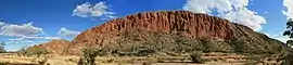 Glen Helen Gorge in the MacDonnell Ranges | |
| Highest point | |
| Peak | Mount Zeil |
| Elevation | 1,531 m (5,023 ft) AHD |
| Coordinates | 23°22′59″S 132°22′59″E |
| Dimensions | |
| Length | 644 km (400 mi) E/W |
| Naming | |
| Etymology | Sir Richard MacDonnell |
| Native name | Tjoritja |
| Geography | |
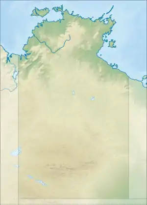 Location of the MacDonnell Ranges in the Northern Territory | |
| Country | Australia |
| Territory | Northern Territory |
| Region | Alice Springs |
| Range coordinates | 23°42′S 132°30′E |
| Geology | |
| Age of rock | Carboniferous |
| MacDonnell Ranges Northern Territory | |||||||||||||||
|---|---|---|---|---|---|---|---|---|---|---|---|---|---|---|---|
 | |||||||||||||||
| Area | 39,294 km2 (15,171.5 sq mi) | ||||||||||||||
| |||||||||||||||
The ranges were named after Sir Richard MacDonnell (the Governor of South Australia at the time) by John McDouall Stuart, whose 1860 expedition reached them in April of that year. The Horn Expedition investigated the ranges as part of the scientific expedition into central Australia. Other explorers of the range included David Lindsay and John Ross.
The MacDonnell Ranges were often depicted in the paintings of Albert Namatjira.[3]
Geography
The highest peaks are Mount Zeil with an elevation of 1,531 metres (5,023 ft) AHD, Mount Liebig at 1,524 metres (5,000 ft) AHD, Mount Edward at 1,423 metres (4,669 ft), Mount Giles at 1,389 metres (4,557 ft) and Mount Sonder at 1,380 metres (4,530 ft) AHD; the five highest mountains in the Northern Territory.[4] The headwaters of the Todd, Finke and Sandover rivers form in the MacDonnell Ranges. The range is crossed by the Australian Overland Telegraph Line and the Stuart Highway at the Heavitree Gap, a water gap created by the Todd River, at the southern entrance to Alice Springs.
Geology
300-350 million years ago a mountain building event created the MacDonnell Ranges.[4] Since that time, folding, faulting and erosion have shaped the range and created numerous gaps and gorges.[4][5] The ranges are composed of many rock types, but are most famous for their red quartzite peaks and gorges. Other rock types include granite, limestone, sandstone and siltstone.[5] Some of the valleys of the range contain fossil evidence of the inland sea that once covered central Australia.[5]
Ecology
Part of the Central Ranges xeric scrub ecoregion of dry scrubby grassland,[6] the ranges are home to a large number of endemic species that includes the centralian tree frog Litoria gilleni. This is mostly due to the micro climates that are found around the cold rock pools.
Tourist attractions
The West MacDonnell National Park was established in 1984 to protect the numerous parks and reserves of the range, including internal residents inside the range.[5] It also facilitated the development of the Larapinta Trail.
To the east of Alice Springs, within an hour's drive, are sites important to the local Arrernte people, many of which contain examples of Aboriginal rock art. These include Emily Gap, Jessie Gap, Trephina Gorge and N’Dhala Gorge.
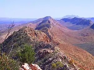
To the west of Alice Springs is the Larapinta Trail—a world-class, long distance bush walking trail that runs 223 kilometres (139 mi) along the backbone of the range.[5] Along the trail are Simpsons Gap, Standley Chasm, Ellery Creek Big Hole, Serpentine Gorge, Ochre Pits, Ormiston Pound, Redbank Gorge, Glen Helen Gorge, Tnorala Gosse Bluff, Palm Valley, Mount Sonder, Mount Zeil and Mount Giles.
Gallery
 From the Larapinta Trail near Glen Helen
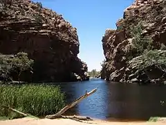 Ellery Creek Big Hole
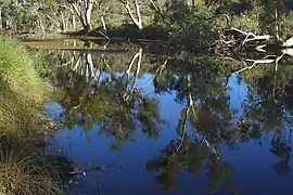 Ellery Creek and river red gum trees
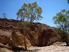 Ochre pits
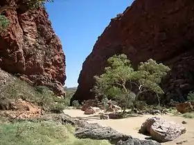 Simpsons Gap
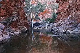 Serpentine Gorge
See also
References
- Environment Australia. "Revision of the Interim Biogeographic Regionalisation for Australia (IBRA) and Development of Version 5.1 - Summary Report". Department of the Environment and Water Resources, Australian Government. Archived from the original on 5 September 2006. Retrieved 31 January 2007. Cite journal requires
|journal=(help) - IBRA Version 6.1 Archived 2006-09-08 at the Wayback Machine data
- Joanne Lane (5 September 2009). "Drawn by a legend". theage.com.au. Fairfax Digital. Retrieved 17 November 2009.
- "Rangelands - Overview - MacDonnell Ranges". Australian Natural Resources Atlas. Department of the Environment, Water, Heritage and the Arts. Archived from the original on 5 October 2009. Retrieved 17 November 2009.
- Hema Maps (1997). Discover Australia's National Parks. Milsons Point, New South Wales: Random House Australia. pp. 242–246. ISBN 1-875992-47-2.
- World Wildlife Fund, ed. (2001). "Central Ranges xeric scrub". WildWorld Ecoregion Profile. National Geographic Society. Archived from the original on 8 March 2010.