Maine State Route 86
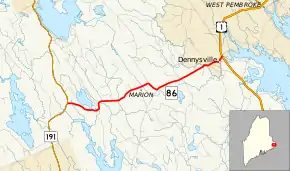
State Route 86 (SR 86) is part of Maine's system of numbered state highways, located in the far eastern part of the state. It is a minor connecting route, running 10.3 miles (16.6 km) from an intersection with SR 191 near East Machias to an intersection with U.S. Route 1 (US 1) in Dennysville. SR 86 runs mostly through unincorporated forest land.
| ||||
|---|---|---|---|---|
 | ||||
| Route information | ||||
| Maintained by MaineDOT | ||||
| Length | 10.28 mi[1] (16.54 km) | |||
| Existed | 1962–present | |||
| Major junctions | ||||
| West end | ||||
| East end | ||||
| Location | ||||
| Counties | Washington | |||
| Highway system | ||||
| ||||

Route description
SR 86 begins at an intersection with SR 191 in Marion Township, part of the unorganized territory of East Central Washington, just outside East Machias. SR 86 proceeds eastward through unincorporated Edmunds Township into the town of Dennysville, where it ends at US 1. SR 86 is named King Road in Dennysville.[2]
Junction list
The entire route is in Washington County.
| Location | mi[1] | km | Destinations | Notes | |
|---|---|---|---|---|---|
| East Central Washington | 0.00 | 0.00 | |||
| Dennysville | 10.28 | 16.54 | |||
| 1.000 mi = 1.609 km; 1.000 km = 0.621 mi | |||||
References
- "Maine DOT Map Viewer". Maine Office of GIS. Retrieved September 16, 2017.
- Google (September 16, 2017). "Maine State Route 86" (Map). Google Maps. Google. Retrieved September 16, 2017.
External links
This article is issued from Wikipedia. The text is licensed under Creative Commons - Attribution - Sharealike. Additional terms may apply for the media files.
