Mars Hill (CDP), Maine
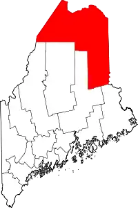
Mars Hill is a census-designated place (CDP) comprising the main village within the town of Mars Hill in Aroostook County, Maine, United States. The population of the CDP was 980 at the 2010 census,[1] out of a population of 1,493 for the entire town. Prior to 2010, the village was part of the Mars Hill-Blaine CDP.
Mars Hill, Maine | |
|---|---|
| Motto(s): MAYOR = Adeline Parker
VICE MAYOR= Janelle Rooney | |
_highlighted.svg.png.webp) Location of Mars Hill, Maine | |
| Coordinates: 46°30′57″N 67°52′0″W | |
| Country | United States |
| State | Maine |
| County | Aroostook |
| Town | Mars Hill |
| Area | |
| • Total | 2.2 sq mi (5.6 km2) |
| • Land | 2.1 sq mi (5.5 km2) |
| • Water | 0.04 sq mi (0.1 km2) |
| Elevation | 420 ft (130 m) |
| Population (2010) | |
| • Total | 980 |
| • Density | 462/sq mi (178.5/km2) |
| Time zone | UTC-5 (Eastern (EST)) |
| • Summer (DST) | UTC-4 (EDT) |
| ZIP code | 04758 |
| Area code(s) | 207 |
| FIPS code | 23-43675 |
| GNIS feature ID | 2583562 |
Geography
The Mars Hill CDP is located near the southwest corner of the town of Mars Hill, bordered by the town and CDP of Blaine to the south. U.S. Route 1 runs through the center of the CDP, leading northwest 14 miles (23 km) to Presque Isle and south 27 miles (43 km) to Houlton. U.S. Route 1A meets Route 1 at the center of the CDP and leads north 19 miles (31 km) to Fort Fairfield, eventually rejoining Route 1 in Van Buren.
According to the United States Census Bureau, the Mars Hill CDP has a total area of 2.2 square miles (5.6 km2), of which 2.1 square miles (5.5 km2) is land and 0.039 square miles (0.1 km2), or 1.48%, is water.[1]
References
- "Geographic Identifiers: 2010 Demographic Profile Data (G001): Mars Hill CDP, Maine". U.S. Census Bureau, American Factfinder. Archived from the original on February 12, 2020. Retrieved May 22, 2013.

