Aroostook County, Maine
Aroostook County (French: Comté d'Aroostook) (/əˈruːstək/ ə-ROOS-tək) is a county in the U.S. state of Maine along the Canada–U.S. border. As of the 2010 census, the population was 71,870.[3] Its seat is Houlton[4] with offices in Caribou and Fort Kent.[5]
Aroostook County | |
|---|---|
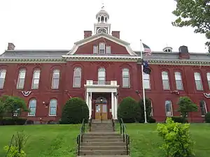 Aroostook County Courthouse | |
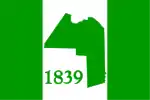 Flag  Seal | |
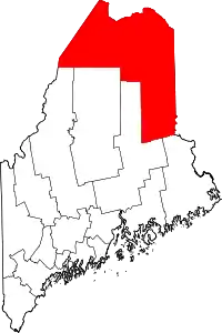 Location within the U.S. state of Maine | |
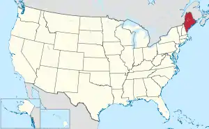 Maine's location within the U.S. | |
| Coordinates: 46.65°N 68.59°W | |
| Country | |
| State | |
| Founded | May 1, 1839 |
| Named for | Miꞌkmaq word meaning "beautiful water"[1][2] |
| Seat | Houlton |
| Largest city | Presque Isle |
| Area | |
| • Total | 6,828 sq mi (17,680 km2) |
| • Land | 6,671 sq mi (17,280 km2) |
| • Water | 156 sq mi (400 km2) 2.3% |
| Population (2010) | |
| • Total | 71,872 |
| • Estimate (2019) | 67,055 |
| • Density | 11/sq mi (4.1/km2) |
| Time zone | UTC−5 (Eastern) |
| • Summer (DST) | UTC−4 (EDT) |
| Congressional district | 2nd |
| Website | www |
Known locally in Maine as "The County", it is the largest American county by land area east of the Mississippi River (St. Louis County, Minnesota, is larger by total area), even larger than three U.S. states. It is Maine's northernmost county. Its northernmost village, Estcourt Station, is also the northernmost community in New England and in the contiguous United States east of the Great Lakes.
Aroostook County is known for its potato crops, as well as its Acadian culture. In the Saint John Valley in the northern part of the county, which borders Madawaska County, New Brunswick, many of the residents are bilingual in English and Acadian French. Elsewhere in Maine, New England French is the predominant form of French spoken (apart from standard French).
The county is also an emerging hub for wind power.
History
The sparsely populated Maine North Woods, roughly defined as the headwaters of the Saint John, Penobscot and Kennebec Rivers, was populated through the colonial era by refugees fleeing unfriendly governments. Native Americans retreating from hostile European colonists, and smugglers trading with these Native Americans and between English Massachusetts and French Acadia lived in small communities along the Atlantic coast on the disputed border between those colonies. As England dominated the Gulf of Maine following the French and Indian Wars, these occupants of the border region retreated up the large rivers into the interior joined by Acadians escaping the Acadian Expulsion. Although the survivors might have preferred to remain independent, surrounding governments dividing their refuge perceived Aroostook County as the west bank of the Saint John River drainage upstream of Canada. Under United States control, the area was initially dominated by lumber manufacturing interests, although agriculture became important as population increased. Transportation along the Saint John River and early rail connections into New Brunswick caused strong business links with Canada until the county was connected to the United States rail network by the Bangor and Aroostook Railroad in 1894. Aroostook County residents retain an independent cultural identity established during their history of isolation on the border frontier.[6]
Aroostook County was formed in 1839 from parts of Penobscot and Washington counties. In 1843, Aroostook gained land from Penobscot County; in 1844, Aroostook again gained land from Penobscot, plus it exchanged land with Piscataquis County. In 1889, Aroostook gained slightly from Penobscot, but gave back the land in 1903 when Aroostook County gained its final form.[7] Some of the territory in this county was part of the land dispute that led to the "Aroostook War" that would be settled by the Webster–Ashburton Treaty.
.jpg.webp)
The county was also part of a route on the Underground Railroad, and was one of the last stops before entering Canada. Slaves would meet and hide just outside Aroostook[8] or in deserted areas. Friends Quaker Church near Fort Fairfield was often a final stop.[9]
Much of Aroostook County's economy was dominated by military spending through the Cold War. Limestone Army Air Field was built in Limestone, Maine in 1947. It was renamed Loring Air Force Base (AFB) in 1953 as the home of the Strategic Air Command (SAC) 42d Bombardment Wing operating Convair B-36 Peacemaker bombers. Aroostook County was chosen due to its strategic location as the closest point in the Continental United States to the Middle East and Europe including the Soviet Union west of the Ural Mountains. Loring AFB could accommodate one hundred of these large bombers; and had both the largest fuel storage capacity, at 9,200,000 US gallons (35,000,000 L), and the largest weapons storage capacity, at 4700 tonnes NEW, of any SAC base. The 42d Bombardment Wing at Loring operated Boeing B-52 Stratofortress bombers[10] until the 1991 Base Realignment and Closure Commission recommended closure and the base closed in 1994.[11]
The 2014 Acadian World Congress was held along the Canada–United States border, co-hosted by Aroostook County and a number of neighboring counties in Canada (Témiscouata in Quebec, and Victoria, Madawaska and Restigouche in New Brunswick). Organizers planned a Tintamarre that was held in the town of Madawaska, Maine, as well as a giant tug of war across the Saint John River.[12]
Geography
According to the U.S. Census Bureau, the county has a total area of 6,828 square miles (17,680 km2), of which 6,671 square miles (17,280 km2) is land and 156 square miles (400 km2) (2.3%) is water.[13] Aroostook County is Maine's largest county by area, about the size of Connecticut and Rhode Island combined.
Adjacent counties and municipalities
- Washington County, Maine – southeast
- Penobscot County, Maine – south
- Piscataquis County, Maine – south
- Somerset County, Maine – southwest
- Montmagny Regional County Municipality, Quebec – west
- L'Islet Regional County Municipality, Quebec – west
- Kamouraska Regional County Municipality, Quebec – northwest
- Témiscouata Regional County Municipality, Quebec – north
- Madawaska County, New Brunswick – northeast
- Victoria County, New Brunswick – east
- Carleton County, New Brunswick – east
- York County, New Brunswick – southeast
National protected area
Government and politics
Although the county is more socially conservative than Maine's southern and coastal counties, it was won by the Democratic Presidential candidate in the six elections from 1992 – 2012[14] before going for the Republican candidate in 2016.[15] In the Maine Legislature, the county's delegation in 2013 included three Democrats and seven Republicans.[16] In 2009 it voted 73% in favor of a referendum rejecting same-sex marriage and 54% against the Maine Medical Marijuana Act.[17] In 2012, it voted 67% against [[Maine Question 1, 2012|a measure to redefine marriage in Maine,[18] the highest opposition percentage of any county in the state.
Due to the remoteness from the rest of Maine and a perceived lack of connection with the Maine government, as well as a strong connection with neighboring Canada, politicians of Aroostook County, Maine, have proposed making Aroostook part of New Brunswick or spinning off the county as its own state, probably named Aroostook, since the 1990s. As recently as 2005 the question has been brought up before the state legislature.[19]
Voter registration
| Voter registration and party enrollment as of May 2019 [20] | |||||
|---|---|---|---|---|---|
| Unenrolled | 16,738 | 33.31% | |||
| Democratic | 15,817 | 31.48% | |||
| Republican | 15,746 | 31.34% | |||
| Green Independent | 1,942 | 3.87% | |||
| Total | 50,243 | 100% | |||
Politics
| Year | Republican | Democratic | Third parties |
|---|---|---|---|
| 2020 | 58.2% 21,080 | 38.5% 13,956 | 3.2% 1,174 |
| 2016 | 55.3% 19,419 | 38.1% 13,386 | 6.5% 2,292 |
| 2012 | 44.9% 15,196 | 52.5% 17,777 | 2.6% 887 |
| 2008 | 44.2% 15,898 | 53.8% 19,345 | 2.1% 751 |
| 2004 | 46.6% 17,564 | 51.9% 19,569 | 1.6% 600 |
| 2000 | 47.1% 16,555 | 48.9% 17,196 | 4.0% 1,392 |
| 1996 | 29.9% 10,400 | 51.8% 18,022 | 18.3% 6,370 |
| 1992 | 32.2% 12,409 | 40.6% 15,682 | 27.2% 10,494 |
| 1988 | 53.4% 17,213 | 46.1% 14,850 | 0.6% 183 |
| 1984 | 63.6% 21,837 | 36.0% 12,348 | 0.5% 153 |
| 1980 | 48.3% 16,343 | 42.8% 14,492 | 8.9% 3,011 |
| 1976 | 48.5% 15,550 | 48.3% 15,484 | 3.2% 1,017 |
| 1972 | 62.4% 19,051 | 37.6% 11,474 | 0.1% 22 |
| 1968 | 47.6% 13,919 | 51.5% 15,044 | 0.9% 273 |
| 1964 | 36.3% 9,994 | 63.7% 17,552 | 0.0% 3 |
| 1960 | 55.8% 18,698 | 44.2% 14,799 | 0.0% 0 |
| 1956 | 72.4% 16,001 | 27.6% 6,089 | 0.0% 0 |
| 1952 | 68.9% 16,851 | 30.9% 7,561 | 0.3% 64 |
| 1948 | 56.5% 9,459 | 42.9% 7,183 | 0.6% 98 |
| 1944 | 59.2% 11,678 | 40.7% 8,017 | 0.1% 22 |
| 1940 | 58.3% 13,888 | 41.5% 9,877 | 0.2% 39 |
| 1936 | 64.7% 14,708 | 33.9% 7,704 | 1.4% 324 |
| 1932 | 59.5% 14,054 | 39.8% 9,409 | 0.7% 168 |
| 1928 | 71.5% 14,545 | 28.4% 5,771 | 0.2% 41 |
| 1924 | 81.6% 9,554 | 12.9% 1,510 | 5.5% 643 |
| 1920 | 88.5% 11,191 | 11.1% 1,407 | 0.4% 50 |
| 1916 | 69.6% 5,770 | 29.2% 2,425 | 1.2% 98 |
| 1912 | 11.5% 898 | 24.6% 1,924 | 63.9% 4,991 |
| 1908 | 77.6% 4,783 | 18.8% 1,157 | 3.7% 227 |
Demographics
| Historical population | |||
|---|---|---|---|
| Census | Pop. | %± | |
| 1840 | 9,413 | — | |
| 1850 | 12,529 | 33.1% | |
| 1860 | 22,479 | 79.4% | |
| 1870 | 29,609 | 31.7% | |
| 1880 | 41,700 | 40.8% | |
| 1890 | 49,589 | 18.9% | |
| 1900 | 60,744 | 22.5% | |
| 1910 | 74,664 | 22.9% | |
| 1920 | 81,728 | 9.5% | |
| 1930 | 87,843 | 7.5% | |
| 1940 | 94,436 | 7.5% | |
| 1950 | 96,039 | 1.7% | |
| 1960 | 106,064 | 10.4% | |
| 1970 | 92,463 | −12.8% | |
| 1980 | 91,331 | −1.2% | |
| 1990 | 86,936 | −4.8% | |
| 2000 | 73,938 | −15.0% | |
| 2010 | 71,870 | −2.8% | |
| 2019 (est.) | 67,055 | [22] | −6.7% |
| U.S. Decennial Census[23] 1790–1960[24] 1900–1990[25] 1990–2000[26] 2010–2016[3] | |||
2000 census
As of the census[27] of 2000, there were 73,938 people, 30,356 households, and 20,429 families residing in the county. The population density was 11 people per square mile (4/km2). There were 38,719 housing units at an average density of 6 per square mile (2/km2). The racial makeup of the county was 96.80% White, 0.38% Black or African American, 1.36% Native American, 0.47% Asian, 0.03% Pacific Islander, 0.17% from other races, and 0.80% from two or more races. 0.60% of the population were Hispanic or Latino of any race. 22.6% were of French, 15.4% United States or American, 14.6% English, 14.3% French Canadian and 10.2% Irish ancestry. As of 2010, 18.0% of the population reported speaking French at home; other than speakers of English, there were no other significant linguistic groups.[28]
There were 30,356 households, out of which 28.40% had children under the age of 18 living with them, 55.60% were married couples living together, 8.10% had a female householder with no husband present, and 32.70% were non-families. 27.60% of all households were made up of individuals, and 13.10% had someone living alone who was 65 years of age or older. The average household size was 2.36 and the average family size was 2.86.
In the county, the population was spread out, with 22.60% under the age of 18, 7.90% from 18 to 24, 26.30% from 25 to 44, 26.20% from 45 to 64, and 17.00% who were 65 years of age or older. The median age was 41 years. For every 100 females there were 95.40 males. For every 100 females age 18 and over, there were 92.70 males.
The median income for a household in the county was $28,837, and the median income for a family was $36,044. Males had a median income of $29,747 versus $20,300 for females. The per capita income for the county was $15,033. About 9.80% of families and 14.30% of the population were below the poverty line, including 16.20% of those under age 18 and 16.00% of those age 65 or over.
2010 census
As of the 2010 United States Census, there were 71,870 people, 30,961 households, and 19,578 families residing in the county.[29] The population density was 10.8 inhabitants per square mile (4.2/km2). There were 39,529 housing units at an average density of 5.9 per square mile (2.3/km2).[30] The racial makeup of the county was 95.7% white, 1.7% Native American, 0.6% black or African American, 0.4% Asian, 0.2% from other races, and 1.4% from two or more races. Those of Hispanic or Latino origin made up 0.9% of the population.[29] In terms of ancestry, 27.2% were French, 18.1% were English, 17.4% were Irish, 8.2% were French Canadian, 8.1% were American, and 5.2% were German.[31]
Of the 30,961 households, 25.5% had children under the age of 18 living with them, 49.6% were married couples living together, 9.4% had a female householder with no husband present, 36.8% were non-families, and 30.8% of all households were made up of individuals. The average household size was 2.26 and the average family size was 2.79. The median age was 45.3 years.[29]
The median income for a household in the county was $36,574 and the median income for a family was $47,114. Males had a median income of $37,222 versus $28,244 for females. The per capita income for the county was $20,251. About 10.6% of families and 15.4% of the population were below the poverty line, including 20.4% of those under age 18 and 11.7% of those age 65 or over.[32]
Communities
Cities
Incorporated towns
- Allagash
- Amity
- Ashland
- Blaine
- Bridgewater
- Castle Hill
- Caswell
- Chapman
- Crystal
- Dyer Brook
- Eagle Lake
- Easton
- Fort Fairfield
- Fort Kent
- Frenchville
- Grand Isle
- Hamlin
- Hammond
- Haynesville
- Hersey
- Hodgdon
- Houlton
- Island Falls
- Limestone
- Linneus
- Littleton
- Ludlow
- Madawaska
- Mapleton
- Mars Hill
- Masardis
- Merrill
- Monticello
- New Canada
- New Limerick
- New Sweden
- Oakfield
- Orient
- Perham
- Portage Lake
- Saint Agatha
- Saint Francis
- Sherman
- Smyrna
- Stockholm
- Van Buren
- Wade
- Wallagrass
- Washburn
- Westfield
- Westmanland
- Weston
- Woodland
Plantations
Census-designated places
Unincorporated communities within towns
Unorganized territories
Indian reservations
- Aroostook Band of Mi'kmaq Indians Reservation, located in Presque Isle
- Houlton Band of Maliseet Indians Reservation, located in Houlton
References
- https://www.britannica.com/place/Aroostook
- "Aroostook County Government". Aroostook.me.us. January 5, 2012. Archived from the original on May 22, 2013. Retrieved May 11, 2013.
- "State & County QuickFacts". United States Census Bureau. Archived from the original on July 17, 2011. Retrieved March 10, 2014.
- "Find a County". National Association of Counties. Archived from the original on May 31, 2011. Retrieved June 7, 2011.
- "Home". aroostook.me.us. Retrieved August 23, 2019.
- Strout, W. Jerome (1966). 75 Years The Bangor and Aroostook. Bangor, Maine: Bangor and Aroostook Railroad. pp. 18–22.
- Adrian B. Ettlinger. AniMap Plus: County Boundary Historical Atlas. Gold Bug Software, Alamo, CA, 1997.
- "Fort Fairfield | Maine: An Encyclopedia". Maineanencyclopedia.com. Archived from the original on September 18, 2012. Retrieved May 11, 2013.
- "Crown of Maine Productions". Crown of Maine Productions. Archived from the original on February 13, 2013. Retrieved May 11, 2013.
- "SAC Bases: Loring Air Force Base". Strategic-Air-Command.com. Retrieved August 3, 2018.
- Earth Tech, Inc. (1994). "Loring Air Force Base" (PDF). Historic American Buildings Survey. Limestone, Maine: Historic American Engineering Record. Archived (PDF) from the original on June 9, 2013. Retrieved May 11, 2013.
- Olmstead, Kathryn (April 10, 2014). "Van Buren, Canadian towns reach across border to get ready for World Acadian Congress in August". Bangor Daily News. Archived from the original on April 13, 2014. Retrieved April 11, 2014.
- "2010 Census Gazetteer Files". United States Census Bureau. August 22, 2012. Archived from the original on September 9, 2014. Retrieved September 7, 2014.
- "New York Times Election Map". Elections.nytimes.com. December 9, 2008. Archived from the original on April 8, 2013. Retrieved May 11, 2013.
- "2016 Maine Presidential Election Results". Politico. Archived from the original on November 26, 2016. Retrieved November 25, 2016.
- "Maine Senate site". Maine.gov. Archived from the original on May 14, 2013. Retrieved May 11, 2013.
- Bangor Daily News Archived December 23, 2010, at the Wayback Machine
- "2012 Election Results Map by State – Live Voting Updates". Politico.Com. February 6, 2013. Archived from the original on January 6, 2012. Retrieved May 11, 2013.
- Bill calls for close look at secession Archived November 11, 2006, at the Wayback Machine
- Bureau of Corporations, Elections & Commissions (May 5, 2019). "Registered & Enrolled Voters - Statewide" (PDF). Department of the Secretary of State, State of Maine. p. 6. Retrieved November 13, 2019.
- Leip, David. "Dave Leip's Atlas of U.S. Presidential Elections". uselectionatlas.org. Archived from the original on March 23, 2018. Retrieved May 4, 2018.
- "Population and Housing Unit Estimates". Archived from the original on May 29, 2017. Retrieved July 31, 2019.
- "U.S. Decennial Census". United States Census Bureau. Retrieved September 7, 2014.
- "Historical Census Browser". University of Virginia Library. Archived from the original on August 11, 2012. Retrieved September 7, 2014.
- "Population of Counties by Decennial Census: 1900 to 1990". United States Census Bureau. Archived from the original on January 23, 2015. Retrieved September 7, 2014.
- "Census 2000 PHC-T-4. Ranking Tables for Counties: 1990 and 2000" (PDF). United States Census Bureau. Archived (PDF) from the original on December 18, 2014. Retrieved September 7, 2014.
- "U.S. Census website". United States Census Bureau. Retrieved January 31, 2008.
- "American Community Survey Aggregate Data, 5-Year Summary File, 2006–2010". Data Center. Aroostook County, Maine: Modern Language Association. 2006–2010. Archived from the original on August 15, 2013. Retrieved August 23, 2013.
- "DP-1 Profile of General Population and Housing Characteristics: 2010 Demographic Profile Data". United States Census Bureau. Archived from the original on February 13, 2020. Retrieved January 21, 2016.
- "Population, Housing Units, Area, and Density: 2010 - County". United States Census Bureau. Archived from the original on February 13, 2020. Retrieved January 21, 2016.
- "DP02 SELECTED SOCIAL CHARACTERISTICS IN THE UNITED STATES – 2006-2010 American Community Survey 5-Year Estimates". United States Census Bureau. Archived from the original on February 13, 2020. Retrieved January 21, 2016.
- "DP03 SELECTED ECONOMIC CHARACTERISTICS – 2006-2010 American Community Survey 5-Year Estimates". United States Census Bureau. Archived from the original on February 13, 2020. Retrieved January 21, 2016.
External links
| Wikivoyage has a travel guide for Aroostook. |
| Wikimedia Commons has media related to Aroostook County, Maine. |
Places adjacent to Aroostook County, Maine | |
|---|---|
Municipalities and communities of Aroostook County, Maine, United States | ||
|---|---|---|
| Cities | Aroostook County map | |
| Towns |
| |
| Plantations | ||
| Unorganized territories | ||
| CDPs | ||
| Other villages | ||
| Indian reservations | ||
| ||
Augusta (capital) | ||
| Topics |
| |
| Society | ||
| Regions | ||
| Counties | ||
| Cities | ||
| Largest towns | ||

| Authority control |
|---|