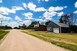
Max, Nebraska
Max is an unincorporated community and census-designated place in Dundy County, Nebraska, United States. Its elevation is 2,900 feet (880 m) above sea level.[1] Max' population as of 2010 was 57.[2]
Max, Nebraska | |
|---|---|
 | |
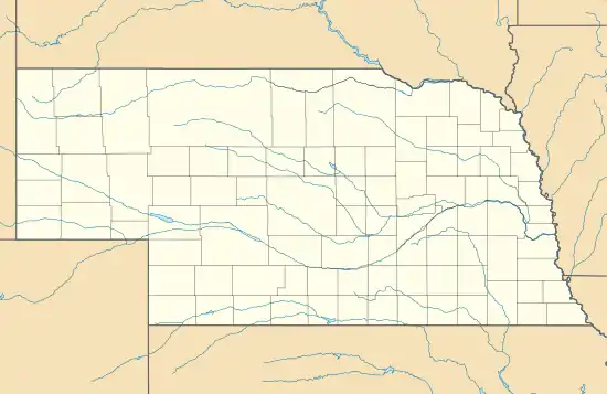 Max Location within the state of Nebraska | |
| Coordinates: 40°06′50″N 101°24′10″W | |
| Country | United States |
| State | Nebraska |
| County | Dundy |
| Area | |
| • Total | 0.22 sq mi (0.57 km2) |
| • Land | 0.22 sq mi (0.57 km2) |
| • Water | 0.0 sq mi (0.0 km2) |
| Elevation | 2,900 ft (900 m) |
| Population (2010) | |
| • Total | 57 |
| • Density | 258/sq mi (99.7/km2) |
| Time zone | UTC-7 (Mountain (MST)) |
| • Summer (DST) | UTC-6 (MDT) |
| ZIP code | 69037 |
| FIPS code | 31-31150 |
| GNIS feature ID | 831092 |
Max is located in eastern Dundy County, along U.S. Route 34 in the valley of the Republican River. Via US 34 it is 9 miles (14 km) southwest to Benkelman, the county seat, and 10 miles (16 km) east to Stratton.
History
The first settlement at Max was made in 1880.[3] The community named itself in honor of the postmaster, Max Monivisin.[4]
References
- U.S. Geological Survey Geographic Names Information System: Max, Nebraska
- "Geographic Identifiers: 2010 Demographic Profile Data (G001): Max CDP, Nebraska". U.S. Census Bureau, American Factfinder. Archived from the original on February 13, 2020. Retrieved November 3, 2015.
- Fitzpatrick, Lillian L. (1960). Nebraska Place-Names. University of Nebraska Press. p. 58. ISBN 0803250606. A 1925 edition is available for download at University of Nebraska—Lincoln Digital Commons.
- Exploring Nebraska Highways: Trip Trivia. Exploring America's Highway. 2007. p. 164. ISBN 978-0-9744358-7-9.
Municipalities and communities of Dundy County, Nebraska, United States | ||
|---|---|---|
| City | Map of Nebraska highlighting Dundy County | |
| Village | ||
| CDPs | ||
| Unincorporated communities | ||
| Ghost town | ||
| ||
This article is issued from Wikipedia. The text is licensed under Creative Commons - Attribution - Sharealike. Additional terms may apply for the media files.