Benkelman, Nebraska
Benkelman is a city in, and the county seat of, Dundy County,[6] Nebraska, United States. As of the 2010 census, the city population was 953.[7]
Benkelman, Nebraska | |
|---|---|
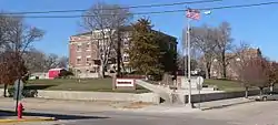 Courthouse square | |
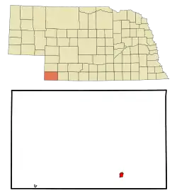 Location within Dundy County and Nebraska | |
| Coordinates: 40°3′2″N 101°32′1″W | |
| Country | United States |
| State | Nebraska |
| County | Dundy |
| Area | |
| • Total | 1.20 sq mi (3.11 km2) |
| • Land | 1.20 sq mi (3.11 km2) |
| • Water | 0.00 sq mi (0.00 km2) |
| Elevation | 2,986 ft (910 m) |
| Population | |
| • Total | 953 |
| • Estimate (2019)[3] | 790 |
| • Density | 658.88/sq mi (254.34/km2) |
| Time zone | UTC−7 (Mountain (MST)) |
| • Summer (DST) | UTC−6 (MDT) |
| ZIP code | 69021 |
| Area code(s) | 308 |
| FIPS code | 31-04230 [4] |
| GNIS feature ID | 0827319 [5] |
| Website | Dundy County CoC |
History
Benkelman was originally called Collinsville, in honor of Moses Collins, and under that name was founded circa 1880.[8] In 1882, it was renamed Benkelman by the railroad for J. G. Benkelman, a stock raiser.[9]
Geography
Benkelman is located at 40°3′2″N 101°32′1″W (40.050615, -101.533660).[10] According to the United States Census Bureau, the city has a total area of 0.80 square miles (2.07 km2), all land.[11]
Demographics
| Historical population | |||
|---|---|---|---|
| Census | Pop. | %± | |
| 1890 | 357 | — | |
| 1900 | 296 | −17.1% | |
| 1910 | 538 | 81.8% | |
| 1920 | 1,009 | 87.5% | |
| 1930 | 1,154 | 14.4% | |
| 1940 | 1,448 | 25.5% | |
| 1950 | 1,512 | 4.4% | |
| 1960 | 1,400 | −7.4% | |
| 1970 | 1,349 | −3.6% | |
| 1980 | 1,235 | −8.5% | |
| 1990 | 1,193 | −3.4% | |
| 2000 | 1,006 | −15.7% | |
| 2010 | 953 | −5.3% | |
| 2019 (est.) | 790 | [3] | −17.1% |
| U.S. Decennial Census | |||
2010 census
As of the census[2] of 2010, there were 953 people, 445 households, and 242 families residing in the city. The population density was 1,191.3 inhabitants per square mile (460.0/km2). There were 556 housing units at an average density of 695.0 per square mile (268.3/km2). The racial makeup of the city was 95.9% White, 0.4% African American, 0.8% Native American, 0.2% Asian, 0.7% from other races, and 1.9% from two or more races. Hispanic or Latino of any race were 4.4% of the population.
There were 445 households, of which 23.6% had children under the age of 18 living with them, 44.9% were married couples living together, 6.7% had a female householder with no husband present, 2.7% had a male householder with no wife present, and 45.6% were non-families. 42.5% of all households were made up of individuals, and 22% had someone living alone who was 65 years of age or older. The average household size was 2.07 and the average family size was 2.86.
The median age in the city was 48.5 years. 22.4% of residents were under the age of 18; 3.7% were between the ages of 18 and 24; 19.2% were from 25 to 44; 29.4% were from 45 to 64; and 25.4% were 65 years of age or older. The gender makeup of the city was 46.6% male and 53.4% female.
2000 census
As of the census[4] of 2000, there were 1,006 people, 458 households, and 266 families residing in the city. The population density was 1,267.6 people per square mile (491.7/km2). There were 576 housing units at an average density of 725.8 per square mile (281.5/km2). The racial makeup of the city was 97.51% White, 0.80% Native American, 0.60% Asian, 0.10% Pacific Islander, 0.10% from other races, and 0.89% from two or more races. Hispanic or Latino of any race were 0.30% of the population.
There were 458 households, out of which 24.0% had children under the age of 18 living with them, 51.3% were married couples living together, 5.5% had a female householder with no husband present, and 41.9% were non-families. 38.6% of all households were made up of individuals, and 24.7% had someone living alone who was 65 years of age or older. The average household size was 2.07 and the average family size was 2.76.
In the city, the population was spread out, with 20.0% under the age of 18, 5.9% from 18 to 24, 21.1% from 25 to 44, 23.4% from 45 to 64, and 29.7% who were 65 years of age or older. The median age was 47 years. For every 100 females, there were 79.3 males. For every 100 females age 18 and over, there were 75.0 males.
As of 2000 the median income for a household in the city was $27,788, and the median income for a family was $37,813. Males had a median income of $26,741 versus $19,107 for females. The per capita income for the city was $16,700. About 7.4% of families and 11.9% of the population were below the poverty line, including 15.2% of those under age 18 and 8.0% of those age 65 or over.
Climate
| Climate data for Benkelman, Nebraska (1981–2010) | |||||||||||||
|---|---|---|---|---|---|---|---|---|---|---|---|---|---|
| Month | Jan | Feb | Mar | Apr | May | Jun | Jul | Aug | Sep | Oct | Nov | Dec | Year |
| Average high °F (°C) | 42.9 (6.1) |
46.3 (7.9) |
55.7 (13.2) |
65.4 (18.6) |
74.8 (23.8) |
85.4 (29.7) |
91.9 (33.3) |
89.9 (32.2) |
81.2 (27.3) |
68.4 (20.2) |
54.2 (12.3) |
43.4 (6.3) |
66.6 (19.2) |
| Average low °F (°C) | 14.1 (−9.9) |
17.6 (−8.0) |
25.6 (−3.6) |
34.5 (1.4) |
46.3 (7.9) |
56.5 (13.6) |
62.4 (16.9) |
60.3 (15.7) |
49.4 (9.7) |
35.8 (2.1) |
24.2 (−4.3) |
14.8 (−9.6) |
36.8 (2.7) |
| Average precipitation inches (mm) | 0.55 (14) |
0.59 (15) |
1.20 (30) |
1.96 (50) |
3.04 (77) |
2.88 (73) |
2.93 (74) |
2.22 (56) |
1.41 (36) |
1.59 (40) |
0.76 (19) |
0.60 (15) |
19.73 (501) |
| Average snowfall inches (cm) | 6.2 (16) |
4.5 (11) |
4.5 (11) |
2.7 (6.9) |
0.1 (0.25) |
0.0 (0.0) |
0.0 (0.0) |
0.0 (0.0) |
0.4 (1.0) |
1.6 (4.1) |
3.5 (8.9) |
5.5 (14) |
28.8 (73) |
| Source: NOAA[12] | |||||||||||||
Notable people
- Ward Bond, actor
- Dave Heineman, 39th Governor of Nebraska
- Edward W. Snedeker, Lieutenant general in the Marine Corps
References
- "2019 U.S. Gazetteer Files". United States Census Bureau. Retrieved July 26, 2020.
- "U.S. Census website". United States Census Bureau. Retrieved 2012-06-24.
- "Population and Housing Unit Estimates". United States Census Bureau. May 24, 2020. Retrieved May 27, 2020.
- "U.S. Census website". United States Census Bureau. Retrieved 2008-01-31.
- "US Board on Geographic Names". United States Geological Survey. 2007-10-25. Retrieved 2008-01-31.
- "Find a County". National Association of Counties. Archived from the original on 2011-05-31. Retrieved 2011-06-07.
- "2010 City Population and Housing Occupancy Status". U.S. Census Bureau. Retrieved February 8, 2012.
- Burr, George L. (1921). History of Hamilton and Clay Counties, Nebraska, Volume 1. S.J. Clarke Publishing Company. p. 109.
- "Benkelman, Dundy County". Center for Advanced Land Management Information Technologies. University of Nebraska. Retrieved 8 August 2014.
- "US Gazetteer files: 2010, 2000, and 1990". United States Census Bureau. 2011-02-12. Retrieved 2011-04-23.
- "US Gazetteer files 2010". United States Census Bureau. Archived from the original on 2012-07-02. Retrieved 2012-06-24.
- "NOWData - NOAA Online Weather Data". National Oceanic and Atmospheric Administration. Retrieved May 6, 2013.
External links
Municipalities and communities of Dundy County, Nebraska, United States | ||
|---|---|---|
| City | Map of Nebraska highlighting Dundy County | |
| Village | ||
| CDPs | ||
| Unincorporated communities | ||
| Ghost town | ||
| ||
