Merangin Regency
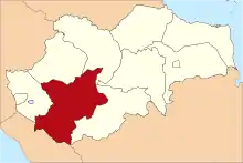
Merangin is a regency (kabupaten) of Jambi Province on the island of Sumatra, Indonesia. The Regency covers an area of 7,679 km2, and had a population of 333,206 at the 2010 Census[1] and 365,763 at the 2015 Census; the latest estimate (for mid 2019) is 382,762.[2]

Administrative Districts
Merangin Regency is divided into twenty-four districts (kecamatan), tabulated below with their areas and their populations at the 2010 census[3] together with the latest official estiamte of population as at mid 2018.[4] The table also includes the number of administrative villages (205 rural desa and 10 urban kelurahan in total) in each district, and its post code.
| District | Area in km2 | Population 2010 Census | Population 2018 Estimate | Number of villages | Post code |
|---|---|---|---|---|---|
| Jangkat | 967.23 | 8,932 | 9,890 | 11 | 37372 |
| Sungai Tenang (Jangkat Timur) | 593.46 | 9,005 | 9,898 | 14 | 37374 |
| Muara Siau | 655.06 | 9,327 | 9,902 | 17 | 37370 |
| Lembah Masurai | 688.99 | 19,522 | 27,653 | 15 | 37373 |
| Tiang Pumpung | 274.86 | 4,586 | 4,773 | 6 | 37371 |
| Pamenang | 346.54 | 30,362 | 36,602 | 14 | 37352 |
| Pamenang Barat (West Pamenang) | 199.55 | 15,737 | 17,903 | 8 | 37318 |
| Renah Pamenang | 107.58 | 13,439 | 14,829 | 4 | 37351 |
| Pamenang Selatan (South Pamenang) | 167.47 | 9,612 | 10,954 | 4 | 37319 |
| Bangko | 168.39 | 45,557 | 54,380 | 8 | 37311 -37314 |
| Bangko Barat (West Bangko) | 196.47 | 10,607 | 11,916 | 6 | 37315 |
| Batang Masumai | 111.34 | 9,563 | 10,945 | 10 | 37316 |
| Nalo Tantan | 206.58 | 11,674 | 14,164 | 7 | 37317 |
| Sungai Manau | 295.50 | 9,577 | 10,274 | 10 | 37363 |
| Renah Pembarap | 272.86 | 11,623 | 12,646 | 12 | 37362 |
| Pangkalan Jambu | 427.05 | 6,142 | 6,690 | 8 | 37361 |
| Tabir | 333.33 | 27,602 | 30,228 | 11 | 37350 |
| Tabir Ulu | 219.64 | 8,411 | 9,294 | 6 | 37356 |
| Tabir Selatan (South Tabir) | 196.25 | 26,397 | 30,082 | 8 | 37354 |
| Tabir Ilir | 158.92 | 9,623 | 10,923 | 7 | 37358 |
| Tabir Timur (East Tabit) | 108.75 | 7,381 | 8,097 | 4 | 37355 |
| Tabir Lintas | 115.38 | 7,375 | 8,741 | 5 | 37357 |
| Margo Tabir | 128.30 | 12,941 | 14,015 | 6 | 37359 |
| Tabir Barat (West Tabir) | 739.50 | 8,211 | 8,682 | 14 | 37353 |
| Totals | 7,679.00 | 333,206 | 383,480 | 215 |
However, the last-mentioned eight districts, comprising the northern third of Merangin Regency, are in the process of being separated out to form a new Regency - Kabupaten Tabir Raya; these eight districts cover 2,000.07 km2 and had an estimated combined population of 120,061 in mid 2018.[5]
Merangin Geopark
Merangin Geopark has been proposed to UNESCO to be a World's Heritage Merangin Geopark and UNESCO team has visited Merangin Geopark. The geopark has Araucarioxylon fossil tree complete with the root of 300 million years, the oldest in Asia. Today the ancient Merangin River is usually used for white water sports.[6]
References
- Biro Pusat Statistik, Jakarta, 2011.
- Badan Pusat Statistik, Jakarta, 2020 (web).
- Biro Pusat Statistik, Jakarta, 2011.
- Badan Pusat Statistik, Jakarta, 2019.
- Badan Pusat Statistik, Jakarta, 2019.
- Deddy (November 20, 2014). "Warga Jepang Buru Batuan Purba Geopark".
