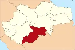
Sarolangun Regency
Sarolangun Regency is a regency of Jambi Province, Indonesia. It is located on the island of Sumatra. The regency has an area of 6,184 km² and had a population of 246,245 at the 2010 Census[1] and 277,733 at the 2015 Census; the latest official estimate (as at mid 2019) is 297,214.[2] The administrative centre is at the town of Sarolangun.
Sarolangun Regency
(Kabupaten Sarolangun) | |
|---|---|
 | |
 Coat of arms | |
 | |
| Country | Indonesia |
| Province | Jambi |
| Regency seat | Sarolangun |
| Area | |
| • Total | 6,184 km2 (2,388 sq mi) |
| Population (2019) | |
| • Total | 297,214 |
| • Density | 48/km2 (120/sq mi) |
| Time zone | UTC+7 (WIB) |
| Website | sarolangunkab.go.id |
Administrative districts
Sarolangun Regency comprises ten districts (kecamatan), tabulated below with their areas and their populations at the 2010 census[3] and 2015 Census, together with the latest official estiamte of population as at mid 2018.[4] The table also includes the number of administrative villages (rural desa and urban kelurahan) in each district, and its post code.
| District | Area in km2 | Pop'n 2010 Census | Pop'n 2015 Census | Pop'n 2018 Estimate | No. of vill. | Post code |
|---|---|---|---|---|---|---|
| Batang Asai | 858 | 16,036 | 16,992 | 17,606 | 23 | 37485 |
| Limun | 799 | 15,343 | 17,212 | 18,150 | 16 | 37382 |
| Cermin Nan Gedang | 320 | 10,858 | 12,045 | 12,618 | 10 | 37381 |
| Pelawan | 330 | 28,138 | 31,027 | 32,384 | 14 | 37482 |
| Singkut | 173 | 36,184 | 40,422 | 42,520 | 13 | 37483 |
| Saronangun (district) | 319 | 46,098 | 54,728 | 59,673 | 16 | 37481 |
| Bathin VIII | 498 | 18,031 | 19,407 | 20,295 | 15 | 37480 |
| Pauh | 1,770 | 20,566 | 23,441 | 24,950 | 14 | 37491 |
| Air Hitam | 471 | 23,757 | 27,899 | 30,222 | 9 | 37490 |
| Mandiangin | 636 | 31,234 | 35,049 | 37,567 | 28 | 37492 |
| Totals | 6,174 | 246,245 | 278,222 | 295,985 | 158 |
References
- Biro Pusat Statistik, Jakarta, 2011.
- Badan Pusat Statistik, Jakarta, 2019.
- Biro Pusat Statistik, Jakarta, 2011.
- Badan Pusat Statistik, Jakarta, 2019.
This article is issued from Wikipedia. The text is licensed under Creative Commons - Attribution - Sharealike. Additional terms may apply for the media files.
