East Tanjung Jabung Regency
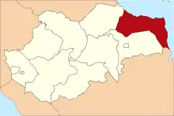
East Tanjung Jabung Regency is a regency of Jambi Province, Indonesia. It is located on the island of Sumatra. The regency has an area of 5,445 km² and had a population of 205,272 at the 2010 Census;[2] the latest official estimate (for mid 2018) is 218,413.[3] The capital lies at Muara Sabak.
East Tanjung Jabung
(Kabupaten Tanjung Jabung Timur) | |
|---|---|
Coat of arms | |
 | |
| Country | Indonesia |
| Province | Jambi |
| Regency seat | Muara Sabak |
| Area | |
| • Total | 5,445.00 km2 (2,102.33 sq mi) |
| Population (2018)[1] | |
| • Total | 218,413 |
| • Density | 40/km2 (100/sq mi) |
| Time zone | UTC+7 (WIB) |
| Website | tanjabtimkab.go.id |
Administrative districts
The regency is divided into eleven districts (kecamatan), subdivided into 93 administrative villages (desa), and tabulated below with their areas and their populations at the 2010 census,[4] together with the latest official estimate of population as at mid 2018.[5] The table also includes the number of administrative villages (rural desa and urban kelurahan) in each district, and its post code.
| District | Area in km2 | Pop'n 2010 Census | Pop'n 2018 Estimate | No. of vill. | Post code |
|---|---|---|---|---|---|
| Mendahara | 911.15 | 25,581 | 26,348 | 9 | 36765 |
| Mendahara Ulu | 381.30 | 14,440 | 18,468 | 7 | 36766 |
| Geragai | 285.35 | 20,919 | 23,193 | 9 | 36764 |
| Dendang | 478.17 | 14,895 | 15,058 | 7 | 36763 |
| Muara Sabak Barat (West Muara Sabak) | 251.75 | 15,233 | 17,789 | 7 | 36761 |
| Muara Sabak Timur (East Muara Sabak) | 410.28 | 30,906 | 31,415 | 12 | 36762 |
| Kuala Jambi | 120.52 | 14,003 | 14,671 | 6 | 36760 |
| Rantau Raseu | 356.12 | 22,078 | 23,667 | 11 | 36772 |
| Berbak | 194.46 | 9,805 | 9,924 | 6 | 36751 |
| Nipah Panjang | 234.70 | 25,326 | 25,624 | 10 | 36771 |
| Sadu | 1,821.20 | 12,086 | 12,256 | 9 | 36773 |
| Totals | 5,445.00 | 205,272 | 218,413 | 93 |
References
- Badan Pusat Statistik, Jakarta, 2019.
- Biro Pusat Statistik, Jakarta, 2011.
- Badan Pusat Statistik, Jakarta, 2019.
- Biro Pusat Statistik, Jakarta, 2011.
- Badan Pusat Statistik, Jakarta, 2019.
This article is issued from Wikipedia. The text is licensed under Creative Commons - Attribution - Sharealike. Additional terms may apply for the media files.