Mgahinga Gorilla National Park
Mgahinga Gorilla National Park is a national park in southwestern Uganda. It was created in 1991 and covers an area of 33.9 km2 (13.1 sq mi).[1]
| Mgahinga Gorilla National Park | |
|---|---|
IUCN category II (national park) | |
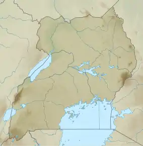 Location of Mgahinga Gorilla National Park | |
| Location | Kisoro District |
| Nearest city | Kisoro |
| Coordinates | 01°22′10″S 29°38′25″E |
| Area | 33.9 km2 (13.1 sq mi) |
| Established | 1991 |
| Governing body | Ugandan Wildlife Authority |
Geography
Mgahinga Gorilla National Park is located in the Virunga Mountains and encompasses three inactive volcanoes, namely Mount Muhabura, Mount Gahinga, and Mount Sabyinyo. In altitude the national park ranges from 2,227 to 4,127 m (7,306 to 13,540 ft) and is part of the Nile River watershed area. It is contiguous with Rwanda's Volcanoes National Park and the southern sector of Virunga National Park in the Democratic Republic of the Congo.[1]
The park is about 15 kilometres (9.3 mi) by road south of the town of Kisoro and approximately 55 kilometres (34 mi) by road west of Kabale, the largest city in the sub-region.[2]
Climate
The area experiences two wet rainy seasons: February to May; and September to December. The average monthly rainfall varies from 250 mm (9.8 in) in October to 10 mm (0.39 in) in July.
Biodiversity


The national park encompasses bamboo forest, Albertine Rift montane forests, Ruwenzori-Virunga montane moorlands with tree heath, and an alpine zone at higher altitudes.[1]
Fauna
Primates present in the national park include mountain gorilla (Gorilla beringei beringei) and golden monkey (Cercopithecus kandti).[1][3]
Of the Albertine Rift's endemic birds, the following were recorded in the national park during surveys in 2004: handsome spurfowl, dusky crimson-wing, red-throated alethe, Kivu ground thrush, Rwenzori turaco, Rwenzori batis, Rwenzori double-collared sunbird, collared apalis, mountain masked apalis, Archer's ground robin, stripe-breasted tit, blue-headed sunbird, regal sunbird, strange weaver, montane nightjar, red-faced woodland warbler and Grauer's swamp warbler.[4]
History
Mgahinga Gorilla National Park was established in 1991 in an area that used to be a game reserve between the 1930s and 1950, but was partly converted to crop fields in lower altitudes. Biological surveys were initiated in 1989, wire traps destroyed, rangers trained and trees planted. Settlers were relocated to areas outside the national park's borders in the early 1990s.[1]
In November 2013, the M23 Movement, a Congolese rebel group, surrendered in the park after being defeated by the Congolese Army in the M23 rebellion.[5]
See also
References
- Butynski, T. M., Kalina, J. (1993). "Three new mountain parks for Uganda". Oryx. 27 (4): 214–224. doi:10.1017/s003060530002812x.CS1 maint: uses authors parameter (link)
- Location of Mgahinga at Google Maps
- Twinomugisha, D., Basuta, G.I. and Chapman, C.A. (2003). "Status and ecology of the golden monkey (Cercopithecus mitis kandti) in Mgahinga Gorilla National Park, Uganda". African Journal of Ecology. 41 (1): 47–55. doi:10.1046/j.1365-2028.2003.00409.x.CS1 maint: uses authors parameter (link)
- Owiunji, I., Nkuutu, D., Kujirakwinja, D., Liengola, I., Plumptre, A., Nsanzurwimo, A., Fawcett, K., Gray, M. & McNeilage, A. (2005). Biological Survey of Virunga Volcanoes (PDF). New York: Wildlife Conservation Society.CS1 maint: uses authors parameter (link)
- "DR Congo's M23 rebel chief Sultani Makenga 'surrenders'". BBC News. 2013.
| Wikimedia Commons has media related to Mgahinga Gorilla National Park. |
External links
- "Overview of Mgahinga Gorilla National Park". Uganda Wildlife Authority. Archived from the original on 2009-12-16. Retrieved 2009-12-07.