Kisoro
Kisoro is a town in the Western Region of Uganda. It is the chief town of Kisoro District and the site of the district headquarters.
Kisoro
Gisoro | |
|---|---|
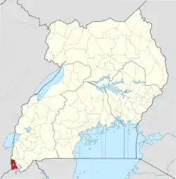
 Kisoro Location in Uganda | |
| Coordinates: 01°17′06″S 29°41′06″E | |
| Country | |
| Region | Western Region of Uganda |
| Sub-region | Kigezi sub-region |
| District | Kisoro District |
| Government | |
| • Chairman LC5 | Bizimana Abel |
| Elevation | 6,200 ft (1,890 m) |
| Population (2014 Census) | |
| • Total | 17,561[1] |
| Time zone | East African time |
| Climate | Cfb |
Location
Kisoro is approximately 43 kilometres (27 mi), by road, west of Kabale, the largest town in the Kigezi sub-region.[2] This is approximately 460 kilometres (290 mi), by road, southwest of Kampala, the capital of Uganda and its largest city.[3] Kisoro is east of Rumangabo and the Virunga Mountains in the Democratic Republic of the Congo (DRC). The geographical coordinates of Kisoro are 1°17'06.0"S, 29°41'06.0"E (Latitude:-1.2850; Longitude:29.6850).[4]
Overview
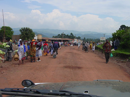
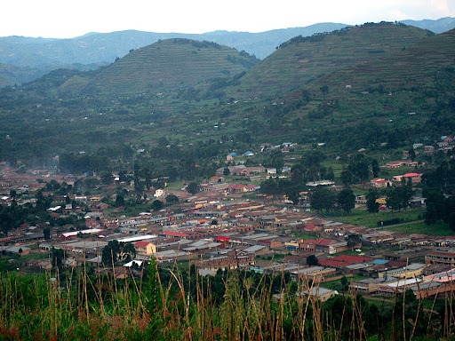
Kisoro is located under the peaks of the Mufumbiro Mountains, which are part of the Virunga Mountains and home to rare mountain gorillas. Mountain scenery, Lake Mutanda, colorful markets, and volcano trekking also are available for visitors to Kisoro. It is the nearest town to the Mgahinga Gorilla National Park and is an access town for those traveling to Rwanda or the DRC for gorilla tracking in the Volcanoes National Park or the Virunga National Park.[5]
Population
The 2002 national census estimated the population of Kisoro at 11,330. The Uganda Bureau of Statistics (UBOS) estimated the population at 12,700 in 2010. In 2011, UBOS estimated the mid-year population at 12,900.[6] In 2014, the national population census estimated the population at 17,561.[1]
Points of interest
The following additional points of interest are located within the town limits or near its edges:
- offices of Kisoro Town Council
- Kisoro central market
- Kisoro Airport, administered by the Civil Aviation Authority of Uganda
- Kisoro District Hospital, a 160-bed public hospital administered by the Uganda Ministry of Health
- Lake Mutanda, located approximately 20 kilometres (12 mi), by road, north of Kisoro.
- Bwindi Impenetrable National Park, for viewing mountain gorillas
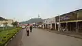 A street in Kisoro town
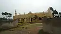 Kisoro mosque
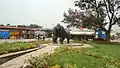 Kisoro town
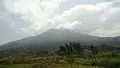 Mountain Muhabura
 Residential neighbourhood in Kisoro town
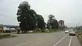 Street in kisoro
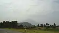 Gardens in Kisoro
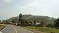 A hill in Kisoro
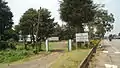 National Water offices Kisoro
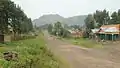 Neighbourhood in Kisoro
References
- UBOS (29 November 2014). "The Population of The Regions of the Republic of Uganda And All Cities And Towns of More Than 15,000 Inhabitants". Citypopulation.de Quoting Uganda Bureau of Statistics (UBOS). Retrieved 28 February 2015.
- "Road Distance Between Kabale And Kisoro With Map". Globefeed.com. Retrieved 7 June 2014.
- "Map Showing Kampala And Kisoro With Distance Marker". Globefeed.com. Retrieved 7 June 2014.
- Google (13 July 2015). "Location of Kisoro At Google Maps" (Map). Google Maps. Google. Retrieved 13 July 2015.
- UTP. "Overview of Kisoro Town, Uganda". Uganda Travel Planner (UTP). Archived from the original on 28 May 2014. Retrieved 7 June 2014.
- UBOS. "Estimated Population of Kisoro In 2002, 2010 And 2011" (PDF). Uganda Bureau of Statistics (UBOS). Archived from the original (PDF) on 7 July 2014. Retrieved 7 June 2014.
External links
| Wikivoyage has a travel guide for Kisoro. |
| Authority control |
|
|---|
Capital: Kisoro | ||
| Parishes |
|  |
| Towns and villages | ||
| Economy | ||
| Transport | ||
| Notable landmarks | ||
| Health | ||
| Education |
| |
| Notable people | ||
