Milan Township, Michigan
Milan Township is a civil township of Monroe County in the U.S. state of Michigan. The population was 1,601 at the 2010 census. The township was organized in 1836. The city of Milan borders the township on the north, but the two are administrated autonomously since Milan incorporated as a city in 1967.
Milan Township, Michigan | |
|---|---|
 Milan Township Hall on Cone Road | |
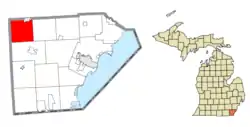 Location within Monroe County | |
 Milan Township Location within the state of Michigan  Milan Township Milan Township (the United States) | |
| Coordinates: 42°02′12″N 83°42′26″W | |
| Country | United States |
| State | Michigan |
| County | Monroe |
| Organized | 1836 |
| Government | |
| • Supervisor | Phil Heath |
| • Clerk | Barbara Collins |
| Area | |
| • Total | 34.20 sq mi (88.6 km2) |
| • Land | 34.18 sq mi (88.5 km2) |
| • Water | 0.02 sq mi (0.05 km2) |
| Elevation | 679 ft (207 m) |
| Population (2010) | |
| • Total | 1,601 |
| • Density | 46.8/sq mi (18.1/km2) |
| Time zone | UTC-5 (Eastern (EST)) |
| • Summer (DST) | UTC-4 (EDT) |
| ZIP code(s) | |
| Area code(s) | 734 |
| FIPS code | 26-53900[1] |
| GNIS feature ID | 1626739[2] |
| Website | Official website |
Communities
- Azalia (originally called East Milan) is an unincorporated community within the township.
- Cone (originally called West Milan) is an unincorporated community within the township.
Geography
According to the United States Census Bureau, the township has a total area of 34.20 square miles (88.58 km2), of which 34.18 square miles (88.53 km2) is land 0.02 square miles (0.05 km2) (0.06%) is water.[3]
Demographics
As of the census[1] of 2000, there were 1,670 people, 610 households, and 489 families residing in the township. The population density was 47.6 per square mile (18.4/km2). There were 632 housing units at an average density of 18.0 per square mile (7.0/km2). The racial makeup of the township was 98.20% White, 0.36% African American, 0.36% Native American, 0.06% Asian, 0.36% from other races, and 0.66% from two or more races. Hispanic or Latino of any race were 1.74% of the population.
There were 610 households, out of which 32.3% had children under the age of 18 living with them, 70.5% were married couples living together, 6.7% had a female householder with no husband present, and 19.7% were non-families. 16.4% of all households were made up of individuals, and 6.2% had someone living alone who was 65 years of age or older. The average household size was 2.74 and the average family size was 3.08.
In the township the population was spread out, with 25.0% under the age of 18, 5.9% from 18 to 24, 32.0% from 25 to 44, 25.6% from 45 to 64, and 11.6% who were 65 years of age or older. The median age was 38 years. For every 100 females, there were 110.1 males. For every 100 females age 18 and over, there were 103.7 males.
The median income for a household in the township was $57,361, and the median income for a family was $66,875. Males had a median income of $43,696 versus $33,667 for females. The per capita income for the township was $23,269. About 2.2% of families and 4.5% of the population were below the poverty line, including 5.3% of those under age 18 and 3.9% of those age 65 or over.
Highways
References
Notes
- "U.S. Census website". United States Census Bureau. Retrieved 2008-01-31.
- U.S. Geological Survey Geographic Names Information System: Milan Township, Michigan
- "Michigan: 2010 Population and Housing Unit Counts 2010 Census of Population and Housing" (PDF). 2010 United States Census. United States Census Bureau. September 2012. p. 34 Michigan. Retrieved July 22, 2020.
Sources
- Romig, Walter (October 1, 1986) [1973]. Michigan Place Names: The History of the Founding and the Naming of More Than Five Thousand Past and Present Michigan Communities. Great Lakes Books Series (Paperback). Detroit, Michigan: Wayne State University Press. ISBN 0-8143-1838-X.
Municipalities and communities of Monroe County, Michigan, United States | ||
|---|---|---|
| Cities | 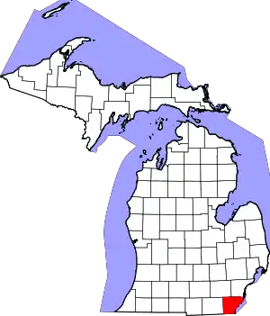 Map of Michigan highlighting Monroe County | |
| Villages | ||
| Charter townships | ||
| Civil townships | ||
| CDPs | ||
| Other unincorporated communities | ||
| Ghost towns | ||
| Footnotes | ‡This populated place also has portions in an adjacent county or counties | |
| ||