South Rockwood, Michigan
South Rockwood is a village in Monroe County in the U.S. state of Michigan. The population was 1,675 at the 2010 census. The village is within Berlin Charter Township.
South Rockwood, Michigan | |
|---|---|
| Village of South Rockwood | |
 South Rockwood Village Hall | |
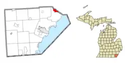 Location within Monroe County | |
 South Rockwood Location within the state of Michigan | |
| Coordinates: 42°03′50″N 83°15′40″W | |
| Country | United States |
| State | Michigan |
| County | Monroe |
| Township | Berlin |
| Founded | 1863 |
| Incorporated | 1955 |
| Government | |
| • Type | Village council |
| • President | Charles Horn |
| • Clerk | Angela Hightower |
| Area | |
| • Total | 3.33 sq mi (8.64 km2) |
| • Land | 3.27 sq mi (8.48 km2) |
| • Water | 0.06 sq mi (0.16 km2) |
| Elevation | 587 ft (179 m) |
| Population | |
| • Total | 1,675 |
| • Estimate (2019)[4] | 1,657 |
| • Density | 505.95/sq mi (195.36/km2) |
| Time zone | UTC-5 (Eastern (EST)) |
| • Summer (DST) | UTC-4 (EDT) |
| ZIP code(s) | 48179 |
| Area code(s) | 734 |
| FIPS code | 26-75280[5] |
| GNIS feature ID | 0638409[6] |
| Website | Official website |
Geography
According to the United States Census Bureau, the village has a total area of 2.46 square miles (6.37 km2), of which 2.35 square miles (6.09 km2) is land and 0.11 square miles (0.28 km2) (4.47%) is water.[7]
Demographics
| Historical population | |||
|---|---|---|---|
| Census | Pop. | %± | |
| 1880 | 251 | — | |
| 1960 | 1,337 | — | |
| 1970 | 1,477 | 10.5% | |
| 1980 | 1,353 | −8.4% | |
| 1990 | 1,221 | −9.8% | |
| 2000 | 1,284 | 5.2% | |
| 2010 | 1,675 | 30.5% | |
| 2019 (est.) | 1,657 | [4] | −1.1% |
| U.S. Decennial Census[8] | |||
2010 census
As of the census[3] of 2010, there were 1,675 people, 687 households, and 453 families living in the village. The population density was 712.8 inhabitants per square mile (275.2/km2). There were 734 housing units at an average density of 312.3 per square mile (120.6/km2). The racial makeup of the village was 95.4% White, 2.3% African American, 0.2% Native American, 0.4% Asian, 0.4% from other races, and 1.3% from two or more races. Hispanic or Latino of any race were 4.1% of the population.
There were 687 households, of which 30.0% had children under the age of 18 living with them, 50.4% were married couples living together, 11.5% had a female householder with no husband present, 4.1% had a male householder with no wife present, and 34.1% were non-families. 25.6% of all households were made up of individuals, and 6.2% had someone living alone who was 65 years of age or older. The average household size was 2.44 and the average family size was 2.95.
The median age in the village was 38.9 years. 20.8% of residents were under the age of 18; 8.9% were between the ages of 18 and 24; 29% were from 25 to 44; 31.1% were from 45 to 64; and 10.1% were 65 years of age or older. The gender makeup of the village was 50.7% male and 49.3% female.
2000 census
As of the census[5] of 2000, there were 1,284 people, 450 households, and 359 families living in the village. The population density was 526.1 per square mile (203.2/km2). There were 464 housing units at an average density of 190.1 per square mile (73.4/km2). The racial makeup of the village was 97.59% White, 0.23% African American, 0.23% Native American, 0.08% Asian, 0.08% from other races, and 1.79% from two or more races. Hispanic or Latino of any race were 0.78% of the population.
There were 450 households, out of which 37.3% had children under the age of 18 living with them, 66.9% were married couples living together, 8.9% had a female householder with no husband present, and 20.2% were non-families. 14.9% of all households were made up of individuals, and 5.8% had someone living alone who was 65 years of age or older. The average household size was 2.85 and the average family size was 3.18.
In the village, the population was spread out, with 26.6% under the age of 18, 9.0% from 18 to 24, 29.0% from 25 to 44, 26.3% from 45 to 64, and 9.0% who were 65 years of age or older. The median age was 37 years. For every 100 females, there were 109.8 males. For every 100 females age 18 and over, there were 102.6 males.
The median income for a household in the village was $62,500, and the median income for a family was $68,304. Males had a median income of $50,882 versus $27,813 for females. The per capita income for the village was $22,245. About 2.3% of families and 4.1% of the population were below the poverty line, including 2.9% of those under age 18 and 4.8% of those age 65 or over.
Major Highways and Roads
 I-75: From southern village limits slightly south of the Ready Road bridge to the Huron River.
- South Huron River Drive: East/West from the western village limit near Wesburn Golf & Country Club to the eastern village limit at Ready Road.
- Carleton-Rockwood Road: East/West from the western village limit to South Huron River Drive.
- North Dixie Highway: North/South from the village limit slightly south of Ready Road to the county line at the Huron River.
- Ready Road: East/West from the village limit at Armstrong Road to South Huron River Drive.
Recreation
Boat Launches
South Rockwood is located along the Huron River less than 5 miles from Lake Erie, making it a popular location to launch small crafts. Two launches are located within the village: Dodge Park, at the end of Strong Boulevard near Interstate 75, and Labo Park along South Huron River Drive slightly east of downtown.
Parks
Located on the western side of the village is Morley Riggs Park at the Village Hall, with baseball diamonds and a children's play area, outside the South Rockwood Branch Library and village community center. Nearby, the 18-hole Wesburn Golf and Country Club stretches 190 acres along the Huron River.
References
- Village of South Rockwood (2020). "Village Officials". Retrieved April 2, 2020.
- "2019 U.S. Gazetteer Files". United States Census Bureau. Retrieved July 25, 2020.
- "U.S. Census website". United States Census Bureau. Retrieved 2012-11-25.
- "Population and Housing Unit Estimates". United States Census Bureau. May 24, 2020. Retrieved May 27, 2020.
- "U.S. Census website". United States Census Bureau. Retrieved 2008-01-31.
- "US Board on Geographic Names". United States Geological Survey. 2007-10-25. Retrieved 2008-01-31.
- "US Gazetteer files 2010". United States Census Bureau. Archived from the original on 2012-01-25. Retrieved 2012-11-25.
- "Census of Population and Housing". Census.gov. Retrieved June 4, 2015.
Places adjacent to South Rockwood, Michigan | ||||||||||
|---|---|---|---|---|---|---|---|---|---|---|
| ||||||||||
Municipalities and communities of Monroe County, Michigan, United States | ||
|---|---|---|
| Cities | 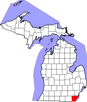 Map of Michigan highlighting Monroe County | |
| Villages | ||
| Charter townships | ||
| Civil townships | ||
| CDPs | ||
| Other unincorporated communities | ||
| Ghost towns | ||
| Footnotes | ‡This populated place also has portions in an adjacent county or counties | |
| ||