Mille Lacs Lake
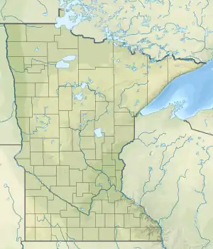
Mille Lacs Lake (also called Lake Mille Lacs or Mille Lacs) is a large but shallow lake in the U.S. state of Minnesota. It is located in the counties of Mille Lacs, Aitkin, and Crow Wing, roughly 75 miles north of the Minneapolis-St. Paul metropolitan area.
| Mille Lacs Lake | |
|---|---|
 Lake in September 2011 | |
 Mille Lacs Lake | |
| Location | Aitkin / Mille Lacs / Crow Wing Counties, Minnesota, US |
| Coordinates | 46°14′17.27″N 93°38′36.29″W |
| Type | moraine-dammed lake |
| Primary inflows | Garrison Creek, Seguchie Creek, Peterson Creek, and Thain's River |
| Primary outflows | Rum River |
| Basin countries | United States |
| Surface area | 132,516 acres (207 sq mi; 536 km2) |
| Max. depth | 42 ft (13 m) |
| Surface elevation | 1,251 ft (381 m) |
| Settlements | see list |
Mille Lacs means "thousand lakes" in French. In the Ojibwe language of the people who historically occupied this area, the lake is called Misi-zaaga'igan ("grand lake").
Physical features
Mille Lacs is Minnesota's second-largest inland lake at 132,516 acres (536 km2), after Red Lake.[1] The maximum depth is 53 feet (16 m). Much of the main lake has depths ranging from 20- to 38-feet. Gravel and rock bars are common in the southern half of the lake. Two islands in the center comprise the Mille Lacs National Wildlife Refuge, the smallest such refuge in the United States.
Fishing
Shallow reef-top fishing exists on all sides of the lake. Deep-water angling takes place on the southern deep gravel and rocks as well as on dozens of mud flats in the north half of the lake. Shoreline break fishing on varied bottom types occurs all around the lake. The weed line is at nine to twelve feet. There are many local fisherman's names for some features of the lake. Spirit Island, the small rock-made island in the south west region of the lake, consists of weathered and eroded pink and white granite boulders. Spirit Island is one of two Islands in Mille Lakes Lake designated as a National Wildlife Refuge.
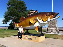
The lake has many species of fish including walleye, northern pike, muskie, jumbo perch, smallmouth bass, largemouth bass, black crappie, burbot, and tullibee. It is one of Minnesota's most popular fishing lakes. Ice fishing houses number in the thousands during the winter. It is a prime spawning grounds for walleye. Billions of walleye eggs and fry are produced there every year. In the absence of a thermocline, fish can travel the whole area of the lake.
History
Archaeologists indicate that the area around the lake is one of the earliest known sites of human settlement in the state of Minnesota. The Rum River drains from Lake Mille Lacs into the Mississippi River to the south at present-day Anoka.
On early French maps, the lake was also identified as Lac Buade or Minsisaugaigun.[2] On a 1733 map by Henry Popple, Mille Lacs Lake is shown as "Lake Miſsiſsucaigan or Baude". As late as 1843, it was referred to as "Mini Sagaigonin or Mille Lacs" on United States government maps.[3]
The lake is known in Dakota as Bdé Wakháŋ (Spiritual/Mystic Lake). The Mdewakanton group of the Santee Sioux identified by their location around the lake. In Ojibwe, the lake is known as Misi-zaaga'igan megwe Midaaswaakogamaakaan (Grand/Great/Big Lake in the Region of a Thousand Lakes), or simply as Misi-zaaga'igan (Grand Lake), as it is the largest lake in the Brainerd Lakes Area. Likewise, the French named the lake as "Mille Lacs Lake" (Lac des Mille Lacs), as the Brainerd Lakes Area was called "Region of Thousand Lakes" (Pays des Mille Lacs).[4]
Areas around the lake are protected and available to the public in state parks: Father Hennepin State Park and Mille Lacs Kathio State Park. Portions of the Mille Lacs Indian Reservation, of the federally recognized Mille Lacs Ojibwe, border the lake.
In 2013, a windblown wall of ice, called an ice shove, moved off the lake and damaged houses on the lake shore.
Towns on Mille Lacs Lake
See also
- List of lakes in Minnesota
Notes
- Minnesota DNR Lakes Fact Page
- Named Lac Buade, after Louis de Buade de Frontenac, governor of New France, by Daniel Greysolon, Sieur du Lhut, see d'Eschambault, Antoine (1951). "La vie aventureuse de Daniel Greysolon, sieur Dulhut". Revue d'histoire de l'Amérique française (in French). 5 (3): 320–339. doi:10.7202/801714ar.
- Joseph Nicollet (1843), Hydrographical Basin of the Mississippi River, Corps of Topographical Engineers, U.S. War Department
- Upham, Warren. (1920; repr. 1991) Minnesota Place Names St. Paul: Minnesota Historical Society Press.
External links
| Wikimedia Commons has media related to Mille Lacs Lake. |
| Wikivoyage has a travel guide for Mille Lacs. |
- Mille Lacs Area Tourism Council
- Mille Lacs Messenger newspaper
- Mille Lacs Webcam
- Mille Lacs - Isle Bay Webcam - Hunter Winfields
- Mille Lacs - Isle Bay Webcam - Chapman's Mille Lacs Resort & Guide Service
| Authority control |
|
|---|