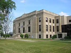
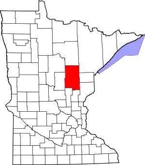
Aitkin County, Minnesota
Aitkin County (/ˈeɪkɪn/ AY-kin) is a county in the U.S. state of Minnesota. As of the 2010 United States Census, the population was 16,202.[2] Its county seat is Aitkin.[3] Part of the Mille Lacs Indian Reservation is in the county. The county was created in 1857 and organized in 1871.
Aitkin County | |
|---|---|
 | |
 Location within the U.S. state of Minnesota | |
 Minnesota's location within the U.S. | |
| Coordinates: 46°37′N 93°25′W | |
| Country | |
| State | |
| Founded | May 23, 1857 (created) June 30, 1871 (organized)[1] |
| Named for | William Alexander Aitken |
| Seat | Aitkin |
| Largest city | Aitkin |
| Area | |
| • Total | 1,995 sq mi (5,170 km2) |
| • Land | 1,822 sq mi (4,720 km2) |
| • Water | 174 sq mi (450 km2) 8.7%% |
| Population (2010) | |
| • Total | 16,202 |
| • Estimate (2019) | 15,886 |
| • Density | 8.69/sq mi (3.36/km2) |
| Time zone | UTC−6 (Central) |
| • Summer (DST) | UTC−5 (CDT) |
| Congressional district | 8th |
| Website | www |
History
Aitkin County was established in 1857 as Aiken County. The current spelling was adopted in 1872. It was named for William Alexander Aitken, a fur trader for the American Fur Company, under John Jacob Astor. Formed from Ramsey and Pine counties, Aiken County originally consisted of the 17 townships closest to Mille Lacs Lake. It acquired outlands of Ramsey, Itasca and Pine Counties to its north and east. It was organized in 1871, taking up lands from Cass and Itasca Counties and losing a point in the southwestern corner to Crow Wing County to form its current boundaries.
Geography
The Mississippi River flows southward through the west central part of the county. The county terrain consists of wooded rolling hills, dotted with lakes and ponds.[4] The terrain slopes to the south; its highest point is Quadna Mountain, 2.5 miles (4.0 km) south-southeast of Hill City, at 1,591' (485m) ASL.[5] Otherwise the highest terrain is near its northwestern corner, at 1,388' (423m) ASL.[6] The county has a total area of 1,995 square miles (5,170 km2), of which 1,822 square miles (4,720 km2) is land and 174 square miles (450 km2) (8.7%) is water.[7]
Major highways
Adjacent counties
- Itasca County - north
- Saint Louis County - northeast
- Carlton County - east
- Pine County - southeast
- Kanabec County - south
- Mille Lacs County - southwest
- Crow Wing County - west
- Cass County - northwest
Protected areas
- Grayling State Wildlife Management Area
- Hill River State Forest
- Kimberly State Wildlife Management Area
- McGregor Marsh Scientific and Natural Area
- Rice Lake National Wildlife Refuge
- Ripple River State Wildlife Management Area
- Salo Marsh State Wildlife Management Area
- Savanna Portage State Park
- Snake River County Park
- Solana State Forest
Government and Politics
Aitkin County voters have selected the Democratic Party candidate in 67% of national elections since 1960. Recent presidential elections have shifted to the Republican Party, with their candidate winning four of the last five elections as of 2020.
| Year | Republican | Democratic | Third parties |
|---|---|---|---|
| 2020 | 62.4% 6,258 | 36.0% 3,607 | 1.6% 160 |
| 2016 | 59.8% 5,516 | 34.0% 3,134 | 6.3% 581 |
| 2012 | 49.6% 4,533 | 48.3% 4,412 | 2.2% 197 |
| 2008 | 48.8% 4,589 | 48.8% 4,595 | 2.4% 226 |
| 2004 | 50.4% 4,768 | 48.0% 4,539 | 1.5% 145 |
| 2000 | 45.5% 3,755 | 46.4% 3,830 | 8.2% 675 |
| 1996 | 31.4% 2,327 | 51.5% 3,810 | 17.1% 1,267 |
| 1992 | 28.5% 2,151 | 45.0% 3,400 | 26.6% 2,008 |
| 1988 | 43.4% 3,011 | 55.7% 3,863 | 1.0% 68 |
| 1984 | 46.1% 3,422 | 53.2% 3,943 | 0.7% 51 |
| 1980 | 44.3% 3,396 | 47.9% 3,677 | 7.8% 597 |
| 1976 | 35.6% 2,476 | 62.0% 4,308 | 2.4% 165 |
| 1972 | 53.7% 3,241 | 44.6% 2,687 | 1.7% 104 |
| 1968 | 39.8% 2,254 | 54.7% 3,094 | 5.5% 309 |
| 1964 | 34.0% 2,000 | 65.8% 3,874 | 0.3% 16 |
| 1960 | 50.7% 3,097 | 48.8% 2,980 | 0.6% 36 |
| 1956 | 50.2% 2,762 | 49.7% 2,733 | 0.2% 9 |
| 1952 | 55.9% 3,384 | 42.6% 2,577 | 1.5% 89 |
| 1948 | 41.1% 2,466 | 54.6% 3,277 | 4.4% 264 |
| 1944 | 49.4% 2,720 | 49.8% 2,743 | 0.8% 46 |
| 1940 | 50.1% 3,744 | 48.3% 3,610 | 1.6% 116 |
| 1936 | 37.3% 2,466 | 57.6% 3,806 | 5.1% 339 |
| 1932 | 40.8% 2,341 | 51.3% 2,945 | 8.0% 457 |
| 1928 | 70.1% 3,951 | 25.3% 1,428 | 4.6% 257 |
| 1924 | 53.7% 2,720 | 4.2% 212 | 42.1% 2,136 |
| 1920 | 70.2% 2,933 | 14.7% 613 | 15.2% 635 |
| 1916 | 46.2% 1,122 | 36.1% 877 | 17.6% 428 |
| 1912 | 17.4% 362 | 19.8% 413 | 62.8% 1,308 |
| 1908 | 67.0% 1,205 | 21.6% 389 | 11.4% 204 |
| 1904 | 81.0% 1,327 | 11.7% 191 | 7.4% 121 |
| 1900 | 77.3% 988 | 20.5% 262 | 2.2% 28 |
| 1896 | 69.5% 855 | 27.9% 344 | 2.6% 32 |
| 1892 | 62.6% 445 | 30.5% 217 | 6.9% 49 |
| Position | Name | District | |
|---|---|---|---|
| Commissioner | J. Mark Wedel | District 1 | |
| Commissioner | Laurie Westerlund | District 2 | |
| Commissioner and Vice Chair | Donald Niemi | District 3 | |
| Commissioner and Chairperson | William "Bill" Pratt | District 4 | |
| Commissioner | Anne Marcotte | District 5 | |
| Position | Name | Affiliation | District | |
|---|---|---|---|---|
| Senate | Carrie Ruud[11] | Republican | District 10 | |
| House of Representatives | Dale Lueck[12] | Republican | District 10B | |
| Position | Name | Affiliation | District | |
|---|---|---|---|---|
| House of Representatives | Pete Stauber[13] | Republican | 8th | |
| Senate | Amy Klobuchar[14] | Democrat | N/A | |
| Senate | Tina Smith[15] | Democrat | N/A | |
Climate and weather
| Aitkin, Minnesota | ||||||||||||||||||||||||||||||||||||||||||||||||||||||||||||
|---|---|---|---|---|---|---|---|---|---|---|---|---|---|---|---|---|---|---|---|---|---|---|---|---|---|---|---|---|---|---|---|---|---|---|---|---|---|---|---|---|---|---|---|---|---|---|---|---|---|---|---|---|---|---|---|---|---|---|---|---|
| Climate chart (explanation) | ||||||||||||||||||||||||||||||||||||||||||||||||||||||||||||
| ||||||||||||||||||||||||||||||||||||||||||||||||||||||||||||
| ||||||||||||||||||||||||||||||||||||||||||||||||||||||||||||
In recent years, average temperatures in the county seat of Aitkin have ranged from a low of 0 °F (−18 °C) in January to a high of 80 °F (27 °C) in July, although a record low of −47 °F (−44 °C) was recorded in January 1972 and a record high of 100 °F (38 °C) was recorded in August 1976. Although these records are the official records, temperatures above 100 °F (38 °C) has been detected numerous times throughout Aitkin County and surrounding areas. Average monthly precipitation ranged from 0.79 inches (20 mm) in February to 4.46 inches (113 mm) in June.[16]
Demographics
| Historical population | |||
|---|---|---|---|
| Census | Pop. | %± | |
| 1860 | 2 | — | |
| 1870 | 178 | 8,800.0% | |
| 1880 | 366 | 105.6% | |
| 1890 | 2,462 | 572.7% | |
| 1900 | 6,473 | 162.9% | |
| 1910 | 10,371 | 60.2% | |
| 1920 | 15,043 | 45.0% | |
| 1930 | 15,009 | −0.2% | |
| 1940 | 17,865 | 19.0% | |
| 1950 | 14,327 | −19.8% | |
| 1960 | 12,162 | −15.1% | |
| 1970 | 11,403 | −6.2% | |
| 1980 | 13,404 | 17.5% | |
| 1990 | 12,425 | −7.3% | |
| 2000 | 15,301 | 23.1% | |
| 2010 | 16,202 | 5.9% | |
| 2019 (est.) | 15,886 | [17] | −2.0% |
| US Decennial Census[18] 1790-1960[19] 1900-1990[20] 1990-2000[21] 2010-2019[2] | |||

2010 census
As of the 2010 United States Census, there were 16,202 people, 7,542 households, and 4,458 families in the county. The population density was 8.89/sqmi (3.50/km2). There were 16,626 housing units at an average density of 9.13/sqmi (3.52/km2). The racial makeup of the county was 95.63% or 15,494 people White, 0.35% or 57 people Black or African American, 2.4% or 390 people Native American, 0.17% or 27 people Asian, 0.025% or 4 people Pacific Islander, 0.13% or 21 people from other races, and 1.29% or 209 people from two or more races. Of the population with two or more races, 0.9% of the population were Hispanic or Latino of any race. 29.5% were of German, 14.3% Norwegian, 13.0% Swedish, 6.2% Irish, 5.3% United States or American and 5.2% Finnish ancestry.
There were 6,644 households, out of which 22.60% had children under the age of 18 living with them, 57.50% were married couples living together, 6.30% had a female householder with no husband present, and 32.90% were non-families. 28.70% of all households were made up of individuals, and 14.00% had someone living alone who was 65 years of age or older. The average household size was 2.28 and the average family size was 2.76.
The county population contained 20.90% under the age of 18, 5.50% from 18 to 24, 21.60% from 25 to 44, 29.10% from 45 to 64, and 23.00% who were 65 years of age or older. The median age was 46 years. For every 100 females there were 101.60 males. For every 100 females age 18 and over, there were 99.90 males.
The median income for a household in the county was $44,139, and the median income for a family was $58,290. Males had a median income of $51,604 versus $30,633 for females. The per capita income for the county was $21,848. About 5.20% of families and 7.60% of the population were below the poverty line, including 15.50% of those under age 18 and 11.00% of those age 65 or over.
Communities
Townships
- Aitkin Township
- Ball Bluff Township
- Balsam Township
- Beaver Township
- Clark Township
- Cornish Township
- Farm Island Township
- Fleming Township
- Glen Township
- Haugen Township
- Hazelton Township
- Hill Lake Township
- Idun Township
- Jevne Township
- Kimberly Township
- Lakeside Township
- Lee Township
- Libby Township
- Logan Township
- Macville Township
- Malmo Township
- McGregor Township
- Millward Township
- Morrison Township
- Nordland Township
- Pliny Township
- Rice River Township
- Salo Township
- Seavey Township
- Shamrock Township
- Spalding Township
- Spencer Township
- Turner Township
- Verdon Township
- Wagner Township
- Waukenabo Township
- Wealthwood Township
- White Pine Township
- Williams Township
- Workman Township
Unorganized territories
Unincorporated communities
References
- "Aitkin County". Minnesota Historical Society. Archived from the original on October 25, 2014. Retrieved March 17, 2014.
- "State & County QuickFacts". United States Census Bureau. Archived from the original on June 7, 2011. Retrieved August 30, 2013.
- "Find a County". National Association of Counties. Archived from the original on May 31, 2011. Retrieved June 7, 2011.
- Aitkin County MN Google Maps (accessed March 4, 2019)
- Quadna Mountain MN. PeakBagger.com (accessed 4 May 2019)
- ""Find an Altitude/Aitkin County MN" Google Maps (accessed 4 March 2019)". Archived from the original on May 21, 2019. Retrieved March 4, 2019.
- "2010 Census Gazetteer Files". US Census Bureau. August 22, 2012. Archived from the original on October 6, 2014. Retrieved October 5, 2014.
- Nelson, Steven (2011). Savanna Soils of Minnesota. Minnesota: Self. pp. 71-72. ISBN 978-0-615-50320-2.
- Leip, David. "Atlas of US Presidential Elections". uselectionatlas.org. Retrieved April 17, 2018.
- "Aitkin County Commissioners". www.co.aitkin.mn.us. Retrieved June 24, 2020.
- "MN State Senate". www.senate.mn. Retrieved June 24, 2020.
- "Rep. Dale Lueck (10B) - Minnesota House of Representatives". www.house.leg.state.mn.us. Retrieved June 24, 2020.
- "Representative Pete Stauber". Representative Pete Stauber. Retrieved June 24, 2020.
- "U.S. Senator Amy Klobuchar". www.klobuchar.senate.gov. Retrieved June 24, 2020.
- "Home". Senator Tina Smith. Retrieved June 24, 2020.
- "Monthly Averages for Aitkin MN". The Weather Channel. Archived from the original on January 31, 2011. Retrieved February 13, 2011.
- "Population and Housing Unit Estimates". Retrieved March 26, 2020.
- "US Decennial Census". US Census Bureau. Archived from the original on April 26, 2015. Retrieved October 5, 2014.
- "Historical Census Browser". University of Virginia Library. Retrieved October 5, 2014.
- "Population of Counties by Decennial Census: 1900 to 1990". United States Census Bureau. Retrieved October 5, 2014.
- "Census 2000 PHC-T-4. Ranking Tables for Counties: 1990 and 2000" (PDF). US Census Bureau. Retrieved October 5, 2014.
External links
- Aitkin County government’s website
- Minnesota Department of Transportation map of Aitkin County (southern portion, northern portion)
- Records
Places adjacent to Aitkin County, Minnesota | ||||||||||
|---|---|---|---|---|---|---|---|---|---|---|
| ||||||||||
Municipalities and communities of Aitkin County, Minnesota, United States | ||
|---|---|---|
| Cities | Map of Minnesota highlighting Aitkin County | |
| Townships |
| |
| Unorganized territories | ||
| Unincorporated communities | ||
| Indian reservations | ||
| Footnotes | ‡This populated place also has portions in an adjacent county or counties | |
| ||

| Authority control |
|---|