Minnesota City, Minnesota
Minnesota City is a city in Winona County, Minnesota, United States. The population was 204 at the 2010 census.[6]
Minnesota City | |
|---|---|
| Motto(s): "A Past That We Honor A Present That We Give Meaning A Future That We Build Together" | |
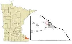 Location of Minnesota City, Minnesota | |
| Coordinates: 44°5′29″N 91°44′59″W | |
| Country | United States |
| State | Minnesota |
| County | Winona |
| Government | |
| • Type | Mayor - Council |
| • Mayor | Don O’Neil |
| Area | |
| • Total | 0.25 sq mi (0.64 km2) |
| • Land | 0.25 sq mi (0.64 km2) |
| • Water | 0.00 sq mi (0.00 km2) |
| Elevation | 686 ft (209 m) |
| Population | |
| • Total | 1,278 |
| • Estimate (2019)[3] | 890 |
| • Density | 751.00/sq mi (290.26/km2) |
| Time zone | UTC-6 (Central (CST)) |
| • Summer (DST) | UTC-5 (CDT) |
| ZIP code | 55959 |
| Area code(s) | 507 |
| FIPS code | 27-43144[4] |
| GNIS feature ID | 0647934[5] |
| Website | www |
History
Minnesota City was platted in 1852.[7] The city took its name from the Minnesota Territory.[8] A post office has been in operation in Minnesota City since 1852.[9]
Geography
According to the United States Census Bureau, the city has a total area of 0.26 square miles (0.67 km2), all of it land.[10]
Demographics
| Historical population | |||
|---|---|---|---|
| Census | Pop. | %± | |
| 1880 | 273 | — | |
| 1900 | 242 | — | |
| 1910 | 211 | −12.8% | |
| 1920 | 141 | −33.2% | |
| 1930 | 151 | 7.1% | |
| 1940 | 211 | 39.7% | |
| 1950 | 201 | −4.7% | |
| 1960 | 190 | −5.5% | |
| 1970 | 301 | 58.4% | |
| 1980 | 265 | −12.0% | |
| 1990 | 258 | −2.6% | |
| 2000 | 235 | −8.9% | |
| 2010 | 204 | −13.2% | |
| 2019 (est.) | 187 | [3] | −8.3% |
| U.S. Decennial Census[11] | |||
2010 census
As of the census[2] of 2010, there were 204 people, 81 households, and 60 families living in the city. The population density was 784.6 inhabitants per square mile (302.9/km2). There were 89 housing units at an average density of 342.3 per square mile (132.2/km2). The racial makeup of the city was 99.5% White and 0.5% Native American. Hispanic or Latino of any race were 0.5% of the population.
There were 81 households, of which 39.5% had children under the age of 18 living with them, 54.3% were married couples living together, 9.9% had a female householder with no husband present, 9.9% had a male householder with no wife present, and 25.9% were non-families. 16.0% of all households were made up of individuals, and 2.4% had someone living alone who was 65 years of age or older. The average household size was 2.52 and the average family size was 2.77.
The median age in the city was 36 years. 25.5% of residents were under the age of 18; 6.8% were between the ages of 18 and 24; 29% were from 25 to 44; 26.4% were from 45 to 64; and 12.3% were 65 years of age or older. The gender makeup of the city was 52.9% male and 47.1% female.
2000 census
As of the census[4] of 2000, there were 235 people, 84 households, and 64 families living in the city. The population density was 912.0 people per square mile (349.0/km2). There were 85 housing units at an average density of 329.9 per square mile (126.2/km2). The racial makeup of the city was 99.57% White, 0.43% from other races. Hispanic or Latino of any race were 0.43% of the population.
There were 84 households, out of which 34.5% had children under the age of 18 living with them, 65.5% were married couples living together, 7.1% had a female householder with no husband present, and 23.8% were non-families. 16.7% of all households were made up of individuals, and 4.8% had someone living alone who was 65 years of age or older. The average household size was 2.80 and the average family size was 3.05.
In the city, the population was spread out, with 27.7% under the age of 18, 7.7% from 18 to 24, 29.8% from 25 to 44, 25.1% from 45 to 64, and 9.8% who were 65 years of age or older. The median age was 35 years. For every 100 females, there were 113.6 males. For every 100 females age 18 and over, there were 104.8 males.
The median income for a household in the city was $46,458, and the median income for a family was $47,708. Males had a median income of $30,000 versus $22,500 for females. The per capita income for the city was $18,430. None of the families and 2.5% of the population were living below the poverty line, including no under eighteens and 10.0% of those over 64.
References
- "2019 U.S. Gazetteer Files". United States Census Bureau. Retrieved July 26, 2020.
- "U.S. Census website". United States Census Bureau. Retrieved 2012-11-13.
- "Population and Housing Unit Estimates". United States Census Bureau. May 24, 2020. Retrieved May 27, 2020.
- "U.S. Census website". United States Census Bureau. Retrieved 2008-01-31.
- "US Board on Geographic Names". United States Geological Survey. 2007-10-25. Retrieved 2008-01-31.
- "2010 Census Redistricting Data (Public Law 94-171) Summary File". American FactFinder. United States Census Bureau. Retrieved 27 April 2011.
- Upham, Warren (1920). Minnesota Geographic Names: Their Origin and Historic Significance. Minnesota Historical Society. p. 582.
- Chicago and North Western Railway Company (1908). A History of the Origin of the Place Names Connected with the Chicago & North Western and Chicago, St. Paul, Minneapolis & Omaha Railways. p. 103.
- "Winona County". Jim Forte Postal History. Retrieved 22 March 2015.
- "US Gazetteer files 2010". United States Census Bureau. Archived from the original on 2012-01-25. Retrieved 2012-11-13.
- "Census of Population and Housing". Census.gov. Retrieved June 4, 2015.
External links
Municipalities and communities of Winona County, Minnesota, United States | ||
|---|---|---|
| Cities | 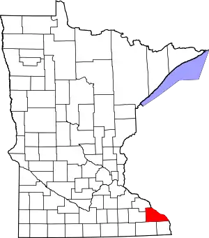 Map of Minnesota highlighting Winona County | |
| Townships | ||
| CDP | ||
| Unincorporated communities | ||
| Ghost towns | ||
| Footnotes | ‡This populated place also has portions in an adjacent county or counties | |
| ||
| Authority control |
|---|