Winona County, Minnesota
Winona County is a county in the U.S. state of Minnesota. As of the 2010 census, its population was 51,461. Its county seat is Winona.[1]
Winona County | |
|---|---|
 | |
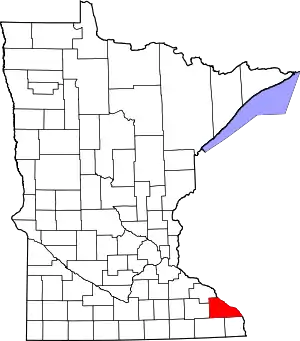 Location within the U.S. state of Minnesota | |
 Minnesota's location within the U.S. | |
| Coordinates: 43°59′N 91°46′W | |
| Country | |
| State | |
| Founded | February 23, 1854 |
| Named for | Winona (Native American) |
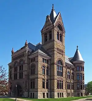
| Seat | Winona |
| Largest city | Winona |
| Area | |
| • Total | 642 sq mi (1,660 km2) |
| • Land | 626 sq mi (1,620 km2) |
| • Water | 15 sq mi (40 km2) 2.4%% |
| Population (2010) | |
| • Total | 51,461 |
| • Estimate (2019) | 50,484 |
| • Density | 81.2/sq mi (31.4/km2) |
| Time zone | UTC−6 (Central) |
| • Summer (DST) | UTC−5 (CDT) |
| Congressional district | 1st |
| Website | www |
Winona County comprises the Winona, MN Micropolitan Statistical Area.
History

The Wisconsin Territory was established by the federal government effective July 3, 1836, and existed until its eastern portion was granted statehood (as Wisconsin) in 1848. The federal government set up the Minnesota Territory effective March 3, 1849. The newly organized territorial legislature created nine counties across the territory in October of that year. One of those original counties, Wabasha, had its southern section partitioned off on March 5, 1853, into a new county, Fillmore. On February 23, 1854, the legislature partitioned the northern part of Fillmore County, plus a small section of Wabasha, to create Winona County, with the village of Winona as county seat.[2] The county name was taken from the village name, which is said to derive from a Dakota legend about a woman, Winona, (a relative of Chief Wabasha) who was betrothed to a warrior she did not love. Rather than marry him, she jumped to her death from a rock on Lake Pepin now called "Maiden's Rock".[3] This is known as the Winona legend.[4]
The county boundaries have remained unchanged since 1854.
Geography
Winona County lies on Minnesota's border with Wisconsin and is part of the driftless area that defines southeastern Minnesota, northeastern Iowa, southwestern Wisconsin and northwestern Illinois. The Mississippi, flowing south-southeast, defines the county's eastern border. The U.S. Army Corps of Engineers (St. Paul District[6]) maintains the lock and dam system in this region.
The Whitewater River flows north-northeast through the northwest part of the county toward its discharge into the Mississippi just above Winona County. The eastern part of the county is drained into the Mississippi by east-flowing streams including Rollingstone Creek, Garvin Brook, Cedar Creek, and Big Trout Creek. The county terrain consists of low rolling hills with the east portion particularly etched by drainages, and lightly sprinkled with lakes. The land is devoted to agriculture where possible.[7] The terrain slopes to the south and east,[8] with its highest point at 1,365' (416m) ASL on a hill two miles (3 km) east of Wilson.[9] The county has a total area of 642 square miles (1,660 km2), of which 626 square miles (1,620 km2) is land and 15 square miles (39 km2) (2.4%) is water.[10]
Within Minnesota, Winona County borders Wabasha County, Olmsted County, Fillmore County and Houston County.
Major highways
Public airports
- Winona Municipal Airport (ONA) (Max Conrad Field), NW of Winona
Adjacent counties
- Wabasha County - northwest
- Buffalo County, Wisconsin - north
- Trempealeau County, Wisconsin - northeast
- La Crosse County, Wisconsin - east
- Houston County - south
- Fillmore County - southwest
- Olmsted County - west
Protected areas[7]
- Great River Bluffs State Park
- John A Latsch State Park
- Richard John Dorer Memorial Hardwood State Forest
- Upper Mississippi River National Wildlife and Fish Refuge (part)
- Whitewater State Park
- Whitewater State Wildlife Management Area (part)
- Callahan Unit
- McCarthy Ravine Unit
- South Branch Unit
- Upper South Branch Unit
Lakes[7]
- Airport Lake
- Bartlet Lake
- Bollers Lake
- Hunters Lake
- Lake Goodview
- Lake Winona
- Rileys Lake
Demographics
| Historical population | |||
|---|---|---|---|
| Census | Pop. | %± | |
| 1860 | 9,208 | — | |
| 1870 | 22,319 | 142.4% | |
| 1880 | 27,107 | 21.5% | |
| 1890 | 33,797 | 24.7% | |
| 1900 | 35,686 | 5.6% | |
| 1910 | 33,398 | −6.4% | |
| 1920 | 33,653 | 0.8% | |
| 1930 | 35,144 | 4.4% | |
| 1940 | 37,795 | 7.5% | |
| 1950 | 39,841 | 5.4% | |
| 1960 | 40,937 | 2.8% | |
| 1970 | 44,409 | 8.5% | |
| 1980 | 46,256 | 4.2% | |
| 1990 | 47,828 | 3.4% | |
| 2000 | 49,985 | 4.5% | |
| 2010 | 51,461 | 3.0% | |
| 2019 (est.) | 50,484 | [11] | −1.9% |
| U.S. Decennial Census[12] 1790-1960[13] 1900-1990[14] 1990-2000[15] 2010-2019[16] | |||
2018 estimate
As of the 2018 estimate of Winona County population, there were 50,825 residents. The racial makeup of the county was 94% White, 1% African American, 2% Asian, 2% Hispanic or Latino, below 1% from other races, and 1% from two or more races. The male population constituted 49% of the total.
2000 census

As of the 2000 United States Census, there were 49,985 people, 18,744 households, and 11,696 families in the county. The population density was 79.8/sqmi (30.8/km2). There were 19,551 housing units at an average density of 31.2/sqmi (12.1/km2). The racial makeup of the county was 95.80% White, 0.77% Black or African American, 0.19% Native American, 1.87% Asian, 0.02% Pacific Islander, 0.53% from other races, and 0.81% from two or more races. 1.37% of the population were Hispanic or Latino of any race. 41.8% were of German, 13.9% Norwegian, 9.9% Polish and 7.4% Irish ancestry.
There were 18,744 households, out of which 30.20% had children under the age of 18 living with them, 51.30% were married couples living together, 7.80% had a female householder with no husband present, and 37.60% were non-families. 28.20% of all households were made up of individuals, and 10.50% had someone living alone who was 65 years of age or older. The average household size was 2.46 and the average family size was 3.04.
The county population contained 22.80% under the age of 18, 18.60% from 18 to 24, 25.10% from 25 to 44, 20.50% from 45 to 64, and 13.10% who were 65 years of age or older. The median age was 33 years. For every 100 females there were 95.20 males. For every 100 females age 18 and over, there were 91.80 males.
The median income for a household in the county was $38,700, and the median income for a family was $49,845. Males had a median income of $31,926 versus $23,406 for females. The per capita income for the county was $18,077. About 5.60% of families and 12.00% of the population were below the poverty line, including 9.80% of those under age 18 and 9.30% of those age 65 or over.
In 2016, Winona County planning commissioners voted to approve new permits for existing commercial dog breeding operations, also known as "puppy mills", despite overwhelming evidence of animal cruelty and neglect. Due to the high number of kennels in the county, Winona county has earned the dubious title "Puppy Mill Capital of Minnesota".[17]
Micropolitan Statistical Area
The United States Office of Management and Budget (OMB) has designated Winona County as the Winona, MN Micropolitan Statistical Area (µSA), with Winona as its principal city.[18] The US Census Bureau ranked this µSA as the 582nd most populous Core Based Statistical Area of the United States as of July 1, 2012.[19]
Politics
Winona County voters tended to vote Democratic until recently. Since 1960 the county selected the Democratic Party candidate in 64% of national elections (as of 2016).
| Year | Republican | Democratic | Third parties |
|---|---|---|---|
| 2020 | 48.7% 13,227 | 49.1% 13,333 | 2.2% 613 |
| 2016 | 46.5% 12,122 | 43.6% 11,366 | 9.9% 2,586 |
| 2012 | 42.2% 11,480 | 55.0% 14,980 | 2.8% 772 |
| 2008 | 39.3% 10,975 | 58.4% 16,308 | 2.3% 652 |
| 2004 | 46.3% 12,686 | 51.9% 14,231 | 1.8% 505 |
| 2000 | 45.0% 10,773 | 46.3% 11,069 | 8.7% 2,076 |
| 1996 | 36.8% 7,955 | 47.5% 10,272 | 15.7% 3,389 |
| 1992 | 35.0% 8,585 | 39.6% 9,707 | 25.4% 6,226 |
| 1988 | 50.9% 11,012 | 47.7% 10,310 | 1.4% 302 |
| 1984 | 55.0% 11,981 | 44.0% 9,577 | 1.0% 212 |
| 1980 | 45.1% 10,332 | 42.9% 9,814 | 12.0% 2,757 |
| 1976 | 47.6% 10,436 | 49.9% 10,939 | 2.5% 539 |
| 1972 | 56.5% 10,910 | 41.8% 8,080 | 1.7% 337 |
| 1968 | 45.9% 7,998 | 49.5% 8,627 | 4.7% 818 |
| 1964 | 35.7% 6,345 | 64.1% 11,397 | 0.2% 28 |
| 1960 | 52.1% 9,271 | 47.7% 8,484 | 0.1% 25 |
| 1956 | 61.3% 9,743 | 38.1% 6,048 | 0.6% 102 |
| 1952 | 64.5% 10,723 | 35.1% 5,834 | 0.4% 64 |
| 1948 | 44.9% 6,880 | 54.1% 8,281 | 1.0% 152 |
| 1944 | 57.2% 8,296 | 42.2% 6,117 | 0.6% 93 |
| 1940 | 56.8% 9,599 | 42.6% 7,187 | 0.6% 105 |
| 1936 | 34.4% 5,353 | 59.6% 9,268 | 6.0% 930 |
| 1932 | 35.7% 4,751 | 62.4% 8,305 | 1.9% 252 |
| 1928 | 53.2% 7,459 | 46.2% 6,484 | 0.6% 88 |
| 1924 | 43.5% 5,670 | 8.5% 1,111 | 48.0% 6,245 |
| 1920 | 69.8% 7,888 | 25.6% 2,896 | 4.6% 516 |
| 1916 | 47.9% 2,916 | 47.8% 2,907 | 4.3% 259 |
| 1912 | 16.5% 1,042 | 47.7% 3,004 | 35.8% 2,254 |
| 1908 | 48.2% 3,014 | 49.2% 3,072 | 2.6% 163 |
| 1904 | 61.2% 3,734 | 33.8% 2,063 | 5.0% 302 |
| 1900 | 47.4% 3,305 | 49.2% 3,436 | 3.4% 239 |
| 1896 | 51.5% 3,935 | 46.2% 3,528 | 2.3% 176 |
| 1892 | 40.0% 2,734 | 54.1% 3,701 | 6.0% 409 |
Winona County is represented in the Minnesota House of Representatives by Rep. Steve Drazkowski (R), and Rep. Gene Pelowski (DFL). Winona County is represented in the Minnesota Senate by Sen. Jeremy Miller (R). Winona County is located in Minnesota's 1st Congressional District, represented by Rep. Jim Hagedorn (R). There are five commissioners on the Winona County Board.[21]
Communities
Cities
- Altura
- Dakota
- Elba
- Goodview
- La Crescent (partly in Houston County)
- Lewiston
- Minneiska (partly in Wabasha County)
- Minnesota City
- Rollingstone
- St. Charles
- Stockton
- Utica
- Winona (county seat)
Census-designated place
Unincorporated communities
Ghost towns
References
- "Find a County". National Association of Counties. Retrieved June 7, 2011.
- "Minnesota Place Names". Minnesota Historical Society. Retrieved March 19, 2014.
- Upham, Warren (1920). Minnesota Geographic Names: Their Origin and Historic Significance. Minnesota Historical Society. pp. 581–4.
- Porter, Cynthya (1 February 2009). "Homecoming To Explore Roles Of American Indian Women". Winona Daily News (reprinted at Diversity Foundation). Retrieved October 21, 2015.
- Nelson, Steven (2011). Savanna Soils of Minnesota. Minnesota: Self. pp. 43 - 48. ISBN 978-0-615-50320-2.
- "ASACE St. Paul District".
- Winona County MN Google Maps (accessed 24 April 2019)
- "Find an Altitude/Winona County MN" Google Maps (accessed April 19, 2019)
- Winona County High Point, Minnesota. PeakBagger (accessed 24 April 2019)
- "2010 Census Gazetteer Files". United States Census Bureau. August 22, 2012. Archived from the original on October 6, 2014. Retrieved October 25, 2014.
- "Population and Housing Unit Estimates". Retrieved March 26, 2020.
- "U.S. Decennial Census". United States Census Bureau. Retrieved October 25, 2014.
- "Historical Census Browser". University of Virginia Library. Retrieved October 25, 2014.
- "Population of Counties by Decennial Census: 1900 to 1990". United States Census Bureau. Retrieved October 25, 2014.
- "Census 2000 PHC-T-4. Ranking Tables for Counties: 1990 and 2000" (PDF). US Census Bureau. Retrieved October 25, 2014.
- "State & County QuickFacts". US Census Bureau. Retrieved September 1, 2013.
- Post, Winona. "Winona County's dirty little secret: It's the puppy mill capital of Minnesota - Winona Post > Opinion". www.winonapost.com. Retrieved 5 September 2018.
- "OMB Bulletin No. 13-01: Revised Delineations of Metropolitan Statistical Areas, Micropolitan Statistical Areas, and Combined Statistical Areas, and Guidance on Uses of the Delineations of These Areas" (PDF). United States Office of Management and Budget. February 28, 2013. Retrieved April 1, 2013.
- "Table 1. Annual Estimates of the Population of Metropolitan and Micropolitan Statistical Areas: April 1, 2010 to July 1, 2012". 2012 Population Estimates. US Census Bureau, Population Division. March 2013. Archived from the original (CSV) on April 1, 2013. Retrieved April 9, 2013.
- Leip, David. "Atlas of US Presidential Elections". uselectionatlas.org. Retrieved April 10, 2018.
- "Winona County Board".
Further reading
- DeLorme's Minnesota Atlas and Gazetteer (ISBN 0-89933-333-8)
External links
Places adjacent to Winona County, Minnesota | |
|---|---|
Municipalities and communities of Winona County, Minnesota, United States | ||
|---|---|---|
| Cities | Map of Minnesota highlighting Winona County | |
| Townships | ||
| CDP | ||
| Unincorporated communities | ||
| Ghost towns | ||
| Footnotes | ‡This populated place also has portions in an adjacent county or counties | |
| ||

| Authority control |
|---|