Minnesota State Highway 251
Minnesota State Highway 251 (MN 251) is a 16.374-mile-long (26.351 km) highway in southeast Minnesota, which runs from its interchange with Interstate 35 at Clarks Grove and continues east to its eastern terminus at its intersection with U.S. Highway 218 in Lansing Township, north of Austin.
| ||||
|---|---|---|---|---|
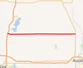
MN 251 highlighted in red | ||||
| Route information | ||||
| Defined by MS § 161.115(182) | ||||
| Maintained by MnDOT | ||||
| Length | 16.374 mi (26.351 km) | |||
| Existed | July 1, 1949[1]–present | |||
| Major junctions | ||||
| West end | ||||
| East end | ||||
| Location | ||||
| Counties | Freeborn, Mower | |||
| Highway system | ||||
| ||||

Route description
Highway 251 serves as an east–west route in southeast Minnesota between Clarks Grove, Hollandale, Corning, and Lansing Township near Austin.
Highway 251 is also known as Park Avenue in Hollandale.
At its western terminus interchange with I-35, Highway 251 becomes Freeborn County Road 31, also known as Main Street in Clarks Grove.
History
Highway 251 was authorized on July 1, 1949.[1]
The route was paved between Clarks Grove and Maple Island and between Corning and U.S. 218 at the time it was marked.[2] Originally, the highway turned south at the county line and followed present-day County Road 2 east to U.S. 218. The highway was moved to its current alignment in 1952.[3][4] This new routing, as well as the remaining gravel portion of the roadway, was paved in 1954 or 1955.[5][6]
Highway 251 originally extended into Clarks Grove proper to intersect U.S. 65 (present-day County Road 45) until Interstate 35 was built.
Major intersections
| County | Location | mi | km | Destinations | Notes |
|---|---|---|---|---|---|
| Freeborn | Bath Township | 0.000– 0.153 | 0.000– 0.246 | Interchange | |
| 0.308 | 0.496 | ||||
| Geneva–Riceland township line | 3.764 | 6.058 | |||
| Hollandale | 6.026 | 9.698 | |||
| Maple Island | 7.795 | 12.545 | |||
| Newry Township | 10.290 | 16.560 | |||
| Moscow Township | 10.532 | 16.950 | |||
| Freeborn–Mower county line | | 13.794 | 22.199 | ||
| Mower | Udolpho–Lansing township line | 16.780 | 27.005 | ||
| 1.000 mi = 1.609 km; 1.000 km = 0.621 mi | |||||
References
- "Chapter 663-H.F. No. 1792", Session Laws of Minnesota for 1949, Earl L. Berg, Commissioner of Administration, pp. 1177–1185
- Minnesota 1950 Official Highway Map (Map). Minnesota Department of Highways. January 1, 1950. § M22-N22. Archived from the original on July 21, 2011. Retrieved December 29, 2010.
- 1952 Official Road Map of Minnesota (Map). Cartography by The H.M. Gousha Company. Minnesota Department of Highways. January 1, 1952. § L20. Archived from the original on July 21, 2011. Retrieved December 29, 2010.
- 1953 Official Road Map of Minnesota (Map). Cartography by The H.M. Gousha Company. Minnesota Department of Highways. January 1, 1953. § L20. Archived from the original on August 25, 2011. Retrieved December 29, 2010.
- 1954 Official Road Map of Minnesota (Map). Cartography by The H.M. Gousha Company. Minnesota Department of Highways. January 1, 1954. § K20-L20. Archived from the original on August 25, 2011. Retrieved December 29, 2010.
- 1956 Official Road Map of Minnesota (Map). Cartography by The H.M. Gousha Company. Minnesota Department of Highways. 1956. § K20-L20. Archived from the original on August 25, 2011. Retrieved December 29, 2010.
