Freeborn County, Minnesota
Freeborn County is a county in the state of Minnesota. As of the 2010 United States Census, the population was 31,255.[2] Its county seat is Albert Lea.[3]
Freeborn County | |
|---|---|
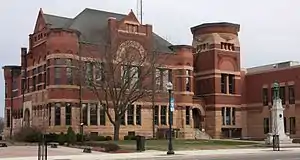 Freeborn County Courthouse | |
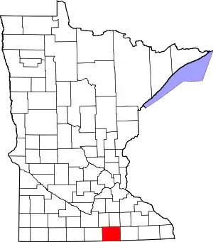 Location within the U.S. state of Minnesota | |
 Minnesota's location within the U.S. | |
| Coordinates: 43°40′N 93°21′W | |
| Country | |
| State | |
| Founded | February 20, 1855[1] |
| Named for | William Freeborn |
| Seat | Albert Lea |
| Largest city | Albert Lea |
| Area | |
| • Total | 722 sq mi (1,870 km2) |
| • Land | 707 sq mi (1,830 km2) |
| • Water | 15 sq mi (40 km2) 2.1%% |
| Population (2010) | |
| • Total | 31,255 |
| • Estimate (2019) | 30,281 |
| • Density | 43.2/sq mi (16.7/km2) |
| Time zone | UTC−6 (Central) |
| • Summer (DST) | UTC−5 (CDT) |
| Congressional district | 1st |
| Website | www |
Freeborn County comprises the Albert Lea, MN Micropolitan Statistical Area.
History
Freeborn County was created on February 20, 1855.[4] It was named for William Freeborn, an early Minnesota politician.[5]
Geography
Freeborn County lies on Minnesota's border with Iowa. The Shell Rock River flows southward from Albert Lea Lake in central Freeborn County, crossing into Iowa. Turtle Creek flows eastward through the upper eastern part of the county, crossing into Mower County. The terrain is hilly and etched with drainages and gullies. The Le Sueur River, a tributary of the Minnesota River, begins in the northern part of the county and flows northward into Waseca County. The available land is devoted to agriculture.[6] The terrain generally slopes to the south and east. although the highest point is near the northeast corner, at 1,296' (395m) ASL.[7] The county has a total area of 722 square miles (1,870 km2), of which 707 square miles (1,830 km2) is land and 15 square miles (39 km2) (2.1%) is water.[8]
Lakes[6]
- Albert Lea Lake
- Bear Lake
- Church Lake
- Everhart Lake
- Fountain Lake
- Freeborn Lake
- Geneva Lake
- Goose Lake
- Halls Lake
- Hickory Lake
- Lower Twin Lake
- Penny Lake
- Pickerel Lake
- School Section Lake
- State Line Lake
- Sugar Lake
- Trenton Lake (part)
- Upper Twin Lake
- White Lake
Protected areas[6]
- Bear Lake State Wildlife Management Area
- Carex State Wildlife Management Area
- Halls Lake State Wildlife Area
- Moscow State Game Refuge
- Myre-Big Island State Park
- White Woods County Park
Major highways
 Interstate 35
 Interstate 90
 U.S. Highway 65
 U.S. Highway 69
 Minnesota State Highway 13
 Minnesota State Highway 109
 Minnesota State Highway 251
Adjacent counties
- Steele County - northeast
- Mower County - east
- Worth County, Iowa - south
- Winnebago County, Iowa - southwest
- Faribault County - west
- Waseca County - northwest
Demographics
| Historical population | |||
|---|---|---|---|
| Census | Pop. | %± | |
| 1860 | 3,367 | — | |
| 1870 | 10,578 | 214.2% | |
| 1880 | 16,069 | 51.9% | |
| 1890 | 17,962 | 11.8% | |
| 1900 | 21,838 | 21.6% | |
| 1910 | 22,282 | 2.0% | |
| 1920 | 24,692 | 10.8% | |
| 1930 | 28,741 | 16.4% | |
| 1940 | 31,780 | 10.6% | |
| 1950 | 34,517 | 8.6% | |
| 1960 | 37,891 | 9.8% | |
| 1970 | 38,064 | 0.5% | |
| 1980 | 36,329 | −4.6% | |
| 1990 | 33,060 | −9.0% | |
| 2000 | 32,584 | −1.4% | |
| 2010 | 31,255 | −4.1% | |
| 2019 (est.) | 30,281 | [10] | −3.1% |
| US Decennial Census[11] 1790-1960[12] 1900-1990[13] 1990-2000[14] 2010-2019[2] | |||
2000 census
As of the 2000 United States Census, there were 32,584 people, 13,356 households, and 9,015 families in the county. The population density was 46.1/sqmi (17.8/km2). There were 13,996 housing units at an average density of 19.8/sqmi (7.64/km2). The racial makeup of the county was 95.22% White, 0.24% Black or African American, 0.20% Native American, 0.55% Asian, 0.02% Pacific Islander, 2.92% from other races, and 0.85% from two or more races. 6.29% of the population were Hispanic or Latino of any race. 34.8% were of Norwegian, 26.2% German and 5.8% Danish ancestry.
There were 13,356 households, out of which 29.10% had children under the age of 18 living with them, 56.50% were married couples living together, 7.50% had a female householder with no husband present, and 32.50% were non-families. 28.20% of all households were made up of individuals, and 14.00% had someone living alone who was 65 years of age or older. The average household size was 2.40 and the average family size was 2.92.
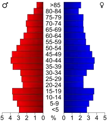
The county population contained 24.00% under the age of 18, 7.50% from 18 to 24, 25.50% from 25 to 44, 24.10% from 45 to 64, and 18.90% who were 65 years of age or older. The median age was 40 years. For every 100 females there were 96.60 males. For every 100 females age 18 and over, there were 95.00 males.
The median income for a household in the county was $36,964, and the median income for a family was $45,142. Males had a median income of $31,491 versus $21,799 for females. The per capita income for the county was $18,325. About 5.60% of families and 8.40% of the population were below the poverty line, including 9.00% of those under age 18 and 9.10% of those age 65 or over.
Communities
Cities
Unincorporated communities
- Armstrong
- Corning (partial)
- Gordonsville
- Mansfield
- Maple Island
- Moscow
- Oakland
- Petran
Townships
- Albert Lea Township
- Alden Township
- Bancroft Township
- Bath Township
- Carlston Township
- Freeborn Township
- Freeman Township
- Geneva Township
- Hartland Township
- Hayward Township
- London Township
- Manchester Township
- Mansfield Township
- Moscow Township
- Newry Township
- Nunda Township
- Oakland Township
- Pickerel Lake Township
- Riceland Township
- Shell Rock Township
Government and politics
Freeborn County voters have trended Democratic for several decades. However, the county has supported the Republican presidential candidate in the last two elections, marking the first time a Republican presidential candidate has won the county since 1980. Donald Trump won the county with 55% of the vote in 2016, and an even larger share of the vote in 2020, despite losing the state-wide and popular vote both times.
| Year | Republican | Democratic | Third parties |
|---|---|---|---|
| 2020 | 57.0% 9,578 | 41.0% 6,889 | 2.1% 351 |
| 2016 | 54.9% 8,808 | 37.6% 6,041 | 7.5% 1,202 |
| 2012 | 41.7% 6,969 | 55.8% 9,326 | 2.5% 411 |
| 2008 | 40.3% 6,955 | 57.4% 9,915 | 2.4% 410 |
| 2004 | 43.5% 7,681 | 55.1% 9,733 | 1.4% 252 |
| 2000 | 42.4% 6,843 | 52.8% 8,514 | 4.9% 782 |
| 1996 | 32.3% 5,166 | 52.9% 8,458 | 14.8% 2,364 |
| 1992 | 28.6% 5,089 | 43.6% 7,759 | 27.9% 4,965 |
| 1988 | 44.6% 7,226 | 54.5% 8,836 | 1.0% 156 |
| 1984 | 47.1% 8,413 | 52.3% 9,338 | 0.7% 116 |
| 1980 | 47.7% 8,475 | 46.2% 8,212 | 6.2% 1,098 |
| 1976 | 45.6% 8,220 | 52.6% 9,470 | 1.8% 328 |
| 1972 | 56.9% 9,747 | 41.8% 7,163 | 1.3% 220 |
| 1968 | 44.2% 7,315 | 52.4% 8,671 | 3.5% 577 |
| 1964 | 36.7% 6,136 | 63.2% 10,554 | 0.1% 19 |
| 1960 | 52.7% 8,970 | 47.1% 8,018 | 0.1% 22 |
| 1956 | 51.6% 7,632 | 48.3% 7,138 | 0.1% 11 |
| 1952 | 56.3% 8,450 | 43.4% 6,525 | 0.3% 46 |
| 1948 | 39.5% 5,238 | 58.9% 7,825 | 1.6% 213 |
| 1944 | 46.8% 5,728 | 53.0% 6,486 | 0.3% 32 |
| 1940 | 48.9% 6,683 | 50.8% 6,942 | 0.4% 55 |
| 1936 | 37.8% 4,653 | 60.0% 7,378 | 2.2% 274 |
| 1932 | 44.6% 4,931 | 52.8% 5,838 | 2.6% 283 |
| 1928 | 72.7% 7,815 | 26.6% 2,859 | 0.7% 76 |
| 1924 | 63.8% 6,139 | 5.0% 480 | 31.3% 3,011 |
| 1920 | 82.0% 6,772 | 13.7% 1,131 | 4.4% 360 |
| 1916 | 60.1% 2,418 | 33.5% 1,347 | 6.5% 260 |
| 1912 | 17.0% 672 | 22.3% 880 | 60.7% 2,392 |
| 1908 | 61.1% 2,465 | 24.2% 976 | 14.7% 591 |
| 1904 | 78.2% 2,876 | 12.5% 461 | 9.3% 341 |
| 1900 | 74.2% 2,934 | 21.2% 838 | 4.7% 184 |
| 1896 | 72.3% 3,400 | 25.1% 1,179 | 2.7% 127 |
| 1892 | 61.3% 2,004 | 22.7% 743 | 16.0% 524 |
| Position | Name | District | Next Election | |
|---|---|---|---|---|
| Commissioner and Chairperson | Glen Mathiason | District 1 | 2020 | |
| Commissioner | Dan Belshan | District 2 | 2022 | |
| Commissioner and Vice Chair | Jim Nelson | District 3 | 2020 | |
| Commissioner | Christopher Shoff | District 4 | 2022 | |
| Commissioner | Mike Lee | District 5 | 2020 | |
| Position | Name | Affiliation | District | |
|---|---|---|---|---|
| Senate | Dan Sparks[17] | Democrat | District 27 | |
| House of Representatives | Peggy Bennett[18] | Republican | District 27A | |
| House of Representatives | Jeanne Poppe[19] | Democrat | District 27B | |
| Position | Name | Affiliation | District | |
|---|---|---|---|---|
| House of Representatives | Jim Hagedorn[20] | Republican | 1st | |
| Senate | Amy Klobuchar[21] | Democrat | N/A | |
| Senate | Tina Smith[22] | Democrat | N/A | |
References
- "Minnesota Place Names". Minnesota Historical Society. Archived from the original on June 20, 2012. Retrieved March 18, 2014.
- "State & County QuickFacts". United States Census Bureau. Archived from the original on June 9, 2011. Retrieved August 31, 2013.
- "Find a County". National Association of Counties. Archived from the original on May 31, 2011. Retrieved June 7, 2011.
- Upham, Warren (1920). Minnesota Geographic Names: Their Origin and Historic Significance. Minnesota Historical Society. p. 198.
- Gannett, Henry (1905). The Origin of Certain Place Names in the United States. Govt. Print. Off. p. 131.
- Freeborn County MN Google Maps (accessed 8 March 2019)
- "Find an Altitude/Freeborn County MN" Google Maps (accessed 8 March 2019)
- "2010 Census Gazetteer Files". US Census Bureau. August 22, 2012. Archived from the original on October 6, 2014. Retrieved October 15, 2014.
- Nelson, Steven (2011). Savanna Soils of Minnesota. Minnesota: Self. pp 43–48. ISBN 978-0-615-50320-2
- "Population and Housing Unit Estimates". Retrieved March 26, 2020.
- "US Decennial Census". US Census Bureau. Archived from the original on April 26, 2015. Retrieved October 15, 2014.
- "Historical Census Browser". University of Virginia Library. Retrieved October 15, 2014.
- "Population of Counties by Decennial Census: 1900 to 1990". US Census Bureau. Retrieved October 15, 2014.
- "Census 2000 PHC-T-4. Ranking Tables for Counties: 1990 and 2000" (PDF). US Census Bureau. Retrieved October 15, 2014.
- Leip, David. "Atlas of US Presidential Elections". uselectionatlas.org. Retrieved September 18, 2018.
- "Board of Commissioners | Freeborn County, MN - Official Website". www.co.freeborn.mn.us. Retrieved June 25, 2020.
- "MN State Senate". www.senate.mn. Retrieved June 25, 2020.
- "Rep. Peggy Bennett (27A) - Minnesota House of Representatives". www.house.leg.state.mn.us. Retrieved June 25, 2020.
- "Rep. Jeanne Poppe (27B) - Minnesota House of Representatives". www.house.leg.state.mn.us. Retrieved June 25, 2020.
- "Representative Jim Hagedorn". Representative Jim Hagedorn. Retrieved June 25, 2020.
- "U.S. Senator Amy Klobuchar". www.klobuchar.senate.gov. Retrieved June 24, 2020.
- "Home". Senator Tina Smith. Retrieved June 24, 2020.
External links
Places adjacent to Freeborn County, Minnesota | ||||||||||
|---|---|---|---|---|---|---|---|---|---|---|
| ||||||||||
Municipalities and communities of Freeborn County, Minnesota, United States | ||
|---|---|---|
| Cities | Map of Minnesota highlighting Freeborn County | |
| Townships | ||
| Unincorporated communities | ||
| Footnotes | ‡This populated place also has portions in an adjacent county or counties | |
| ||

| Authority control |
|---|