Minnesota State Highway 286
Minnesota State Highway 286 (MN 286) is a 4.302-mile-long (6.923 km) highway in north-central Minnesota, which runs from its intersection with State Highway 6 in Talmoon and continues east to its eastern terminus at its intersection with State Highway 38 in Marcell.
| ||||
|---|---|---|---|---|
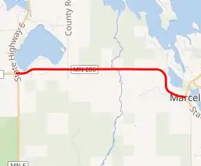
MN 286 highlighted in red | ||||
| Route information | ||||
| Defined by MS § 161.115(217) | ||||
| Maintained by MnDOT | ||||
| Length | 4.302 mi[1] (6.923 km) | |||
| Existed | July 1, 1949[2]–present | |||
| Major junctions | ||||
| West end | ||||
| East end | ||||
| Location | ||||
| Counties | Itasca | |||
| Highway system | ||||
| ||||

Route description
Highway 286 serves as a short east–west connector route in north-central Minnesota between the unincorporated communities of Talmoon and Marcell. The route connects State Highways 6 and 38. It is located within the Chippewa National Forest.
The roadway passes around the south side of Little Turtle Lake at Talmoon.[3]
The route is legally defined as Route 286 in the Minnesota Statutes.[4]
History
Highway 286 was authorized on July 1, 1949.[2]
The route was paved at the time it was marked.[5]
Major intersections
The entire route is in Itasca County.
| Location | mi[1] | km | Destinations | Notes | |
|---|---|---|---|---|---|
| Talmoon | 0.000 | 0.000 | |||
| Marcell | 4.327 | 6.964 | |||
| 1.000 mi = 1.609 km; 1.000 km = 0.621 mi | |||||
References
- "Trunk Highway Log Point Listing - Construction District 1" (PDF). Minnesota Department of Transportation. August 20, 2010. Archived from the original (PDF) on December 4, 2008. Retrieved January 24, 2010.
- "Chapter 663-H.F. No. 1792", Session Laws of Minnesota for 1949, Earl L. Berg, Commissioner of Administration, pp. 1177–1185
- General Highway Map of Itasca County (sheet 3) (PDF) (Map). Minnesota Department of Transportation. 2010. Archived from the original (PDF) on December 5, 2008. Retrieved January 24, 2010.
- "161.115, Additional Trunk Highways". Minnesota Statutes. Office of the Revisor of Statutes, State of Minnesota. 2010. Retrieved January 24, 2011.
- Minnesota 1950 Official Highway Map (Map). Minnesota Department of Highways. January 1, 1950. § K7. Archived from the original on July 21, 2011. Retrieved January 24, 2011.