Grand Rapids, Minnesota
Grand Rapids is a city in and the county seat of Itasca County, Minnesota, United States. The population was 10,869 at the 2010 census.[5][6]
Grand Rapids | |
|---|---|
| Motto(s): "It's In Minnesota's Nature" | |
 Location of Grand Rapids in Itasca County and Minnesota | |
| Coordinates: 47°14′14″N 93°31′49″W | |
| Country | United States |
| State | Minnesota |
| County | Itasca |
| Founded | c. 1872 |
| Incorporated (village) | June 9, 1891 |
| Government | |
| • Type | Mayor – Council |
| • Mayor | Dale Adams |
| Area | |
| • Total | 24.46 sq mi (63.36 km2) |
| • Land | 22.57 sq mi (58.46 km2) |
| • Water | 1.89 sq mi (4.90 km2) |
| Elevation | 1,286 ft (392 m) |
| Population | |
| • Total | 10,869 |
| • Estimate (2019)[3] | 11,214 |
| • Density | 496.81/sq mi (191.82/km2) |
| Time zone | UTC−6 (Central (CST)) |
| • Summer (DST) | UTC−5 (CDT) |
| ZIP codes | 55730, 55744, 55745 |
| Area code(s) | 218 |
| FIPS code | 27-25118 |
| GNIS feature ID | 0656428[4] |
| Website | cityofgrandrapidsmn |
The city is named for the 3.5-mile (5.6 km) long local rapids in the Mississippi River, which was the uppermost limit of practical steamboat travel during the late 19th century. Today the rapids are hidden below the dam of the Blandin Paper Mill.
History
Grand Rapids was founded as a logging town, as the Mississippi River provided an optimal method of log shipment to population centers. The predecessor of the Blandin paper mill opened in 1902.[7]
The Forest History Center[8] is a State Historic Site and a living history museum that recreates life as it was in a turn of the 20th century logging camp. Costumed interpreters guide visitors through a recreated circa 1890s logging camp to educate the public on the history of white pine logging and its relevance to today's economy. Miles of nature trails, educational naturalist programming, and an interpretive museum are also located on the site.
Old Central School, located in downtown Grand Rapids, was built in 1895 in the Richardsonian Romanesque style of architecture. The three story building served as an elementary school from 1895 to 1972. A community effort restored the building in 1984 and it now serves as a location for commerce and is listed on the National Register of Historic Places.
In 1991 Enbridge's Line 3 pipeline ruptured, spilling 1.7 million of gallons of oil into the area, including the Prairie River, in the largest inland oil spill in US history.[9][10]
Geography
According to the United States Census Bureau, the city has a total area of 24.44 square miles (63.30 km2), of which 22.56 square miles (58.43 km2) is land and 1.88 square miles (4.87 km2) is water.[11]
Grand Rapids is the county seat of Itasca County, a county that contains over 1000 lakes.
The city of Grand Rapids sits at the junction of U.S. Highways 2 and 169. U.S. Highway 2 runs west towards Bemidji and east towards Duluth. U.S. Highway 169 heads south to Hill City, and ultimately towards the city of Minneapolis. In the opposite direction, U.S. Highway 169 heads up the Mesabi Range until it reaches the city of Virginia, passing through Hibbing and several other smaller towns along the way. Grand Rapids is also the starting point of State Highway 38, running 47 miles (76 km) north along the Edge of the Wilderness Scenic Byway towards Effie. State Highway 38 has been designated a National Scenic Byway by the USDOT.
Major highways
The following routes are located within the city of Grand Rapids.
 U.S. Highway 2
.svg.png.webp) U.S. Highway 169
U.S. Highway 169 Minnesota State Highway 38 – Edge of the Wilderness Scenic Byway
Climate
The city of Grand Rapids has a Humid continental climate (Köppen Climate Classification Dfb) with warm summers and long, cold winters, typical of its location on the Mesabi Iron Range.
| Climate data for Grand Rapids, Minnesota (1981–2010) | |||||||||||||
|---|---|---|---|---|---|---|---|---|---|---|---|---|---|
| Month | Jan | Feb | Mar | Apr | May | Jun | Jul | Aug | Sep | Oct | Nov | Dec | Year |
| Record high °F (°C) | 51 (11) |
61 (16) |
80 (27) |
93 (34) |
101 (38) |
100 (38) |
104 (40) |
100 (38) |
99 (37) |
89 (32) |
71 (22) |
59 (15) |
104 (40) |
| Average high °F (°C) | 19.4 (−7.0) |
26.3 (−3.2) |
38.5 (3.6) |
54.3 (12.4) |
67.0 (19.4) |
75.5 (24.2) |
80.2 (26.8) |
78.2 (25.7) |
67.9 (19.9) |
53.8 (12.1) |
36.6 (2.6) |
22.5 (−5.3) |
51.7 (10.9) |
| Average low °F (°C) | −2.7 (−19.3) |
2.3 (−16.5) |
16.1 (−8.8) |
29.7 (−1.3) |
41.4 (5.2) |
51.1 (10.6) |
56.0 (13.3) |
54.1 (12.3) |
44.9 (7.2) |
33.3 (0.7) |
20.1 (−6.6) |
4.2 (−15.4) |
29.2 (−1.6) |
| Record low °F (°C) | −51 (−46) |
−45 (−43) |
−39 (−39) |
−10 (−23) |
11 (−12) |
24 (−4) |
33 (1) |
27 (−3) |
15 (−9) |
−3 (−19) |
−25 (−32) |
−45 (−43) |
−51 (−46) |
| Average precipitation inches (mm) | 0.92 (23) |
0.64 (16) |
1.31 (33) |
2.06 (52) |
3.07 (78) |
4.37 (111) |
4.29 (109) |
3.41 (87) |
3.31 (84) |
2.81 (71) |
1.61 (41) |
1.07 (27) |
28.87 (733) |
| Average snowfall inches (cm) | 12.3 (31) |
7.2 (18) |
7.7 (20) |
3.8 (9.7) |
0.2 (0.51) |
0 (0) |
0 (0) |
0 (0) |
— | 1.5 (3.8) |
9.4 (24) |
11.7 (30) |
54.4 (138) |
| Average precipitation days (≥ 0.01 in) | 10 | 9 | 9 | 9 | 12 | 13 | 12 | 10 | 12 | 11 | 10 | 11 | 128 |
| Average snowy days (≥ 0.1 in) | 11 | 8 | 6 | 3 | 0 | 0 | 0 | 0 | 0 | 1 | 7 | 11 | 48 |
| Source: NOAA (extremes 1915–present)[12] | |||||||||||||
Demographics
| Historical population | |||
|---|---|---|---|
| Census | Pop. | %± | |
| 1900 | 1,428 | — | |
| 1910 | 2,230 | 56.2% | |
| 1920 | 2,914 | 30.7% | |
| 1930 | 3,205 | 10.0% | |
| 1940 | 4,875 | 52.1% | |
| 1950 | 6,019 | 23.5% | |
| 1960 | 7,265 | 20.7% | |
| 1970 | 7,247 | −0.2% | |
| 1980 | 7,934 | 9.5% | |
| 1990 | 7,976 | 0.5% | |
| 2000 | 7,764 | −2.7% | |
| 2010 | 10,869 | 40.0% | |
| 2019 (est.) | 11,214 | [3] | 3.2% |
| U.S. Decennial Census[13] | |||
2010 census
As of the census[2] of 2010, there were 10,869 people, 4,615 households, and 2,633 families living in the city. The population density was 481.8 inhabitants per square mile (186.0/km2). There were 4,910 housing units at an average density of 217.6 per square mile (84.0/km2). The racial makeup of the city was 94.6% White, 0.6% African American, 1.9% Native American, 0.6% Asian, 0.3% from other races, and 2.0% from two or more races. Hispanic or Latino of any race were 1.2% of the population.
There were 4,615 households, of which 26.6% had children under the age of 18 living with them, 41.1% were married couples living together, 12.4% had a female householder with no husband present, 3.6% had a male householder with no wife present, and 42.9% were non-families. 36.5% of all households were made up of individuals, and 17.1% had someone living alone who was 65 years of age or older. The average household size was 2.20 and the average family size was 2.84.
The median age in the city was 42 years. 22.2% of residents were under the age of 18; 8.5% were between the ages of 18 and 24; 22.4% were from 25 to 44; 26% were from 45 to 64; and 20.8% were 65 years of age or older. The gender makeup of the city was 47.5% male and 52.5% female.
2000 census
As of the census of 2000, there were 7,764 people, 3,446 households, and 1,943 families living in the city. The population density was 1,057.8 people per square mile (408.4/km2). There were 3,621 housing units at an average density of 493.3 per square mile (190.5/km2). The racial makeup of the city was 95.53% White, 0.28% African American, 1.93% Native American, 0.71% Asian, 0.03% Pacific Islander, 0.39% from other races, and 1.13% from two or more races. Hispanic or Latino of any race were 0.85% of the population.
There were 3,446 households, out of which 25.6% had children under the age of 18 living with them, 41.5% were married couples living together, 11.8% had a female householder with no husband present, and 43.6% were non-families. 38.1% of all households were made up of individuals, and 20.4% had someone living alone who was 65 years of age or older. The average household size was 2.15 and the average family size was 2.82.
In the city, the population was spread out, with 22.1% under the age of 18, 10.0% from 18 to 24, 23.9% from 25 to 44, 21.0% from 45 to 64, and 23.0% who were 65 years of age or older. The median age was 41 years. For every 100 females, there were 87.0 males. For every 100 females age 18 and over, there were 81.7 males.
The median income for a household in the city was $28,991, and the median income for a family was $39,468. Males had a median income of $36,035 versus $20,759 for females. The per capita income for the city was $17,223. About 9.2% of families and 11.2% of the population were below the poverty line, including 15.1% of those under age 18 and 6.4% of those age 65 or over.
Religion
Churches in Grand Rapids include the Grand Rapids Alliance Church, the Grand Rapids Evangelical Free Church, St. Luke's Evangelical Lutheran Church, member of the Wisconsin Evangelical Lutheran Synod (WELS);[14] St. Andrew's Lutheran Church and Zion Lutheran Churches, members of the Evangelical Lutheran Church in America (ELCA);,[15][16] the United Methodist Church of Grand Rapids,[17] St. Joseph's Roman Catholic Church,[18] River of Life Church; Apostolic; Pentecostal and Grace Bible Chapel;[19] Non-Denominational.
Government
Grand Rapids is represented at the federal and state level by:
- U.S. House of Representatives 8th District – by Republican Pete Stauber
- Minnesota Senate District 5 – by Republican Justin Eichorn
- Minnesota House of Representatives District 5B – by Republican Sandy Layman
Economy
Historically, the local economy was based on timber harvesting, and to this day, Blandin Paper Mill, now owned by the Finnish-based UPM paper company, has its papermaking facilities in downtown Grand Rapids, while Ainsworth (formerly Potlach) located just outside the city limits, produced oriented strand board until it ceased operation in September 2006.
The Mesabi Range or Iron Range region of Minnesota begins with one iron mine to the southwest and a number to the northeast of the city. Although technically and geographically a member of the Iron Range, Grand Rapids and its economy has been historically based on paper manufacturing and other wood products. Its current economy also has a large tourist footing, with many local resorts, four golf courses, over one million acres (4,000 km2) of public and industrial forestlands that provide excellent regional hunting, and more than 1,000 lakes for fishing. It also is the service center for 46,000 people due to a large seasonal and weekend population of summer residences on surrounding lakes, and a number of smaller bedroom communities located near Grand Rapids.
Grand Rapids was the first rural city in Minnesota to be served by an Advanced Life Support Ambulance Service.
Annual tourism events
- Home & Cabin Show - March
- White Oak Classic Dog Sled Race – March
- Children's Fair - April
- Bluegrass Music in the Pines Festival - June
- Wizard of Oz Festival – June
- Timberman Triathlon - July
- Northern Mn Swap Meet & Car Show – July
- Tall Timber Days – August
- Grand Slam of Golf Tournament – August
- Threshing & Antique Show - August
- Bargains are Great on 38 - September
- National Ruffed Grouse Society Annual Hunt – October
- WinterGlo Festival - December
Education
Grand Rapids has one of the few competitive high school marching bands north of the Twin Cities. Schools in ISD 318 include:
- Southwest Elementary
- Murphy Elementary
- Forest Lake Elementary
- St. Joseph's Elementary
- Cohasset Elementary
- Robert J. Elkington Middle School
- Grand Rapids High School
- Bigfork School in Bigfork
Grand Rapids also has the following parochial and secondary schools:
- Itasca Community College
- St. Joseph's Catholic School
Media
Local radio stations
The following radio stations are based in Grand Rapids. The city is also served by many other radio stations from the Iron Range area.
- KOZY 1320 AM – Talk/Oldies
- K201IX FM 88.1, Simulcasting Duluth's Contemporary Christian KDNW owned by the University of Northwestern – St Paul
- KMFY 96.9 FM – Adult Contemporary
- KAXE 91.7 FM – Public Radio (first rural public radio station in the United States)
- WDKE 96.1 FM – Country
- K256CW FM 99.1, Simulcasting Duluth's Christian talk and teaching KDNI owned by the University of Northwestern – St Paul
- KBAJ 105.5 FM – Classic Rock
Newspapers
- Grand Rapids Herald-Review – Published on Sundays and Wednesdays.
Television stations
Grand Rapids TV is primarily fed in from Duluth, MN television stations, but some cable subscribers also receive Bemidji, MN & Minneapolis, MN television stations as well. Local government and community events are covered by the local community television station. Television stations available in Grand Rapids are:
- KAWE 9 – PBS station based in Bemidji.
- KRII 11 – NBC station serving Chisholm/Hibbing (multiplexed into several digital subchannels; 11.1 rebroadcasts KBJR-TV NBC 6 of Duluth & 11.3 rebroadcasts KDLH CBS 3 of Duluth).
- KCCW 12 – CBS station serving Walker/Bemidji/Brainerd (rebroadcast of WCCO-TV CBS 4 of Minneapolis).
- WIRT 13 – ABC station serving Hibbing (rebroadcast of WDIO ABC 10 of Duluth).
- K29EB 29 – Translator of KQDS-TV FOX 21 of Duluth.
- WRPT 31 – PBS station serving Hibbing (rebroadcast of WDSE PBS 8 of Duluth).
Notable people
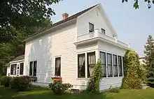
Grand Rapids was the birthplace and early childhood home of singer and actress Judy Garland, although her family moved to Lancaster, California, when she was four years old. The Itasca County Historical Society maintains a Judy Garland exhibit in their Heritage Museum, and Garland's fully restored birthplace, in a home built in 1892, is open to the public as the Judy Garland Museum.
Other notable people who were born or lived in Grand Rapids include:
- Bill Baker, member of the Miracle on Ice 1980 U.S. Olympic Hockey Team that won the Gold Medal in Lake Placid, New York. Baker was also a member of the first Grand Rapids High School State Championship winning hockey team.
- Hugh Beaumont, actor of films and Leave it to Beaver fame, retired from show business in the late 1960s, launching a second career as a Christmas-tree farmer here.
- Jon Casey, professional hockey player for the Minnesota North Stars with a record of most wins of 31 in 1989–1990.
- Judy Garland, iconic actress and singer, born June 10, 1922, in Grand Rapids.
- Alex Goligoski, current professional hockey player for the Arizona Coyotes, formerly with the Pittsburgh Penguins and Dallas Stars.
- Lois Hall, actress.
- Trent Klatt, played in NHL for Los Angeles Kings, Vancouver Canucks, Dallas Stars and Philadelphia Flyers, and collegiately for Minnesota Golden Gophers.
- Don Lucia, hockey coach at the University of Minnesota.
- Jeff Nielsen, professional hockey player for the Minnesota Wild and other NHL teams.
- Norman Ornstein, political scientist.
- Dick Pesonen, professional football player.
- Janelle Pierzina, Big Brother television series cast member.
- Jon Rohloff, professional hockey player for the Boston Bruins.
- Dusty Rychart, basketball player for the Cairns Taipans.
- Granville Van Dusen, born in Grand Rapids in 1944
References
- "2019 U.S. Gazetteer Files". United States Census Bureau. Retrieved July 26, 2020.
- "U.S. Census website". United States Census Bureau. Retrieved 2012-11-13.
- "Population and Housing Unit Estimates". United States Census Bureau. May 24, 2020. Retrieved May 27, 2020.
- "US Board on Geographic Names". United States Geological Survey. 2007-10-25. Retrieved 2008-01-31.
- "2010 Census Redistricting Data (Public Law 94-171) Summary File". American FactFinder. U.S. Census Bureau, 2010 Census. Retrieved 23 April 2011.
- "Find a County". National Association of Counties. Archived from the original on 2011-05-31. Retrieved 2011-06-07.
- "Grand Rapids Minnesota". Archived from the original on 2008-07-05.
- https://www.mnhs.org/foresthistory
- Siple, Julie; Wareham, Bill; Kraker, Dan; Nelson, Cody (20 June 2018). "Rivers of Oil, Episode 2: The largest inland spill". MPR News. Retrieved 19 January 2021.
- Laduke, Winona (3 March 2017). "Happy Anniversary: The largest inland oil spill in U.S. history happened in Minnesota". Grand Rapids Herald-Review. Retrieved 19 January 2021.
- "US Gazetteer files 2010". United States Census Bureau. Archived from the original on 2012-01-25. Retrieved 2012-11-13.
- "NOWData - NOAA Online Weather Data". National Oceanic and Atmospheric Administration. Retrieved May 29, 2016.
- United States Census Bureau. "Census of Population and Housing". Retrieved September 11, 2013.
- "Saint Luke's Church Grand Rapids, MN".
- "Saint Andrew's Lutheran Church Grand Rapids, MN".
- "Zion Lutheran Church Grand Rapids, MN".
- "United Methodist Church of Grand Rapids, MN".
- "St. Joseph's Catholic Church Grand Rapids, MN".
- "Grace Bible Chapel, Grand Rapids, MN".
External links
| Wikimedia Commons has media related to Grand Rapids, Minnesota. |
- City of Grand Rapids official website
- Grand Rapids Herald Review
- Itasca Community Television
- VisitGrandRapids.com
- Grand Rapids Community Internet
Municipalities and communities of Itasca County, Minnesota, United States | ||
|---|---|---|
| Cities | 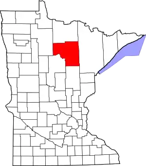 Map of Minnesota highlighting Itasca County | |
| Townships |
| |
| Unorganized territories | ||
| CDPs | ||
| Unincorporated communities | ||
| Indian reservations | ||
| Footnotes | ‡This populated place also has portions in an adjacent county or counties | |
| ||

| Authority control |
|---|