Minnesota State Highway 72
Minnesota State Highway 72 (MN 72) is a 76.810-mile-long (123.614 km) highway in northwest Minnesota, which runs from its intersection with U.S. 71 in Blackduck and continues north to its northern terminus at the Canada–US border in Baudette. The road continues as Ontario Highway 11 upon entering the town of Rainy River, Ontario at the Baudette-Rainy River International Bridge.
| ||||
|---|---|---|---|---|
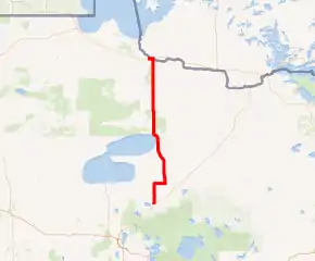
MN 72 highlighted in red | ||||
| Route information | ||||
| Maintained by MnDOT | ||||
| Length | 76.810 mi[1] (123.614 km) | |||
| Existed | 1923[2]–present | |||
| Major junctions | ||||
| South end | ||||
| North end | ||||
| Location | ||||
| Counties | Beltrami, Lake of the Woods | |||
| Highway system | ||||
| ||||

Route description
State Highway 72 serves as a north–south route between the communities of Blackduck, Shooks, Kelliher, and Baudette.
The roadway passes through the Red Lake State Forest in northeast Beltrami County between Kelliher and Waskish. Big Bog State Recreation Area is located on Highway 72, immediately north of Waskish.
Highway 72 crosses the Rainy River at Baudette.
History
State Highway 72 was authorized as one of the first two Minnesota legislative routes in 1923. This portion of the route was located between Blackduck and Baudette.
The route was paved by 1942.
At one time, Highway 72 had continued farther north, extending over what is now State Highway 172 in Lake of the Woods County. The section of present day Minnesota 172 between State Highway 11 (at Baudette) and Wheeler's Point (at Lake of the Woods) was originally designated Minnesota 72 as well between 1934 and 1963.
Major intersections
| County | Location | mi[1] | km | Destinations | Notes |
|---|---|---|---|---|---|
| Beltrami | Blackduck | 0.000 | 0.000 | ||
| Hines Township | 1.829 | 2.943 | |||
| Hornet Township | 6.895 | 11.096 | |||
| Shooks Township | 9.910 | 15.949 | West end of MN 1 overlap | ||
| Shooks | 14.970 | 24.092 | East end of MN 1 overlap | ||
| Kelliher | 19.586 | 31.521 | |||
| 19.696 | 31.698 | ||||
| Shotley Brook | 29.752 | 47.881 | |||
| Lake of the Woods | Swiftwater Township | 59.889 | 96.382 | ||
| Township 158-30 | 62.375 | 100.383 | |||
| Boone Township | 62.873 | 101.184 | |||
| Rapid River Township | 65.878 | 106.020 | |||
| Gudrid Township | 71.875 | 115.672 | |||
| Baudette | 73.880 | 118.898 | |||
| 74.680 | 120.186 | East end of MN 11 overlap | |||
| 76.377 | 122.917 | West end of MN 11 overlap | |||
| 76.518 | 123.144 | ||||
| Rainy River | 76.864 | 123.701 | |||
1.000 mi = 1.609 km; 1.000 km = 0.621 mi
| |||||
References
- "Trunk Highway Log Point Listing - Construction District 2" (PDF). Minnesota Department of Transportation. August 23, 2010. Archived from the original (PDF) on December 4, 2008. Retrieved October 26, 2010.
- Riner, Steve. "Details of Routes 51-75". The Unofficial Minnesota Highways Page. Retrieved 2006-12-16.