Minnesota State Highway 73
Minnesota State Highway 73 (MN 73) is a 119.697-mile-long (192.634 km) highway in northeast Minnesota, which runs from its interchange with Interstate Highway 35 in Moose Lake and continues north to its northern terminus at its intersection with U.S. Highway 53 in Field Township near Cook and Orr.
| ||||
|---|---|---|---|---|
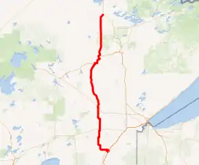
MN 73 highlighted in red | ||||
| Route information | ||||
| Defined by MS § 161.115(94) | ||||
| Maintained by MnDOT | ||||
| Length | 119.697 mi[1] (192.634 km) | |||
| Existed | 1933–present | |||
| Major junctions | ||||
| South end | ||||
| North end | ||||
| Location | ||||
| Counties | Carlton, St. Louis | |||
| Highway system | ||||
| ||||

Route description
Highway 73 serves as a north–south route in northeast Minnesota between Moose Lake, Kettle River, Cromwell, Floodwood, Hibbing, and Chisholm.
The roadway passes through the Sturgeon River State Forest and the Superior National Forest, both north of Chisholm, in Saint Louis County.
The route is legally defined as Legislative Route 163 in the Minnesota Statutes.[2] It is not marked with this number.
History
Highway 73 was authorized in 1933, and was originally numbered "Minnesota 63" until that U.S. route number was added elsewhere in Minnesota.[3]
The route was marked as "Minnesota 73" by 1935.[3]
In 1940, the route was mostly gravel south of Hibbing. The last segments paved in the mid-1950s were south of Hibbing.[3]
The Highway 73 designation was extended south through Moose Lake, partially along old U.S. 61, to Interstate 35 in the mid-1970s.[3]
Major intersections
| County | Location | mi[1] | km | Destinations | Notes |
|---|---|---|---|---|---|
| Carlton | Moose Lake Township | 0.000 | 0.000 | Interchange | |
| Moose Lake | 1.136 | 1.828 | |||
| 1.486 | 2.391 | Old U.S. 61 | |||
| 2.289 | 3.684 | East end of MN 27 overlap | |||
| Silver Township | 7.007 | 11.277 | West end of MN 27 overlap | ||
| Kettle River | 9.423 | 15.165 | CR 12 (Locker Plant Road) | ||
| Silver Township | 10.870 | 17.494 | |||
| Kalevala Township | 14.252 | 22.936 | |||
| 18.808 | 30.269 | ||||
| Cromwell | 25.225 | 40.596 | |||
| St. Louis | Fine Lakes Township | 32.789 | 52.769 | CR 86 | |
| 35.030 | 56.375 | CR 51 | |||
| Floodwood Township | 42.874 | 68.999 | South end of US 2 overlap | ||
| Floodwood | 43.120 | 69.395 | North end of US 2 overlap | ||
| 43.481 | 69.976 | ||||
| Van Buren Township | 44.983 | 72.393 | CR 29 | ||
| Cedar Valley Township | 54.668 | 87.980 | CR 133 east | ||
| 55.764 | 89.743 | CR 133 west | |||
| 63.506 | 102.203 | CR 18 | |||
| Hibbing | 70.494 | 113.449 | |||
| 76.584 | 123.250 | ||||
| 78.846 | 126.890 | South end of US 169 overlap | |||
| Chisholm | 87.153 | 140.259 | North end of US 169 overlap | ||
| Dark River | 101.606 | 163.519 | CR 65 | ||
| Sturgeon Township | 108.675 | 174.895 | CR 22 | ||
| Linden Grove | 114.637 | 184.490 | |||
| Field Township | 119.855 | 192.888 | |||
1.000 mi = 1.609 km; 1.000 km = 0.621 mi
| |||||
References
- "Trunk Highway Log Point Listing - Construction District 1" (PDF). Minnesota Department of Transportation. August 20, 2010. Archived from the original (PDF) on December 4, 2008. Retrieved October 29, 2010.
- "161.115, Additional Trunk Highways". Minnesota Statutes. Office of the Revisor of Statutes, State of Minnesota. 2010. Retrieved October 25, 2010.
- Riner, Steve. "Details of routes 51–75". The Unofficial Minnesota Highways Page. Self-published. Retrieved October 29, 2010.