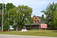
Rainy River, Ontario
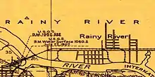
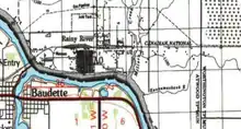
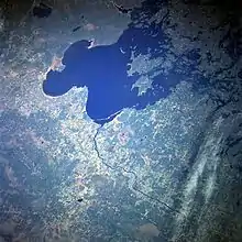
Rainy River is a town in north-western Ontario, Canada, southeast of Lake of the Woods. Rainy River is situated on the eponymous Rainy River, which forms part of the Ontario-Minnesota segment of the Canada–US border. Across the river is the town of Baudette, Minnesota. The two towns are connected by the Baudette – Rainy River International Bridge. Rainy River is at the northwestern terminus of Highway 11.
Rainy River | |
|---|---|
| Town of Rainy River | |
 | |
 Rainy River | |
| Coordinates: 48°43′N 94°34′W | |
| Country | Canada |
| Province | Ontario |
| District | Rainy River |
| Settled | 1895 |
| Incorporated | 1901 (township) |
| Incorporated | 1902 (town) |
| Government | |
| • Type | Town |
| • Mayor | Deborah Ewald |
| • Federal riding | Thunder Bay—Rainy River |
| • Prov. riding | Kenora—Rainy River |
| Area | |
| • Land | 3.11 km2 (1.20 sq mi) |
| Population (2016)[1] | |
| • Total | 807 |
| • Density | 259.9/km2 (673/sq mi) |
| Time zone | UTC−6 (CST) |
| • Summer (DST) | UTC−5 (CDT) |
| Postal code | P0W 1L0 |
| Area code(s) | 807 |
| Website | www.rainyriver.ca |
Rainy River was frequently thought to have been the northwestern terminus of Yonge Street, or Highway 11 running north from Toronto. Because of this incorrect conflation, Yonge Street was known as the "longest street in the world." and gained its fame in the Guinness World Records for many years. Highway 11 is marked through Rainy River as Atwood Avenue, although the town and the City of Toronto both maintain commemorative markers at each end.
History
From Rainy Lake, derived from the French Lac la Pluie (Lake of Rain). Appears as Rain Lake in 1813 Gazetteer. Post office (Rainy River) established in 1886.[2] Incorporated as the town of Rainy River in 1904, the community was first formed around 1895 as part of mill development by a group of lumbermen along the East shore of the Rainy River. Their mill and related developments were located about 2 km from the current town center. In 1898 their mill was purchased by the Beaver Mills Lumber Company. The small village took the name Beaver Mills until it was incorporated as a town. In 1901 the Ontario and Rainy River Railway completed a bridge connecting Minnesota, United States to Ontario, but the Beaver Mills town site was in the way of the eastern end. The company developed a new town further upriver, between the two large lumber mills. The only method of transport at the time was by steamship so parts of the bridge were shipped and arrived addressed to "Rainy River". The town eventually accepted this as their name.[3]
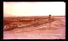
The thriving lumber industry and associated mills stimulated growth of the town, as did the Railway. In 1910, a forest fire known as the Great Fire of 1910, originating in northern Minnesota, swept north and destroyed the mills. On the southern, US side of the river, the villages of Baudette and Spooner were completely burned out. Many of the people survived only because a group of brave residents from Rainy River backed a train of box cars across the bridge and pulled the people north to safety. After the fire, the mill industry relocated. The population of Rainy River quickly declined from more than 2000 people to less than 800. No alternative economy was developed to support a larger population.
But the railroad and the growing hunting/fishing tourism industry have helped the town to survive. At one time it was the site of a rail round house and associated jobs. In the 1960s the Rainy River Boat company operated here, and in the 1970s Arctic Cat Apparel manufactured related clothing. The decline of these industries has adversely affected the rural town.[4]

Demographics
| Canada census – Rainy River, Ontario community profile | |||
|---|---|---|---|
| 2016 | 2011 | 2006 | |
| Population: | 807 (−4.2% from 2011) | 842 (−7.4% from 2006) | 909 (−7.3% from 2001) |
| Land area: | 3.11 km2 (1.20 sq mi) | 2.99 km2 (1.15 sq mi) | 2.99 km2 (1.15 sq mi) |
| Population density: | 259.9/km2 (673/sq mi) | 281.5/km2 (729/sq mi) | 303.9/km2 (787/sq mi) |
| Median age: | 52.6 (M: 51.6, F: 54.2) | 50.8 (M: 49.2, F: 51.9) | 47.8 (M: 44.8, F: 49.3) |
| Total private dwellings: | 434 | 457 | 452 |
| Median household income: | $59,520 | $49,117 | |
| References: 2016[5] 2011[6] 2006[7] earlier[8] | |||
| Year | Pop. | ±% |
|---|---|---|
| 1991 | 968 | — |
| 1996 | 1,008 | +4.1% |
| 2001 | 981 | −2.7% |
| 2006 | 909 | −7.3% |
| 2011 | 842 | −7.4% |
| 2016 | 807 | −4.2% |
| [9][10][1] | ||
Government
Federal representation
The town is in the Canadian electoral district of Thunder Bay—Rainy River, which elects one Member of Parliament (MP) to represent it in Parliament. Don Rusnak, a member of the Liberal Party, was elected in 2015.
City Mayor and Council
The city is headed by Rainy River Mayor and six elected city councillors.[11]
Notable people
- Bronko Nagurski, Hall of fame NFL player
- James Arthur Mathieu, businessman and politician
- Angela Bulloch, sound and installation artist
See also
References
- "Census Profile, 2016 Census: Rainy River, Town". Statistics Canada. Retrieved July 1, 2019.
- Hamilton, William (1978). The Macmillan Book of Canadian Place Names. Toronto: Macmillan. p. 168. ISBN 0-7715-9754-1.
- "History « Town of Rainy River". Retrieved 2012-08-19.
- "Economic Development « Town of Rainy River". Retrieved 2012-08-19.
- "2016 Community Profiles". 2016 Canadian Census. Statistics Canada. February 21, 2017. Retrieved 2019-07-01.
- "2011 Community Profiles". 2011 Canadian Census. Statistics Canada. July 5, 2013. Retrieved 2012-03-29.
- "2006 Community Profiles". 2006 Canadian Census. Statistics Canada. March 30, 2011. Retrieved 2011-05-05.
- "2001 Community Profiles". 2001 Canadian Census. Statistics Canada. February 17, 2012.
- Statistics Canada: 2001, 2006, 2011 census
- "Rainy River census profile". 2011 Census of Population. Statistics Canada. Retrieved 2012-03-29.
- "Mayor and Council". Town of Rainy River. Retrieved July 1, 2019.
External links
| Wikisource has the text of The New Student's Reference Work article "Rainy River". |
Places adjacent to Rainy River, Ontario | |
|---|---|
| Towns | 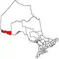 | |
|---|---|---|
| Townships | ||
| First Nations | ||
| Indian reserves |
| |
| Unorganized areas | ||
| Unincorporated communities | ||
| ||