Mirny, Sakha Republic
Mirny (Russian: Мирный, IPA: [ˈmʲirnɨj], lit. peaceful; Yakut: Мирнэй, Mirney, IPA: [ˈmiɾnej]) is a town and the administrative center of Mirninsky District in the Sakha Republic, Russia, located on the Irelyakh River (Vilyuy's basin), 820 kilometers (510 mi) west of Yakutsk, the capital of the republic. As of the 2010 Census, its population was 37,188.[2]
Mirny
Мирный | |
|---|---|
Town under republic jurisdiction[1] | |
| Other transcription(s) | |
| • Yakut | Мирнэй |
.jpg.webp) Central square in Mirny | |
.svg.png.webp) Flag _(2004).png.webp) Coat of arms | |
Location of Mirny 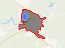
| |
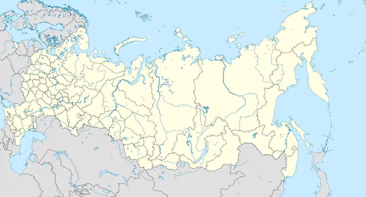 Mirny Location of Mirny 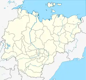 Mirny Mirny (Sakha Republic) | |
| Coordinates: 62°33′N 113°58′E | |
| Country | Russia |
| Federal subject | Sakha Republic[1] |
| Administrative district | Mirninsky District[1] |
| Town | Mirny[1] |
| Founded | 1955 |
| Town status since | 1959[1] |
| Government | |
| • Head | Klim Antonov |
| Elevation | 340 m (1,120 ft) |
| Population | |
| • Total | 37,188 |
| • Estimate (2018)[3] | 35,223 (−5.3%) |
| • Capital of | Mirninsky District[1], Town of Mirny[1] |
| • Municipal district | Mirninsky Municipal District[4] |
| • Urban settlement | Mirny Urban Settlement[4] |
| • Capital of | Mirninsky Municipal District[5], Mirny Urban Settlement[4] |
| Time zone | UTC+9 (MSK+6 |
| Postal code(s)[7] | 678170–678175, 678179 |
| Dialing code(s) | +7 41136 |
| OKTMO ID | 98631101001 |
| Website | www |
| 2010 Census | 37,188[2] |
|---|---|
| 2002 Census | 39,981[8] |
| 1989 Census | 38,793[9] |
| 1979 Census | 30,462[10] |
History
Mirny was founded in 1955 after the discovery of a nearby kimberlite pipe by an expedition led by Yury Khabardin. Town status was granted to it in 1959.[1]
Administrative and municipal status
Within the framework of administrative divisions, Mirny serves as the administrative center of Mirninsky District.[1] As an inhabited locality, Mirny is classified as a town under republic jurisdiction.[1] As an administrative division, it is incorporated within Mirninsky District as the Town of Mirny.[1] As a municipal division, the Town of Mirny is incorporated within Mirninsky Municipal District as Mirny Urban Settlement.[4]
Economy
The Mir mine is located within the town. It is an open pit mine, which, with the depth of 525 meters (1,722 ft) and a diameter of 1.25 kilometers (0.78 mi) is reckoned to be the second largest in the world.[11][12] Production was stopped in 2004, and the mine was permanently closed in 2011, due to reduced recovery and the costs of working in the far northern climate.[13]
Transportation
The town is served by the Mirny Airport. Safety concerns have been raised about aircraft operations near to the open diamond mine; helicopters are forbidden to pass over the abandoned workings.
Education
The Mirny Polytechnic Institute, a branch of the North-Eastern Federal University, operates in the town.
References
Notes
- Registry of the Administrative-Territorial Divisions of the Sakha Republic
- Russian Federal State Statistics Service (2011). "Всероссийская перепись населения 2010 года. Том 1" [2010 All-Russian Population Census, vol. 1]. Всероссийская перепись населения 2010 года [2010 All-Russia Population Census] (in Russian). Federal State Statistics Service.
- "26. Численность постоянного населения Российской Федерации по муниципальным образованиям на 1 января 2018 года". Federal State Statistics Service. Retrieved January 23, 2019.
- Law #173-Z #353-III
- Law #172-Z #351-III
- "Об исчислении времени". Официальный интернет-портал правовой информации (in Russian). June 3, 2011. Retrieved January 19, 2019.
- Почта России. Информационно-вычислительный центр ОАСУ РПО. (Russian Post). Поиск объектов почтовой связи (Postal Objects Search) (in Russian)
- Russian Federal State Statistics Service (May 21, 2004). "Численность населения России, субъектов Российской Федерации в составе федеральных округов, районов, городских поселений, сельских населённых пунктов – районных центров и сельских населённых пунктов с населением 3 тысячи и более человек" [Population of Russia, Its Federal Districts, Federal Subjects, Districts, Urban Localities, Rural Localities—Administrative Centers, and Rural Localities with Population of Over 3,000] (XLS). Всероссийская перепись населения 2002 года [All-Russia Population Census of 2002] (in Russian).
- "Всесоюзная перепись населения 1989 г. Численность наличного населения союзных и автономных республик, автономных областей и округов, краёв, областей, районов, городских поселений и сёл-райцентров" [All Union Population Census of 1989: Present Population of Union and Autonomous Republics, Autonomous Oblasts and Okrugs, Krais, Oblasts, Districts, Urban Settlements, and Villages Serving as District Administrative Centers]. Всесоюзная перепись населения 1989 года [All-Union Population Census of 1989] (in Russian). Институт демографии Национального исследовательского университета: Высшая школа экономики [Institute of Demography at the National Research University: Higher School of Economics]. 1989 – via Demoscope Weekly.
- "Всесоюзная перепись населения 1979 г. Национальный состав населения по регионам России" [All Union Population Census of 1979. Ethnic composition of the population by regions of Russia] (XLS). Всесоюзная перепись населения 1979 года [All-Union Population Census of 1979] (in Russian). 1979 – via Demoscope Weekly (website of the Institute of Demographics of the State University—Higher School of Economics.
- Bennett, Mia. "2016: The Arctic in Photos". Cryopolitics. Archived from the original on 17 January 2017.
- Michaud, David (Chrispine) (4 September 2013). "Largest Mines in the World". Mining Examiner. 911 Metallurgist. Archived from the original on 14 November 2014.
- "Mirny Mine". MineDat. Retrieved January 29, 2017.
Sources
- Official website of the Sakha Republic. Registry of the Administrative-Territorial Divisions of the Sakha Republic. Mirninsky District. (in Russian)
- Государственное Собрание (Ил Тумэн) Республики Саха (Якутия). Закон №172-З №351-III от 30 ноября 2004 г. «Об установлении границ и о наделении статусом муниципального района муниципальных образований Республики Саха (Якутия)», в ред. Закона №1535-З №597-V от 27 ноября 2015 г. «О внесении изменений в статьи 1 и 2 Закона Республики Саха (Якутия) "Об установлении границ и о наделении статусом муниципального района муниципальных образований Республики Саха (Якутия)"». Вступил в силу со дня официального опубликования. Опубликован: "Якутия", №245, 31 декабря 2004 г. (State Assembly (Il Tumen) of the Sakha (Yakutia) Republic. Law #172-Z No. 351-III of November 30, 2004 On Establishing the Borders and on Granting the Municipal District Status to the Municipal Formations of the Sakha (Yakutia) Republic, as amended by the Law #1535-Z No. 597-V of November 27, 2015 On Amending Articles 1 and 2 of the Law of the Sakha (Yakutia) Republic "On Establishing the Borders and on Granting the Municipal District Status to the Municipal Formations of the Sakha (Yakutia) Republic". Effective as of the day of the official publication.).
- Государственное Собрание (Ил Тумэн) Республики Саха (Якутия). Закон №173-З №353-III от 30 ноября 2004 г. «Об установлении границ и о наделении статусом городского и сельского поселений муниципальных образований Республики Саха (Якутия)», в ред. Закона №1058-З №1007-IV от 25 апреля 2012 г. «О внесении изменений в Закон Республики Саха (Якутия) "Об установлении границ и о наделении статусом городского и сельского поселений муниципальных образований Республики Саха (Якутия)"». Вступил в силу со дня официального опубликования. Опубликован: "Якутия", №245, 31 декабря 2004 г. (State Assembly (Il Tumen) of the Sakha (Yakutia) Republic. Law #173-Z No. 353-III of November 30, 2004 On Establishing the Borders and on Granting the Urban and Rural Settlement Status to the Municipal Formations of the Sakha (Yakutia) Republic, as amended by the Law #1058-Z No. 1007-IV of April 25, 2012 On Amending the Law of the Sakha (Yakutia) Republic "On Establishing the Borders and on Granting the Urban and Rural Settlement Status to the Municipal Formations of the Sakha (Yakutia) Republic". Effective as of the day of the official publication.).
External links
- Official website of Mirny (in Russian)