Mitchell, Kansas
Mitchell is an unincorporated community in Rice County, Kansas, United States.[1] Located about 6 miles (9.7 km) east-northeast of the city of Lyons,[2] the county seat,[3] it lies along local roads a fraction of a mile (less than 1 km) north of U.S. Route 56.[2]
Mitchell, Kansas | |
|---|---|
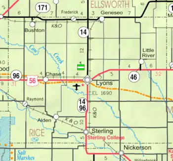 KDOT map of Rice County (legend) | |
 Mitchell  Mitchell | |
| Coordinates: 38°23′2″N 98°05′59″W[1] | |
| Country | United States |
| State | Kansas |
| County | Rice |
| Township | Mitchell |
| Elevation | 1,739 ft (530 m) |
| Time zone | UTC-6 (CST) |
| • Summer (DST) | UTC-5 (CDT) |
| Area code | 620 |
| FIPS code | 20-47500 [1] |
| GNIS ID | 475681 [1] |
History

For millennia, the land now known as Kansas was inhabited by Native Americans. In 1803, most of modern Kansas was secured by the United States as part of the Louisiana Purchase. In 1854, the Kansas Territory was organized, then in 1861 Kansas became the 34th U.S. state. In 1867, Rice County was founded.
In 1878, Atchison, Topeka and Santa Fe Railway and parties from Marion County and McPherson County chartered the Marion and McPherson Railway Company.[4] In 1879, a branch line was built from Florence to McPherson, in 1880 it was extended to Lyons, in 1881 it was extended to Ellinwood.[5] The line was leased and operated by the Atchison, Topeka and Santa Fe Railway. The line from Florence to Marion, was abandoned in 1968.[6] In 1992, the line from Marion to McPherson was sold to Central Kansas Railway. In 1993, after heavy flood damage, the line from Marion to McPherson was abandoned. The original branch line connected Florence, Marion, Canada, Hillsboro, Lehigh, Canton, Galva, McPherson, Conway, Windom, Little River, Mitchell, Lyons, Chase, Ellinwood.
A post office was opened in Mitchell in 1882, and remained in operation until it was discontinued in 1953.[7]
Education
The community is served by Lyons USD 405 public school district.
Notable people
- Leo B. Bozell - Advertising executive, born in Mitchell.[8]
References
- Geographic Names Information System (GNIS) details for Mitchell, Kansas; United States Geological Survey (USGS); October 13, 1978.
- DeLorme. Kansas Atlas & Gazetteer. 4th ed. Yarmouth: DeLorme, 2009, p. 47. ISBN 0-89933-342-7.
- "Find a County". National Association of Counties. Retrieved 2011-06-07.
- Marion County Kansas : Past and Present; Sondra Van Meter; MB Publishing House; LCCN 72-92041; 344 pages; 1972.
- Fourth Annual Report of the Board of Railroad Commissioners for the Year Ending December 1, 1886 in State of Kansas; Kansas Publishing House; 1886.
- Railway Abandonment 1968
- "Kansas Post Offices, 1828-1961". Kansas Historical Society. Archived from the original on 9 October 2013. Retrieved 22 June 2014.
- "Who's who in Finance and Industry". google.ca. 1944.
Further reading
External links
Municipalities and communities of Rice County, Kansas, United States | ||
|---|---|---|
| Cities | 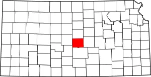 Map of Kansas highlighting Rice County | |
| Unincorporated communities | ||
| Ghost towns | ||
| Townships | ||
| ||
