Silica, Kansas
Silica is an unincorporated community in southwestern Pioneer Township, Rice County, Kansas, United States. It lies along local roads a fraction of a mile (about 500 m) north of U.S. Route 56/K-96, 6 miles (9.7 km) east of Ellinwood and 14 miles (23 km) west of Lyons,[2] the county seat of Rice County.[3]
Silica, Kansas | |
|---|---|
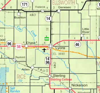 KDOT map of Rice County (legend) | |
 Silica  Silica | |
| Coordinates: 38°21′6″N 98°27′43″W | |
| Country | United States |
| State | Kansas |
| County | Rice |
| Township | Pioneer |
| Elevation | 1,795 ft (547 m) |
| Time zone | UTC-6 (Central (CST)) |
| • Summer (DST) | UTC-5 (CDT) |
| Area code(s) | 620 |
| GNIS feature ID | 484747[1] |
History
For millennia, the land now known as Kansas was inhabited by Native Americans. In 1803, most of modern Kansas was secured by the United States as part of the Louisiana Purchase. In 1854, the Kansas Territory was organized, then in 1861 Kansas became the 34th U.S. state. In 1867, Rice County was founded.
Silica had a post office from 1893 until 1953.[4]
Education
The community is served by Chase–Raymond USD 401 public school district.
References
- "US Board on Geographic Names". United States Geological Survey. 2007-10-25. Retrieved 2008-01-31.
- DeLorme. Kansas Atlas & Gazetteer. 4th ed. Yarmouth: DeLorme, 2009, p. 47. ISBN 0-89933-342-7.
- "U.S. Census website". United States Census Bureau. Retrieved 2008-01-31.
- "Kansas Post Offices, 1828-1961". Kansas Historical Society. Archived from the original on October 9, 2013. Retrieved 22 June 2014.
Further reading
Municipalities and communities of Rice County, Kansas, United States | ||
|---|---|---|
| Cities | 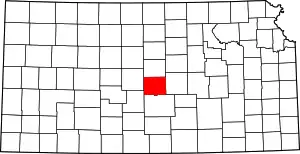 Map of Kansas highlighting Rice County | |
| Unincorporated communities | ||
| Ghost towns | ||
| Townships | ||
| ||
This article is issued from Wikipedia. The text is licensed under Creative Commons - Attribution - Sharealike. Additional terms may apply for the media files.