Mohpa
Mohpa is a city with a municipal council in Nagpur district in the Indian state of Maharashtra. Although physically located within Kalmeshwar ( former in saoner) taluka, it is not subject to taluka governance. It is divided in to basically three part
Mohpa | |
|---|---|
city | |
.jpg.webp) Cultural Hall of Nagar Parishad, Mohpa | |
 Mohpa Location in Maharashtra, India | |
| Coordinates: 21°18′34″N 78°49′49″E | |
| Country | |
| State | Maharashtra |
| District | Nagpur |
| Tahasil | Kalameshwar Former in saoner taluka |
| Government | |
| • Type | municipal council |
| Area | |
| • Total | 5.18 km2 (2.00 sq mi) |
| Elevation | 351 m (1,152 ft) |
| Population (2001) | |
| • Total | 7,066 |
| • Density | 1,400/km2 (3,500/sq mi) |
| Languages | |
| • Official | Marathi |
| Time zone | UTC+5:30 (IST) |
1.Galbardi "गळबर्डी"- this area is at the beginning and higher in height from mohpa , so in regional language hill means 'Gal' and area means 'Bardi'
2.Mohpa "मोहपा"- main town which includes regular market for daily needs
3.Mhasepathar "म्हसेपठार"- the word is came platue (Pathar in marathi) of mohpa ,it is governed by grampanchayt.
the mohpa is famous for its bull market from past 50 years, although orange farm is the main identity of this town.
Geography
Mohpa is located on a tributary of the Chandrabhaga River.[2] It is 13 kilometres (8 mi) north-west of Kalmeshwar and 34 kilometres (21 mi) north-west of Nagpur. It has an average elevation of 351 metres (1151 feet).
History
Before 1955, Mohpa was a panchayat village,[1] but it was given municipal status that year,[3]
Demographics
As of 2001 India census, Mohpa had a population of 7,066.[4] Males constituted 51% of the population and females 49%. Mohpa had an average literacy rate of 74%, higher than the national average of 59.5%: male literacy was 81%, and female literacy was 66%. In Mohpa, 11% of the population was under 6 years of age.[5][6]
References
- "Municipalities". Nagpur District Gazetteer. 1966. Archived from the original on 10 April 2009.
- "Mohpa Town". Nagpur District Gazetteer. 1908. Archived from the original on 10 April 2009.
- Vide notification No. 1482-7825-M-B, 23 March 1955
- "2001 Alphabetical List of Towns and Their Population: Maharashtra" (PDF). Archived (PDF) from the original on 24 November 2007.
- "Census of India 2001: Data from the 2001 Census, including cities, villages and towns (Provisional)". Census Commission of India. Archived from the original on 16 June 2004. Retrieved 1 November 2008.
- 2001 Census Town Code = 40921000; 2011 Census Town Code = 802704
Nagpur district topics | |||||||||||||
|---|---|---|---|---|---|---|---|---|---|---|---|---|---|
| History | 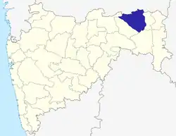 | ||||||||||||
| Geography | |||||||||||||
| Cities and towns | |||||||||||||
| Monuments | |||||||||||||
| Education |
| ||||||||||||
| Transport |
| ||||||||||||
| Constituencies |
| ||||||||||||