Mount Ginini
Mount Ginini is a mountain with an elevation of 1,762 metres (5,781 ft) AHD in the Brindabella Ranges that is located on the border between the Australian Capital Territory and New South Wales in Australia.
| Mount Ginini | |
|---|---|
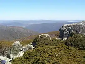 View from Mount Ginini | |
| Highest point | |
| Elevation | 1,762 m (5,781 ft) [1] |
| Prominence | 202 m (663 ft) [1] |
| Coordinates | 35°32′S 148°47′E [1] |
| Geography | |
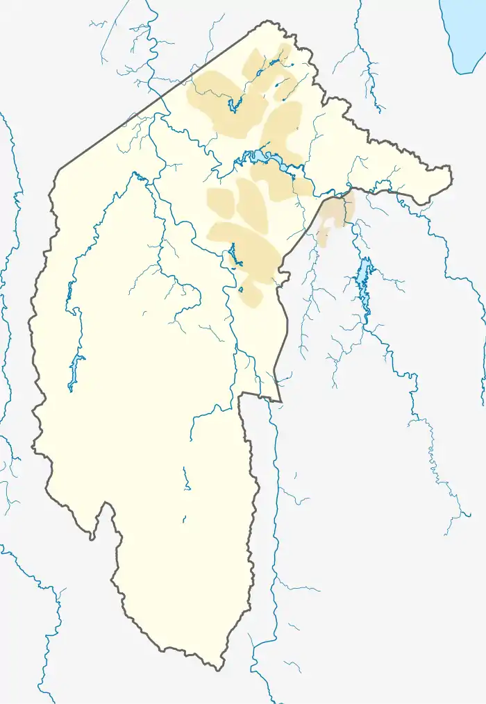 Mount Ginini Location in the ACT | |
| Location | Australian Capital Territory / New South Wales, Australia |
| Parent range | Brindabella Ranges |
Geography
The summit of the mountain is located within the ACT, and is the third highest mountain in the Territory. The ACT portion of the mountain is located in Bimberi Nature Reserve and Namadgi National Park and the NSW portion in Kosciuszko National Park. It is often climbed by bushwalkers from Corin Dam, as it is a few hours' hike. The mountain is close to the Ginini Flats Wetlands Ramsar Site.
Facilities
The mountain is home to an Airservices Australia installation serving as part of the AERIES network and as a transceiver for communications between ATCs and aircraft. It also hosts a repeater station for the local amateur radio club. The transmitter tower is located at 35°31′46.61″S 148°46′21.06″E.
Climate
Mount Ginini has a subpolar oceanic climate (Cfc) with mild summers and cold winters.
| Climate data for Mount Ginini AWS (2004–) | |||||||||||||
|---|---|---|---|---|---|---|---|---|---|---|---|---|---|
| Month | Jan | Feb | Mar | Apr | May | Jun | Jul | Aug | Sep | Oct | Nov | Dec | Year |
| Record high °C (°F) | 33.2 (91.8) |
30.2 (86.4) |
25.8 (78.4) |
22.4 (72.3) |
16.0 (60.8) |
12.6 (54.7) |
10.2 (50.4) |
16.0 (60.8) |
19.9 (67.8) |
23.3 (73.9) |
27.8 (82.0) |
29.0 (84.2) |
33.2 (91.8) |
| Average high °C (°F) | 20.8 (69.4) |
18.9 (66.0) |
16.4 (61.5) |
11.9 (53.4) |
7.7 (45.9) |
3.9 (39.0) |
2.4 (36.3) |
4.1 (39.4) |
8.5 (47.3) |
12.8 (55.0) |
15.7 (60.3) |
17.8 (64.0) |
11.7 (53.1) |
| Average low °C (°F) | 10.0 (50.0) |
9.0 (48.2) |
7.3 (45.1) |
4.0 (39.2) |
1.1 (34.0) |
−1.0 (30.2) |
−2.5 (27.5) |
−2.0 (28.4) |
0.3 (32.5) |
2.9 (37.2) |
5.9 (42.6) |
7.3 (45.1) |
3.5 (38.3) |
| Record low °C (°F) | −1.3 (29.7) |
−2.0 (28.4) |
−2.0 (28.4) |
−5.0 (23.0) |
−6.4 (20.5) |
−8.5 (16.7) |
−8.0 (17.6) |
−8.2 (17.2) |
−6.6 (20.1) |
−5.5 (22.1) |
−6.0 (21.2) |
−4.0 (24.8) |
−8.5 (16.7) |
| Average precipitation mm (inches) | 74.5 (2.93) |
94.4 (3.72) |
78.8 (3.10) |
59.9 (2.36) |
57.1 (2.25) |
86.8 (3.42) |
101.9 (4.01) |
88.5 (3.48) |
90.5 (3.56) |
72.8 (2.87) |
108.9 (4.29) |
107.9 (4.25) |
1,051.2 (41.39) |
| Average precipitation days | 10.9 | 12.7 | 12.0 | 9.9 | 10.0 | 12.1 | 16.4 | 13.6 | 11.8 | 10.2 | 12.2 | 12.4 | 144.2 |
| Source: [2] | |||||||||||||
See also
References
- "Mount Ginini, Australia". Peakbagger.com. Retrieved 11 October 2013.
- "Climate statistics for MOUNT GININI AWS". Bureau of Meteorology. Retrieved 25 July 2018.